How to choose a bay area drone company for engineering firms
Key Takeaways
Choosing a bay area drone company for engineering firms starts with the project’s information needs, not the aircraft alone.
- Define the decisions the drone data must support before requesting proposals.
- Match sensors, accuracy, deliverables, and turnaround to each project phase.
- Check pilot qualifications, flight authorization, insurance, and site safety procedures.
- Confirm that the resulting files fit your CAD, GIS, BIM, and reporting workflows.
- Compare the full project cost, communication process, and revision support.
Define your engineering project’s drone requirements
A useful drone engagement begins with a clear engineering question. The right provider should understand whether the team needs progress evidence, terrain information, inspection imagery, or measurements for planning. A short brief can prevent an attractive flight plan from producing data that no one can use. It also gives every vendor the same basis for pricing and scheduling.

Match drone services to project phases
Different phases call for different kinds of aerial information. Early planning may benefit from broad site imagery and terrain visualization, while active construction may require repeatable progress documentation. Later work can involve inspection records, as-built comparisons, or visual material for closeout. Ask the provider to explain how each proposed flight supports a decision your team must make.
The frequency matters as much as the flight itself. A one-time capture may suit a feasibility review, whereas a recurring schedule is more useful for documenting movement, site conditions, and changes over time. Keep the scope tied to the project schedule rather than buying a generic package.
Identify the data and deliverables you need
“Drone data” can mean photographs, georeferenced imagery, measurements, models, or a structured report. Specify the formats, coordinate system, area of interest, naming conventions, and level of detail before work begins. If engineers will review the information remotely, ask how files will be organized and shared, not simply whether they will be delivered.
A practical scope should also identify who reviews the first delivery and how corrections are handled. Decision-ready information is easier to use when the provider explains what was captured, what assumptions apply, and where the limits of the data lie.
Assess site access, terrain, and operating conditions
A Bay Area site may combine steep grades, dense development, active traffic, overhead lines, restricted airspace, or nearby people and property. Describe those conditions during the initial conversation, along with access points, launch areas, work-hour limits, and any coordination required with a general contractor or facility owner. Site complexity affects both safety planning and the time required in the field.
Weather and lighting can also affect the result. A provider should identify conditions that could reduce image quality or prevent a safe flight, then explain how a rescheduled visit would be managed. Clear assumptions are more useful than a low quote that leaves the difficult parts unresolved.
Set accuracy, resolution, and turnaround expectations
Accuracy is a project requirement, not a marketing adjective. Ask how accuracy will be assessed, whether ground control is needed, what resolution is appropriate, and how the final product will be checked. Engineering teams should distinguish visual documentation from professional land surveying or legal deliverables and involve a licensed Professional Land Surveyor when those deliverables are required.
Turnaround should be tied to the decision deadline. A rapid preview may help a field team respond quickly, while a processed model or report may require more time. Put both the expected first delivery and the final approved delivery in writing.
Evaluate the capabilities of a bay area drone company
A capable bay area drone company for engineering firms should be evaluated as a technical service partner. Look past polished aerial footage and ask how the team plans, captures, processes, checks, and explains its work. Experience with similar environments is useful, but the provider must still show how its workflow fits this particular project. Request a sample deliverable or a clear description of the handoff.
Review surveying, mapping, and inspection experience
Review experience by application rather than by flight count. A team that documents construction progress may have a different workflow from one capturing inspection imagery or terrain information. Ask for examples involving comparable site constraints, deliverables, and reporting needs, while keeping the distinction between aerial data services and licensed surveying clear.
For background on how different aerial applications can fit construction and engineering work, teams can consult drone service guides. The useful question is not whether a provider lists many services, but whether it can explain the limits and quality checks behind the one you need.
Check aircraft, sensors, and payload options
The aircraft is only one part of the selection. Sensor choice affects coverage, detail, lighting tolerance, and the type of output that can be produced. Ask which sensor is proposed, why it fits the site, how many flights are likely, and whether a backup plan exists if conditions change.
Avoid choosing equipment by specification alone. A sensor with impressive headline numbers may not improve the result if the flight plan, ground control, overlap, or processing method is unsuitable. The provider should connect the equipment choice to the requested deliverables in plain language.
Assess pilot qualifications and technical expertise
Confirm who will conduct the work and who will be responsible for processing and quality review. Ask about FAA certification, relevant aviation experience, site-specific risk planning, and experience around construction, utilities, infrastructure, or other hazards present on the project. Technical judgment matters when conditions change quickly in the field.
It is also reasonable to ask how the team documents incidents, near misses, equipment problems, and reflight decisions. A professional process should make accountability visible without turning the proposal into a pile of unexplained technical terms.
Verify data processing and engineering software compatibility
Before approving a flight, identify the software environment where the data will be used. Confirm whether the provider can deliver the required imagery, point clouds, models, measurements, or reports in formats your team can open and review. Clarify coordinate reference systems, file-size expectations, metadata, and whether the output can be revised.
A provider’s processing workflow should include a review step before delivery. Ask what happens when an area is obscured, coverage is incomplete, or a file does not align with existing project information. Compatibility is useful only when the data also arrives organized and documented.
Compare drone services for common engineering applications
The same aircraft can support very different engineering tasks, but the scope and success criteria will change. Compare proposals by the decision being supported, the field conditions, and the form of the final deliverable. Construction documentation, inspection, mapping, and material measurement should not be treated as interchangeable line items.
Construction progress and site documentation
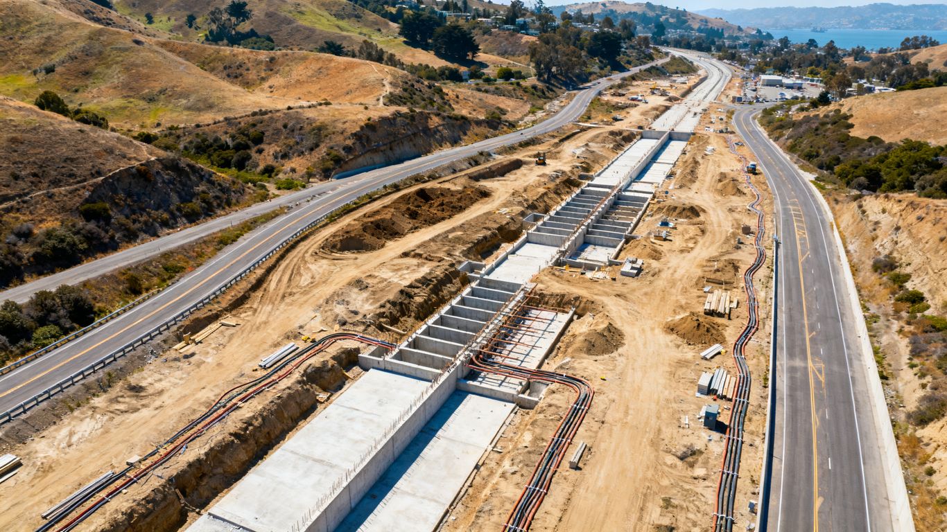
For construction, establish a repeatable capture plan before the first flight. Define viewpoints, coverage, frequency, naming, and who receives the imagery. Consistency makes it easier to compare conditions across dates and communicate with owners, subcontractors, and field teams.
A service such as construction site monitoring can be considered when the project needs recurring aerial visuals and analytics. The proposal should still state the actual cadence, coverage, review method, and delivery format rather than relying on a broad service label.
Land surveying and topographic mapping
Aerial mapping can provide useful visual and geospatial information for planning, site context, terrain visualization, and coordination. Ask how control points, checkpoints, overlap, and processing will be handled. If the work requires a survey-grade or legal deliverable, coordinate with a licensed Professional Land Surveyor; aerial imaging alone does not replace that professional role.
For terrain-focused work, compare the proposed capture method with vegetation, slope, obstructions, and the required level of detail. A provider should explain where the method is dependable and where supplemental field work may be needed.
Structural, utility, and infrastructure inspections
Inspection proposals should identify the asset, viewing angles, inaccessible areas, safety constraints, and defect documentation method. High-resolution imagery can help teams review locations that are difficult or hazardous to reach, but the provider should not imply that imagery alone is a complete structural assessment. Define who interprets the findings and how observations are recorded.
Commercial Drone Inspection is a relevant service description when the need involves aerial inspection imagery and terrain visualization for construction or infrastructure work. Keep the scope specific: asset type, access conditions, image requirements, and reporting responsibilities should all be documented.
Volumetric analysis and stockpile measurement
Stockpile work depends on complete coverage, suitable overlap, clear boundaries, and a defined measurement date. Ask how the base surface will be established, how piles will be separated, and what assumptions will accompany the volume result. Repeat measurements are most useful when the same method and reference approach are maintained.
The proposal should say whether the output is a measurement report, a model, imagery, or a combination. It should also identify how the team will address occlusion, active material movement, and areas that cannot be safely captured.
Environmental and geotechnical assessments
Environmental and geotechnical projects often involve large areas, difficult access, changing ground conditions, or sensitive surroundings. A drone may help document site conditions and provide aerial context, but the capture plan should be coordinated with field sampling, monitoring, and professional analysis. Ask what the imagery can establish and what it cannot.
For these applications, timing can affect usefulness. A capture before grading, after rainfall, or during a particular phase of site activity may answer a different question. Tie the flight date to the field program and preserve enough metadata for later review.
Verify compliance, safety, and risk management
Compliance should be part of the proposal, not a last-minute administrative task. The provider and client share responsibility for making the operation fit the site, the people involved, and the applicable rules. A strong process explains permissions, hazards, operating limits, communications, and contingency actions before equipment arrives.

Confirm FAA certification and flight authorization
Ask who holds the required FAA remote pilot certification and who is responsible for the operation. Confirm that the proposed flight can be conducted lawfully and that any needed authorization has been identified. The answer should cover the actual site and operating conditions, not just a general statement that the company flies drones.
Also ask whether the provider maintains flight records and a preflight checklist. Those documents help the project team understand what was approved, what conditions existed, and how deviations were handled.
Understand airspace restrictions in the Bay Area
The Bay Area includes airports, heliports, dense urban areas, public facilities, and other locations where operating conditions may be restricted or tightly coordinated. Share the precise address and proposed flight area early. A provider should explain how it checks airspace, obtains authorization when needed, and communicates with affected site personnel.
Do not assume that a familiar project location is automatically straightforward. Restrictions can vary by altitude, time, nearby operations, and the planned flight path. Build enough lead time into the schedule for coordination.
Review insurance coverage and site safety procedures
Request evidence of appropriate insurance and ask how the provider’s safety plan interacts with the project’s existing site rules. Clarify exclusion zones, launch and recovery areas, spotter responsibilities, worker notifications, emergency landing procedures, and stop-work authority. These details matter most when a site is active or close to the public.
A good safety conversation should be practical rather than ceremonial. Walk through what happens if a person enters the operating area, the weather changes, communications fail, or the aircraft cannot complete the planned route.
Evaluate privacy, security, and data-handling practices
Engineering imagery can include private property, workers, facilities, and sensitive infrastructure. Ask where files are stored, who can access them, how they are transferred, and how long they are retained. Clarify whether subcontractors or processing platforms are involved and how revisions are tracked.
The contract should address ownership, permitted use, confidentiality, and deletion requests where applicable. A clear data-handling process protects both the client and the provider while making later project reviews easier.
Assess data quality and project integration
A flight is successful only when its output can be trusted and used. Quality review should cover capture conditions, processing, coordinate information, completeness, and the requested formats. Engineering teams should see enough of the workflow to understand the limits of the result without having to reverse-engineer it themselves.
Validate geospatial accuracy and ground control methods
Ask what accuracy is expected, how it will be measured, and whether ground control points or checkpoints are appropriate. The answer should account for terrain, vegetation, satellite visibility, image quality, and the intended use of the data. Accuracy claims without a stated method are difficult to evaluate.
Have the provider document the coordinate system and any assumptions in the final delivery. If the output will be compared with design or survey information, agree on the reference framework before capture rather than trying to correct inconsistencies afterward.
Review orthomosaics, point clouds, 3D models, and reports
Review a sample or draft output for gaps, distortion, blur, alignment, and clarity. Ask how the provider flags areas that were not captured adequately and whether the team receives both the primary output and supporting documentation. A model can look polished while still being unsuitable for a particular measurement or design decision.
Reports should make the result understandable to people who did not attend the flight. Include capture date, area, processing notes, limitations, and any required interpretation so the information remains useful after the original project meeting.
Confirm supported CAD, GIS, and BIM workflows
Coordinate with the people who will consume the data: survey staff, designers, GIS analysts, BIM coordinators, inspectors, and project managers may each need different formats. Confirm file compatibility, coordinate handling, layer or object organization, and transfer limits. A simple test file can expose problems before the full project is processed.
The provider should also clarify whether the deliverable is intended for reference, measurement, coordination, or formal design use. That distinction helps prevent a visual product from being mistaken for a legally or professionally certified document.
Establish quality-control and revision processes
Agree on who reviews the delivery, how comments are submitted, and what constitutes a correction rather than a new scope item. Set a reasonable review window while the flight details are still fresh. This is especially helpful for recurring work, where small inconsistencies can accumulate across multiple captures.
A written acceptance process should cover missing coverage, incorrect naming, unusable files, and agreed reflight conditions. It gives both sides a fair way to resolve issues without relying on informal assumptions.
Compare pricing, timelines, and vendor support
Price comparisons are meaningful only when proposals describe the same work. One quote may cover a flight and raw files, while another includes planning, processing, quality review, and organized delivery. Ask for an itemized scope and compare what is included, excluded, and triggered by changed conditions.
Understand hourly, daily, and project-based pricing
Hourly pricing may fit a short, simple capture, while a daily or project-based fee can be easier to manage for a defined site and deliverable. Recurring documentation may require a schedule with a consistent per-visit cost. Ask whether processing, travel, equipment, pilot time, and revisions are priced separately.
A lower flight fee is not necessarily lower project cost if the engineering team must organize files, correct coordinate issues, or commission missing work. Evaluate the total effort required to turn the delivery into something usable.
Account for permitting, mobilization, and processing fees
Permitting or flight authorization work, site coordination, travel, mobilization, control placement, processing, and reporting can all affect the final price. Have the vendor identify which costs are fixed and which depend on site conditions. This makes it easier to compare proposals without penalizing a provider for being more transparent.
If the site or scope changes, ask how the change will be approved. A simple written change process can prevent a small access issue from becoming an unexpected invoice or a missed deadline.
Set expectations for scheduling and weather delays
Ask how far in advance the provider typically schedules work and what conditions require postponement. Wind, rain, smoke, poor visibility, site activity, airspace restrictions, and equipment issues may affect the date. The proposal should explain notification, rescheduling priority, and any costs associated with a second mobilization.
For recurring work, define an acceptable capture window rather than a single rigid date when possible. That gives the provider room to operate safely while preserving the project’s documentation rhythm.
Evaluate communication, documentation, and ongoing support
A responsive provider should name the project contact, describe preflight coordination, and explain how questions are handled after delivery. Ask whether the team receives a flight summary, processing notes, quality findings, and a clear file index. These small details reduce the burden on project managers.
When comparing providers, use an action-oriented project quote request that includes the site, phase, deliverables, schedule, and known constraints. Then compare the answers as carefully as the numbers. The strongest partner is usually the one that makes responsibilities and limitations easiest to understand.
A Practical Next Step
If your engineering team has a defined site, schedule, and data need, share those details with Aeroskape so the scope can be matched to the work rather than reduced to a generic flight. A focused conversation can clarify the capture plan, deliverables, safety considerations, and next steps.
Conclusion
Choosing a bay area drone company for engineering firms is less about finding the most impressive aircraft and more about finding a dependable path from site conditions to usable project information. Define the decision, test the workflow, verify compliance, and compare the complete scope before selecting a provider.
Frequently Asked Questions
What should an engineering firm ask a drone provider first?
Start with the intended decision, site location, required deliverables, accuracy expectations, schedule, and known operating constraints. These details allow providers to propose comparable methods and pricing.
Can drone imagery replace professional land surveying?
No. Aerial imagery and mapping may support planning and documentation, but professional land surveying or legal deliverables should be handled by a licensed Professional Land Surveyor when required.
What deliverables are common in engineering drone projects?
Common outputs may include georeferenced imagery, orthomosaics, point clouds, 3D models, measurements, inspection images, and written reports. The appropriate combination depends on the project’s purpose and workflow.
How accurate is drone mapping?
Accuracy varies with the aircraft, sensor, flight plan, ground control, site conditions, processing, and intended use. Ask the provider how accuracy will be measured and documented for the specific project.
How long does a drone project usually take?
Timing depends on site size, access, airspace, authorization, weather, capture requirements, processing, and review. A proposal should distinguish the field date from the first preview and final delivery dates.
What safety information should a provider supply?
Ask about pilot qualifications, airspace review, insurance, exclusion zones, launch areas, worker coordination, emergency procedures, weather limits, and stop-work authority. The plan should fit the actual site.
How can teams compare drone service quotes fairly?
Compare the complete scope, including planning, mobilization, flight time, sensors, processing, quality control, formats, reporting, revisions, travel, authorization, and rescheduling terms. A detailed scope is more useful than a low headline price.