Drone facade inspection San Francisco high-rise buildings: A practical guide
Key Takeaways
A drone facade inspection san francisco high rise project works best when aerial imaging is treated as part of a wider inspection and reporting process.
- Confirm the building’s applicable San Francisco inspection and filing requirements before planning the flight.
- Define the facade areas, defects, and decisions the inspection needs to address.
- Match the aircraft and sensors to the building, weather, access, and airspace conditions.
- Use drone imagery to identify and document conditions, then verify significant findings through appropriate close-up review.
- Deliver organized evidence that helps owners, engineers, and contractors prioritize repairs and plan follow-up work.
Understanding facade inspection requirements in San Francisco
A high-rise facade inspection begins with the building’s legal and physical context, not with the aircraft. San Francisco requirements can depend on factors such as building height, construction history, inspection tier, and filing obligations. Owners should confirm current requirements with the San Francisco Department of Building Inspection and qualified design professionals before relying on a general summary. Aerial imagery can improve visibility and documentation, but it does not by itself satisfy every regulatory or engineering requirement.
The city’s facade program is best treated as a starting point for a project-specific inspection plan. The useful question is not simply whether a drone can see the facade, but what evidence is needed, who must review it, and how findings will be documented. The facade ordinance guidance provides a helpful orientation to that process, while the applicable local requirements should remain the controlling reference.
When high-rise facade inspections are required
San Francisco’s facade inspection and maintenance requirements may apply to qualifying taller buildings, with additional requirements for certain higher structures. The exact cadence and scope can vary, so an owner should verify the building’s classification, construction date, prior filings, and any applicable waivers or special provisions. A property manager can assemble this information early, before an inspection contractor begins planning access or flight operations.
A drone can support the visual portion of a scheduled inspection by creating consistent views of elevations, parapets, balconies, cladding, windows, and other exterior elements. It cannot determine the legal applicability of an ordinance or replace the licensed professional responsible for the required evaluation. That distinction keeps the technology useful without overstating what aerial data proves.
How San Francisco’s facade ordinance affects building owners
The ordinance makes recordkeeping and follow-through part of the owner’s responsibility. A practical workflow therefore connects the inspection scope to prior reports, maintenance records, photographs, repair documents, and the final submission or project file. Owners should also allow time for reviewing images, resolving uncertain observations, and coordinating any required close-up examination.
A well-organized inspection reduces the chance that a visible condition becomes an isolated photograph with no location, severity, or history. Each observation should be traceable to a facade elevation or building feature. It should also be clear whether it is an initial visual observation, a confirmed defect, or a condition requiring further professional assessment.
Which facade conditions require closer evaluation
Aerial imagery may reveal cracks, staining, displaced panels, failed sealant, exposed reinforcement, corrosion, spalling, biological growth, and loose or deteriorated materials. The image is most useful when it shows the condition in context, including its position on the elevation and relationship to windows, joints, balconies, or drainage paths. Repeated patterns across several floors can also help an engineer decide where closer examination is warranted.
Not every mark on a facade has the same significance. Water staining may point to an active leak, an old repair, or a surface discoloration. A hairline crack may be cosmetic, or it may be part of a wider movement pattern. Interpretation requires material knowledge, history, and sometimes physical testing rather than visual confidence alone.
When drone inspections complement hands-on inspections
Drones are especially useful for broad visual coverage and for areas that are difficult, costly, or disruptive to reach with conventional access equipment. They can help an inspection team screen elevations, compare conditions, and identify locations for targeted close-up work. That makes the later hands-on effort more focused, though it does not eliminate the need for it where direct examination is necessary.
The right sequence is often aerial review followed by selective physical access. Findings that may affect public safety, structural performance, or repair design deserve confirmation by the appropriate qualified professional. This layered approach produces a more defensible record than treating one flight as a complete answer.

Planning a drone facade inspection
Planning determines whether a flight produces useful evidence or merely a large folder of photographs. A San Francisco high-rise presents tight setbacks, active sidewalks, changing wind, reflective glass, occupied rooms, and complicated airspace. The inspection team should decide what must be captured, what constraints apply, and what the final deliverable needs to support before the aircraft leaves the ground.
A clear plan also protects the people around the building. It gives the pilot, property manager, inspector, and building occupants a shared understanding of timing, access, privacy, emergency procedures, and areas that may need to be cordoned off. Small coordination details often matter as much as camera resolution.
Defining the inspection scope and objectives
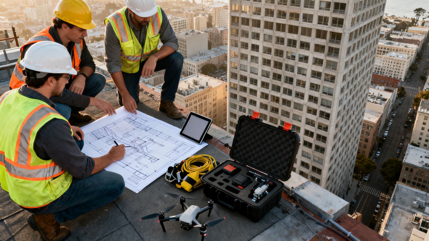
Start with the decisions the inspection must support. Is the purpose routine condition documentation, an ordinance-related evaluation, repair planning, post-weather review, construction quality control, or a comparison with an earlier inspection? The answer affects the elevations, camera angles, resolution, flight paths, and review criteria.
Break the building into manageable zones and identify the features that need consistent coverage. Include corners, recessed areas, roof edges, balconies, mechanical screens, expansion joints, and transitions between materials. Define whether the team needs overview images, close visual details, thermal indicators, a 3D model, or a repeatable baseline for future inspections.
A concise scope might include:
- All street-facing and courtyard elevations, with separate coverage for difficult recesses.
- High-priority features such as balconies, cladding joints, window perimeters, and parapets.
- Image naming and location conventions tied to elevations, floors, or grid references.
- A review process for uncertain observations and conditions requiring close-up access.
That scope keeps the flight focused. It also helps the owner compare a proposal against the actual information needed instead of comparing providers only by flight time or the number of images captured.
Gathering building plans and prior inspection records
Plans, elevations, repair drawings, material schedules, and previous inspection reports give the pilot and reviewer a useful map of the building. They can reveal hidden courtyards, changes in facade material, repaired zones, roof access points, and areas where earlier reports identified recurring concerns. Even imperfect drawings are valuable when paired with current photographs.
Prior records should be reviewed for both findings and terminology. If an earlier report calls a portion of the building “northwest tower,” the new image set should use the same reference where practical. Consistent language makes change detection easier and prevents a condition from appearing new simply because it was labeled differently.
The objective is not to assume that old findings remain unchanged. It is to create a baseline for asking better questions: Has a crack widened? Did a repair hold? Has staining spread? Is a previously inaccessible area now visible? Those questions turn a flight into part of an ongoing maintenance record.
Identifying access, privacy, and airspace constraints
Urban flight planning must account for more than the facade itself. Review takeoff and landing areas, nearby roads, pedestrian routes, neighboring properties, rooftop equipment, overhead obstructions, building operations, and the airspace rules that apply to the location. The pilot should determine what approvals, notifications, or operational limitations are needed before the scheduled date.
Privacy deserves equal attention. Occupied offices and residences may appear through windows, balconies, or reflections, so the capture plan should minimize unnecessary views into private spaces. Image handling, storage, access permissions, and retention should be agreed upon in advance, especially when the property remains occupied during the inspection.
Weather and access plans should include a stopping point. If wind increases, visibility drops, or a safe exclusion zone cannot be maintained, postponing the flight is better than forcing a marginal operation. A reliable inspection record is never improved by avoidable risk.
Coordinating tenants, property managers, and contractors
The building manager is often the practical link between the inspection team and everyone affected by the work. Advance notices should explain the date, approximate duration, areas involved, possible sidewalk controls, and any temporary restrictions around balconies or windows. Tenants may also need instructions to keep certain windows clear or to avoid entering designated areas during the flight.
Contractors and maintenance staff can add useful context. They may know about recent sealant work, façade washing, window replacement, leaks, or temporary barriers that could otherwise be mistaken for defects. Their input should inform the review without replacing independent evaluation.
A short coordination meeting before mobilization can settle who provides roof access, who watches the ground area, who receives urgent observations, and who approves a weather delay. That simple chain of responsibility keeps the operation calm when conditions change.
Choosing drones, sensors, and inspection technology
Equipment should follow the inspection question. A compact aircraft may be easier to operate near a constrained courtyard, while a different configuration may provide steadier imaging in open air. The camera, lighting, flight distance, and data-processing workflow all influence whether a visible condition can be interpreted later.
The goal is not to collect every possible data type. It is to select the smallest practical combination that produces reliable evidence for the owner, inspector, and repair team. For teams that need a broader comparison of inspection planning and deliverables, commercial drone inspection guidance offers a useful reference point.
Selecting aircraft for dense urban environments
An aircraft for a high-rise facade should be chosen for controllability, stability, image quality, and the operator’s ability to maintain safe separation. Dense urban sites leave little room for improvisation. The flight plan may require careful movement around corners, balconies, roof projections, antennas, and neighboring structures while maintaining a predictable relationship to the facade.
The operator should also consider battery changes, takeoff and landing logistics, communications, lighting, and the ability to pause or return safely if a pedestrian enters the operating area. A technically capable aircraft is only part of the system; the pilot’s planning and site procedures determine how that capability is used.
Comparing high-resolution cameras, thermal imaging, and LiDAR
A high-resolution visual camera is the starting point for most facade documentation. It can capture material transitions, cracking, staining, failed finishes, displaced components, and other visible conditions when distance, light, and focus are controlled. Thermal imaging can identify unusual temperature patterns that may justify further investigation, but those patterns are indicators rather than automatic diagnoses.
LiDAR can add spatial information where geometry, occlusion, or dimensional context matters. It may be useful for mapping irregular surfaces or combining facade observations with a broader site model. Each sensor has limits, and a sensor should not be selected simply because it produces more data.
A practical comparison looks like this:
| Tool | Useful for | Main caution |
|---|---|---|
| High-resolution visual camera | Visible facade conditions and repeatable photo records | Image quality depends on distance, light, focus, and angle |
| Thermal camera | Unusual heat patterns and areas for further review | Results can be affected by weather, materials, reflections, and timing |
| LiDAR | Spatial geometry and three-dimensional context | Point-cloud usefulness depends on coverage, processing, and surface conditions |
| Photogrammetry | Scaled visual models and location-based documentation | Overlap, control, texture, and consistent capture are important |
The table is a planning aid, not a substitute for professional judgment. Combining sensors can strengthen the record, but only when each output is tied to a defined inspection purpose and reviewed with its limitations in mind.
Using photogrammetry to document facade conditions
Photogrammetry uses overlapping photographs to build a visual three-dimensional representation of a structure or area. For a high-rise, it can help organize elevations, locate observations, and create a shared reference for discussions between owners, inspectors, and contractors. The value comes from consistent capture and clear alignment with the building’s known geometry.
A useful photogrammetry plan considers overlap, lighting, reflective glass, repetitive surfaces, occluded corners, and the reference information needed to scale or orient the model. The output should be checked for gaps and distortions before anyone treats it as a reliable basis for measurement or repair planning.
A model is most helpful when it connects to the inspection record. A reviewer should be able to move from a mapped location to the underlying photographs, notes, and any follow-up action. That connection makes the model a working record rather than an attractive but isolated visualization.
Applying AI-assisted defect detection responsibly
Automated image review can help sort a large collection of facade photographs and flag visual patterns for human attention. It may be useful for prioritizing images, identifying repeated features, or supporting comparisons across inspection dates. It should not be presented as a final diagnosis of structural significance or material failure.
Reviewers need to understand what the system can detect, what it may miss, and how lighting, reflections, dirt, repairs, and image angle affect its results. Every flagged condition should be checked against the original image and the building context. Human review remains essential when an observation could influence public safety, repair scope, or regulatory documentation.
The strongest workflow treats automation as an assistant to organized inspection, not as a replacement for the people responsible for interpretation. Clear confidence labels and an audit trail of decisions can make that distinction visible in the final record.
Conducting a safe inspection on a San Francisco high-rise
A safe flight is a site operation, not a camera exercise. The pilot and project team must manage the aircraft, the building, the public, the occupants, and the changing environment at the same time. That requires a written plan, clear roles, and the willingness to pause when the site no longer matches the assumptions made during planning.
For project teams that need aerial information organized around practical decisions, Commercial Drone Inspection describes an approach centered on high-resolution imagery, terrain visualization, and 3D aerial modeling. Those outputs are useful only when the flight itself is conducted within the applicable operational and site-safety requirements.
Establishing flight plans and exclusion zones
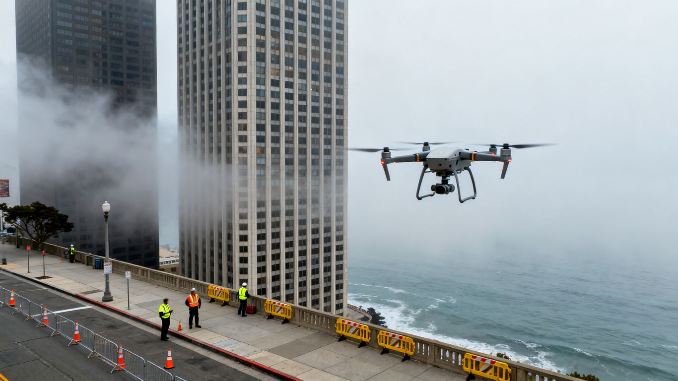
The flight plan should show takeoff and landing points, facade paths, altitude bands, turns, emergency options, and areas where people or vehicles must not enter. It should account for the building’s shape rather than assuming that one orbit will provide consistent coverage. Recesses, overhangs, and corners often need separate passes.
Before launching, the team should confirm who controls the ground area and how that person communicates with the pilot. A practical preflight sequence includes:
- Confirm the approved operating area, weather, airspace information, and site permissions.
- Inspect the aircraft, batteries, controller, camera settings, and return or landing procedures.
- Establish and monitor exclusion zones around takeoff, landing, and the facade work area.
- Review emergency actions for lost communications, unexpected people, vehicles, birds, or changing wind.
The list is simple by design. Repeating it at each mobilization reduces dependence on memory and gives the property team a clear view of what must be ready before the flight begins. If any part cannot be confirmed, the correct action is to delay or redesign the operation.
Managing wind, fog, and changing weather conditions
San Francisco weather can shift quickly around tall buildings. Wind may accelerate around corners and rooflines, while fog can reduce visibility and change the appearance of reflective materials. The team should review conditions at the building, not only a regional forecast, and establish operating limits before launch.
Weather affects image quality as well as safety. Moisture, glare, low light, and moving shadows can make a surface appear different from one pass to the next. If conditions prevent consistent coverage, the flight may need to be divided into shorter sessions or repeated during a better window.
A good field decision is conservative and documented. Record the conditions, the areas completed, and the areas deferred. That makes a later return efficient and prevents anyone from assuming that an incomplete flight covered the whole facade.
Protecting pedestrians, vehicles, and occupants
Ground safety planning should reflect how the property actually operates. Sidewalks, loading zones, garage entrances, transit stops, delivery schedules, and building events can all change the risk around a flight. Barriers and spotters may help, but they do not replace the pilot’s responsibility to maintain safe operation and the property manager’s responsibility to coordinate the site.
Occupants also need protection from unnecessary disruption. Avoid flying close to open windows or balconies when the inspection objective does not require it, and use agreed procedures for areas where people may appear. The team should know how to stop the operation immediately if a person enters the exclusion zone or an unexpected condition develops.
Clear communication is often the most effective control. A visible site contact, a simple notification process, and a defined stop-work signal make it easier for everyone to respond before a minor conflict becomes an incident.
Combining aerial imaging with targeted close-up access
Drone images can narrow the field of investigation, but they do not answer every question. A close-up review may be needed to assess a crack, determine whether material is loose, examine corrosion, test a repair, or understand a joint that is hidden by angle or shadow. The inspection plan should reserve time and budget for that possibility.
Aerial and hands-on observations should be connected by location. Use the same elevation, floor, grid, or feature reference in the image set and the close-up notes. This lets the reviewer compare the broad pattern with the physical detail without guessing where the observations belong.
The result is a more efficient inspection, not a less rigorous one. The drone helps direct attention; the appropriate professional examination provides the basis for decisions that require more than a photograph.
Evaluating facade defects and inspection findings
Evaluation begins after capture, when images are reviewed in context rather than one at a time. Reviewers should look for recurring patterns, changes from prior records, relationships between materials, and conditions that could affect people below or the building envelope. A clear distinction between observation and interpretation is essential.
The inspection record should preserve uncertainty. If an image suggests a defect but does not establish its cause or severity, label it for confirmation instead of forcing a conclusion. That approach gives engineers and owners a more honest basis for deciding what happens next.
Identifying cracks, spalling, corrosion, and loose materials
Cracks should be described by location, direction, apparent extent, and relationship to nearby features. Spalling may appear as missing surface material, exposed aggregate, or a rough edge, while corrosion can be associated with staining, delamination, or exposed metal. Loose materials may be difficult to confirm from a drone image alone, particularly when the surface is shadowed or partially hidden.
Photographs should include both a close view and a wider context view. The close view records the visible feature; the context view shows where it occurs on the building. Together they support repeat visits, repair estimates, and communication among people who were not present during the flight.
Image quality matters, but interpretation matters more. A sharp photograph with no location or comparison point is less useful than a slightly less dramatic image that can be found again and related to the building’s history.
Distinguishing cosmetic damage from safety hazards
Surface discoloration, minor finish variation, and isolated sealant aging may be maintenance concerns without being immediate hazards. By contrast, displaced components, deteriorated concrete, loose fragments, or conditions above active pedestrian areas may require urgent attention. The distinction depends on material, location, extent, and the professional assessment of risk.
A reviewer should avoid assigning severity from appearance alone. Reflections can exaggerate cracks, shadows can conceal damage, and recent cleaning can change the way a surface reads. The safest report describes what is visible, identifies the uncertainty, and recommends the next appropriate level of examination.
Context changes the priority of a finding. A small defect above a busy sidewalk may deserve faster action than a larger cosmetic mark in an inaccessible service area, even before the complete repair scope is known.
Verifying drone observations through closer examination
Verification may involve a ground view, binocular review, lift access, rope access, physical probing, nondestructive testing, or another method selected by the responsible professional. The method should match the question. For example, visual confirmation may be enough to document a displaced finish, while determining the depth or cause of deterioration may require a different examination.
The team should preserve the original aerial image alongside the verification record. Do not overwrite an initial observation simply because later access changes its interpretation. Keeping both records shows how the conclusion was reached and helps improve future inspection planning.
When a condition cannot be verified during the same visit, assign it a clear status and follow-up owner. An unresolved observation should not disappear into a general photo folder.
Prioritizing repairs based on severity and location
Repair prioritization should consider safety, water intrusion, progressive deterioration, consequences of failure, access difficulty, and the relationship to planned facade work. A condition affecting several connected areas may be more efficient to address as part of one repair package than through isolated responses. Owners and engineers can use the inspection record to compare those choices.
A simple priority framework can separate immediate controls from near-term repairs and routine maintenance. It should remain flexible enough to change when close-up examination reveals a different condition than the aerial image suggested. The report should explain why an item sits in a particular category rather than presenting an unexplained color code.
This is where organized data becomes practical. The purpose of the inspection is not to produce the longest defect list; it is to help the building team decide what needs attention first, what evidence is still missing, and how to schedule the work responsibly.
Reporting results and planning repairs
A report should let a reader move from a building-wide view to a specific observation without losing the thread. Start with the scope, date, weather, equipment, areas covered, limitations, and people involved. Then organize the findings so each image, map point, or model location has a clear relationship to the written assessment.
The final package should be useful to more than one audience. Owners may need a concise risk and maintenance view, engineers may need detailed evidence, contractors may need locations and quantities, and regulators may need documentation in a prescribed format. A layered report can serve those needs without pretending that every reader requires the same level of detail.
Organizing annotated images and inspection evidence
Use a consistent file structure and naming convention from the start. A useful image record may include the building, elevation, floor or grid, feature, date, and sequence number. Annotations should identify the observation without covering the detail needed to review it independently.
The report should retain original files, edited or annotated copies, field notes, and any review log. That separation protects the source evidence and makes later questions easier to answer. It also supports comparison when the facade is inspected again.
Avoid presenting only selected images that make the building appear better or worse than the complete record. Explain coverage gaps, inaccessible zones, poor weather, glare, and other limitations. Transparency makes the useful findings more credible.
Creating 3D models, maps, and condition records
A 3D model can provide a shared spatial reference for discussions about facade geometry and defect locations. A map or elevation sheet may be easier for a contractor or property manager to use during repair coordination. The right format depends on the audience and the decision, not on the novelty of the output.
Each model or map should include enough orientation information to prevent misreading. Identify north or the relevant elevation convention, show the building reference system, and connect marked conditions to the underlying photographs. If an output is approximate or incomplete, state that plainly.
A condition record becomes more valuable when it can be updated. Preserve the location and description of each finding so a future inspection can classify it as unchanged, repaired, worsened, or newly observed. That turns one project into a repeatable maintenance workflow.
Preparing documentation for owners and regulators
Regulatory documentation should be assembled according to the current requirements and the responsible professional’s direction. Drone imagery may support the record, but the report should clearly identify who performed the inspection, who reviewed the findings, what methods were used, and what limitations applied. Do not imply that aerial capture alone fulfills a professional sign-off or filing obligation.
For owners, a short executive section can summarize urgent observations, recommended next steps, and items needing confirmation. Appendices can hold detailed image registers, elevation maps, field notes, and model references. This structure keeps the main decision visible while preserving evidence for technical review.
Before submission or circulation, check that dates, locations, terminology, and image references agree throughout the package. Small inconsistencies can slow approvals and create confusion during repair planning.
Estimating repair needs and scheduling follow-up inspections
Inspection findings can inform preliminary repair planning, but they should not be mistaken for a final construction estimate when quantities, access, concealed conditions, or design details remain unknown. Use the evidence to define likely work areas, request targeted close-up review, and identify where an engineer or contractor needs more information.
Follow-up inspections should be scheduled according to the risk and the expected rate of change. A repaired area may need a quality review, while a stable cosmetic condition may fit into a routine cycle. Record the reason for each interval so the next inspection is based on an explicit decision rather than habit.
Aerial imaging can also establish a repeatable baseline for future comparison. When the same elevations, references, and capture standards are used, the building team can see change more clearly and spend close-up resources where they are most needed.
Conclusion
A drone facade inspection san francisco high rise project is most effective when it joins careful planning, safe flight operations, professional interpretation, and organized reporting; if your team needs decision-ready aerial documentation, plan an inspection with Aeroskape and define the building questions the work needs to answer.
Frequently Asked Questions
Can a drone inspection replace a required facade inspection?
Usually not by itself. Drone imagery can support visual coverage and documentation, but the applicable San Francisco requirements and the responsible qualified professional determine what inspection methods, reviews, and filings are required.
What can a drone typically identify on a high-rise facade?
A drone may document visible cracks, staining, spalling, displaced materials, failed sealant, corrosion indicators, and other surface conditions. It may not reveal concealed damage or establish the cause and severity of a condition without closer examination.
Do high-rise facade inspections require hands-on access?
Some conditions require closer physical review, testing, or confirmation. Aerial imaging can help target that work and reduce unnecessary access, but it does not remove the need for hands-on examination where the inspection question cannot be answered visually.
How should building owners prepare for a facade drone inspection?
Owners should gather plans and prior reports, confirm the scope, coordinate with occupants and property staff, identify access and privacy constraints, and establish a safe operating area. They should also confirm current regulatory requirements before the inspection begins.
What weather conditions can affect a facade drone inspection?
Wind, fog, rain, low light, glare, and changing conditions around a tall building can affect both safety and image quality. The operator should set weather limits in advance and postpone or repeat the work when conditions prevent reliable coverage.
Are thermal images enough to confirm a facade defect?
No. Thermal patterns can indicate areas for further review, but they may be influenced by weather, surface materials, reflections, moisture, and timing. A qualified reviewer should interpret them alongside visual evidence and any needed close-up examination.
What should a final facade inspection report include?
A useful report generally includes the scope, date, conditions, areas covered, methods, limitations, annotated images, location references, findings, recommended follow-up, and supporting maps or models. The exact documentation needed depends on the project and applicable regulatory requirements.