
Drone Mapping for General Contractors.

Aerial Data Capture for General Contractors – Enhancing Construction Efficiency
Why General Contractors Need Aerial Data Capture in Today’s Construction World
The world of construction and site planning is rapidly evolving with the integration of cutting-edge technology.
Among these advancements, drone photogrammetry services have become an indispensable tool for construction professionals and planners alike.
By combining high-tech drones with photogrammetry techniques, this service revolutionizes 3D data capture.
This page delves into how drone photogrammetry is transforming project management, offering unparalleled reliability, efficiency, and cost-effectiveness in construction and site planning projects.
The Advantages of 3D Aerial Modeling from Imagery for Construction Projects
3D Aerial Data Capture for Construction takes traditional monitoring to the next level.
By generating high-resolution, three-dimensional visual representations of your job sites, it becomes possible to clearly visualize the project area for planning and coordination purposes.
These 3D aerial visualizations allow for advanced modeling, improved design coordination, and better communication among stakeholders.
In short, aerial data capture gives general contractors in Northern California the tools to plan smarter, build faster, and reduce risks.
Whether you’re managing a commercial complex or a residential development, integrating drones into your workflow boosts project outcomes.
Ready to improve your project efficiency and reliability?
Contact us today to learn how Aerial Data Capture for General Contractors in Santa Clara County can enhance your construction operations.
Aerial Data Capture in Morgan Hill – Localized Solutions for Regional Projects
Tailored Aerial Services for Morgan Hill Construction Projects
Aerial Data Capture in Morgan Hill is especially relevant for regional contractors in Santa Clara County looking to gain a competitive edge.
Morgan Hill’s varied terrain and ongoing construction boom make it ideal for drone-assisted data capture.
General contractors here benefit from aerial data capture that accounts for the area’s specific terrain, zoning constraints, and environmental considerations.
Aerial Data Capture for General Contractors in Morgan Hill offers highly localized data, allowing for better resource planning and reduced site visits.
From planning subdivisions to infrastructure developments, Aerial Data Capture for Construction in this region streamlines processes, making it easier to stay compliant and efficient.
Elevating Regional Construction with 3D Aerial Modeling from Imagery
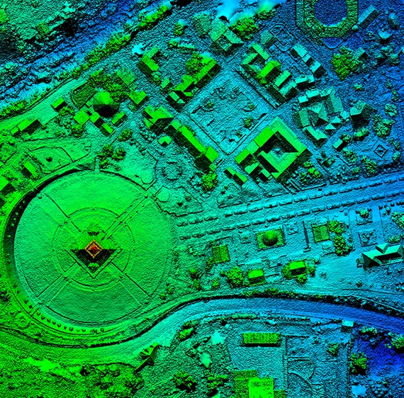
3D Aerial Data Capture for Construction projects in Morgan Hill enables teams to overcome terrain-related challenges and build with confidence.
These 3D visual models offer more than just visuals—they provide detailed surface visualization data to support excavation, grading, and utility planning for informational and coordination purposes only.
By integrating aerial data capture in Morgan Hill-specific workflows, general contractors can reduce monitoring costs, avoid delays, and maintain strong documentation throughout the lifecycle of the project.
Working on a Morgan Hill construction project?
Get region-specific insights with our expert Aerial Data Capture for General Contractors services in Santa Clara County and Northern California. Schedule a consultation now.
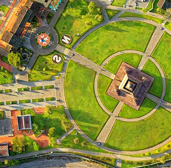
Streamlining Construction Workflows Through Aerial Data Capture for General Contractors
Integrating Aerial Data Capture for Seamless Project Execution
Implementing Aerial Data Capture for Construction into your day-to-day operations in Northern California begins with identifying areas where aerial data can eliminate bottlenecks.
From pre-construction monitoring to ongoing progress tracking, drones provide a continuous stream of actionable intelligence.
For general contractors, integrating aerial data capture into existing software (such as CAD, BIM, or GIS) helps maintain a cohesive digital workflow. Whether you’re tracking material stockpiles, assessing site grading, or verifying compliance with project specs, drones provide a consistent feedback loop.
Building a Drone-Ready Construction Team
To truly harness the power of Aerial Data Capture for General Contractors in Santa Clara County, you need a team that understands both the technology and its construction applications.
Aeroskape offers training support and consultations for teams to help with this process.
Training staff in FAA-compliant drone operation and interpretation of data capture outputs ensures smooth integration.
Invest in certifications and ongoing education to remain compliant and informed.
A well-trained team can proactively identify and respond to issues before they become costly delays.
Want to build a drone-ready team in Northern California?
Let us help you train and integrate drone technology into your existing construction workflow.
Reach out for a free consultation.
The Role of 3D Aerial Data Capture for Construction in Decision-Making
From Planning to Completion – Using Aerial Data to Support Results
Data is only as good as its usability.
With 3D Aerial Data Capture for Construction in Santa Clara County and Northern California, general contractors have access to real-time data that’s both visual and quantifiable.
This makes it easier to assess the current status of your site and make informed decisions instantly.
Use 3D aerial visualizations to monitor surface changes, compare actual vs. planned development, and track progress against key project milestones for planning and documentation purposes.
This dynamic visualization cuts down on ambiguity and helps you clearly communicate with architects, clients, and project managers.
Real-Time Collaboration with Cloud-Based Aerial Data Platforms
Using cloud-based platforms, stakeholders can access drone data from anywhere.
This is particularly helpful for general contractors managing multiple sites or working with remote teams across Santa Clara County and Northern California.
The combination of drone technology and cloud collaboration reduces downtime, shortens the approval cycle, and boosts productivity.
Ready to make smarter decisions faster?
Learn how 3D Aerial Data Capture for Construction in Santa Clara County and Northern California can revolutionize your project planning and execution.
Contact us today!
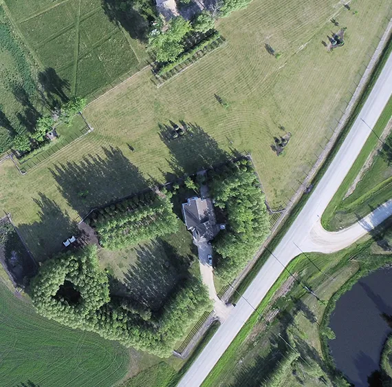
Aerial Data Capture for General Contractors: Future Trends and Applications
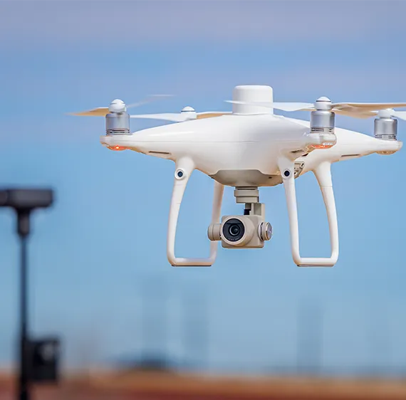
Innovations in Aerial Data Capture That Will Impact Construction
These systems automatically detect anomalies in construction progress, flagging potential issues before they affect your budget or timeline.
As drone flight time and camera quality continue to improve, so too will the quality and utility of drone-generated aerial visualizations and informational site data.
Expect to see integration with AR/VR platforms, real-time visual estimate tools, and predictive analytics that redefine how construction is managed.
Expanding the Use Cases of Aerial Data Capture in Construction
Aerial Data Capture for Construction in Santa Clara County can be used for site marketing, environmental compliance, and safety assessments.
Capture stunning aerial visuals to market your completed projects or track compliance for environmental regulations.
Stay ahead of construction trends.
Discover how next-gen Aerial Data Capture for General Contractors in Santa Clara County and Northern California can future-proof your business.
Book a strategy session now.
FAQs Section
We offer Aerial Imaging, Construction Site Monitoring, Structural Inspection Services, and more across the following locations:
Fremont, Fresno, Gilroy, Modesto, Monterey, Morgan Hill, Oakland, Sacramento, Salinas, San Francisco, San Jose, Santa Cruz, Stockton, Watsonville, Santa Clara County, Northern California, and the surrounding areas.
Disclaimer:
Aeroskape, LLC does not provide Professional Land Surveying services. Aeroskape’s services do not include the determination of property boundaries, contours, monuments, or the authoritative position of land or fixed objects as defined under California Business & Professions Code §8726. All deliverables are provided for planning, visualization, documentation, and informational purposes only. When survey-grade or legal deliverables are required, clients should consult a licensed Professional Land Surveyor (PLS).