Case Studies.

At Aeroskape, we leverage advanced aerial imaging to enhance project efficiency and coordination.
As a leading drone service provider, we deliver high-resolution aerial data capture and visual analysis for planning and documentation purposes.

Case Study 1: Aeroskape’s Progress Monitoring for Construction Project

Client Overview

  • Aeroskape provides aerial data acquisition and visual documentation services using drone technology.
  • Tasked with weekly progress monitoring and 360-degree panorama photos.

Project Scope:

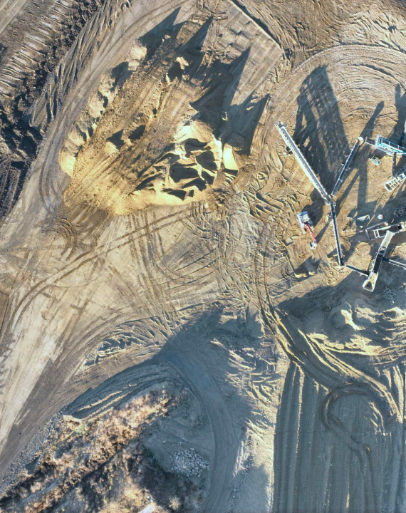
  • Conducted an autonomous aerial data capture mission covering a 370-acre site.
  • Drones operated at an altitude of 400 feet AGL.
  • Data collection focused on overall site progress from the previous week.

Key Benefits:

  • Efficiency: Drones expedited data collection, speeding up the project.
  • Detailed Visualization: High-resolution imagery provided detailed insights.
  • Informed Decisions: Ability to track project milestones.

Conclusion

  • Aeroskape’s project monitoring ensures that projects stay on track, delivering high-quality results on time and within budget.
Aerial photo of construction site dirt.
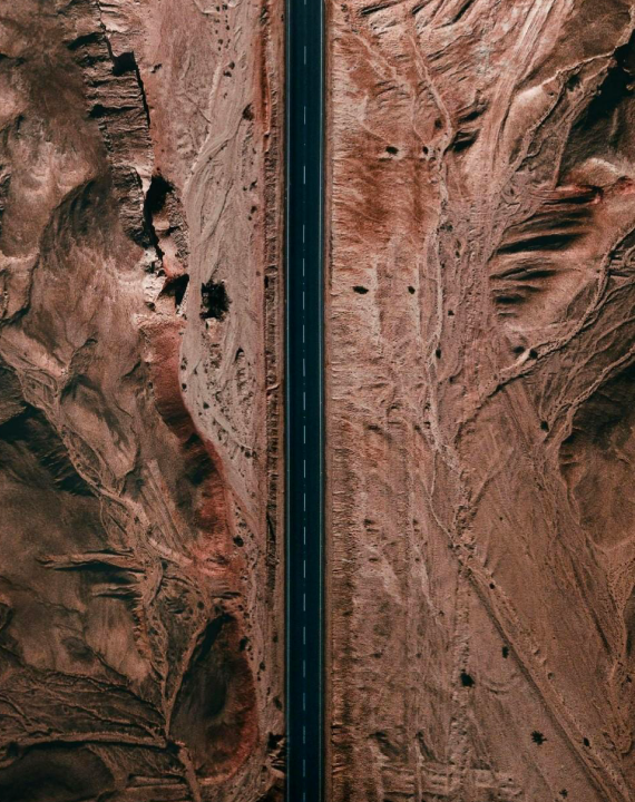
Aerial Corridor Data Capture for Broadband Installation Project

Case Study 2: Aeroskape’s Aerial Corridor Data Capture for Broadband Installation Project

Client Overview

  • Aeroskape provides aerial imaging and infrastructure documentation services using drone technology.
  • Tasked with corridor-based aerial data capture for a broadband installation project in Central California.

Project Scope:

  • Conducted corridor-based aerial data capture missions covering 25 miles.
  • Drones operated at an altitude of 200 feet. GSD of 0.5 inch.
  • Data collection focused on utility structures, roads, sidewalks, and curbs.

Key Benefits:

  • Efficiency: Drones expedited data collection, speeding up the project.
  • Detailed Visualization: High-resolution imagery provided detailed insights.
  • Community Impact: Minimized disruptions, fostering understanding.

Conclusion

  • Aeroskape’s project supported broadband installation, demonstrating commitment to innovation and community development.

Case Study 3: Aeroskape’s IR/Thermal Inspection for Water Leak Detection

Client Overview

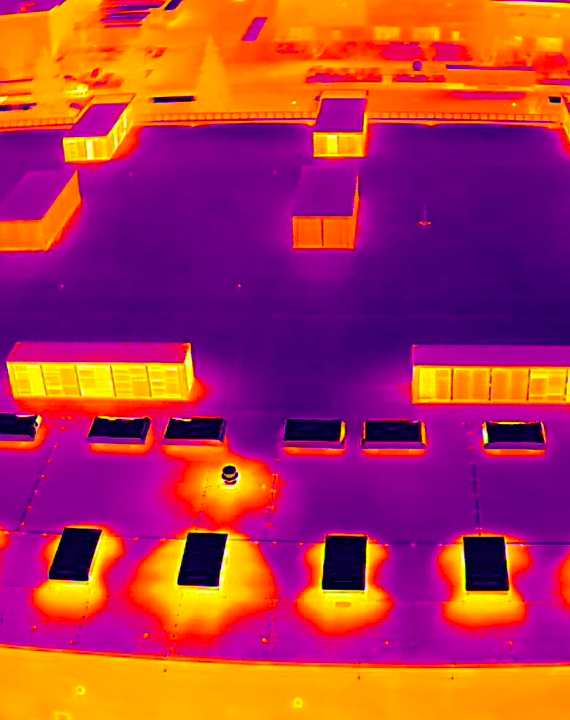
  • Conducted IR/Thermal inspection of the rooftop to locate water leaks and moisture.
  • One capture at night, 30 mins after sunset during Civil Twilight.

Project Scope:

  • Thermal Orthomosaic at 180ft AGL with 75/75 overlap.
  • Minimum 5 Manual Thermal photos of the roof.

Key Benefits:

  • Objective: Identify water leaks using IR/Thermal imaging.
  • Timing: Night inspection during Civil Twilight for optimal thermal conditions.
  • Data Collection: Drones equipped with IR/Thermal cameras.
  • Benefits: Reliable detection, timely inspection, comprehensive reporting.

Conclusion

  • Aeroskape’s IR/Thermal inspection project provided timely thermal documentation to support rooftop moisture assessments.
IR Thermal Inspection for Water Leak Detection

Disclaimer:

Aeroskape, LLC does not provide Professional Land Surveying services. Aeroskape’s services do not include the determination of property boundaries, contours, monuments, or the authoritative position of land or fixed objects as defined under California Business & Professions Code §8726. All deliverables are provided for planning, visualization, documentation, and informational purposes only. When survey-grade or legal deliverables are required, clients should consult a licensed Professional Land Surveyor (PLS).