California Drone Bridge Inspection Services: Ensuring Infrastructure Safety
Keeping California’s roads, bridges, and other vital structures in good shape is a big job. Traditional inspection methods can be slow, expensive, and sometimes downright dangerous for the people doing the work. That’s where new technology comes in. Drones, or Unmanned Aerial Vehicles (UAVs), are changing the game for how we check on our infrastructure. They’re faster, safer, and can get super detailed information, helping us spot problems before they become big headaches. This is especially true for something as important as our state’s bridges.
Key Takeaways
- Drone bridge inspection services in California offer a quicker way to check bridges compared to old methods.
- Using drones for bridge inspections can save money by cutting down on labor and equipment costs.
- Drones make bridge inspections safer by keeping workers out of hazardous spots.
- High-resolution cameras on drones provide very accurate data for detailed analysis.
- These services help maintain public safety by identifying potential issues on bridges early.
Benefits of Drone Services for Infrastructure Inspection
When it comes to checking on our bridges, roads, and other big structures, the old ways of doing things could be pretty slow and sometimes risky. But now, we’ve got drones, and they’re really changing the game. They make inspections faster, cheaper, safer, and give us way better information to work with.
Speed and Efficiency
Drones can cover a lot of ground, or in this case, a lot of bridge, really quickly. Think about it: instead of setting up scaffolding or bringing in big cherry pickers, you can launch a drone and get eyes on the structure in minutes. This means less disruption to traffic and less time spent on the inspection itself. For a bridge, this could cut down inspection time by half compared to how it used to be done. It’s a big win for keeping things moving.
Cost-Effectiveness
Let’s talk money. Traditional inspections often need a whole crew, plus all sorts of gear like lifts and safety harnesses. That adds up fast. Drones cut down on the need for so many people and so much equipment. This can lead to some serious savings, sometimes up to 75% less than what you’d spend with older methods. It makes sense to use technology that saves money while still getting the job done right. You can find providers who specialize in drone LiDAR technology for highly accurate surveys.
Safety Enhancements
This is a big one. Sending people up high or into tight, hard-to-reach spots can be dangerous. Drones take the inspectors out of harm’s way. They can get close-up views of critical areas without anyone having to put themselves at risk. This dramatically lowers the chances of accidents and injuries, which is good for everyone involved.
Accuracy and Data Quality
Drones aren’t just flying cameras; they’re packed with high-resolution cameras and other sensors. This means they can capture incredibly detailed images and data. They can spot small cracks or signs of wear that might be missed by the human eye during a quick visual check. This detailed information is super important for figuring out exactly what needs fixing and when. It helps make sure we’re not missing anything important.
The data collected by drones provides a clear, visual record of an infrastructure’s condition. This makes it easier to track changes over time and plan maintenance before small issues become big, expensive problems.
Here’s a quick look at how much time and money can be saved:
| Aspect | Traditional Method | Drone Method |
|---|---|---|
| Inspection Time | High | Low |
| Manpower Needed | High | Low |
| Equipment Costs | High | Low |
| Safety Risks | High | Low |
| Data Detail | Moderate | High |
Types of Infrastructure Inspected by Drones
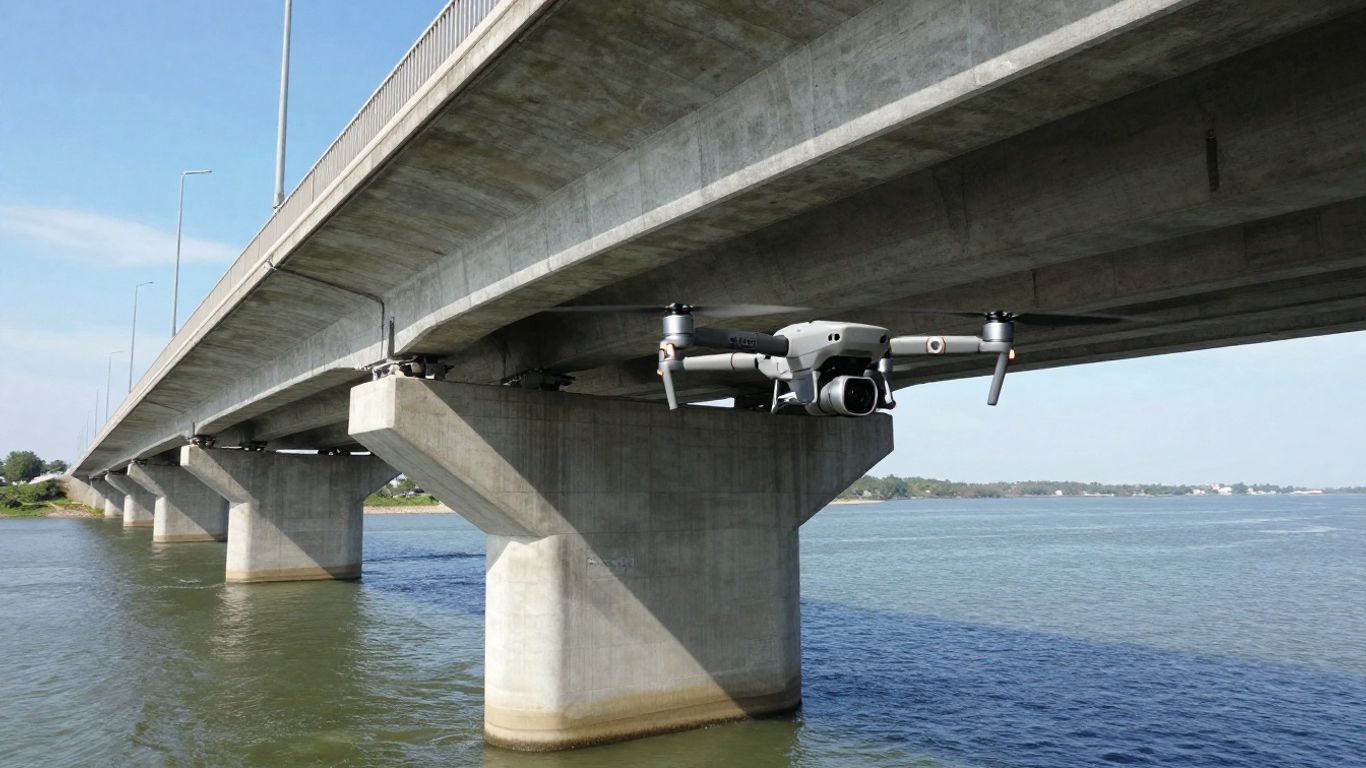
Bridges
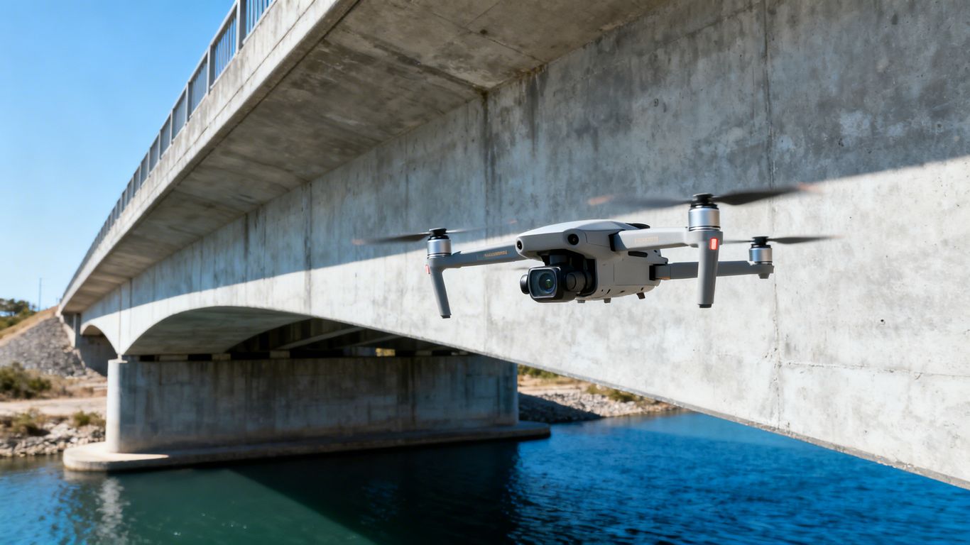
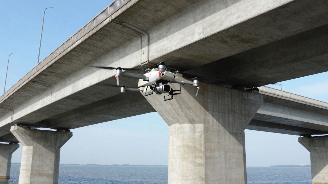
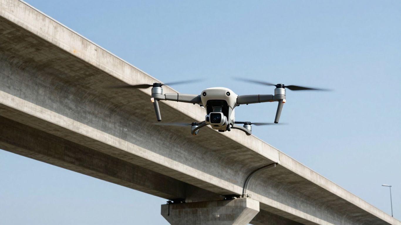
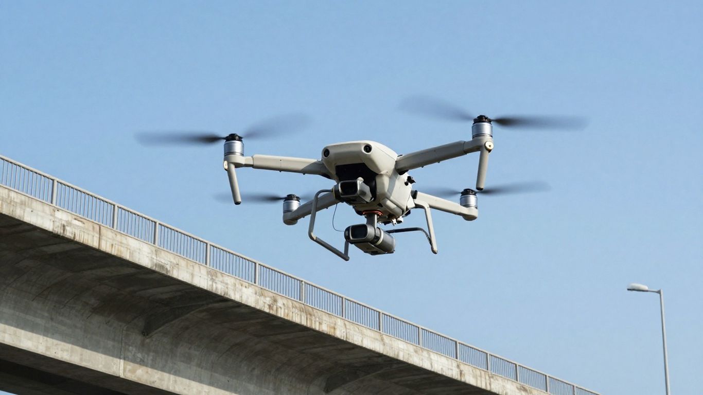
When it comes to bridges, drones are a game-changer. They can get up close and personal with every nook and cranny, spotting things like cracks, rust, or any signs of wear that might be hard to see from the ground or even from a cherry picker. Using techniques like photogrammetry, they create detailed 3D models, and thermal cameras can show us hidden issues like water trapped within concrete. This level of detail helps us understand a bridge’s health way better.
Roadways and Highways
For roads and highways, drones are great for checking the surface. They can map out potholes, see where the pavement is breaking down, and generally give a clear picture of the road’s condition. This helps road crews know exactly where to focus their repair efforts. Plus, they can even help with traffic studies, spotting problem areas or busy spots that might need rethinking.
Railways
Keeping train tracks safe is super important, and drones make that easier. They can fly along the tracks, looking for anything out of place – like debris that could cause a derailment or areas where the track itself might be damaged. They also keep an eye on how vegetation is growing near the tracks, which can be a hazard if it gets too close.
Energy Infrastructure
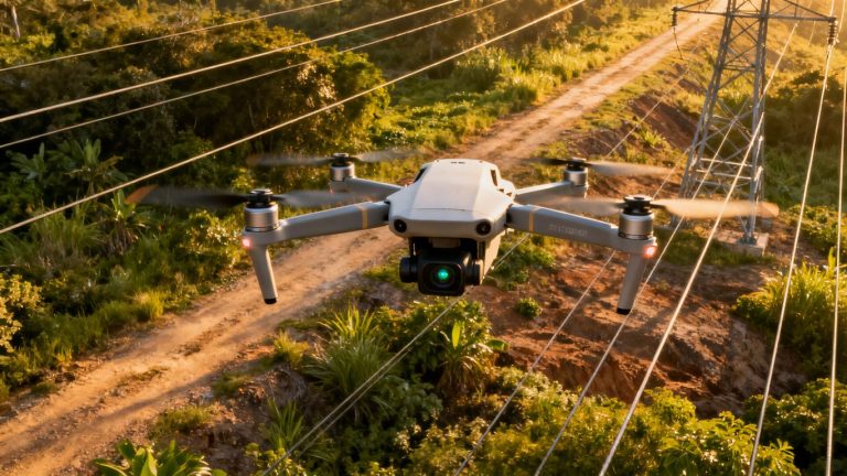
Think about power lines stretching for miles, or tall wind turbines. Drones can inspect all of this without needing to shut things down or send people way up high. They can spot problems like damaged insulators on power lines or check for overheating components. For wind turbines, they can inspect the blades for any damage that could affect performance or safety. It’s all about keeping the lights on and the energy flowing reliably.
Drones provide a bird’s-eye view that’s both practical and incredibly informative for managing our built environment. They let us see problems before they become big, expensive headaches.
Here’s a quick look at what drones can help with:
- Bridges: Spotting cracks, corrosion, and structural weaknesses.
- Roads: Identifying potholes, surface wear, and planning repairs.
- Railways: Checking for track defects and obstructions.
- Energy: Inspecting power lines, turbines, and solar panels for damage or wear.
The Drone Inspection Process
So, how does this whole drone inspection thing actually work? It’s not just about sending a flying camera up and hoping for the best. There’s a pretty solid process behind it, making sure we get the most useful information possible.
Initial Planning and Assessment
First off, nobody just flies a drone without a plan. We start by figuring out exactly what needs to be checked and why. This means looking at the structure, like a bridge or a stretch of highway, and deciding which parts are most important or might have issues. We set clear goals for the inspection. This helps us focus the drone’s flight path and the type of data we need to collect. It’s all about being smart with our time and resources.
Data Collection Techniques
This is where the drone really shines. We use different tools depending on what we’re looking for. High-resolution cameras are standard, capturing super clear pictures and videos. But we also use things like:
- LiDAR (Light Detection and Ranging): This shoots out laser pulses to create a super detailed 3D map of the structure. It’s great for measuring things precisely and spotting even tiny changes in shape.
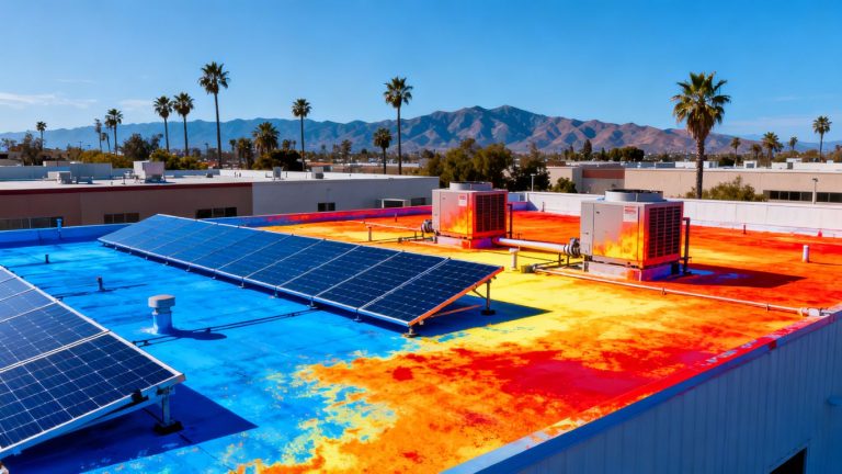
- Thermal Cameras: These detect heat. If a part of a bridge is hotter or colder than it should be, it could mean there’s a problem, like water trapped inside or an electrical issue.
- Photogrammetry: This is basically taking a ton of overlapping photos from different angles. Software then stitches them together to make a very accurate 3D model. It’s fantastic for seeing surface details.
The goal here is to gather data that’s not just pretty to look at, but actually tells us something useful about the condition of the infrastructure. We want to see things we might miss from the ground.
Data Analysis and Interpretation
Okay, so we’ve got all this data – tons of photos, 3D models, thermal readings. What now? We use special software to sort through it all. This isn’t just looking at pictures; the software can help identify patterns, measure cracks, compare current conditions to past inspections, and flag anything that looks out of the ordinary. It’s like having a super-powered assistant that can spot problems humans might overlook.
Reporting and Recommendations
Finally, we put all our findings into a clear report. This isn’t just a dump of data. We explain what we found, where we found it, and what it means. We’ll point out specific areas that need attention, like a crack that’s getting bigger or a spot of rust that’s spreading. The report usually includes recommendations for what to do next – maybe a repair is needed, or perhaps it just needs to be monitored more closely. This makes it easy for the people in charge to make decisions about maintenance and keep everything safe.
Case Studies of Successful Drone Inspections
Getting a feel for what drone inspections really achieve means looking at actual projects. Here are some real stories that highlight how drones are already shaping safer, smarter infrastructure upkeep in California.
Bridge Inspection Case Study
A public works department decided to use drones to check the condition of an old concrete overpass that spanned a busy urban highway. Instead of closing lanes or hanging ropes over traffic, inspectors launched a drone, which flew along the bridge deck and supports, snapping thousands of crisp photos and capturing thermal video for signs of water damage and cracking.
The result? Early signs of weaker concrete and rust on reinforcement bars were spotted, so repairs started before things got worse.
- No need to close traffic lanes
- Work finished in hours, not days
- Safer for everyone involved
| Metric | Traditional Inspection | Drone Inspection |
|---|---|---|
| Bridge Closure Needed | Yes | No |
| Inspection Duration | 2 days | 4 hours |
| Staff in Hazard Zones | 6 | 0 |
Fast, remote inspections keep maintenance teams out of harm’s way and prevent long shutdowns that frustrate commuters.
Railway Inspection Case Study
A railway company wanted to spot track defects and overgrown brush. They sent out a drone team to patrol a 50-mile stretch, checking rails, ties, and nearby trees.
- Drones found debris blocking tracks and branches leaning over the rail line.
- Video and maps were sent directly to operations crews for same-day cleanup.
- Reduced inspection time from several days to a single morning.
For more about different site survey approaches, see this summary of drone-based site surveys.
Energy Grid Inspection Case Study
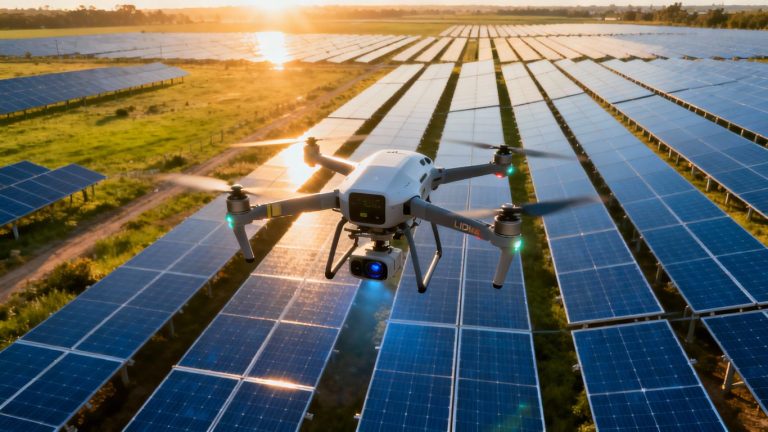
A solar company in southern California requested drone inspections for a large rooftop panel field and its connecting power lines. Using thermal imaging, drones tracked down panels running hot and spots with loose wiring:
- Drones tracked faulty connections and flagged panels that needed cleaning.
- Repairs were scheduled right away, helping prevent power outages.
- The whole inspection crew stayed safely on the ground.
- Fast results cut customer downtime
- No climbing or risky roof work
- Data for long-term repair planning
These case studies show how drones make regular, detailed infrastructure checks possible without much hassle or risk for workers. The combination of speed, safety, and accurate data keeps projects on time and budgets down.
Choosing a Drone Service Provider
So, you’ve decided that drones are the way to go for inspecting your infrastructure, which is a smart move. But now comes the big question: how do you pick the right company to actually do the job? It’s not just about finding someone with a drone; it’s about finding a partner who can give you reliable data and peace of mind.
Key Features to Look For
When you’re shopping around, keep these points in mind. It’s easy to get dazzled by fancy tech, but what really matters is how they can help you.
- Experience and Expertise: Have they done this kind of work before? Specifically, have they inspected structures like yours? A company that’s been around the block will know the ins and outs, potential pitfalls, and how to get the best data.
- Technology and Equipment: What kind of drones and sensors are they using? High-resolution cameras are a must, but depending on the job, you might need thermal imaging or other specialized gear. Make sure their tech is up-to-date and suited for your project’s needs. You can check out some of the latest advancements in drone tech here.
- Regulatory Compliance: This is a big one. Are they properly licensed and insured? Do they know all the local and federal rules for flying drones, especially around critical infrastructure? Getting this wrong can cause major headaches.
- Reporting and Data Delivery: How do they present the information they collect? You want clear, easy-to-understand reports that highlight any issues and offer practical advice. Some companies can even create 3D models of your infrastructure, which is pretty neat for visualizing problems.
Picking the right provider means looking beyond just the price tag. A slightly more expensive service that delivers accurate, actionable data can save you a lot more money and hassle in the long run compared to a cheap option that misses critical issues.
Experience and Expertise
This is where you really want to dig in. Don’t be shy about asking for examples of past projects. A provider with a solid track record in bridge inspections, for instance, will have a better grasp of what to look for and how to interpret the findings. They’ll understand the unique challenges that come with inspecting aging structures and can tailor their approach accordingly. It’s about finding someone who speaks the language of infrastructure maintenance.
Technology and Equipment
While experience is key, the tools they use matter too. Think about the specific needs of your inspection. For a bridge, you might need drones that can handle wind and capture incredibly detailed close-ups of concrete or steel. For other projects, like inspecting large solar farms, different types of sensors might be more important. It’s worth discussing the specific equipment they plan to use and why it’s the best fit for your job. Some providers might even offer different pricing models depending on the tech involved [0a50].
Regulatory Compliance
This isn’t the most exciting part, but it’s super important. Drone regulations can be complex and change often. A reputable provider will be completely up-to-date on all the rules and have the necessary certifications and insurance. This protects you from potential legal issues and ensures the inspection is conducted safely and legally. You don’t want your project stalled because of a paperwork oversight.
Future Trends in Drone Infrastructure Inspection
The world of inspecting things like bridges and power lines with drones is always changing. It’s pretty cool to think about how much better these flying gadgets are getting.
Advancements in Drone Technology
We’re seeing drones get smarter and fly longer. Think about drones that can fly for hours on a single charge, covering way more ground. Plus, they’re getting better at spotting problems on their own. This means fewer trips out and quicker identification of issues.
Integration with AI and Machine Learning
This is where things get really interesting. Drones are starting to work hand-in-hand with artificial intelligence (AI) and machine learning. Instead of just taking pictures, they can actually analyze them. Imagine a drone flying around a bridge and not just showing you a picture of a crack, but telling you how bad it is and what might have caused it. It’s like giving the drone a brain.
Expanded Applications
It’s not just bridges anymore. Drones are being used for all sorts of infrastructure. We’re talking about inspecting tunnels, dams, wind turbines, and even underground pipes. The more we can do with drones, the less we have to put people in risky spots.
The data these drones collect is becoming incredibly detailed. We’re moving beyond just spotting obvious damage to understanding the subtle signs of wear and tear that could become big problems later. This proactive approach is a game-changer for keeping our infrastructure in good shape.
Here’s a quick look at what’s coming:
- Smarter Sensors: Drones will have even more advanced sensors that can detect things like heat loss, material fatigue, or even subtle vibrations.
- Better Battery Life: Expect drones to fly much longer, allowing for more extensive inspections in a single outing.
- Autonomous Flight Paths: Drones will be able to plan and execute their own inspection routes, adapting on the fly to unexpected obstacles.
- Cloud-Based Data: All the information gathered will be easily accessible and shareable through cloud platforms, making collaboration simpler.
Drone Bridge Inspection Services in California
Serving Los Angeles and Surrounding Areas
California’s infrastructure is vast, and keeping tabs on all those bridges, especially around busy areas like Los Angeles, can be a real challenge. Traditional methods just take forever and cost a fortune, right? That’s where drones come in. We’re talking about getting a super close look at bridges without shutting down traffic for days or sending people way up high where it’s risky. Think of it like giving your car an inspection, but for a giant piece of concrete and steel that thousands of people rely on every single day. Our drone services are designed to make this process faster, safer, and way more affordable for agencies across the state.
Ensuring Public Safety
When it comes to bridges, safety is the absolute top priority. Nobody wants to hear about a bridge having problems, especially not when it could affect people’s lives. Drones help us spot issues early on. We’re talking about tiny cracks, signs of rust, or even just wear and tear that might be hard to see from the ground or with just a quick visual check. Getting this detailed information means that maintenance crews can fix things before they become big, dangerous problems. It’s all about being proactive and keeping everyone who uses these bridges out of harm’s way.
Cost-Effective Solutions
Let’s be real, maintaining infrastructure costs a ton of money. Old ways of inspecting bridges often involve a lot of equipment like cranes, scaffolding, and a whole crew of people. That adds up fast. Drones cut down on a lot of that. You don’t need to close down lanes for as long, and you don’t need as many people on-site. This means less disruption for drivers and, importantly, less money spent on the inspection itself. The data we collect is also super detailed, so you know exactly what needs fixing, avoiding unnecessary work and saving even more cash down the line.
Here’s a quick look at how drone inspections stack up:
- Reduced Inspection Time: Often cut by 50% or more compared to manual methods.
- Lower Costs: Can save up to 75% on inspection expenses.
- Minimized Traffic Disruption: Less need for lane closures and detours.
- Improved Safety: Significantly less risk for inspection personnel.
We’re seeing a big shift in how infrastructure is managed. Drones aren’t just a fancy gadget anymore; they’re becoming a standard tool for keeping our roads and bridges in good shape. It’s about using smart technology to do a better job with the resources we have.
Conclusion
So, that’s the big picture on drone bridge inspection services in California. Drones are changing the way we look after our bridges—making things faster, safer, and honestly, a lot less expensive. Instead of sending crews out with tons of gear, a drone can zip around and spot problems before they get serious. The data is clear and detailed, which helps everyone make smarter decisions about repairs and maintenance. As technology keeps moving forward, it’s likely drones will become an even bigger part of keeping our infrastructure in good shape. If you’re curious about how drone inspections could help your next project, it might be worth reaching out to a local provider and seeing what they can do. It’s a simple step that could save a lot of time and hassle down the road.
Frequently Asked Questions
What are the main benefits of using drones for inspecting things like bridges and roads?
Drones make inspections much faster and safer. They can cover large areas quickly and get close-up views without putting people in dangerous spots, like high up on a bridge or near moving traffic. This also saves money because you need fewer people and less equipment.
How do drones help make infrastructure safer?
Drones help keep infrastructure safe by finding problems early. They use special cameras to spot small cracks or signs of wear that might be missed by the human eye. This lets workers fix issues before they become big, dangerous problems.
Are drone inspections more accurate than traditional methods?
Yes, drones can be more accurate because they capture very detailed pictures and data from many angles. This information is then analyzed by experts using special software, leading to a better understanding of the structure’s condition.
What kinds of infrastructure can drones inspect?
Drones are great for inspecting many things, including bridges, roads, railways, power lines, wind turbines, and even dams. They are useful for any large structure that might be difficult or risky to inspect by hand.
How does the drone inspection process work?
First, a plan is made for what needs to be inspected. Then, the drone flies around and collects lots of data using its cameras and sensors. This data is later looked at closely to find any issues and create a report with suggestions for repairs.
Why is it important to choose the right drone service provider?
Picking the right company is important to make sure the job is done well and safely. You should look for providers with experience, good technology, and who follow all the rules and laws for flying drones.