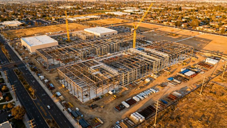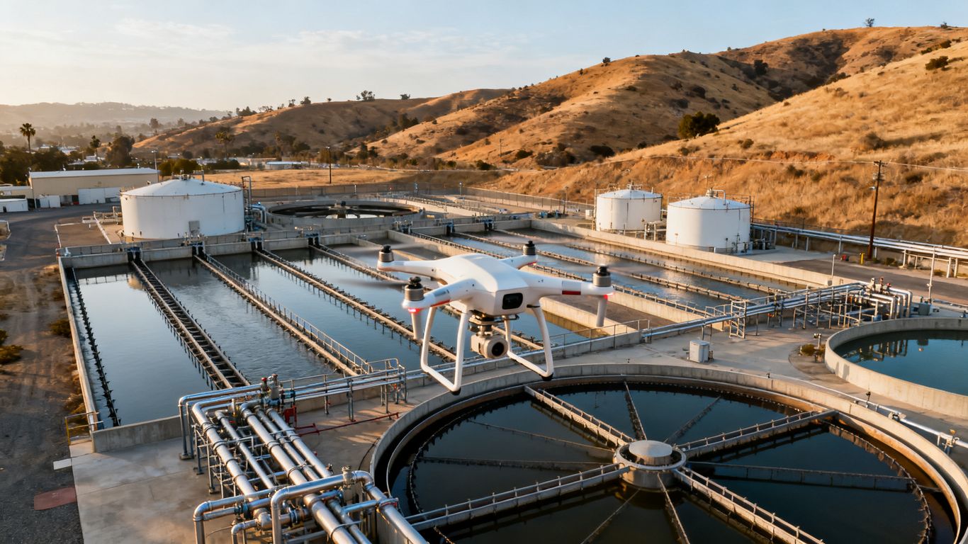
Water treatment plant drone inspection California: A practical guide to safer, smarter facility assessments
Key Takeaways
A well-planned drone inspection can give California water and wastewater teams a safer, clearer view of difficult assets. The best results come from matching the aircraft and sensors to the facility, then connecting the findings to practical maintenance decisions.
- Use aerial access to inspect elevated, remote, or hazardous areas before sending workers into them.
- Treat drone imagery as an inspection input that complements engineering review and hands-on testing.
- Select cameras, thermal sensors, LiDAR, or mapping tools according to the inspection question.
- Plan every flight around FAA requirements, facility safety rules, airspace, weather, and active operations.
- Request organized, repeatable deliverables that maintenance teams can act on.
Why water treatment plants in California use drone inspections
Water treatment facilities combine large structures, deep basins, elevated equipment, moving machinery, and areas that are difficult to reach safely. A water treatment plant drone inspection california program can provide useful visual evidence without making routine access the first step. It is especially valuable when a team needs current information before deciding whether a shutdown, lift, scaffold, or confined-space entry is warranted.
The goal is not simply to fly over a facility. It is to collect information that helps operators, engineers, and maintenance managers understand condition, risk, and next actions.
High-risk areas that benefit from aerial access
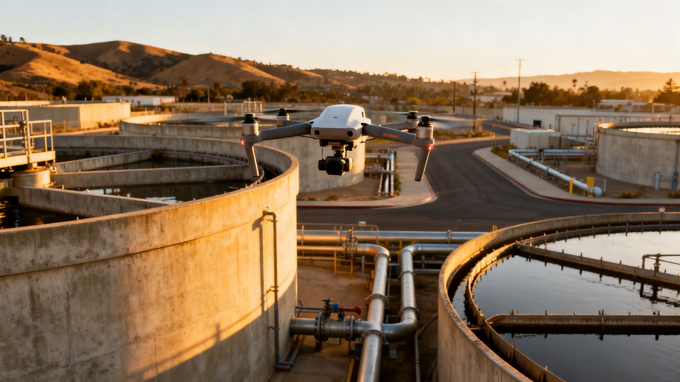
Roofs, tank exteriors, clarifier walls, towers, pipe racks, embankments, and reservoir edges are natural candidates for an aerial view. These assets may be visible from the ground but still difficult to examine closely, particularly when access requires ladders, lifts, traffic control, or temporary fall protection.
Aerial images can establish the condition of a broad area quickly and help staff identify where closer investigation is justified. The same principle appears in utility inspection and mapping, where optical, LiDAR, and thermal data can support infrastructure monitoring without treating the drone as a substitute for professional judgment.
Inspection challenges caused by confined spaces and hazardous conditions
Tanks, wet wells, channels, and enclosed process areas can involve limited access, poor lighting, water, slippery surfaces, or potentially unsafe air. Sending people into such spaces requires a separate safety assessment, entry procedures, monitoring, and rescue planning. A drone may allow a preliminary visual review before those controls are considered.
Indoor or confined-space flights also have different demands from open-air flights. Operators need suitable lighting, stable communications, obstacle awareness, and a clear recovery plan. The inspection question should determine whether a small protected aircraft, a tethered system, or a conventional outdoor drone is appropriate.
How drones reduce downtime and worker exposure
Aerial inspection can reduce the need for repeated climbs, temporary access equipment, and early-stage shutdowns. It may also let a facility team document conditions during a planned operating window rather than waiting for a major outage. Those benefits depend on careful coordination; a drone flight still has to respect energized equipment, moving assets, personnel, and process constraints.
Safer initial access is often the practical value. A first-pass view can help a manager separate routine maintenance from conditions that warrant immediate isolation or a specialist inspection.
When drone inspections complement, rather than replace, traditional methods
Drone imagery generally shows visible surface conditions and spatial context. It does not, by itself, establish material strength, subsurface damage, water chemistry, coating adhesion, or every structural cause. Qualified engineers, inspectors, operators, and maintenance personnel still need to interpret findings and select confirmatory methods.
A useful program pairs aerial evidence with records such as previous inspection reports, corrosion measurements, leak history, work orders, and engineering drawings. This keeps the drone in its proper role: a way to gather timely information and focus human expertise where it matters most.
What to inspect with a drone at a water treatment facility
The inspection scope should follow the facility’s assets and the decision that needs to be made. Some flights are broad condition surveys; others focus on a roof, reservoir, embankment, or process structure after a reported concern. Before launch, define the areas to cover, the image quality required, and the deliverable that staff will use afterward.
A visual record is most useful when it is tied to identifiable assets and repeatable viewpoints. That makes a later comparison more meaningful than a folder of unrelated photographs.
Clarifiers, tanks, basins, and reservoirs
Large circular clarifiers, storage tanks, open basins, and reservoirs can be documented from above and around their perimeter. Imagery may reveal visible coating deterioration, unusual staining, debris, damaged appurtenances, access issues, or changes along a rim or wall. It can also provide context for planning a closer inspection.
Water surfaces create glare and reflections, so flight timing and camera angle matter. Operators should avoid assuming that a clear-looking surface proves the absence of submerged, internal, or structural problems.
Roofs, pipes, towers, and structural exteriors
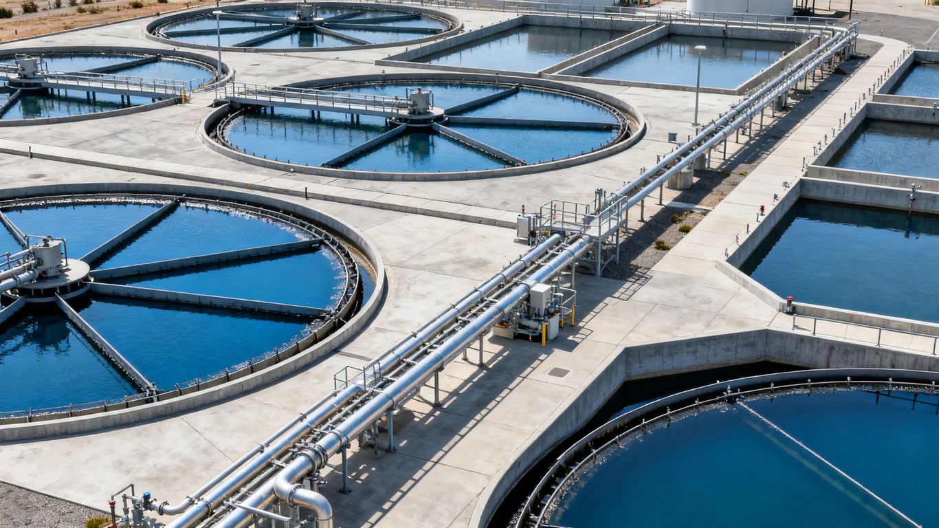
Roofs and elevated structures often contain drains, vents, seams, supports, ladders, and penetrations that are hard to view from grade. High-resolution imagery can document visible damage and help teams decide where a lift or close visual examination is needed. Pipe bridges and towers likewise benefit from planned passes that capture both wide context and close detail.
The flight should account for wind around tall structures and the possibility of radio interference near metal equipment. A good operator also preserves safe separation rather than flying close simply to obtain a dramatic image.
Dams, ponds, channels, and surrounding infrastructure
Dams, ponds, channels, access roads, drainage features, and perimeter areas may extend beyond the main plant. Aerial coverage can help identify visible erosion, vegetation growth, blocked drainage, slope changes, or access problems. For a broader site view, levee inspection planning offers a useful reminder that aerial data supports ground verification rather than replacing it.
The same limitation applies to treatment-facility earthworks. Surface imagery can point to a concern, but subsurface conditions and structural questions require appropriate field methods and professional review.
Corrosion, leaks, cracks, sediment, and vegetation concerns
Drone imagery can help locate visible corrosion, staining, cracking, leaks, sediment patterns, and vegetation encroachment. It is strongest when the flight captures enough surrounding context to show exactly where a defect occurs and enough detail to support a follow-up decision.
Operators should record the asset identifier, viewpoint, date, lighting conditions, and any relevant operating state. A mark on a map or model is far more useful than an unlabeled close-up whose location must be guessed later.
Choosing the right drone inspection technology
The right aircraft is determined by the environment and the information required, not by the most impressive specification sheet. A wide outdoor survey may need efficient coverage and stable positioning, while a dark or enclosed space may need lighting, collision protection, and a different control approach. Sensor selection should follow the defect or condition the team is trying to evaluate.
It is also worth separating data collection from interpretation. More sensors can create more files, but they do not automatically create a better maintenance decision.
Camera systems for visual and thermal inspections
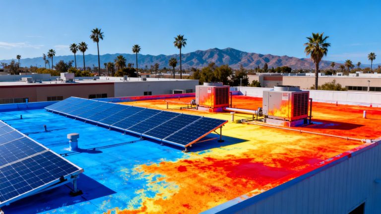
RGB cameras are the foundation for most visual inspections, particularly when the work calls for condition photos, close details, or repeatable views. Thermal cameras can reveal temperature differences that deserve investigation, although an anomaly is an indicator rather than a diagnosis. Surface material, moisture, weather, emissivity, and operating conditions all affect interpretation.
A provider describing thermal drone inspections should be able to explain what the thermal images will show, how they will be captured, and what limitations apply. The deliverable should distinguish observed imagery from conclusions that require engineering or maintenance analysis.
LiDAR, photogrammetry, and 3D mapping capabilities
Photogrammetry can turn overlapping photographs into maps or three-dimensional visual products when the site, lighting, ground control, and processing workflow support that result. LiDAR can be useful where geometry, vegetation, or complex surfaces make laser measurements appropriate. Neither method should be selected without defining the required accuracy and intended use.
For facility work, a model may help teams view a structure from consistent angles, measure visible relationships, or communicate a finding. It should not be presented as a certified land survey or as a replacement for licensed professional services when those are required.
Tethered drones for confined or communication-limited spaces
Tethered systems can provide continuous power and a controlled connection in some confined or communication-limited environments. They may be useful where a short flight is not enough or where recovery and signal reliability are major concerns. Their cables, however, introduce their own management issues around pipes, edges, water, and moving equipment.
Indoor work also calls for a dedicated risk assessment. The team should decide how the aircraft will enter, who controls the area, what happens if it contacts a surface, and how the system will be removed without exposing workers unnecessarily.
Sensors and payloads for gas, moisture, and environmental monitoring
Specialized payloads can support questions about gas, moisture, temperature, or other environmental conditions, but the sensor must be suitable for the target and interpreted within its operating limits. Calibration, sampling method, atmospheric conditions, and placement all affect the reliability of a reading.
Before approving a payload, ask what it measures, what it does not measure, and whether the result is informational or suitable for a regulated decision. In many cases, drone data is best used to identify where a qualified technician should perform a direct test.
California regulations and operational requirements
A safe inspection begins before the aircraft leaves the case. The operator must consider federal flight rules, local airspace, the facility’s security requirements, privacy, environmental sensitivities, and the risks created by active treatment operations. California sites can vary substantially, from urban plants near airports to remote reservoirs with changing terrain and weather.
The facility owner and the drone provider should agree in writing on who controls the work area, who may stop the flight, how data is handled, and what records will be delivered.
FAA Part 107 certification and remote pilot responsibilities
Many commercial small-drone operations are conducted under FAA Part 107, which places responsibilities on the remote pilot and the operation itself. The pilot must understand applicable operating limits, visual-line-of-sight requirements, crew coordination, aircraft condition, and the circumstances that require additional authorization or a different compliance path.
A facility should ask for the pilot’s credentials and operating procedures rather than assuming that a drone license alone covers every site condition. The Otay Water District drone program illustrates how trained personnel and compliance can be part of a broader operational approach to preliminary facility inspections.
Airspace checks near airports, cities, and restricted locations
Airspace must be checked for the specific location and flight date. Nearby airports, temporary restrictions, controlled airspace, heliports, public events, military areas, and other limitations can affect the plan. A flight that is acceptable at one treatment plant may not be acceptable at another a few miles away.
The provider should document the airspace review and any authorization or coordination required. This is particularly important when the work involves elevated structures, nearby public areas, or a flight path that could extend beyond the immediate facility boundary.
California privacy, environmental, and facility access considerations
A plant is an operational site, not an empty backdrop. Workers, neighbors, visitors, security systems, wildlife, and sensitive process information may appear in the imagery. Flights should be limited to the approved area, and captured data should be handled according to the owner’s privacy and security requirements.
Environmental restrictions may also apply, especially near protected habitat, waterways, parks, or areas with posted drone limitations. The provider and owner should confirm access rules instead of treating a general permission to fly as universal permission for a particular site.
Permits, insurance, safety plans, and documentation
A written flight plan should identify the aircraft, pilot, observers, launch and recovery points, hazards, communications method, emergency actions, and data deliverables. Insurance requirements, site orientation, badging, escort rules, and lockout procedures may be just as important as federal aviation compliance.
At minimum, retain the risk assessment, preflight checklist, airspace review, approvals, flight logs, and incident records. Clear documentation protects the facility and makes a later inspection easier to audit.
Planning a water treatment plant drone inspection
Planning turns a flight into an inspection program. Start with the asset, the concern, and the decision that will follow. Then set boundaries around the work so the operator knows what must be captured and the facility knows what will remain outside the scope.
A practical plan also leaves room for changing conditions. Treatment plants are active environments, and an operational need may take precedence over an image collection window.
Defining inspection goals and measurable deliverables
A goal such as “inspect the tanks” is too broad to guide a consistent flight. A stronger scope identifies the assets, visible conditions, viewpoints, resolution, naming convention, map or model requirements, and reporting deadline. It should also say whether the work is a baseline survey, a repeat inspection, a post-event review, or a focused investigation.
Deliverables might include organized still images, annotated findings, georeferenced outputs, a 3D model, thermal imagery, or a concise condition report. The provider should state what is included and what requires engineering interpretation.
Creating a flight plan around active treatment operations
The flight plan should reflect cranes, vehicles, maintenance crews, overhead lines, tall structures, water hazards, restricted zones, and changing process conditions. Establishing launch and recovery areas away from public access and active equipment reduces confusion on site.
For repeat work, preserve the route, camera orientation, altitude, and relevant settings when practical. Consistency helps distinguish actual condition changes from differences caused by the way the data was captured.
Coordinating with plant staff and maintenance teams
Plant staff know which gates are locked, which equipment moves, which areas are sensitive, and when operations change. Their briefing should be part of the inspection plan, not an informal conversation after arrival. Include operations, maintenance, safety, security, and engineering representatives as appropriate.
A short preflight meeting can confirm the day’s scope and establish a single point of contact. It also gives the team a chance to identify assets that are scheduled for repair, so the imagery supports rather than complicates the work record.
Managing weather, lighting, water conditions, and emergency procedures
Wind, rain, glare, heat, fog, and low light can affect both aircraft control and image quality. Water surfaces may reflect sunlight, while shadows from tanks and towers can hide important details. The provider should define weather limits and a rescheduling process before the crew arrives.
Emergency procedures should cover lost communications, low battery, unexpected people or vehicles, contact with a structure, water landing, and a sudden need to clear the area. The plan does not need to be elaborate, but everyone should know who makes the stop-work decision.
Turning drone data into useful maintenance decisions
Raw imagery becomes valuable when people can find the relevant asset, understand the condition, and decide what to do next. That requires disciplined capture, clear file organization, and a reporting format that matches the facility’s existing maintenance process. A visually impressive flight can still fail if no one can connect its findings to a work order or inspection history.
The best workflow usually combines broad context with close evidence. One shows where a concern is; the other helps a reviewer understand why it matters.
Capturing consistent imagery for condition comparisons
Repeat inspections should use stable viewpoints and a documented capture method whenever conditions allow. Record the date, weather, asset status, camera settings where relevant, and route or capture pattern. The goal is not perfect sameness, but enough consistency to make changes easier to recognize.
A baseline set should include reference views as well as defect details. Without context, a later reviewer may see deterioration but struggle to determine its position, extent, or relationship to nearby equipment.
Identifying defects and prioritizing repair needs
A report should separate observed conditions from assumptions about cause. For example, visible staining may justify a leak investigation, while a thermal difference may justify electrical or mechanical testing. Priority can then reflect severity, consequence, likelihood, access difficulty, and the confidence of the evidence.
A compact review sequence helps maintenance teams move from image to action:
- Confirm the asset identity and exact location.
- Describe the visible condition without overstating certainty.
- Compare it with prior imagery, drawings, or inspection records.
- Assign a priority and recommend the appropriate follow-up.
This approach keeps the flight findings useful without turning aerial imagery into an unsupported engineering conclusion.
Combining drone findings with engineering and inspection records
Drone data should sit alongside work orders, coating records, structural assessments, leak reports, operator observations, and previous photographs. That combined record can reveal whether a mark is new, recurring, seasonal, or already scheduled for repair.
A provider may deliver excellent images, but the facility still needs an internal owner for review and escalation. Engineering and maintenance staff should decide when a finding requires nondestructive testing, isolation, repair design, or a formal inspection.
Building reports, maps, models, and maintenance work orders
The final format should fit the people who will use it. Executives may need a short condition summary, while maintenance staff may need annotated photographs, asset identifiers, coordinates, and suggested follow-up actions. A map or model can add context when many findings are distributed across a large site.
Before commissioning the work, agree on file types, naming, storage, access permissions, retention, and turnaround. The Commercial Drone Inspection service page describes a decision-oriented use of high-resolution imagery, terrain visualization, and 3D aerial modeling; those kinds of outputs are most useful when tied to a defined project need rather than collected without a workflow.
Evaluating California drone inspection providers
Choosing a provider is less about finding the lowest flight price and more about finding a team that understands the site, the risk, and the required decision. Ask to see how the company scopes work, documents safety controls, manages data, and explains limitations. A professional provider should be comfortable saying when a drone is not the right tool.
The evaluation should cover both flight operations and the quality of the final information. A safe flight with poorly organized files is not a complete inspection service.
Experience with water and wastewater treatment facilities
Relevant experience matters because treatment plants have unusual access, safety, privacy, and operational constraints. Ask whether the team has worked around tanks, basins, reservoirs, process equipment, confined areas, and active maintenance. Experience should be described specifically, without implying that every facility presents the same risks.
Also ask how the provider coordinates with operators and how findings are presented to engineering or maintenance personnel. The answer will reveal whether the company understands the work as an operational assessment rather than a simple photo shoot.
Pilot qualifications, safety practices, and regulatory compliance
Request information about pilot certification, aircraft maintenance, insurance, airspace review, site risk assessment, emergency procedures, and crew roles. Confirm who has authority to stop the work and how the provider manages people, vehicles, and other aircraft near the flight area.
A good proposal explains assumptions and exclusions. It should not promise access to a confined space, a restricted airspace, or an active process area without describing the approvals and controls required.
Data security, reporting standards, and turnaround times
Facility imagery may reveal security layouts, equipment condition, or sensitive infrastructure. Clarify where data is stored, who can access it, how it is transferred, and how long it is retained. Confirm whether original files, processed outputs, annotations, and reports are included.
Turnaround should be tied to the client’s decision timeline. A rapid delivery is useful only if the files are labeled, reviewable, and accompanied by enough context to support action.
Questions to ask before hiring an inspection company
A short interview can expose gaps before mobilization. Ask questions such as:
- What specific assets and conditions will the flight document?
- Which aircraft and sensors fit the site, and why?
- What approvals, safety controls, and weather limits apply?
- What will the final deliverables look like, and when will they arrive?
- How will findings connect to maps, records, or maintenance decisions?
The answers should be concrete rather than filled with broad promises. If the project needs a project consultation, provide the asset list, site constraints, desired decision, and requested delivery date so the scope can be evaluated accurately.
Conclusion
A water treatment plant drone inspection california program can make difficult assets easier to review while reducing unnecessary exposure and disruption. Its value depends on disciplined planning, compliant operations, suitable sensors, repeatable data capture, and thoughtful integration with engineering and maintenance records. When the scope is clear and the deliverables are usable, aerial inspection becomes a practical part of responsible facility management rather than a flight performed for its own sake.
Frequently Asked Questions
What can a drone inspect at a water treatment plant?
A drone can document visible conditions on tanks, clarifiers, basins, roofs, towers, pipes, reservoirs, ponds, channels, embankments, and surrounding infrastructure. The exact scope depends on access, airspace, weather, facility rules, and the aircraft and sensors selected.
Can drones replace confined-space entry?
They can sometimes provide a preliminary visual assessment and help determine whether entry is necessary. They do not automatically replace required entry procedures, direct testing, engineering review, or inspections that depend on touch, measurement, sampling, or subsurface information.
Are drone inspections allowed near California water facilities?
They may be allowed, but permission depends on FAA requirements, airspace, facility authorization, local conditions, privacy, environmental considerations, and the specific operation. A provider should complete and document the applicable checks before flying.
What drone sensors are useful for treatment-facility inspections?
RGB cameras are useful for visible conditions, while thermal cameras can identify temperature differences that warrant further review. Photogrammetry and LiDAR may support mapping or three-dimensional documentation when the project requires those outputs and the capture conditions are suitable.
How often should a water treatment facility use drone inspections?
There is no universal schedule. Frequency should reflect asset criticality, exposure, operating conditions, previous findings, regulatory or engineering requirements, and changes at the site. A baseline flight followed by repeat imagery can help establish a useful comparison record.
What should an inspection report include?
A report should identify the assets inspected, date and conditions, methods used, organized imagery, annotated findings, limitations, and recommended follow-up. Depending on the scope, it may also include maps, models, thermal outputs, coordinates, and information that can be transferred into maintenance records.
Do drone inspections require an engineer’s review?
A drone operator can collect and organize aerial information, but engineering conclusions may require a qualified engineer or other appropriate specialist. The need depends on the asset, the observed condition, the intended decision, and applicable professional or regulatory requirements.