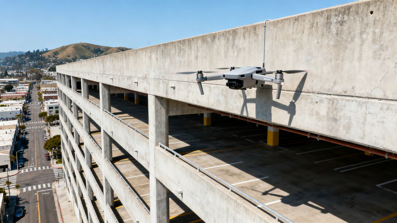
Parking structure drone inspection Bay Area: A practical guide to safer, faster assessments
Key Takeaways
A parking structure drone inspection bay area project can give owners a clearer view of hard-to-reach conditions while reducing disruption to daily operations.
- Drone imagery can document elevated concrete, ramps, joints, and other difficult-to-access areas.
- A flight plan should account for vehicles, pedestrians, nearby buildings, weather, and airspace requirements.
- Aerial findings support engineering judgment; they do not replace hands-on assessment where needed.
- Useful reports connect each defect to a location, severity, photograph, and recommended next step.
- Recurring inspections make it easier to compare conditions and plan maintenance before problems grow.
Why parking structures need regular drone inspections
Parking garages combine heavy traffic, reinforced concrete, water exposure, and repeated loading in one structure. Small cracks, staining, spalls, corrosion, or failing joints may begin in places that are difficult to see from the ground. Regular documentation gives owners and engineers a better basis for deciding what needs attention and when.
Aerial inspection is not a substitute for professional structural evaluation. It is a practical way to collect consistent visual information, especially across façades, upper levels, and other areas where access equipment would slow the work.
Common signs of deterioration in concrete garages
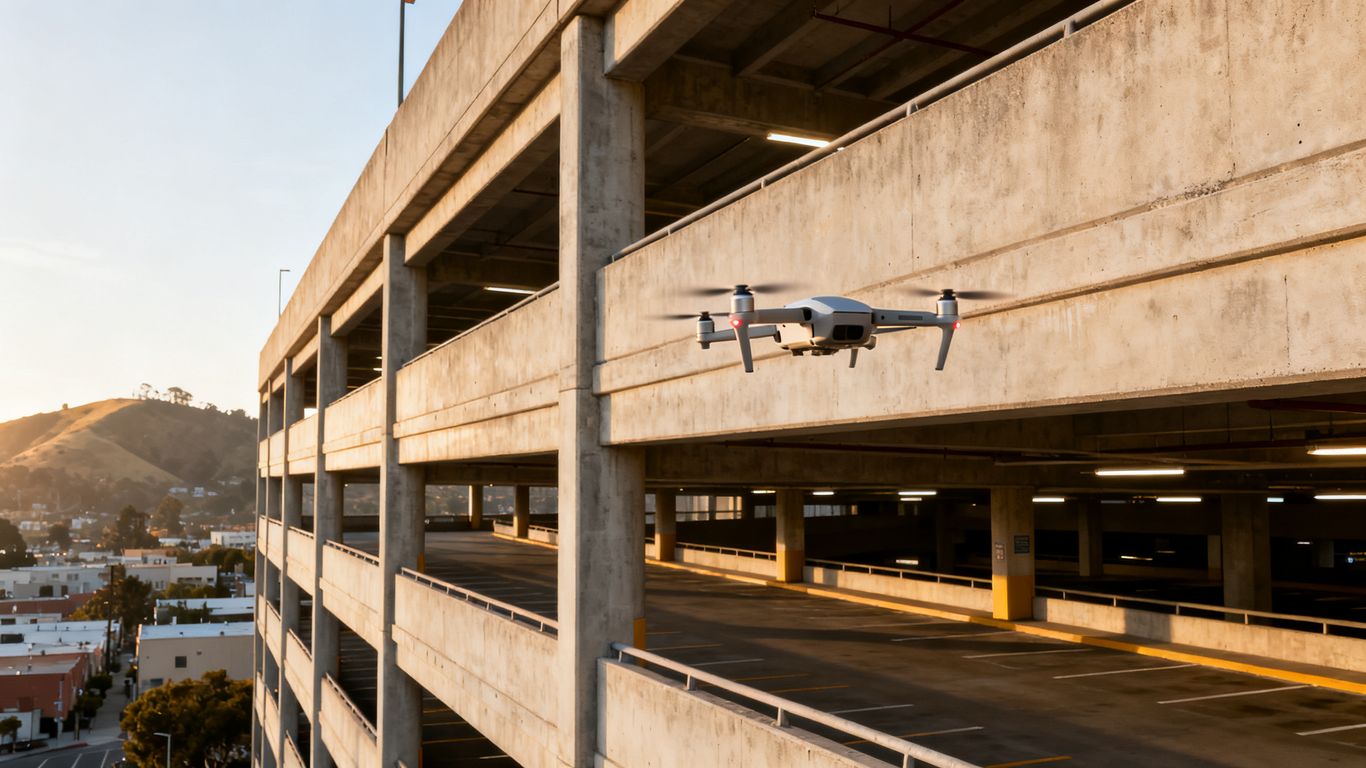
Concrete garages may show cracking, delamination, exposed reinforcing steel, rust staining, efflorescence, water marks, and localized spalling. Drainage problems can leave recurring damp areas, while movement at expansion joints may produce gaps or broken sealants. These signs do not all indicate the same level of risk, but they are useful starting points for a closer review.
The pattern matters as much as the individual mark. A single surface blemish may be cosmetic, while repeated cracking near a joint, beam, column, or slab edge can justify prompt professional attention.
How inspections identify safety and maintenance risks
A systematic flight creates photographs and video from repeatable viewpoints. Reviewers can examine visible concrete surfaces, compare nearby conditions, and mark areas that deserve a ground-level look. The result is a shared visual record for facility managers, engineers, owners, and repair teams.
Clear location context matters because a defect that cannot be found again is difficult to prioritize or price. Images should be tied to a level, elevation, grid reference, or other practical location system whenever possible.
Limitations of traditional access methods
Lifts, scaffolding, ladders, and rope access can still be appropriate, especially when a professional needs close contact with the structure or must perform testing. They may also require staging areas, traffic control, additional labor, and longer periods of disruption. An aerial review can help identify where those more involved methods are actually warranted.
The useful comparison is not “drone versus every other inspection method.” It is whether remote visual documentation can safely cover more of the structure before a team commits to specialized access.
When drone inspections are most valuable
Drone work is particularly useful before a repair program, after severe weather, during an ownership or insurance review, or when recurring records are needed. It can also help teams examine façades and elevated edges while keeping the initial review away from active traffic and fall exposures.
For a broader local framework, commercial inspection planning in Santa Clara County offers a helpful reminder to define scope, choose suitable sensors, and treat aerial data as support for professional judgment. The same discipline applies to a parking structure, even when the property is smaller.
What a parking structure drone inspection includes
The scope should be agreed before the aircraft takes off. A useful inspection brief identifies the structure, levels, elevations, surfaces, known concerns, desired sensors, access limitations, and final deliverables. This keeps the work focused on decisions rather than producing a large folder of disconnected images.
Depending on the site, the collection may combine standard photographs, video, thermal imagery, or other aerial data. The provider should explain what each data type can and cannot show, and where a hands-on assessment remains necessary.
Exterior concrete, beams, columns, and slabs
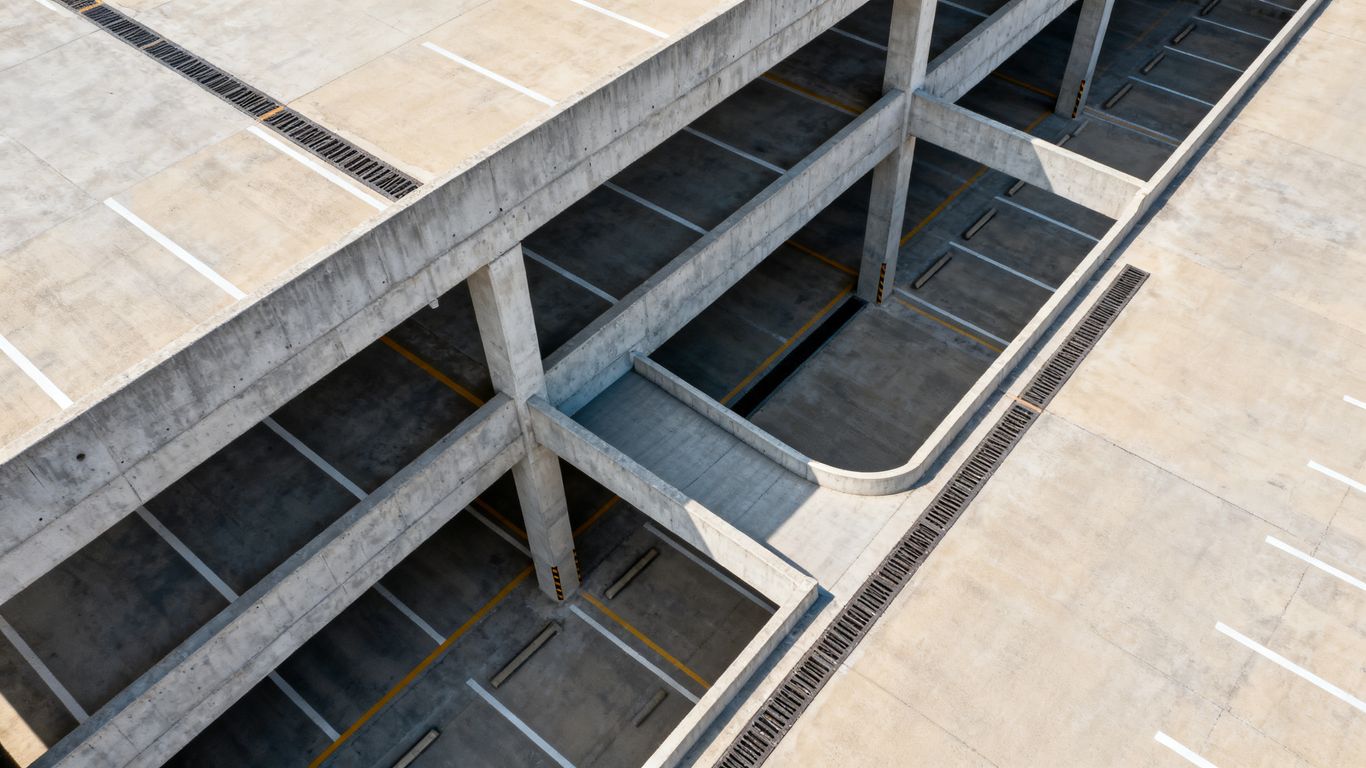
The aircraft can document visible exterior faces and elevated structural elements from multiple angles. Beams, columns, slab edges, soffits, parapets, and façade surfaces may all be included when the flight path and site conditions allow. The inspection team should distinguish between surfaces that were visually captured and areas that were obstructed or outside the agreed scope.
High-resolution imagery helps reviewers zoom into visible conditions without immediately placing personnel at height. It still does not reveal every concealed or internal defect.
Deck surfaces, ramps, and expansion joints
Decks and ramps deserve attention because traffic, water, deicing materials, and movement can affect their condition. Aerial views may document broad surface patterns, joint lines, ponding indicators, damaged edges, and changes around transitions. Ground observations may still be needed to assess texture, soundness, drainage flow, or material depth.
The best scope connects these views to maintenance questions: Is a joint failing? Is water reaching a lower level? Is a damaged ramp creating an operational concern? Those questions make the imagery more useful than a general flyover.
Drainage systems, lighting, and difficult-to-reach areas
Drainage outlets, scuppers, downspouts, light fixtures, upper corners, and narrow exterior recesses can be difficult to inspect from normal walking routes. A planned flight may document their visible condition and reveal blocked, damaged, or deteriorated components. Obstructions, glare, shadows, and line-of-sight limits should be recorded rather than quietly assumed away.
Lighting and drainage observations can also help maintenance teams coordinate several small repairs at once. The report should separate directly observed conditions from items that need confirmation in the field.
High-resolution images, video, and thermal data
Standard visual imagery provides the basic record of visible surfaces. Video can help preserve context across a façade or level, while thermal data may identify heat differences that warrant further investigation; it should not be treated as proof of a specific structural defect. Aeroskape describes Thermal Drone Inspections as using infrared and thermal imagery to identify hidden heat anomalies and support maintenance planning.
Thermal findings need visual context and suitable environmental conditions. A practical report explains where thermal data was collected, how it relates to the visible condition, and what follow-up is appropriate.
Reviewing prior inspection records for comparison
Prior reports, repair drawings, photographs, and maintenance logs give the inspection team a baseline. Matching viewpoints, locations, and naming conventions makes change easier to recognize across seasons or inspection cycles. Even when older records are incomplete, they can help identify areas that deserve extra attention.
Comparison is strongest when the new collection follows a repeatable plan. Consistent flight paths and location references turn separate inspections into a usable condition history.
How drone inspections work in the Bay Area
A Bay Area garage may sit beside busy streets, apartment buildings, offices, transit routes, or other active properties. Coastal wind, fog, uneven terrain, and changing airspace conditions can affect the collection plan. A competent team treats the flight as a site operation, not simply a short equipment demonstration.
The property manager, pilot, and engineer should agree on the purpose of the work before scheduling. That conversation sets realistic expectations for coverage, timing, access, privacy, and the report.
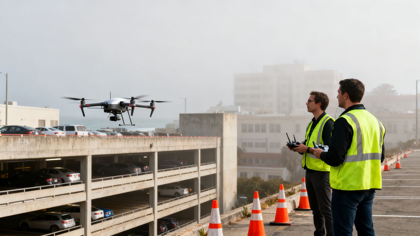
Pre-inspection planning and site assessment
Planning begins with a review of the structure, surrounding obstacles, takeoff and landing areas, access points, and known hazards. The team should identify which elevations need imagery, whether the garage will remain occupied, and what information the final users need. A site visit or remote assessment can expose constraints that are not obvious on a map.
The scope should also identify weather limits, emergency procedures, and any required coordination with building operations. Clear preparation reduces surprises on the collection day.
Selecting flight paths around occupied garages
Flight paths should provide useful viewing angles without bringing the aircraft unnecessarily close to people, vehicles, or structures. The pilot may plan separate passes for façades, upper decks, ramps, and specific details rather than attempting one continuous route. Occupancy patterns can guide whether work is best completed early, during a controlled closure, or in stages.
A flight plan is also a documentation tool. It helps the team explain what was inspected, what was inaccessible, and why a particular area may need a return visit.
Managing pedestrians, vehicles, and nearby buildings
Active garages require simple, visible controls. Staff may coordinate temporary pauses, guide vehicles away from a work zone, use spotters, and maintain an exclusion area around takeoff and landing. Nearby buildings and windows should be considered both as physical obstacles and as privacy-sensitive surroundings.
The operating team should have a clear stop-work procedure. If conditions change or an unexpected person enters the controlled area, the safe response is to pause rather than force the flight to continue.
Handling coastal weather, wind, and fog
Wind can reduce flight stability and image quality, while fog or low cloud can limit visibility and obscure upper surfaces. Weather decisions should be based on the aircraft, sensor, site, and planned proximity to obstacles—not on a generic calendar assumption. Rescheduling may produce better evidence than collecting marginal imagery.
The final record should note conditions that affected coverage. That small detail helps engineers interpret image quality and decide whether another visit is warranted.
Coordinating with property managers and engineers
Property managers can explain access, tenant activity, lighting schedules, and operational constraints. Engineers can define the observations that matter and identify locations where close inspection or testing may follow. Keeping both involved prevents a technically successful flight from producing a report that is difficult to use.
A decision-ready workflow usually includes a kickoff conversation, a collection plan, a review of preliminary findings, and a final report discussion. Aeroskape’s Commercial Drone Inspection service is described as providing high-resolution imagery, terrain visualization, and 3D aerial modeling for inspection and decision-making; the appropriate deliverables should still be confirmed for the specific garage.
Safety, compliance, and privacy considerations
Commercial drone work around a parking structure involves aviation rules and ordinary site-safety responsibilities. The operator must account for the aircraft, people on the ground, nearby property, traffic, and the structure itself. The property owner should ask for a written operating plan rather than assuming that a short flight is automatically low risk.
The inspection brief should also state who controls the site, who can stop the operation, and how collected imagery will be handled. These details protect the public and improve the reliability of the work.
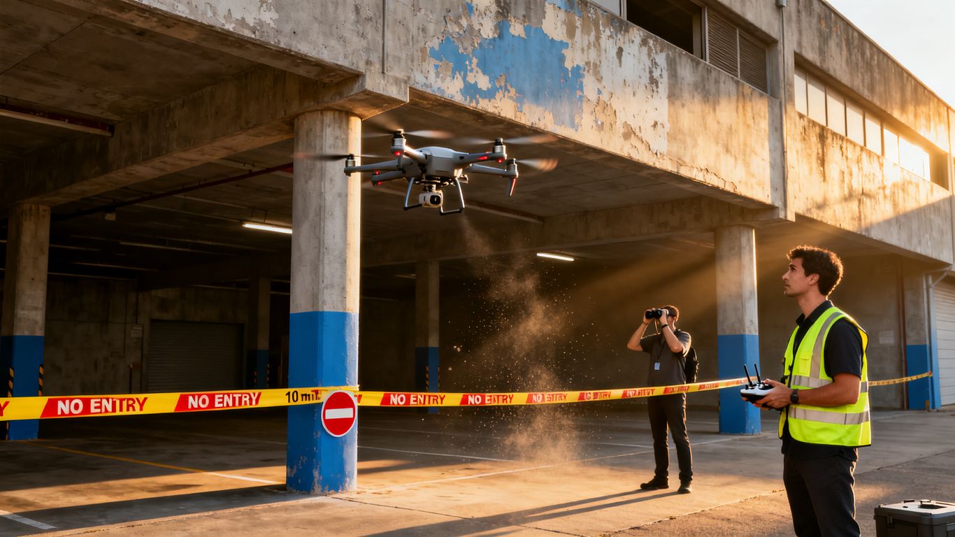
FAA rules for commercial drone operations
Commercial flights in the United States generally fall under FAA requirements, including the applicable provisions of Part 107. The exact operating conditions matter: airspace, flight over people or moving vehicles, daylight, visual line of sight, and waivers or authorizations can all affect the plan. Requirements should be confirmed for the specific location and date.
A provider should be able to explain how regulatory review fits into scheduling. If the proposed operation depends on an approval, that dependency belongs in the project timeline.
Pilot qualifications and operational documentation
Ask who will conduct the flight, what qualification applies, and what records will be maintained. Useful documentation may include the flight plan, site assessment, aircraft and battery checks, weather review, crew assignments, and incident procedures. The goal is not paperwork for its own sake; it is a traceable process.
Experience with occupied commercial sites is also relevant. A pilot who understands how to communicate with facility staff can often prevent avoidable interruptions.
Temporary closures, spotters, and exclusion zones
A garage may need a partial closure, a controlled lane, or a defined ground exclusion zone during launch and landing. Spotters can help monitor people, vehicles, and changing conditions while the pilot concentrates on the aircraft. The right arrangement depends on the site layout and operation.
Controls should be explained to tenants, employees, visitors, and vendors before the work begins. Clear notices and a named site contact make temporary restrictions easier to manage.
Protecting tenant, visitor, and employee privacy
Cameras may capture windows, license plates, people, or neighboring properties even when the inspection target is concrete. The scope should limit collection to what is needed, and the provider should explain storage, access, retention, and sharing practices. Reports can also avoid unnecessary personal information and use appropriate image handling when people appear incidentally.
Privacy planning is especially important in mixed-use or residential settings. It should be part of the preflight discussion, not an afterthought once the imagery has been collected.
Insurance and liability requirements
Owners should confirm that the provider carries insurance appropriate for commercial aviation and site operations. They may also need certificates, contract terms, and indemnity language that align with the property’s requirements. Coverage does not replace safe planning, but it is a basic part of vendor review.
Ask what happens if weather, access, equipment, or an airspace restriction prevents completion. A written rescheduling and deliverables policy can prevent disagreement later.
Choosing a parking structure drone inspection provider
The right provider is not simply the one with the newest aircraft. Look for a team that can define a useful scope, operate safely around an active property, collect appropriate data, and explain findings in language that supports maintenance and engineering decisions. Local familiarity helps, but process discipline matters just as much.
A short proposal should make the work easy to compare. It should state the areas to be inspected, expected sensors, field duration, safety controls, report format, assumptions, exclusions, and schedule.
Evaluating certifications, experience, and equipment
Ask about pilot qualifications, commercial inspection experience, aircraft, cameras, thermal capability if relevant, and data-processing workflow. Equipment should match the structure and the question being asked. A large sensor list is less useful than a clear explanation of why a particular sensor belongs in the scope.
For additional vendor-selection context, this Bay Area engineering provider guide recommends checking capabilities, site conditions, accuracy expectations, compliance, and insurance. Those are sensible questions for parking structure owners as well.
Questions to ask about reporting and deliverables
Before authorizing the work, ask how locations will be referenced, how defects will be annotated, and whether the report includes limitations and recommended follow-up. Clarify whether you receive original imagery, processed files, video, thermal outputs, models, or only a narrative report. Confirm the delivery format and who owns or may access the data.
A provider should also explain who reviews the material. A pilot can collect excellent imagery, but interpretation may require an engineer or another qualified professional depending on the decision.
Confirming Bay Area service coverage
The Bay Area includes dense urban locations, suburban garages, waterfront conditions, and properties with different local constraints. Confirm that the provider can reach the project, coordinate the required site controls, and evaluate the airspace and surrounding environment. Service coverage should mean more than a broad map on a website.
Give the provider the exact address and surrounding context early. That allows the team to identify practical access and scheduling issues before the proposal is finalized.
Comparing inspection timelines and pricing
Price should be compared against scope, not just flight time. A lower quote may exclude planning, traffic coordination, processing, annotations, engineering review, or a useful report. A higher quote may be justified when the structure is complex or the deliverables are more complete.
Useful questions include whether mobilization is separate, how weather delays are handled, what turnaround means, and whether a return visit is included. These details make proposals more comparable.
Checking references and sample reports
A sample report reveals whether the provider connects images to locations and actions. Look for readable annotations, consistent naming, clear limitations, and a format that owners and engineers can use without a separate explanation. References should ideally involve comparable commercial sites or similarly constrained operations.
A good sample is not proof that every project will be identical. It is evidence of how the provider organizes information and communicates uncertainty.
Turning inspection data into maintenance decisions
Imagery becomes valuable when it changes what a team does next. The report should help decision-makers distinguish urgent concerns from routine repairs, identify items for closer examination, and budget work based on documented conditions. It should also make uncertainty visible instead of presenting every mark as a confirmed defect.
Aerial findings are one input into a broader maintenance process. The owner, facility team, and engineer still need to consider history, occupancy, drainage, materials, loads, and any applicable inspection requirements.
Prioritizing urgent structural concerns
Start with conditions that could affect public safety, structural performance, water intrusion, or continued operation. A visible spall over a travel path, exposed reinforcement, severe joint failure, or rapidly worsening crack pattern may deserve faster review than a minor stain. The report should identify the reason for the priority and the person responsible for the next step.
Urgency should be assigned by qualified reviewers, not inferred from image appearance alone. When the evidence is limited, the appropriate action may be a prompt hands-on assessment.
Separating cosmetic damage from deeper defects
Discoloration, surface dirt, old patching, and minor shrinkage cracks can look dramatic in close imagery. Conversely, a subtle pattern may signal moisture movement or a more significant underlying issue. Context, history, material knowledge, and field verification help separate appearance from condition.
The report can use categories such as observed, suspected, and requires confirmation. That language preserves accuracy while still giving maintenance teams a practical route forward.
Combining drone findings with hands-on assessments
Drone imagery is strongest at documenting visible conditions across areas that are difficult or disruptive to reach. Hands-on inspection can assess soundness, depth, movement, moisture, or concealed conditions that imagery cannot establish. Used together, the methods reduce guesswork about where to focus limited field resources.
A useful workflow sends annotated aerial locations to the engineer or inspector before the site visit. The follow-up team can then arrive with a defined set of questions rather than searching the entire structure again.
Creating a repair and monitoring schedule
Once findings are ranked, assign an action, owner, and target date. Some items may require immediate controls, others a repair package, and others periodic observation. The schedule should include dependencies such as design, permits, tenant coordination, procurement, and weather.
A compact action list can keep the report connected to operations:
- Address conditions that may affect immediate public or worker safety.
- Verify uncertain findings through hands-on review or specialist assessment.
- Group compatible repairs to reduce repeated access and disruption.
- Set a date for monitoring items that are not yet repair priorities.
After the list is agreed, the property team can turn observations into work orders and budget discussions. The inspection is then part of a maintenance cycle rather than a document that sits in storage.
Tracking changes across recurring inspections
Repeat inspections are most useful when the same areas are captured with similar perspectives and location references. Comparing dated images can show whether a crack, stain, joint, or patch has changed. It can also document completed repairs and provide a baseline for the next review.
Do not treat apparent visual change as a measured structural movement unless the method supports that conclusion. Consistent documentation improves awareness, while qualified assessment determines what the change means.
What to expect in the final inspection report
A final report should be organized for the people who must make decisions, not only for the person who flew the aircraft. It should state the scope, date, conditions, equipment or data types used, areas not captured, and important limitations. From there, the report can connect images and observations to locations and recommended actions.
Owners may need an executive overview, while engineers and contractors may need detailed files. A well-planned delivery can serve both without burying the main findings.
Executive summaries for owners and facility managers
The summary should answer practical questions: What was inspected? What stood out? What needs immediate attention? What should be verified? What can be scheduled for later? It should use plain language and distinguish observation from professional conclusion.
A short priority table can make the first review faster, provided the categories are explained elsewhere in the report. The summary should point readers to detailed locations rather than trying to contain every image.
Annotated photographs and location references
Each important photograph should have a clear identifier and a useful reference, such as elevation, level, grid, column line, or façade segment. An annotation can identify the observed area without obscuring the condition itself. Consistent labels help a repair team return to the same place.
Photographs should retain enough surrounding context to orient the reader. Close detail and wider location views work better together than either one alone.
Defect severity ratings and recommended actions
Severity categories should be defined in the report and used consistently. A rating might describe urgency or recommended response, but it should not imply a structural diagnosis that the data cannot support. Recommended actions can range from monitor, verify, and clean to repair, restrict access, or obtain engineering review.
The rating system should reflect the agreed scope and reviewer qualifications. If an item is uncertain, that uncertainty belongs beside the recommendation.
Digital models, measurements, and inspection maps
Some projects benefit from organized image sets, inspection maps, measurements, or three-dimensional outputs. These materials can help users orient themselves and compare areas across time. Their accuracy, coordinate reference, and intended use should be documented clearly.
A digital model is not automatically a survey or an engineering deliverable. Aeroskape’s Drone-as-a-Service page describes access to aerial data such as high-resolution imagery and LiDAR scans for project decision-making; owners should confirm exactly which outputs are included in a parking structure scope.
Planning follow-up inspections and repairs
The closing section of the report should identify open questions, recommended next inspections, and conditions that would trigger earlier review. It can also list repair documentation needed for closeout, including before-and-after photographs or updated annotations. This gives the property team a practical handoff.
For owners considering next steps, a consultation request can help define the structure, intended decisions, site constraints, and appropriate deliverables before work is scheduled.
Conclusion
A parking structure drone inspection bay area project is most useful when careful planning turns aerial imagery into clear maintenance decisions. With suitable safety controls, privacy practices, engineering coordination, and a report built around locations and actions, owners can document difficult areas without treating drone data as a replacement for professional judgment.
Frequently Asked Questions
What can a drone inspect on a parking structure?
A drone can document many visible exterior and elevated surfaces, including concrete façades, slab edges, beams, columns, ramps, joints, drainage features, lighting, and other difficult-to-reach areas. Coverage depends on access, weather, airspace, visibility, and the agreed scope.
Can drone imagery identify structural defects?
It can reveal visible signs that may warrant attention, such as cracks, spalls, exposed reinforcement, staining, or damaged joints. Imagery alone usually cannot establish the full cause, depth, or structural significance of a condition, so qualified follow-up may be required.
Is a parking garage required to close during an inspection?
Not always, but temporary closures, controlled lanes, spotters, or exclusion zones may be appropriate for launch, landing, and flight operations. The decision depends on the layout, occupancy, aircraft operation, nearby people, and the site-safety plan.
How long does a parking structure drone inspection take?
The duration varies with the structure’s size, number of levels, inspection scope, weather, access controls, and required data products. Planning, processing, review, and reporting generally take longer than the flight itself.
What weather conditions can affect the inspection?
Wind, fog, rain, low visibility, glare, and changing coastal conditions can affect flight safety and image quality. A provider should establish operating limits and reschedule when conditions would make the data unreliable or the operation unsafe.
Does drone inspection replace a structural engineer?
No. Drone data is a documentation and observation tool. Engineers and other qualified professionals may need to interpret findings, perform hands-on assessments, determine severity, design repairs, or meet inspection requirements.
What should be included in the final report?
A useful report normally includes the scope, date, limitations, annotated photographs, location references, prioritized observations, recommended follow-up, and any agreed digital files or maps. The format should match the needs of owners, facility teams, engineers, and repair contractors.