
Aerial Data Capture in Santa Clara County.
Aerial Imaging in Santa Clara County for Construction Success
If you manage or supervise construction projects in Santa Clara County, you know how critical it is to have detailed, real-time information about your site.
The region’s rapid growth, strict compliance requirements, and demanding stakeholders make reliability and efficiency non-negotiable.
Aerial imaging in Santa Clara County provides project managers, engineers, and contractors with the high-resolution data they need to make smarter decisions, maintain safety, and keep projects on schedule.
With advanced drone technology, aerial imaging gives you site overviews, progress tracking, and detailed structural insights that ground-based inspections can’t match.
From large-scale infrastructure in San Jose to residential developments in Palo Alto, aerial imaging ensures that every aspect of your project is documented, monitored, and optimized for success.
Ready to elevate your construction site management?
Contact us today to schedule your aerial imaging service in Santa Clara County.

Construction Site Monitoring in Santa Clara County
Construction site monitoring in Santa Clara County enables you to manage progress, identify risks, and maintain compliance without constant on-site presence.
Regular drone flights provide visual documentation that keeps your team, stakeholders, and regulatory agencies aligned.
Real-Time Construction Site Monitoring in Santa Clara County
With real-time aerial updates, you’ll receive progress imagery, 3D aerial visualizations derived from imagery, and safety insights directly to your project dashboard.
This allows you to act quickly on potential delays, ensure safety protocols are being followed, and deliver transparent updates to investors and clients.
Improve oversight and accountability with advanced construction site monitoring in Santa Clara County. Book your consultation now.
Enhancing Structural Safety with Aerial Imaging in Santa Clara County
Ensuring the structural integrity of your projects is critical.
Aerial imaging in Santa Clara County gives you access to close-up visuals of hard-to-reach areas, 3D aerial visualizations and drone-assisted inspections that reduce risk while improving visual reliability.
Structural Inspection with Aerial Imaging in Santa Clara County
Drone-enabled inspections allow you to review rooftops, facades, and elevated structures safely, eliminating the need for scaffolding or manual access.
This ensures compliance with engineering standards while improving safety and efficiency.

Enhance your quality assurance with drone-powered structural inspections in Santa Clara County.
Contact us today.
Construction Site Monitoring in Santa Clara County for Compliance
Santa Clara County construction projects must meet strict safety and reporting requirements.
Drone-enabled construction site monitoring provides a reliable, time-stamped record of site activity, ensuring you’re always ready for inspections or audits.

Compliance-Focused Construction Site Monitoring in Santa Clara County
Simplify compliance and reporting with aerial construction monitoring in Santa Clara County. Call us today.
Generate clear reports for regulatory agencies
Keep an audit trail for dispute resolution
Provide visual proof of milestone completion
Sustainability and Innovation with Aerial Imaging in Santa Clara County
Environmental responsibility is a growing priority in construction.
Aerial imaging in Santa Clara County supports sustainable practices by reducing unnecessary earth movement, monitoring erosion control, and planning efficient equipment routes.
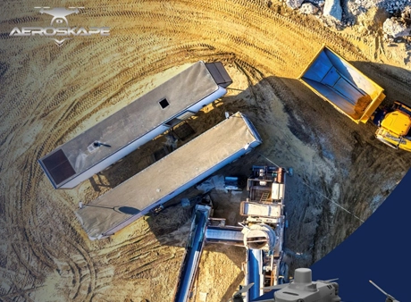
Supporting Green Building with Aerial Imaging in Santa Clara County
Showcase your commitment to sustainability with aerial imaging in Santa Clara County. Schedule your service today.
Frequently Asked Questions
We offer Aerial Imaging, Construction Site Monitoring, Structural Inspection Services, and more across the following locations:
Fremont, Fresno, Gilroy, Modesto, Monterey, Morgan Hill, Oakland, Sacramento, Salinas, San Francisco, San Jose, Santa Cruz, Stockton, Watsonville, Santa Clara County, Northern California, and the surrounding areas.
Disclaimer:
Aeroskape, LLC does not provide Professional Land Surveying services. Aeroskape’s services do not include the determination of property boundaries, contours, monuments, or the authoritative position of land or fixed objects as defined under California Business & Professions Code §8726. All deliverables are provided for planning, visualization, documentation, and informational purposes only. When survey-grade or legal deliverables are required, clients should consult a licensed Professional Land Surveyor (PLS).