Vineyard drone mapping in Monterey County: A practical guide to smarter vineyard management
Key Takeaways
Vineyard drone mapping in Monterey County is most useful when imagery is collected consistently and tied to a specific management question.
- Define the vineyard blocks, decisions, and deliverables before flying.
- Choose RGB, multispectral, or thermal sensors according to the question at hand.
- Plan around FAA rules, property boundaries, weather, and nearby airspace.
- Use repeatable flight methods so maps can be compared over time.
- Turn imagery into prioritized field work rather than leaving it as a visual archive.
Understanding vineyard drone mapping in Monterey County
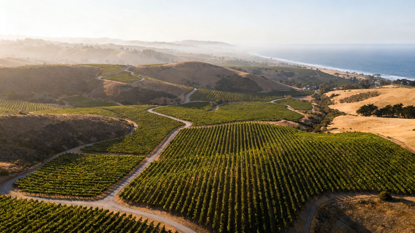
Vineyard drone mapping in Monterey County can turn a broad aerial view into a detailed record of vine rows, terrain, drainage, and visible variation. The value is not simply seeing the property from above; it is creating information that can be checked, compared, and connected to decisions in the field. Monterey County’s changing terrain and coastal influences make that context especially useful.
A well-planned survey can support scouting, irrigation reviews, replanting conversations, and seasonal documentation. It does not replace an agronomist, viticulturist, or other qualified professional, but it can help those people focus their attention where it is most needed.
What drone mapping captures beyond standard aerial photography
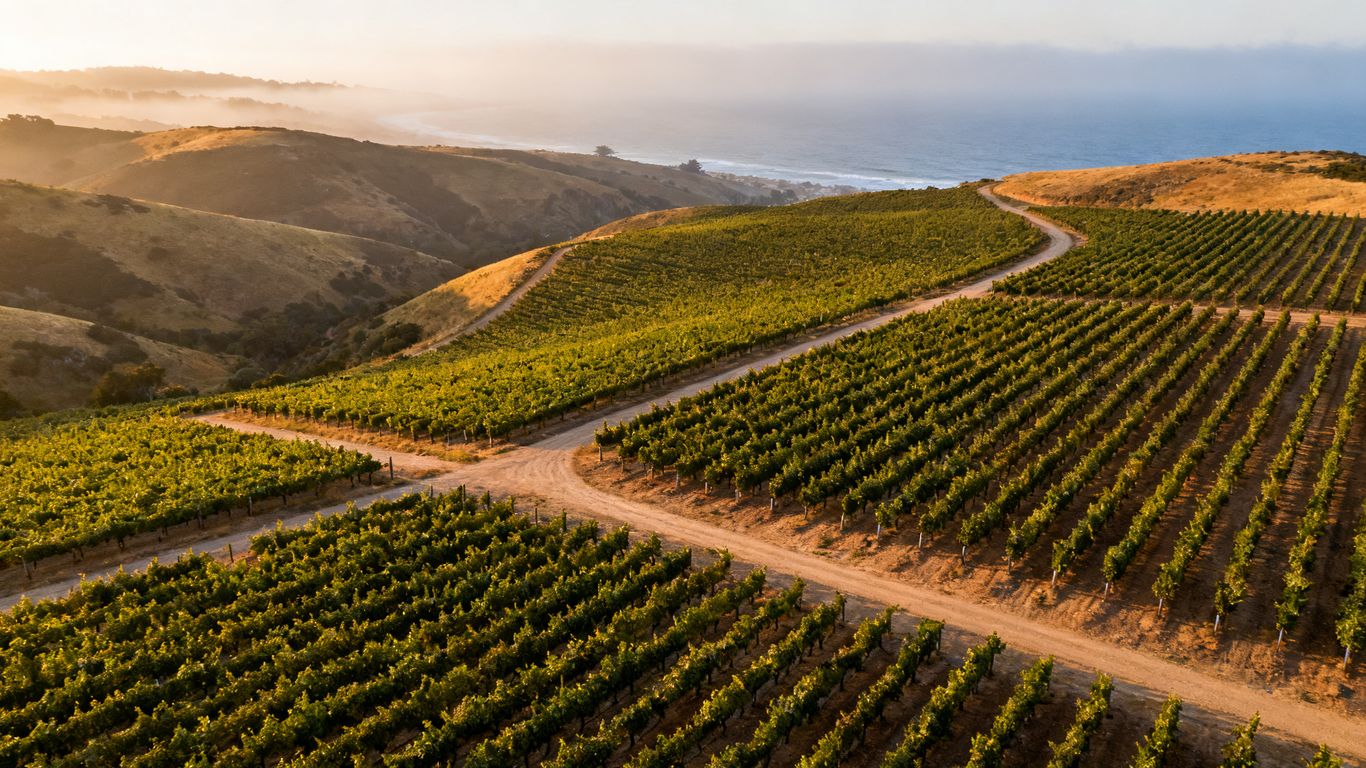
A conventional aerial photograph is a useful visual record, but mapping adds location and measurement context. Overlapping images can be processed into an orthomosaic, surface model, or other spatial layer that allows a manager to inspect patterns across a block rather than relying on isolated photographs. The output is more useful when the same boundaries, flight height, and processing approach are retained for later surveys.
The distinction matters operationally. A photograph may show a brown patch, while a mapped dataset can help identify its position, estimate its extent, and compare it with irrigation zones or previous observations. Aeroskape’s documented 3D Aerial Modeling from Imagery service is a relevant example of turning imagery into a three-dimensional model, though the specific vineyard deliverables should be confirmed before commissioning work.
Why Monterey County’s terrain and microclimates matter
Vineyards in the county can include slopes, benches, low areas, and blocks influenced by different wind and temperature patterns. Those differences may affect vine vigor, soil moisture, and the timing of field observations. A single image taken under uneven light or changing conditions can make natural variation look like a management problem.
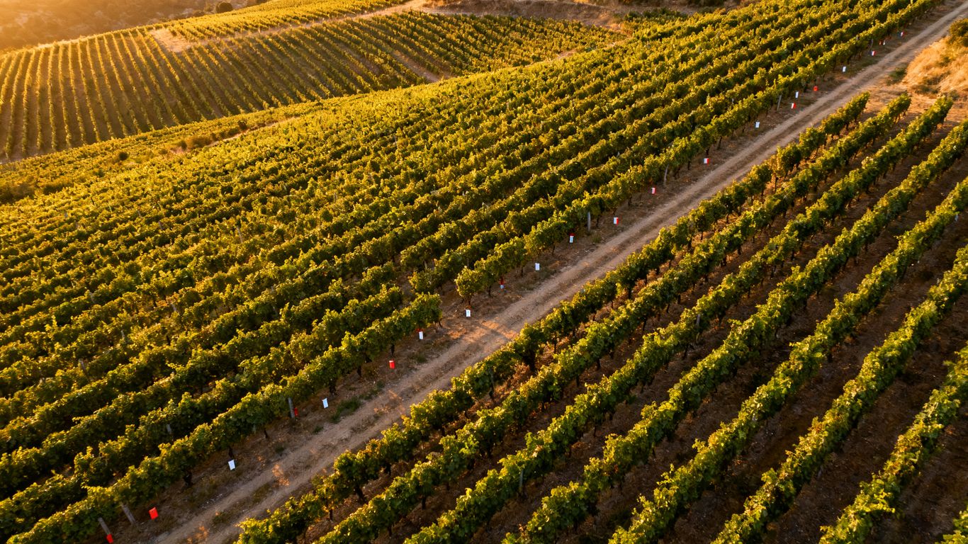
Survey planning should therefore account for aspect, elevation, row direction, and the time of day. The broader regional setting is also worth keeping in mind; Monterey vineyard footage offers a visual sense of the rolling, cultivated terrain, but operational mapping requires calibrated collection and documented processing rather than scenic coverage alone.
The vineyard decisions mapping can support
Mapping is most helpful when it is tied to a decision that someone will make after reviewing the data. That might mean choosing where to scout first, checking whether a weak area follows a drainage feature, or documenting changes before and after a vineyard improvement. The map should answer a practical question, not merely add another file to the farm’s records.
Useful questions include whether a pattern is isolated or repeated, whether it crosses a block boundary, and whether it corresponds with irrigation infrastructure or terrain. Those questions keep interpretation grounded and make it easier to decide what requires a ground visit.
When drone mapping provides the greatest value
The strongest use cases are usually repeatable ones: baseline documentation, seasonal comparisons, targeted scouting, and inspections after a weather event. Mapping can also be useful before a replanting or drainage project, when a clear record of existing conditions supports discussion and planning. Its value grows when the same area is surveyed more than once under reasonably comparable conditions.
A one-time flight can still be worthwhile, but expectations should be modest. It offers a snapshot, not a complete diagnosis of vine health or soil conditions, and interpretation should be checked against field observations.
Choosing the right drone mapping technology
Sensor selection should begin with the management question, not with the most sophisticated payload available. RGB imagery may be enough for row visibility, gaps, erosion, and general documentation, while other sensors can provide additional signals that are not visible to the unaided eye. The final choice also depends on the requested resolution, timing, processing workflow, and budget.
The survey brief should state what the operator will deliver, how the data will be referenced, and how it will be used. For context on map-based aerial outputs, Aeroskape describes orthomosaic mapping as geo-referenced aerial imagery transformed into accurate, map-like visuals; a vineyard project should still define its own accuracy and deliverable requirements.
RGB, multispectral, and thermal imaging compared
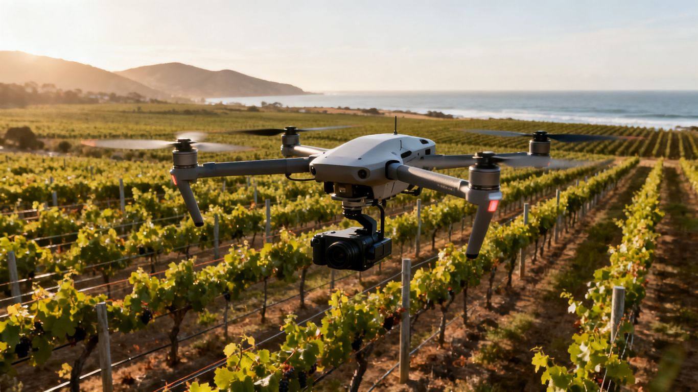
RGB cameras record visible color and are often the simplest choice for mapping rows, bare areas, tracks, trellises, and obvious canopy differences. Multispectral sensors record selected bands beyond ordinary color and may help characterize vegetation variation when the collection and interpretation methods are appropriate. Thermal sensors record temperature differences, which can add context to water-stress investigations but should not be treated as a diagnosis by themselves.
Each sensor has trade-offs. More bands do not automatically produce a better management decision, and thermal results can be affected by weather, time of day, canopy structure, and calibration. Aeroskape’s documented Thermal Drone Inspections service is described generally as a thermal inspection offering; any vineyard application and deliverables should be discussed directly rather than assumed.
Matching sensors to vineyard management goals
Start by writing the question in plain language. If the goal is a visual inventory of missing vines, RGB may be sufficient. If the goal is to compare vegetation response across blocks, multispectral data may be considered, while thermal data may be useful when temperature variation is part of the investigation.
A useful brief identifies the block, the timing, the expected output, and the action that will follow. It should also say what the survey cannot establish, so the map is not mistaken for a laboratory test or a professional diagnosis.
Drone specifications that affect survey quality
Flight stability, camera resolution, positioning capability, battery capacity, and obstacle awareness all affect the practical quality of a survey. The best specification is the one that supports consistent coverage and safe operation over the actual property. A nominal camera resolution matters less if the aircraft cannot maintain the planned overlap or if wind forces major changes in flight height.
Ask how the operator handles changing elevation, narrow blocks, trees, poles, and no-fly constraints. The answer should connect equipment choices to the site rather than presenting specifications as a substitute for a field plan.
Software for orthomosaics, 3D models, and vegetation data
Processing software combines overlapping images and positioning information into usable outputs. Depending on the brief, those outputs may include an orthomosaic, a three-dimensional model, an elevation surface, or vegetation-related layers. File formats, coordinate reference systems, resolution, and delivery dates should be agreed upon before the flight.
Review is part of the workflow. A manager should be able to open the files, understand their extent and date, and relate them to existing block maps. If the result is difficult to interpret, technical sophistication has not translated into operational value.
Planning a compliant vineyard drone survey
Compliance is part of survey quality, not a separate administrative task. Commercial drone work requires an appropriately qualified operator, a safe flight plan, and attention to airspace and people on the ground. Vineyard properties can also include roads, residences, workers, neighboring parcels, and sensitive habitat, so a flight may involve more than the field boundary.
The operator and property owner should agree on access, timing, privacy expectations, emergency procedures, and the intended use of the data. Planning early reduces the chance that a promising survey is delayed or restricted on the day of collection.
FAA requirements for commercial drone operations
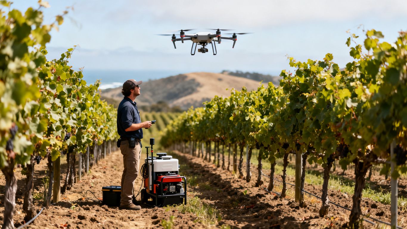
Commercial operators generally need to follow applicable Federal Aviation Administration requirements, including the rules associated with small unmanned aircraft operations and pilot qualification. The exact permissions depend on the aircraft, operation, airspace, people nearby, and flight conditions. A property owner’s approval does not by itself authorize every flight.
Ask the operator to explain how the mission will be reviewed for airspace, people, property, and operational limits. Documentation should be clear enough that the owner understands what is planned without needing to interpret aviation terminology alone.
California privacy, wildlife, and property considerations
A vineyard survey may capture neighboring land, homes, vehicles, workers, or visitors. California privacy concerns and property boundaries should be addressed through flight paths, timing, image handling, and agreed retention practices. Wildlife and environmentally sensitive areas may also require additional care, especially when flights could disturb animals or conflict with site restrictions.
The practical approach is to minimize unnecessary collection and establish who can access the files. A map of one vineyard should not become an informal record of every surrounding property simply because the camera could see beyond the rows.
Permissions for flying near roads, homes, and airports
Roads, residences, and airports introduce distinct planning questions. The operator may need to coordinate with the property owner, account for people and vehicles, and review nearby airspace before selecting a launch point or route. A site visit or preflight review can reveal constraints that are not obvious from a desktop map.
Written confirmation of access and a documented operating area help prevent confusion. If the planned route changes because of wind, activity, or an unexpected obstruction, the operator should have a clear process for reassessing the mission.
Weather, wind, and flight timing in Monterey County
Wind, fog, glare, temperature, and rapidly changing coastal conditions can affect both safety and data consistency. The most visually attractive day is not necessarily the best mapping day. Sensor choice also matters: thermal and vegetation-related outputs can be particularly sensitive to collection timing and environmental conditions.
A practical schedule includes a weather check, a backup date, and a clear threshold for postponement. Consistency is usually more valuable than forcing a flight into marginal conditions simply to meet an arbitrary calendar date.
Collecting accurate vineyard data
Good maps begin with a defined area and a repeatable collection method. Before takeoff, the team should know which blocks are included, what resolution is needed, and which reference information will accompany the imagery. That preparation makes the resulting data easier to review and compare.
Accuracy is not a single number. It can refer to positional accuracy, visible detail, repeatability, or the usefulness of the output for a particular decision. The survey brief should distinguish among those needs instead of using the word “accurate” without a measurable context.
Defining field boundaries and mapping zones
Begin with block boundaries, access points, hazards, row orientation, and areas that should not be included. Large properties are often easier to manage when divided into logical zones, particularly if blocks differ in elevation, variety, irrigation layout, or management history.
The boundary file should be reviewed with someone who knows the property. A line drawn from an outdated map can omit a new block, include a neighboring parcel, or create unnecessary flight time. Clear zones also make later comparisons more meaningful.
Establishing ground control points and GPS accuracy
Ground control points can help tie imagery to known locations, while RTK or PPK positioning may reduce the amount of ground control needed in some workflows. The appropriate method depends on the required accuracy, terrain, equipment, and processing approach. It should be selected before collection, not added as an afterthought.
For a deeper technical discussion, Aeroskape’s California mapping accuracy guide addresses sensor fusion, RTK/PPK technology, and the trade-offs between LiDAR and photogrammetry. Those concepts can inform a vineyard brief, but the operator should state the expected accuracy for the specific site and deliverable.
Capturing consistent imagery across vineyard blocks
Consistent altitude, speed, overlap, lighting, and direction help make maps easier to compare. The operator should note exceptions such as wind, temporary obstructions, or a changed flight line. Without that record, a difference between two maps may reflect collection conditions rather than a change in the vines.
A repeatable mission template is especially useful for seasonal monitoring. It does not eliminate judgment; it creates a stable starting point from which unusual results can be investigated on the ground.
Managing flight logs, image files, and metadata
File management should cover the original images, processed outputs, flight logs, control-point information, boundary files, and notes about conditions. Each dataset should carry a date, block name, sensor description, and processing version where relevant. Consistent naming prevents a useful map from becoming difficult to locate six months later.
A simple delivery checklist can help keep the record usable:
- Confirm that every requested block is present.
- Check dates, coordinate information, and file formats.
- Separate original imagery from processed deliverables.
- Record weather, flight exceptions, and control-point details.
That small amount of discipline supports future comparisons and makes it easier for another member of the vineyard team to understand what was collected.
Turning drone imagery into vineyard insights
Imagery becomes useful when visual patterns are tested against field conditions. A map can reveal where to look, but it cannot by itself explain whether a pattern comes from irrigation, soil, disease, terrain, pruning, or image conditions. Interpretation should therefore combine the aerial record with scouting notes, irrigation information, weather observations, and other relevant records.
The strongest workflow moves from broad screening to focused verification. First identify unusual areas, then rank them by size, persistence, proximity to infrastructure, and likely management consequence. That keeps the map connected to work in the vineyard.
Detecting vine stress and irrigation problems
Differences in canopy color, density, or temperature may indicate areas that warrant inspection. Patterns following a row, irrigation line, slope, or low point can provide useful clues. They remain clues, however, and should be checked against emitters, soil conditions, plant age, recent work, and direct observations.
Timing matters as well. A survey collected shortly after irrigation may tell a different story from one collected during a dry period. Recording the timing of irrigation and flight helps prevent overconfident conclusions.
Identifying gaps, weak growth, and disease patterns
RGB imagery can help locate missing vines, irregular growth, exposed soil, and visible canopy differences. Repeated patterns may justify a closer review, while isolated anomalies may be caused by shadow, equipment, or a temporary condition. A ground visit remains necessary before making a disease or replacement decision.
The most useful output is often a prioritized scouting layer rather than a claim that every affected vine has been identified. That distinction protects the quality of the decision and gives field staff a manageable route.
Using elevation models to understand drainage
Elevation data can show subtle rises, depressions, and slope changes that are difficult to appreciate while walking a long block. Those surfaces may help explain why water accumulates in one area or why erosion appears along a particular route. They can also support conversations about access, grading, and drainage improvements.
Interpretation should account for vegetation, row structures, and processing artifacts. An elevation model is a representation of the surface captured during the flight, so its suitability for a particular engineering or land-surveying purpose should be confirmed with the appropriate professional.
Comparing maps over time to track vineyard changes
Time-series comparisons are most reliable when the collection method stays similar. Use the same block boundaries, comparable resolution, and documented sensor and weather conditions wherever possible. When those conditions change, the difference should be labeled as a limitation rather than treated as a direct measure of vine change.
A comparison becomes actionable when it includes a date, a defined change, and a follow-up decision. For example, a recurring weak area can be assigned for field inspection, while a one-time anomaly may simply be documented for the next survey.
Applying drone mapping to vineyard operations
A map should fit into the rhythm of vineyard work. If it arrives without clear priorities, staff may spend more time reviewing imagery than acting on it. A practical workflow connects the survey to scouting routes, irrigation reviews, maintenance planning, and seasonal records.
The goal is not to replace experience in the field. It is to give that experience a consistent spatial reference, helping teams move from a large property to a smaller set of questions and locations.
Prioritizing scouting and field inspections
Create a short list of areas for inspection and attach coordinates, block names, and a reason for review. A route can then be planned around the most consequential or persistent patterns rather than relying on whoever happens to notice them first. Field staff should record what they find and whether the aerial signal was useful.
Over time, those notes improve interpretation. The team learns which visual patterns tend to correspond with irrigation issues, missing vines, terrain, or harmless variation on that property.
Supporting irrigation and nutrient decisions
Drone maps can help identify areas for follow-up in irrigation and nutrient programs by showing spatial variation across a block. They should be considered alongside soil information, plant tissue results, irrigation schedules, weather, and professional recommendations. Aerial data can guide where to investigate; it should not be presented as a stand-alone prescription.
The same principle applies to fertilizer or water changes. Start with a testable hypothesis, make a measured adjustment when appropriate, and use later observations to evaluate the result.
Improving canopy management and yield estimates
Imagery may assist with documenting canopy development, identifying uneven growth, and organizing field observations before harvest. Yield estimates require more than a top-down image, since fruit load, cluster conditions, sampling methods, and timing all affect the result. A map can provide context and help select areas for sampling.
Canopy comparisons are most useful when the vineyard records the date and management stage. Otherwise, a difference may simply reflect pruning, shoot positioning, or a change in the season rather than a problem.
Integrating drone data with farm management systems
Integration starts with consistent names and locations. Block identifiers, dates, coordinate systems, file formats, and notes should align with the farm’s existing records. Even when there is no automated connection, a clearly organized export can make the data easier to use in mapping, scouting, or reporting workflows.
Aeroskape’s documented Drone-as-a-Service offering is described broadly as a drone service model. For a vineyard, the team should confirm exactly what collection, processing, file delivery, and repeat scheduling are included before treating the service as an integrated farm system.
Evaluating costs, providers, and return on investment
The cost of mapping depends on the property, sensor, accuracy target, processing, travel, permissions, and frequency of surveys. A low flight price may not include the files or interpretation the vineyard actually needs, while a more detailed project may be worthwhile if it replaces repeated searching or improves the timing of field work.
Evaluate the complete workflow rather than comparing aircraft or hourly rates alone. The right provider should explain what will be collected, what will be delivered, what limitations apply, and how the information can support the vineyard’s existing decisions.
Comparing in-house surveys with professional services
An in-house program may offer scheduling flexibility and continuity, but it also requires trained personnel, aircraft and sensor decisions, maintenance, compliance work, processing capacity, and quality control. Professional services can reduce that internal burden, particularly for a first baseline or a technically demanding deliverable.
A hybrid approach can also make sense: establish a professionally planned baseline, then decide whether routine visual monitoring can be handled internally. The choice should follow the required quality and staff capacity, not a general preference for ownership or outsourcing.
Factors that influence vineyard mapping costs
Project scope is usually shaped by area, number of blocks, sensor type, accuracy requirements, terrain, access, processing, and reporting. Repeat surveys may have different economics from a one-time project because a consistent mission plan and data structure can be reused. Rush timing, difficult weather, or special permissions may also affect the estimate.
Ask for a written scope that separates collection from processing and interpretation. This table provides a practical way to compare proposals:
| Cost factor | What to clarify | Why it matters |
|---|---|---|
| Area and blocks | Which boundaries and zones are included | Prevents incomplete coverage |
| Sensor and resolution | What imagery will be collected and at what detail | Connects equipment to the decision |
| Accuracy and control | What positioning method and accuracy are expected | Sets a measurable quality target |
| Deliverables | Which files, maps, models, and reports are included | Avoids paying for unusable outputs |
After reviewing the scope, compare the expected decision value with the cost of collection and follow-up. A detailed map is only economical when the vineyard has a plan to use it.
Questions to ask Monterey County drone operators
A provider should be able to discuss the mission in plain language and identify what could limit the result. Ask who will fly, how airspace and privacy will be handled, what conditions would postpone the flight, and how the files will be secured. Also ask whether the operator has experience with the terrain and access constraints of the property, without assuming that experience in another industry transfers automatically to viticulture.
Clarify whether the provider offers raw imagery, processed maps, models, interpretation, or some combination. The distinction affects both price and the amount of work the vineyard team must perform afterward.
Measuring time savings, crop improvements, and data value
Return on investment should be measured against a baseline. Track time spent scouting, the number of unnecessary field visits, the speed of responding to a confirmed issue, and whether recurring problem areas were identified earlier. Crop outcomes can be considered, but they should not be attributed to mapping alone when weather, labor, irrigation, and other management changes also influenced the season.
Review the program after one or two cycles. Keep the outputs that changed a decision, revise the collection plan where interpretation was weak, and stop requesting layers that no one uses. That turns mapping into a measured management tool instead of a recurring data expense.
Conclusion
Vineyard drone mapping in Monterey County works best as a disciplined information workflow: define the question, collect consistent data, interpret it with field knowledge, and record the resulting decision. With careful planning around sensors, compliance, accuracy, and file management, aerial mapping can help vineyard teams focus attention where it is most useful without overstating what imagery can prove.
Frequently Asked Questions
What is vineyard drone mapping monterey county used for?
It is used to document vineyard blocks, identify areas for scouting, review terrain and drainage, compare conditions over time, and organize field observations. The specific value depends on the sensor, timing, and management question.
Is RGB imagery enough for a vineyard survey?
RGB imagery can be enough for visible features such as row layout, gaps, exposed soil, access paths, and general canopy differences. Other sensors may be appropriate when vegetation or temperature variation is central to the question.
Can drone imagery diagnose vine disease?
No. Imagery may reveal patterns that deserve investigation, but disease diagnosis requires field inspection and, where appropriate, qualified specialist or laboratory assessment.
How often should a vineyard be mapped?
There is no universal schedule. A baseline survey, seasonal comparison, post-event review, or targeted investigation may each call for a different timing plan. Repeatability matters more than an arbitrary frequency.
Do vineyard drone surveys require FAA compliance?
Commercial drone operations generally must follow applicable FAA requirements, including rules concerning pilot qualification, airspace, aircraft, people, and operating conditions. The operator should explain the permissions and limitations for the proposed mission.
What affects the cost of vineyard drone mapping?
Area, number of blocks, sensor type, accuracy requirements, access, travel, processing, reporting, permissions, and repeat frequency all affect cost. A written scope is the best basis for comparing proposals.
Can a drone map replace a vineyard field inspection?
No. A drone map can prioritize locations and provide spatial context, but field inspections remain necessary for confirming conditions and deciding on many agronomic, maintenance, and operational actions.