Achieve Precision: High Resolution Orthomosaic Mapping Across California
California is a big state, and keeping track of everything from construction sites to farmland can be a challenge. That’s where high resolution orthomosaic mapping California comes in. It’s a way to get super detailed, accurate maps from above, using drones. Think of it like putting together a giant, super clear photo of an area, but it’s also a map you can measure things on. This technology is changing how we see and manage projects all over the state.
Key Takeaways
- Orthomosaic mapping turns many aerial photos into one detailed, accurate map.
- This technology provides precise, geo-referenced data for better decision-making.
- Drones are the main tool for capturing the high-resolution imagery needed.
- It’s useful for many industries like construction, planning, and agriculture in California.
- Choosing between photogrammetry and LiDAR depends on what you need to map.
Unlocking Precision With High Resolution Orthomosaic Mapping California
The Power of Photogrammetry Explained
So, what exactly is this orthomosaic mapping thing? Think of it like putting together a giant, super-detailed puzzle, but instead of cardboard pieces, you’re using hundreds, sometimes thousands, of aerial photos. Photogrammetry is the science behind it. We take a bunch of overlapping pictures from a drone, and then special software stitches them all together. It corrects for any distortions, so you end up with one single, flat, and incredibly accurate aerial image. It’s like looking at a map, but it’s a real photo of the ground, with everything in its exact place. This process turns a messy collection of images into a clear, usable picture of an entire area.
Transforming Data Collection with Seamless Imagery
Before this tech, getting detailed aerial views meant a lot of work, often with less precise results. Now, with drones capturing images from above, we can get a bird’s-eye view of almost anything. The software then takes all those individual shots and makes them into one big, seamless image. It’s pretty neat because you don’t see the edges of each photo; it just looks like one continuous picture. This makes it way easier to see the whole site at once.
Here’s a quick look at what makes it so good:
- High Resolution: You can zoom in and see small details.
- Complete Coverage: No gaps, the whole area is mapped.
- Consistent View: All images are corrected to look like they were taken from directly overhead.
This method is a game-changer for anyone who needs to see a large area clearly and accurately from above. It simplifies what used to be a complicated process.
Geo-Referenced Accuracy for Informed Decisions
The best part about these orthomosaic maps is that they’re geo-referenced. This means every single point in the image has real-world coordinates. So, if you measure something on the map, like the length of a road or the size of a building, that measurement is accurate in the real world. This accuracy is super important for planning, building, and managing projects.
Think about it:
- Precise Measurements: You can measure distances and areas directly on the map.
- Accurate Placement: Knowing exactly where things are helps in planning construction or development.
- Reliable Data: The information is trustworthy for making big decisions.
This level of detail and accuracy means you can make smarter choices about your project, saving time and avoiding costly mistakes down the line.
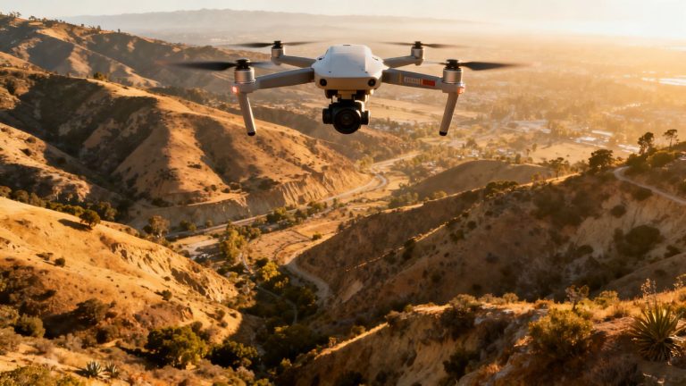
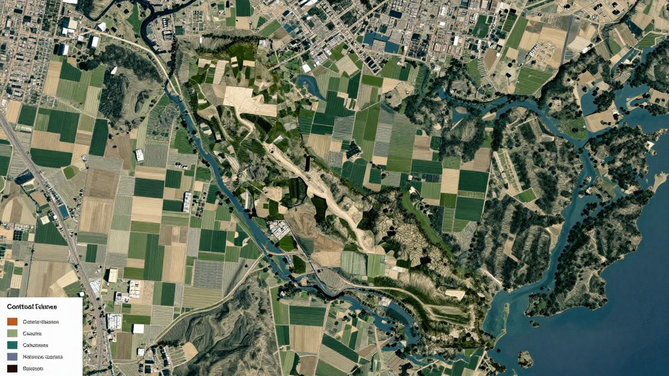
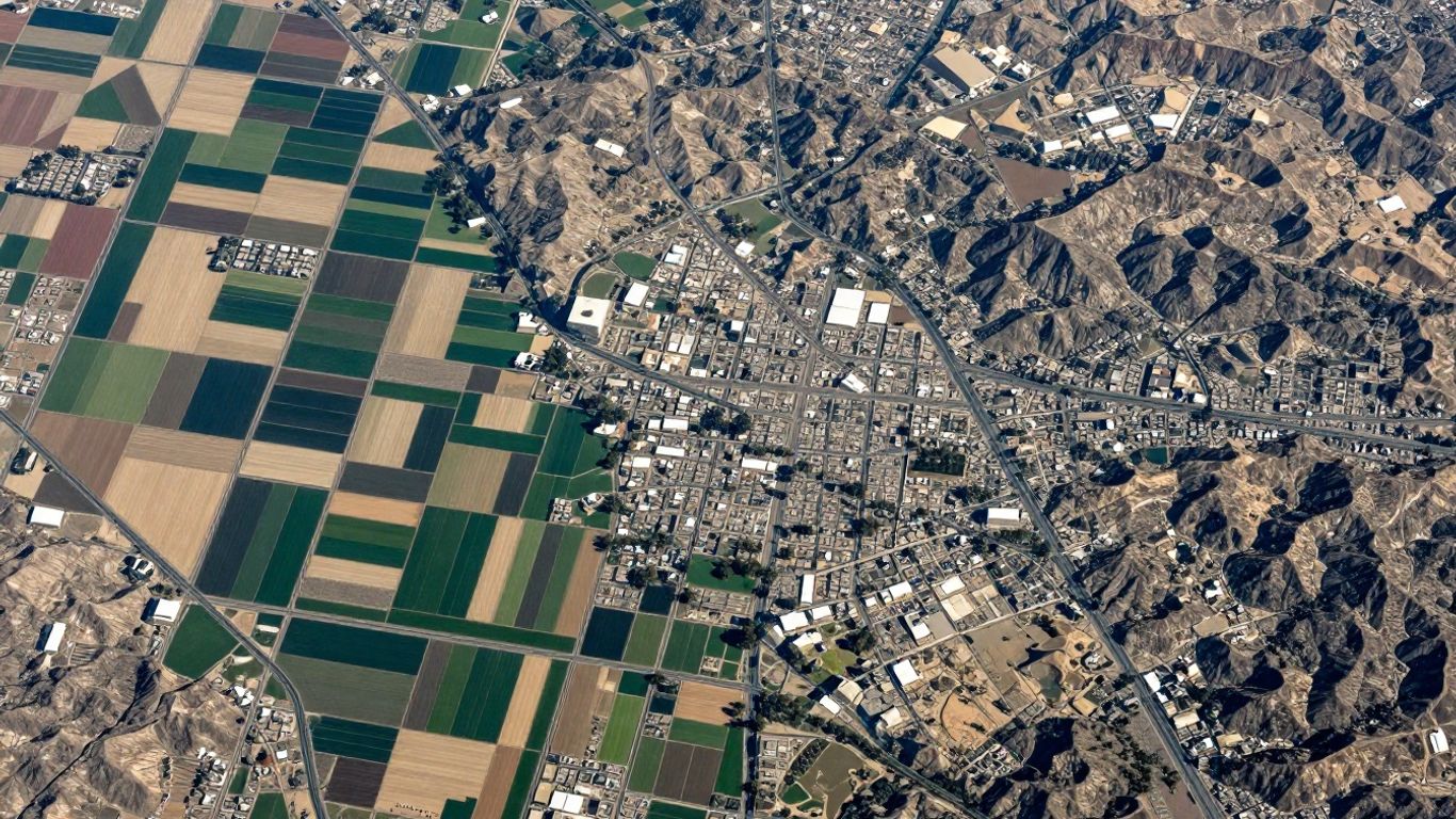
California’s Landscape Demands Advanced Mapping Solutions
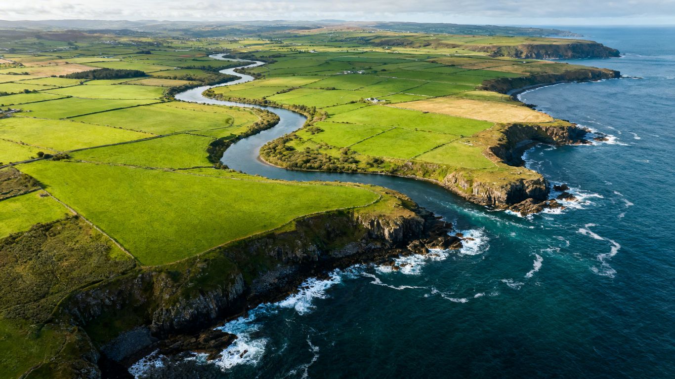
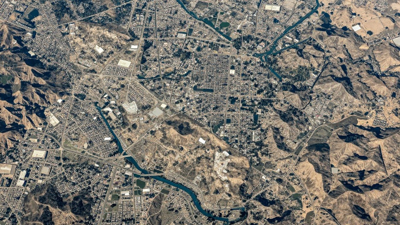
California is a state of extremes, from bustling cities to vast agricultural lands and rugged coastlines. Trying to map all of this with old-school methods just doesn’t cut it anymore. We need tools that can keep up with the pace and complexity of the Golden State. That’s where advanced mapping technology comes in, making sure we get a clear picture, no matter the terrain.
Navigating Diverse Terrains From Urban Centers to Rural Expanses
Think about it: mapping downtown Los Angeles is a whole different ballgame than surveying a vineyard in the Central Valley. Urban areas have buildings, traffic, and lots of people, making ground-based surveys tricky and time-consuming. On the flip side, rural areas might have huge open spaces, but getting accurate elevation data across thousands of acres can be a real challenge. Our drone services can handle both. We can fly over dense city blocks to get detailed building footprints or cover massive farmlands to help with irrigation planning. It’s about having the right tech for the job, whether it’s a small construction site or a huge infrastructure project. We’ve seen this work for everything from mapping [11d7] to helping businesses like [6dc8] manage their land.
Addressing the Unique Challenges of California’s Environment
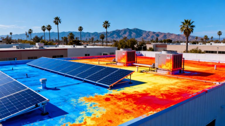
California’s environment throws some curveballs. We’ve got steep hillsides, dense forests, and coastal areas prone to erosion. Traditional surveying methods can be slow, expensive, and sometimes downright dangerous in these conditions. For instance, trying to get accurate ground elevation data under a thick forest canopy is nearly impossible with just cameras. That’s where technologies like LiDAR really shine. It can actually see through the trees to map the ground below. This is super important for things like wildfire management, flood modeling, or even just understanding how water flows across the land. We’re talking about getting data that’s not just accurate, but also practical for real-world problems.
Leveraging Technology for Comprehensive Site Understanding
Getting a good handle on a project site means having all the right information. Advanced mapping gives us that. We can get:
- High-resolution imagery: Like having a super-detailed aerial photo of the entire site.
- Accurate elevation data: Knowing the ups and downs of the land is key for planning and construction.
- 3D models: These give you a virtual walkthrough of the site, helping to spot potential issues before they happen.
- Point clouds: Millions of data points that create a precise digital representation of the landscape.
This kind of detailed information helps everyone involved, from engineers to city planners, make better decisions. It means less guesswork and more confidence in the project’s success. It’s like having a crystal-clear map that shows you exactly what’s going on, from every angle.
When you’re dealing with large areas or tricky terrain, traditional methods just can’t compete with the speed and detail that modern aerial mapping provides. It’s not just about getting a picture; it’s about getting actionable data that saves time and money.
Drone Technology: The Engine Behind Orthomosaic Mapping
Advanced Aerial Triangulation and Image Stitching
So, how do we get from a bunch of individual photos to that super-clear, map-like image? It all starts with the drone itself, but the real magic happens with the software. Drones capture tons of overlapping photos as they fly over an area. Think of it like taking pictures of a landscape with your phone, but way more systematic. Each photo has its location tagged using GPS. Then, special software takes over. It figures out how all those pictures line up, using a process called aerial triangulation. It’s like putting together a giant, super-detailed jigsaw puzzle. The software then stitches these images together, correcting for any distortions, to create one big, seamless picture. This process is what turns raw aerial photos into a precise, geo-referenced orthomosaic map.
Capturing High-Resolution Data Efficiently
One of the biggest wins with drone mapping is how much detail you can get, and how quickly. Drones can fly much lower than planes, which means they can capture images with incredible sharpness. This is super important for seeing small details on the ground. Plus, drones are way more flexible than traditional aerial surveys. You can send them up whenever you need to, without a lot of the hassle and cost associated with manned flights. This makes it possible to get up-to-date information frequently, which is a big deal for projects that change a lot, like construction sites.
Here’s a quick look at why drone data collection is so effective:
- Detail: Low-altitude flights capture sharp images, showing features clearly.
- Speed: Drones can cover large areas relatively quickly.
- Flexibility: Missions can be scheduled on demand, adapting to project needs.
- Cost: Generally more affordable than traditional aerial surveys.
The ability to get highly detailed images from a low altitude means we can spot issues or track progress with a level of clarity that was just not practical before. It’s like having a bird’s-eye view that’s sharp enough to read the fine print.
FAA-Certified Pilots Ensuring Survey-Grade Results
While the technology is impressive, having skilled people behind the controls is just as important. For orthomosaic mapping to be useful for serious projects, the data needs to be accurate and reliable – basically, survey-grade. This is where FAA-certified pilots come in. They know the rules of the sky, how to fly safely, and how to plan flights to get the best possible data. They work with the software and hardware to make sure the final map is not just a pretty picture, but a tool you can actually use for making important decisions. Their training and certification mean you can trust the results for everything from land planning to construction oversight.
Applications Across California Industries
High resolution orthomosaic mapping isn’t just flashy tech; it’s shaping the way all sorts of industries work in California. Each field uses aerial data a bit differently, but the improvements in clarity, speed, and safety reach every project, from skyscrapers to lettuce farms.
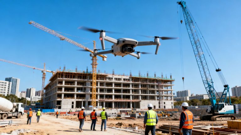
Construction Monitoring and Progress Tracking
Construction teams can now track site changes week by week, spot errors before they get expensive, and share reliable updates with everyone involved. Orthomosaic maps offer clear imagery showing exactly what’s changed, how earthwork is progressing, and whether timelines are on track.
Instead of shuffling messy paper drawings or relying on memory, teams can literally zoom in and see what’s new. The benefits here include:
- Accurate volume measurements for stockpiles
- Less time spent walking large or unsafe sites
- Real-time documentation for reporting and compliance
Here’s what a typical construction mapping schedule might look like:
| Week | Deliverable | Benefit |
|---|---|---|
| Week 1 | Baseline map | Initial site status |
| Week 4 | Update orthomosaic | Track progress/change |
| Week 8 | As-built model | Documentation/record |
For digital twin support and advanced deliverables, inspection services in Southern California are already setting the standard.
Land Development and Urban Planning
Urban designers and planners rely on up-to-date maps to guide projects, big or small. Orthomosaics help them:
- Visualize existing buildings, lots, and green spaces
- Spot land use patterns that might not be obvious from ground level
- Communicate changes clearly to the public and decision makers
These maps often become the go-to base layer for 3D models, zoning overlays, and development proposals. The accuracy and fresh perspective just can’t be matched by older satellite imagery or paper maps.
Seeing a whole neighborhood’s real situation from the air makes planning for growth a lot less theoretical and a lot more practical.
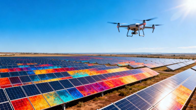
Agriculture and Environmental Conservation Efforts
Farmers and conservation groups are finding out that seeing the land from above really helps with management. Orthomosaic mapping helps them:
- Pinpoint irrigation issues (dry or flooded spots)
- Map the spread of crops, weeds, or disease
- Track changes in wetlands, forests, or habitats over time
With this high-resolution data, growers maximize yields and use fewer inputs, while environmental groups track restoration projects or spot damage quickly. The difference between drone and traditional mapping is especially big in large, open fields or rough terrain.
If you’re curious how aerial data is supporting smart land use, projects using high-resolution drone imagery across California’s diverse regions have already seen positive results.
Choosing the Right Mapping Technology for Your Project
So, you’ve got a project in California and need some top-notch mapping done. That’s great! But here’s the thing: not all mapping tech is created equal. It’s a bit like picking the right tool for a job – you wouldn’t use a hammer to screw in a bolt, right? The same goes for mapping. We’ve got a couple of main players in the game: photogrammetry (which gives you those super detailed orthomosaic maps) and LiDAR. Each has its own strengths, and knowing which one to pick can make a big difference in your results and your budget.
When Photogrammetry Excels for Visual Applications
Photogrammetry is basically the process of taking a bunch of overlapping photos from the air and stitching them together into one big, super-clear picture. Think of it like creating a giant, high-resolution aerial photograph of your site. It’s fantastic when you need to see the visual details of things.
- Great for visual inspections: If you need to check out the condition of roofs, look at real estate properties, or just get a really good visual sense of an area, photogrammetry is your go-to. It captures textures and colors really well.
- Cost-effective for open areas: For projects that don’t have a ton of dense trees or complex terrain, photogrammetry can be a more budget-friendly option.
- Detailed surface texture: It’s excellent for mapping things where the surface appearance is key, like mapping out building facades or looking at the condition of roads.
The main takeaway here is that photogrammetry shines when the visual aspect of the data is the priority. It’s like taking a really, really good picture that’s also a map.
Photogrammetry turns a bunch of photos into a single, clear, and undistorted image. It’s all about capturing what things look like from above with a lot of detail.
LiDAR’s Advantage in Dense Vegetation and Rugged Terrain
Now, LiDAR is a bit different. Instead of just taking pictures, it uses lasers to measure distances. Imagine it like shining a laser pointer down and measuring exactly how long it takes for the light to bounce back. This allows it to create a 3D model of the ground, even if there’s stuff in the way.
- Penetrates vegetation: This is LiDAR’s superpower. It can see through tree canopies to map the actual ground surface underneath. This is huge for forestry, environmental studies, or any project where you need to know the ground elevation under trees.
- Works in any light: Unlike photogrammetry, which needs good lighting, LiDAR doesn’t care if it’s sunny, cloudy, or even dusk. It uses its own light source (the laser).
- High accuracy for elevation: LiDAR is generally more accurate when it comes to measuring precise elevations and ground contours, especially in complex environments.
| Feature | Photogrammetry | LiDAR |
| :—————— | :——————————————- | :———————————————— | —
| Primary Output | High-resolution orthomosaic image | 3D point cloud, bare-earth elevation models |
| Vegetation | Limited penetration, can obscure ground | Excellent penetration, maps ground beneath canopy |
| Lighting Needs | Requires good, consistent lighting | Independent of ambient light |
| Best For | Visual inspections, open terrain, surface texture | Dense vegetation, rugged terrain, elevation accuracy |
Tailoring Solutions for Specific Project Goals
Ultimately, the best technology depends on what you’re trying to achieve. Are you trying to monitor construction progress and need to see the visual state of the site? Photogrammetry might be perfect. Or are you planning a new development in a heavily wooded area and need to know the exact ground elevation? LiDAR would be the smarter choice.
- Define your objective: What specific information do you absolutely need from the mapping? Visuals? Elevation data? Ground surface data under cover?
- Consider the environment: Is the project site open and clear, or is it covered in trees, buildings, or other obstructions?
- Think about accuracy requirements: How precise do your measurements need to be, especially for elevation and terrain?
By thinking through these questions, you can make sure you’re choosing the mapping method that will give you the most useful and accurate data for your California project. It’s all about matching the tool to the task.
Delivering Actionable Data for California Projects
So, you’ve got all this amazing data from your drone mapping flights – what now? It’s not just about pretty pictures, right? The real magic happens when this information actually helps you make smart moves on your California project. We focus on making sure the data we collect is super useful, right out of the gate.
Seamless Integration with Engineering and GIS Workflows
We know you’re probably already using software like Civil 3D, ArcGIS, or QGIS. That’s why we make sure our deliverables play nice with those systems. Think of it like this: we hand you the puzzle pieces, and they fit perfectly into your existing picture. This means less time fiddling with file formats and more time actually using the data for what it’s meant for. Whether you need CAD-ready point clouds, detailed contour lines, or accurate digital elevation models, we format it so it’s ready to go.
- Point Clouds: Millions of elevation points that give you a true 3D view of your site.
- Orthomosaics: Georeferenced, high-resolution maps that are like a perfect aerial photo.
- Digital Elevation Models (DEMs): Essential for understanding terrain and planning earthwork.
We aim to bridge the gap between raw aerial data and practical application, making sure your team can immediately put the information to work without a steep learning curve.
Rapid Turnaround Times for Field-Ready Data
Time is money, especially on a construction site or a development project. We get that. That’s why we’re set up to get your data back to you quickly. Often, you can expect your field-ready data within 48 to 72 hours after the flight. This speed means you can keep your project on schedule, make timely decisions, and avoid costly delays. It’s about getting you the information you need, when you need it, so you can keep moving forward.
Ensuring Accuracy and Reliability Across All Scales
From a small parcel to thousands of acres, accuracy is non-negotiable. Our technology, combined with FAA-certified pilots and experienced analysts, means you can trust the data. We’re talking about centimeter-level accuracy for both horizontal and vertical measurements. This reliability is key, whether you’re tracking small changes on a construction site or analyzing vast tracts of land for environmental conservation. You can count on the data we provide for informed decisions about your project, no matter the size.
Wrapping Up: The Future of Mapping in California
So, that’s the big picture on high-resolution orthomosaic mapping across California. It’s wild to think how far we’ve come—turning hundreds or even thousands of drone photos into one sharp, accurate map that anyone can use. Whether you’re a surveyor, a city planner, or just someone curious about how things are changing in your neighborhood, this technology makes it easier to see and understand the land. From busy cities to remote hillsides, these maps are helping folks work smarter, save time, and avoid headaches. As more people catch on, I bet we’ll see even more creative uses pop up. For now, if you need a clear view of your project or property, orthomosaic mapping is a solid choice. California’s a big place, but with these tools, it feels a little more manageable.
Frequently Asked Questions
What is orthomosaic mapping and how does it work?
Orthomosaic mapping is a process where drones take many photos of an area from above. These photos are then stitched together using special software to create one big, clear, and accurate map. This map looks like a single picture but is made up of hundreds or even thousands of smaller images.
Why is high-resolution mapping important for projects in California?
California has many different types of land, from busy cities to wide-open farms and forests. High-resolution maps help people see details clearly, plan projects better, and make smart decisions about construction, farming, or protecting the environment.
How do drones help with mapping compared to traditional ground surveys?
Drones can fly over big or hard-to-reach areas quickly and safely. They collect lots of data in a short time, which means projects can move forward faster. This is much quicker and often safer than sending people to walk the land or use old-style survey tools.
What is the difference between photogrammetry and LiDAR for mapping?
Photogrammetry uses photos to make maps that show what things look like. It’s great for projects where you need to see details, like buildings or crops. LiDAR uses laser pulses to measure the ground, even under trees or thick plants. LiDAR is better when you need to know the exact shape of the land, especially in forests or hills.
Are the drone pilots and data accurate enough for engineering or legal use?
Yes. Professional drone pilots in California are FAA-certified, and the data they collect can be very accurate—often within a few centimeters. This level of detail is good enough for engineering plans, construction, and even legal documents.
How quickly can I get my mapping results after the drone survey?
Most drone mapping services in California can deliver results in just a few days. The exact time depends on how big the area is and what kind of map you need, but many projects get their data within 48 to 72 hours after the flight.