Accurate Drone Stockpile Volumetrics in California: Essential for Construction Projects
Keeping track of materials on a construction site in California can be a real headache. You need to know exactly how much dirt, gravel, or other stuff you have, but doing it the old way is slow, expensive, and sometimes just plain dangerous. That’s where drone stockpile volumetrics California comes in. These flying gadgets are changing the game, giving you fast, accurate numbers without putting your workers at risk. Let’s look at how this tech makes a big difference for projects all over the Golden State.
Key Takeaways
- Drone stockpile volumetrics California offers a much faster way to measure materials compared to traditional methods, saving valuable project time.
- This technology provides highly accurate volume calculations, reducing guesswork and potential errors in inventory management.
- Using drones significantly improves safety by keeping workers out of potentially hazardous areas around stockpiles.
- Real-time data from drone surveys allows for quicker, more informed decisions on site, keeping projects on track.
- The efficiency and accuracy of drone services often lead to cost savings and better overall project profitability.
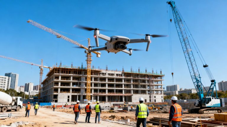
Revolutionizing Stockpile Measurements In California
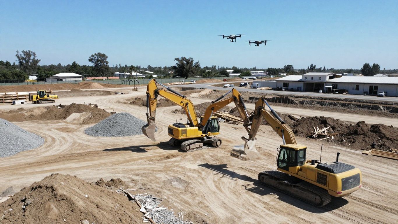
Let’s be honest, keeping track of materials on a construction site used to be a real headache. We’re talking about piles of dirt, gravel, or whatever else you’ve got sitting around. Figuring out exactly how much you have, especially with those oddly shaped piles, was often a guessing game or a super time-consuming manual process. That’s where drone technology comes in, and it’s really changing the game for construction projects all over California.
The Speed Advantage Of Drone Technology
Think about the old way: sending someone out with measuring tapes and maybe a GPS device, carefully walking around each pile. It takes ages, right? Drones can do the same job, but way, way faster. They fly over the site, snapping tons of high-resolution pictures and gathering data in just a fraction of the time it would take a person on the ground. This means you get your numbers back quickly, which is a big deal when you’re trying to keep a project moving.
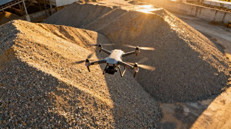
Unmatched Accuracy For Critical Data
It’s not just about speed, though. Drones bring a level of precision that’s hard to match with traditional methods. They capture so many data points from above, mapping out the exact shape and contours of your stockpiles. This detailed information allows for really accurate volume calculations, minimizing those annoying errors that can pop up with estimations. Getting this kind of reliable data is super important for managing inventory and making sure you’re billing correctly. It’s like having a super-detailed map of all your materials.
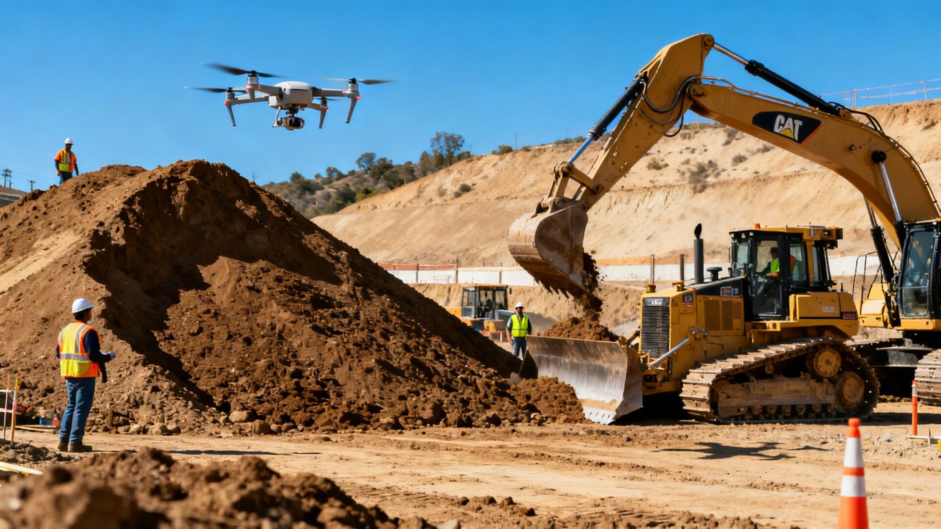
Enhancing Safety On Construction Sites
Safety is always number one on any job site, and let’s face it, climbing around on loose material isn’t exactly the safest activity. Drones take people out of harm’s way. Instead of risking a fall or getting stuck in a tricky spot, a drone can gather all the necessary measurements from a safe distance. This not only protects your crew but also frees them up to focus on their main tasks, which is usually more productive anyway. It’s a win-win for efficiency and well-being.
The shift towards using drones for stockpile measurements isn’t just a trend; it’s a practical upgrade that addresses long-standing challenges in construction. It offers a clearer picture of site resources and reduces the manual labor involved in data collection.
Here’s a quick look at what makes drone surveying so effective:
- Rapid Data Capture: Cover large areas and multiple stockpiles in minutes, not hours.
- High Precision: Generate detailed 3D models for accurate volume and quantity assessments.
- Reduced Risk: Keep your team safe by minimizing the need for physical interaction with stockpiles.
- Cost Efficiency: Save on labor and time compared to traditional survey methods, contributing to better project management.
This technology is really making a difference in how construction projects are managed in California, providing the kind of reliable, up-to-date information that helps keep everything on track and within budget. For anyone involved in earthworks, understanding the capabilities of outdoor AI for mapping is becoming increasingly important.
Precision From Above: The Drone Stockpile Volumetrics California Advantage
So, you’re working on a construction project in California and need to know exactly how much material you’ve got in your stockpiles? Forget the old ways of measuring. Drones are changing the game, and honestly, it’s about time. They give you a bird’s-eye view, literally, and that makes a huge difference.
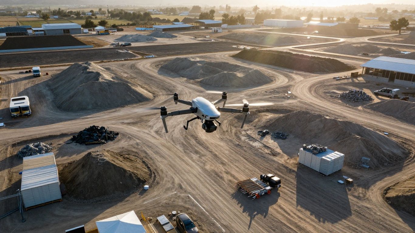
Capturing Comprehensive Data Points
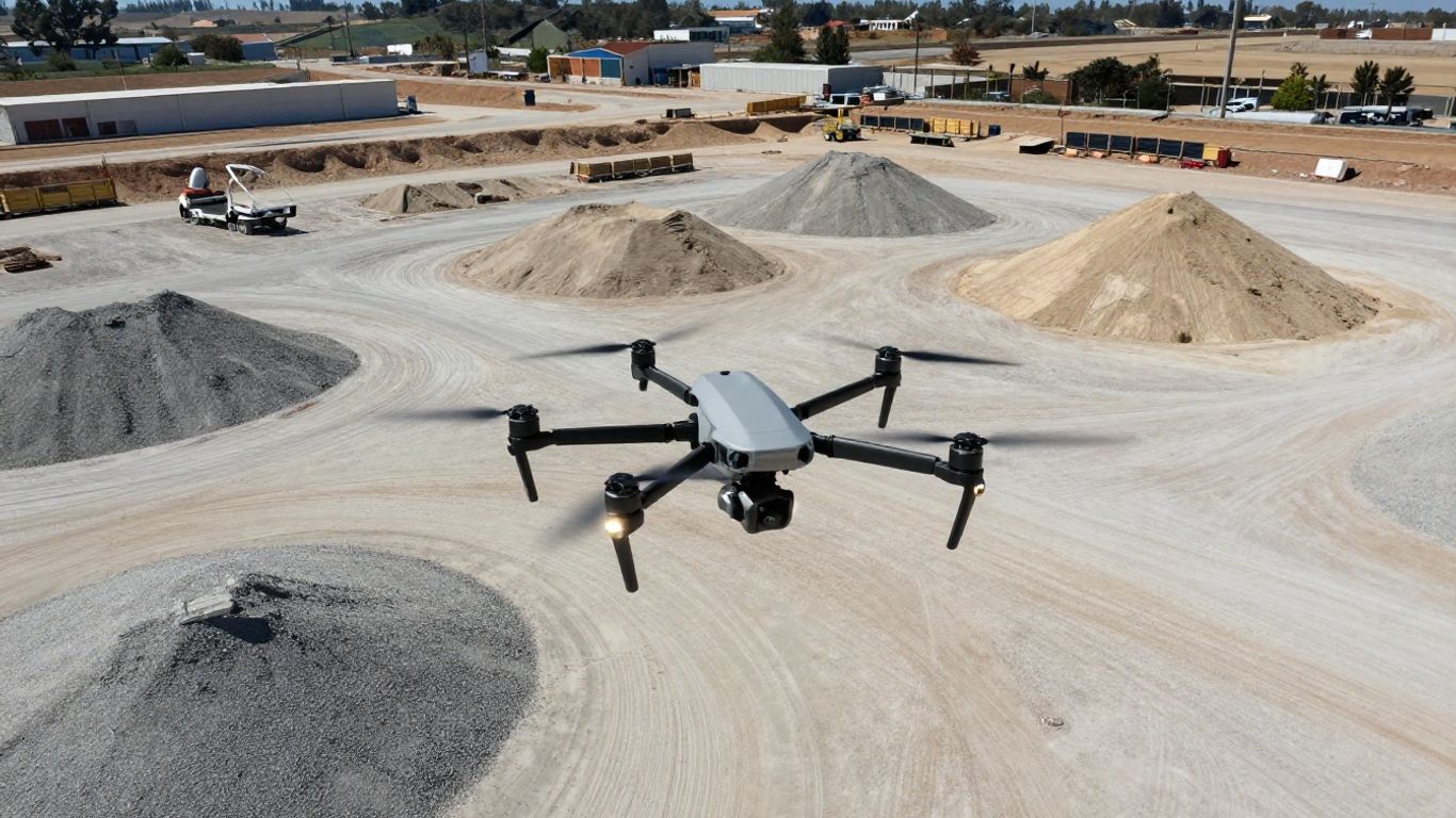
Think about it: traditional methods often involve a lot of guesswork, especially with oddly shaped piles. Drones, however, use advanced cameras and sensors to grab tons of data points from above. This means they can map out the exact shape and size of your stockpiles, no matter how weird they look. This level of detail is pretty hard to get otherwise. It’s like going from a blurry photo to a high-definition video – you just see so much more.
- Detailed topographic data capture
- Mapping of irregular stockpile shapes
- Recording of surface variations
This technology provides the accuracy required for cut/fill calculations and other critical project needs.
Real-Time Insights For Informed Decisions
One of the best parts about using drones is getting information almost instantly. You don’t have to wait days for survey results. The data comes back quickly, showing you things like contour lines, digital surface models, and, of course, the volume of your materials. This means you can make decisions on the fly, adjusting your plans as needed without getting bogged down. It’s all about having the right info when you need it to keep things moving.
- Quick volume calculations
- Up-to-date surface models
- Prompt data for planning adjustments
We’re seeing a big shift towards using drone reality capture for this kind of work because it just makes sense for project timelines.
Minimizing Site Disruption And Downtime
Let’s be real, construction sites are busy places. Having surveyors walking around, taking measurements, can sometimes get in the way of the actual work. Drones fly overhead, collecting all the necessary data without getting in anyone’s way. This means less disruption to your daily operations and, importantly, less downtime. Less downtime usually means more money saved, which is always a good thing on any project. Plus, using RTK-enabled drones means you get super precise measurements without needing a ton of ground control points, further speeding things up.
Streamlining Earthworks With Advanced Drone Technology
Accelerating Stockpile Calculations
Forget the old ways of measuring stockpiles. Drones totally change the game here. Instead of spending hours with a tape measure or a laser scanner, a drone can map out a pile in minutes. This means you get your volume numbers way faster. This speed advantage is a big deal for keeping projects moving. You’re not waiting around for survey crews; you get the data you need, when you need it.
Outpacing Traditional Survey Methods
Traditional surveying methods just can’t keep up. They’re slow, and honestly, they can be pretty dangerous. Think about sending someone up a steep pile of gravel or dirt. Drones fly overhead, safe and sound, capturing all the necessary data. This isn’t just about saving time; it’s about keeping your team out of harm’s way. Plus, the data from drones is way more detailed. You get a 3D model of the stockpile, not just a few points. This means your volume calculations are much more accurate, reducing those annoying disputes over material quantities.
Delivering Actionable Site Data
What you get from a drone survey isn’t just numbers; it’s actual useful information. You can see exactly how much material you have, where it is, and how it’s changing over time. This helps you plan your next steps better, whether that’s ordering more material, scheduling equipment, or figuring out your next excavation phase. It’s like having a bird’s-eye view that actually tells you what’s going on, so you can make smarter choices without all the guesswork.
The shift to drone technology for earthworks isn’t just a trend; it’s a practical upgrade. It means less time spent on tedious measurements and more time focused on the actual construction work. The accuracy and speed mean fewer mistakes and less wasted money.
Here’s a quick look at how drone data stacks up:
- Speed: Map 50+ acres in an afternoon vs. days with ground crews.
- Accuracy: Achieve ±1-3cm precision, far better than estimations.
- Safety: Keep surveyors on the ground, reducing fall risks.
The Future Of Construction Site Analysis
A New Era Of Earthworks Efficiency
So, what’s next for how we look at construction sites? It’s pretty clear that the old ways of doing things just aren’t cutting it anymore. We’re talking about a whole new level of efficiency, and it’s all thanks to technology that lets us see things from above. Think about it: instead of spending days on manual surveys, we can get detailed site information in a fraction of the time. This means project managers can make decisions faster and with more confidence. The future is about using smart tools to keep projects moving smoothly and profitably.
Transformative Power For Project Success
This shift isn’t just about being faster; it’s about being smarter. Drones equipped with advanced sensors can gather so much more data than ground crews ever could. We’re talking about detailed 3D models, precise volume calculations for stockpiles, and a clear picture of site progress. This kind of information helps catch problems early, before they turn into expensive headaches. It also means less guesswork and more certainty when it comes to planning and execution. It’s a big change that really helps projects stay on track and meet their goals.
Driving Progress Through Innovation
Looking ahead, the integration of drone technology into construction is only going to get deeper. We’re seeing more AI-powered analysis that can automatically spot issues or track progress. This means even less manual work and more reliable data. For companies in California, adopting these tools isn’t just about keeping up; it’s about getting ahead. It’s about building better, safer, and more cost-effective projects by embracing the latest advancements in site analysis. The construction industry is evolving, and these technologies are leading the charge.
Achieving Survey-Grade Accuracy With Drones
High-Resolution Mapping and Models
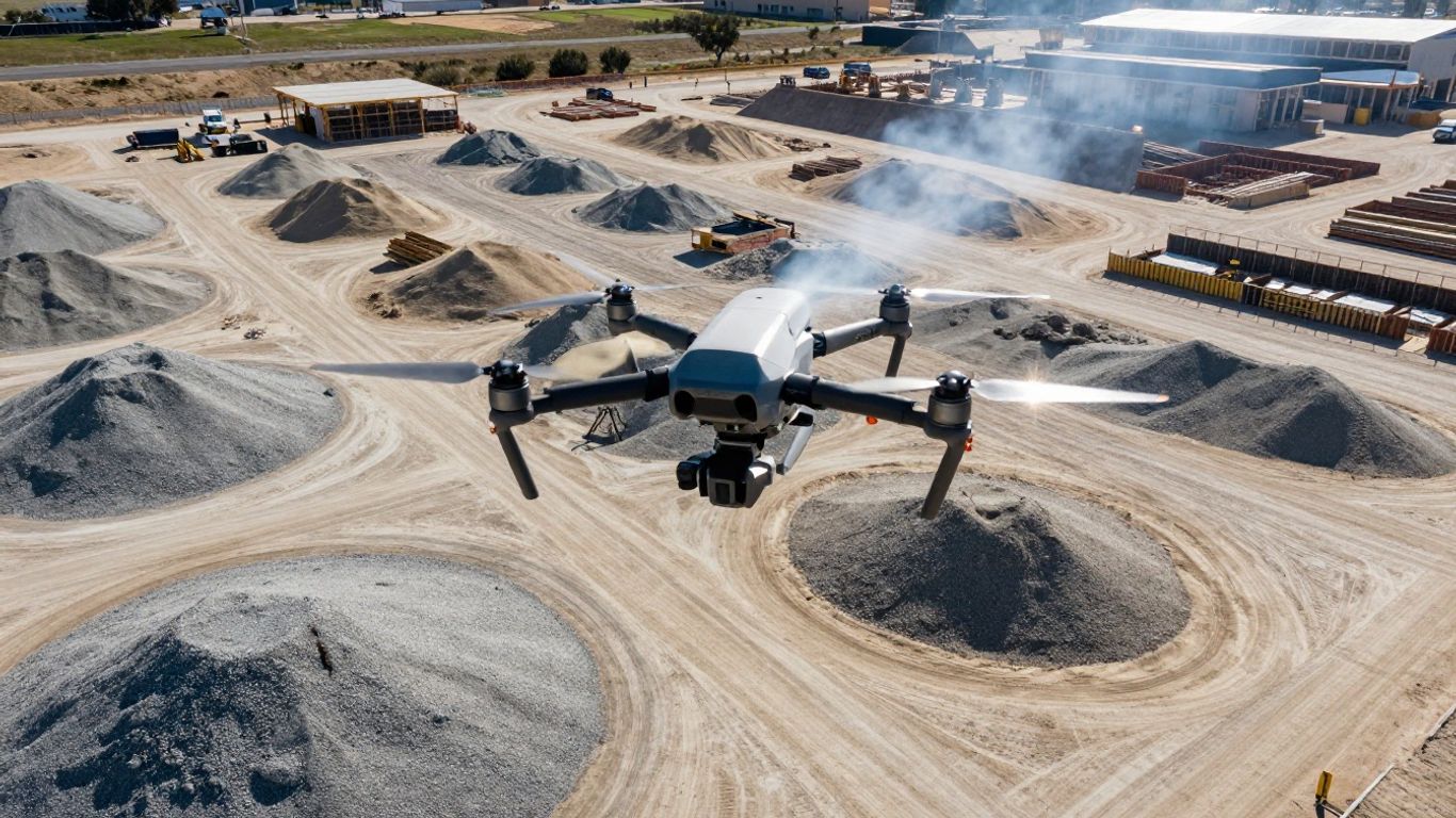
Forget grainy photos and guesswork. Drones equipped with advanced cameras and sensors capture incredibly detailed imagery of your construction site. Think of it like having a super-powered camera that can see every nook and cranny from above. This data is then processed using photogrammetry to create highly accurate 2D maps and 3D models. These aren’t just pretty pictures; they’re precise digital twins of your site, showing topography, existing structures, and of course, your stockpiles with remarkable clarity. This level of detail means you can see exactly what’s happening on the ground, making it easier to plan and manage your project.
Precise Volume Calculations and Inventory
This is where the real magic happens for stockpile management. Once we have those detailed 3D models, calculating the volume of your stockpiles becomes straightforward and, more importantly, highly accurate. We can determine the exact amount of material you have on hand, whether it’s gravel, sand, or any other construction aggregate. This precise inventory management helps prevent over-ordering or running short on materials, which can cause significant delays and cost overruns. Knowing your exact material quantities is key to keeping your project on schedule and budget.
Here’s a quick look at how the accuracy stacks up:
- Traditional Surveys: Often have accuracy within centimeters, but cover limited points.
- Drone Surveys (with RTK/PPK): Can achieve ±1-3cm accuracy, capturing millions of data points.
- Result: Denser data coverage and more reliable volume calculations.
Seamless Integration With Construction Software
We know you’re already using software to manage your projects, and we don’t want to add another complicated step. The data we collect and process is designed to work with the tools you already use. Whether it’s CAD software like AutoCAD or Civil 3D, or other project management platforms, our deliverables can be imported directly. This means you can easily compare the drone data with your design plans, track progress against your schedule, and use the volume calculations for billing and inventory without any hassle. It’s all about making your workflow smoother and your data more useful.
The ability to get survey-grade data quickly and integrate it into existing workflows is a game-changer for construction projects. It means less time spent on manual data entry and more time focused on building.
Maximizing Project ROI With Drone Surveying
When you’re managing a construction project, every dollar and every hour counts. That’s where using drones for surveying really starts to pay off. It’s not just about getting a cool aerial view; it’s about making your project more profitable and less of a headache. Companies using drone mapping often see a positive return on investment within the first year.
Significant Cost Savings Over Time
Let’s talk numbers. Traditional ground surveys can take days or even weeks, and they tie up your skilled crews. Drones, on the other hand, can map large areas in just a few hours. This means your surveyors can get back to their main jobs, and you’re not paying for slow, old-school methods. Think about it: one hour of drone flight can replace five hours of walking the site with traditional equipment. Plus, the cost savings are pretty substantial. Many construction firms report saving around $114,000 annually by switching to drone mapping for routine site documentation. This kind of efficiency directly impacts your bottom line.
Reducing Errors and Rework
Accuracy is key, and drones bring a level of precision that’s hard to match with manual methods. They can capture data with an accuracy of ±1-3cm, which is as good as traditional surveys but with way more detail. This means fewer surprises down the line. When you have precise volume calculations, you reduce quantity variances from 5% down to just 1%. That kind of improvement can save you thousands on a single project. Catching issues early, like incorrect grading or material quantities, prevents costly rework later on. It’s like finding a small problem with your car before it turns into a breakdown on the highway.
Improving Profitability Through Early Detection
One of the biggest wins with drone surveying is spotting problems before they become major issues. Progress monitoring via drones helps catch potential problems when they’re cheap and easy to fix. We’re talking about fixing things when the cost is in the hundreds, not the thousands. This proactive approach can boost overall project profitability by 15-25%. You get real-time insights, not data that’s already a week old, allowing for quicker, smarter decisions. This agility is a huge advantage in today’s construction environment. For a look at how this works in practice, check out this information on drone mapping ROI.
The ability to get accurate, up-to-date site information quickly means you can manage resources better, avoid costly mistakes, and keep the project moving smoothly. It’s about working smarter, not just harder.
Here’s a quick look at how drone surveying stacks up:
- Speed: Map 50+ acres in an afternoon versus days with ground crews.
- Accuracy: Achieve ±1-3cm precision, reducing quantity variances.
- Safety: Keep surveyors safely on the ground, reducing fall risks.
- Cost: Significant savings compared to traditional survey methods, often with a positive ROI in the first year.
- Data: Get detailed, actionable data within 24-48 hours for informed decision-making.
The Future of Stockpile Measurement is Here
So, we’ve talked a lot about how drones are changing the game for construction projects here in California. Measuring stockpiles used to be a real pain, taking up tons of time and money, not to mention putting workers in tricky spots. But now, with drones, you get super accurate numbers fast. This means less guesswork, better planning, and a safer worksite for everyone. It’s a pretty big deal for keeping projects on track and making sure everything adds up right. Basically, if you’re in construction and not looking into drone tech for your measurements, you might be falling behind.
Frequently Asked Questions
Why are drone stockpile measurements better than old ways?
Drones are way faster and more accurate than people walking around with measuring tools. They can cover a big area quickly and get super precise numbers for how much material you have. This saves time and avoids mistakes that can cost a lot of money.
How do drones make construction sites safer?
Drones take pictures and measurements from the sky. This means workers don’t have to climb on or walk around big piles of dirt or rocks, which can be dangerous. It keeps them out of harm’s way so they can focus on their main jobs.
Can drone data be used with my existing software?
Yes! The data drones collect can be easily put into most construction software you’re already using. This makes it simple to use the new information for planning, tracking, and reporting without any extra hassle.
How quickly can I get the results from a drone survey?
Usually, you get the results within a day or two after the drone flies. If you need the information really fast, like for billing, they can often get it to you the same day. This helps keep projects moving without delays.
Are drone measurements as accurate as a surveyor’s?
Yes, drone measurements are just as accurate, and often even more so, than traditional surveying. They capture millions of data points, giving a much more complete picture of the site than older methods.
How much does using drones for surveys cost?
While the exact price depends on the size of your project, using drones is usually much cheaper than traditional surveying. Many companies save a lot of money each year by switching to drone mapping.