Monthly drone progress monitoring subscription cost
Key Takeaways
A monthly drone progress monitoring subscription cost depends less on the aircraft itself than on the work surrounding each flight. Site area, visit frequency, deliverables, travel, and reporting expectations all shape the useful comparison.
- Subscription plans turn recurring site documentation into a predictable operating expense.
- A flight schedule should follow the pace and risk of construction, not a default calendar.
- Orthomosaics, 3D models, photos, and reports carry different processing and review costs.
- ROI can come from fewer site visits, earlier issue detection, and stronger project records.
- Vendor quotes are easiest to compare when scope, ownership, storage, and overages are explicit.
What a monthly drone progress monitoring subscription includes
A recurring monitoring plan is usually a workflow rather than a single aerial photograph. It combines scheduled capture, consistent processing, organized delivery, and some level of support throughout the project. The right scope gives the team comparable information from one month to the next, rather than a collection of disconnected images.
Scheduled site flights and repeatable capture routines
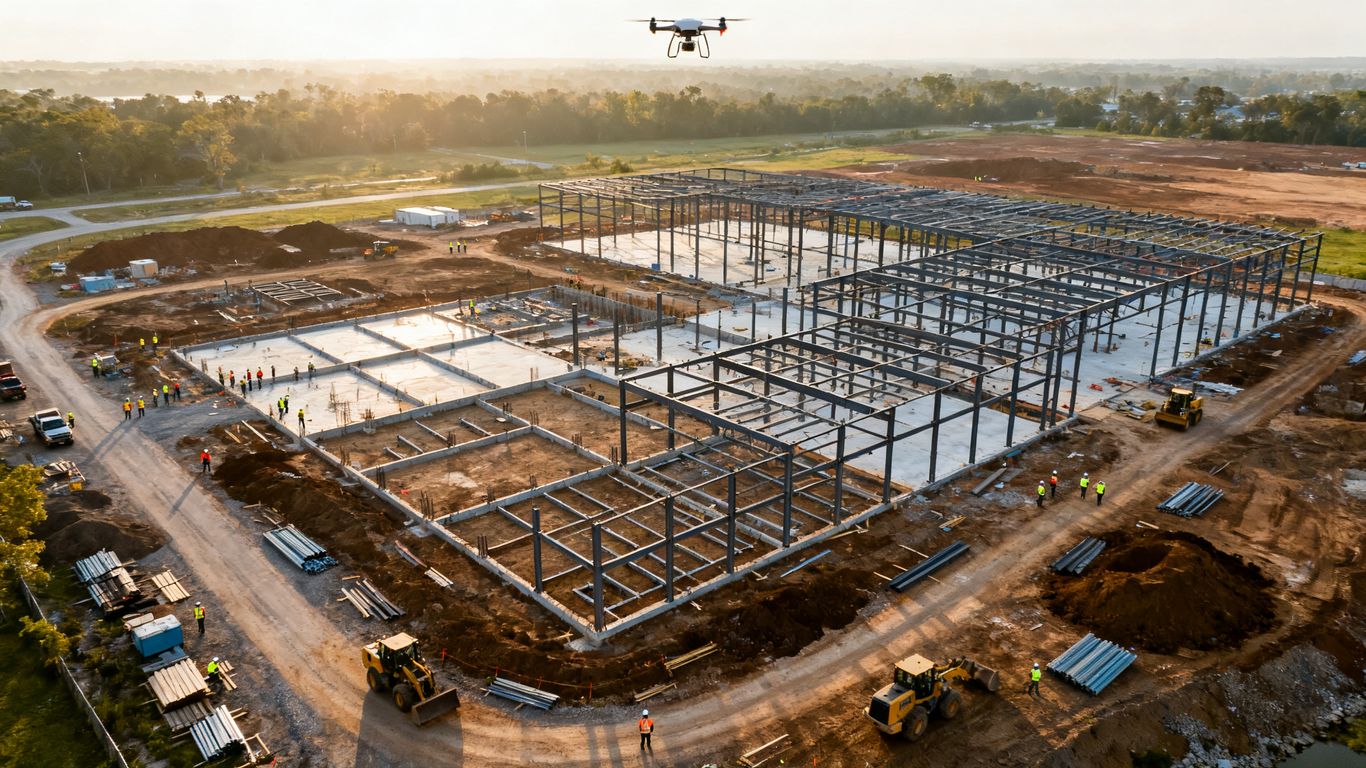
The foundation of a subscription is a repeatable flight routine. The provider establishes a suitable route, capture area, and timing, then returns on an agreed schedule so changes can be compared with a reliable baseline. That may mean monthly visits for a slower project or more frequent flights during earthwork and other fast-moving phases.
A good quote should say what happens when weather, restricted airspace, or an active site prevents the planned flight. It should also identify whether rescheduling is included, whether travel is billed separately, and who coordinates access with the superintendent.
Orthomosaics, 3D models, and aerial progress photos
The deliverable may be a set of aerial progress photos, a map, a model, or a combination of those items. Orthomosaics help teams view the whole site from a consistent perspective, while 3D models and related measurements can support planning and quantity review when that level of detail is included in the scope.
For a useful reference point, high-resolution drone mapping can provide 2D orthomosaic maps and 3D models for construction planning, progress tracking, inspections, and documentation. That does not mean every subscription includes both products, so the quote should name the exact files, resolution, coordinate system, and delivery format.
Dashboards, reports, and stakeholder access
A recurring service becomes easier to use when the results arrive in a consistent report or shared workspace. Owners may want a brief visual update, while project managers may need annotated views, comparisons, or measurements that can be discussed in a coordination meeting. Access rules matter too: confirm how many users can view the data and whether external stakeholders can receive links or exported files.
The reporting cadence should match the meeting cadence. A monthly report delivered after the key review has already happened is less valuable than a simpler report delivered in time to inform decisions.
Storage, revisions, and customer support
Storage is often overlooked when teams compare headline prices. Ask how long the provider retains raw imagery and processed files, whether older flights remain accessible, and what happens when a report needs a correction. A clear revision policy prevents a small change from becoming an unexpected service charge.
Support also has a practical cost. Someone should be available to clarify a measurement, explain a processing limitation, or help a stakeholder find the relevant flight. Those details can distinguish a useful monitoring service from a folder of photographs.
How monthly drone monitoring subscriptions are priced
Providers commonly package recurring work by site, visit, area, or portfolio. The monthly drone progress monitoring subscription cost can therefore look very different between two quotes that appear to describe the same service. The fair comparison is the total included scope: flights, travel, processing, reporting, storage, and any extra work.
Per-site and per-project pricing
A per-site plan is straightforward when one project has a defined boundary and a stable period of work. The monthly fee may cover a set number of visits and standard deliverables for that location. Per-project pricing can also make sense when the provider is planning around milestones, such as site preparation, structural work, and closeout documentation.
This model is easiest to budget when the contract states what counts as one site. A large project with multiple disconnected parcels, remote laydown areas, or changing boundaries may need a revised definition before work begins.
Per-flight and visit-based plans
Visit-based pricing separates the cost of each field campaign from the broader reporting service. It can suit projects that do not need a flight every month or that change cadence as construction progresses. The tradeoff is less certainty if travel, rush processing, or special capture requests are added to individual visits.
Before selecting this approach, ask whether a canceled flight is charged, whether a second location counts as another visit, and whether the rate includes the same deliverables each time. Small exclusions can materially change the annual total.
Tiered subscriptions based on site size
Some plans use area or complexity tiers. A compact urban site may fit a basic tier, while a wide infrastructure corridor or large development needs more flight time, data processing, and quality control. The tier may also change when the monitored boundary expands during construction.
The useful question is not simply which tier is cheapest. It is whether the tier gives enough capture coverage and processing capacity for the decisions the team needs to make.
Enterprise plans for multiple locations
A portfolio plan can consolidate recurring monitoring across several projects. It may offer standardized reporting, a common access process, or negotiated rates, but the details vary widely. Geographic spread, different site conditions, and separate project teams can still create location-level charges.
For a broader view of pricing structures, this commercial drone mapping cost guide discusses project, subscription, hourly, and other approaches alongside factors such as complexity, data type, location, accuracy, labor, insurance, and permits. Those same categories are useful when reviewing a multi-site proposal.
Factors that affect monthly drone monitoring costs
The cost of a recurring service reflects field work, aviation requirements, data processing, and account management. Two projects in the same city can need very different budgets because their boundaries, schedules, and outputs differ. Scope clarity saves money because it limits assumptions before the first flight.
Construction site size and geographic coverage
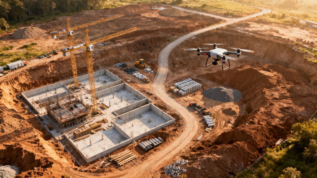
A larger site generally takes longer to plan, fly, process, and review. A project spread across several areas adds travel and coordination even when the total acreage seems manageable. Tall structures, nearby obstacles, and complex boundaries can also make a simple-looking capture routine more demanding.
Ask whether the quoted area includes staging grounds, access roads, stockpiles, and adjacent work zones. If those areas may be added later, request the rate for expanding coverage rather than leaving it open-ended.
Flight frequency and project duration
Frequency is one of the clearest budget levers. Monthly flights may be enough when visible changes are gradual, while weekly or milestone-based capture can be more useful during earthwork, foundations, or other phases where conditions change quickly. A practical construction monitoring guide also treats flight timing as something that should follow project phases rather than a universal schedule.
A long project can justify a recurring rate, but it should not automatically require the same cadence throughout. Seasonal conditions, pauses, and closeout needs may justify a written schedule that changes over time.
Deliverable detail and processing requirements
A photo update is not priced like a georeferenced map or a detailed 3D model. Higher detail may require more images, control, processing time, quality checks, and specialist review. Requests for volume calculations, design comparisons, annotations, or custom file formats can add further work.
Define the minimum useful product before paying for every available output. A project team that needs visual communication may not need the same processing package as a team validating quantities or comparing site conditions with design information.
Pilot, travel, and regulatory expenses
Field pricing can include pilot time, equipment, insurance, mobilization, permits, and travel. Remote sites or locations with complicated operating conditions may carry additional planning costs. A provider should explain which expenses are included in the recurring fee and which are passed through when they arise.
Compliance is part of the service, not an optional decoration. Confirm who handles flight planning, site coordination, and any required permissions, especially when the location has nearby airports, controlled airspace, or other operational constraints.
Integration with BIM, scheduling, or project management tools
A subscription can become more valuable when its outputs fit the systems the project already uses. But integration may require custom formatting, data preparation, or manual review. The quote should distinguish between standard exports and actual setup or synchronization work.
Ask for a sample workflow: where the files land, who can access them, which naming conventions are used, and whether the provider supports the specific comparison or reporting process your team follows. That conversation is more useful than accepting a vague promise of integration.
Typical cost comparisons for drone progress monitoring
There is no single benchmark that makes every plan inexpensive or expensive. A recurring service should be compared with the cost and limitations of the alternative, including staff time and the consequences of missing useful information. The cheapest line item can be costly if it produces records nobody can use.
Subscription services versus one-time drone surveys
A one-time survey may suit a baseline, a specific dispute, or a single measurement. A subscription adds continuity, which makes it easier to see changes and create a dated record across the project. It also spreads planning and setup effort across several visits rather than repeating the buying process each time.
The choice depends on how often information will change and how often the team will act on it. If the project has a long active period, the consistency of recurring capture may justify the additional monthly commitment.
Hiring a drone operator versus using an in-house team
An in-house team may appear cheaper when equipment and personnel are already available. The full calculation should include training, maintenance, software, insurance, compliance administration, pilot availability, and the time required to process and distribute results. A service provider, meanwhile, may bring a repeatable workflow without requiring the contractor to manage every operational detail.
A simple comparison should account for the work that happens after the flight. If staff can capture images but cannot reliably turn them into timely reports, the apparent equipment savings may not hold.
Basic photo updates versus detailed mapping products
Basic photos are often adequate for a quick visual update, marketing record, or meeting discussion. Mapping products cost more when the team needs consistent scale, measurements, models, or comparisons. The right level depends on the decision being supported, not on how impressive the deliverable looks.
The following comparison helps frame a quote without treating the categories as fixed industry prices:
| Service level | Usually useful for | Main cost drivers | Questions to ask |
| Photo update | General visibility and meeting updates | Flight time, editing, delivery | How many images and what viewpoints? |
| Orthomosaic mapping | Site-wide visual comparison | Capture coverage and processing | What accuracy and file format are included? |
| 3D model or measurements | Quantities, planning, and detailed review | Processing, control, and quality checks | Which measurements and revisions are included? |
| Custom reporting | Owner, lender, or multi-team communication | Review time and report design | Who defines the report template? |
The table is a starting point, not a substitute for a scope review. A provider may bundle several levels together, while a project may need only one of them during a particular phase.
Comparing local providers with nationwide platforms
A local provider may offer shorter travel distances, regional familiarity, and direct communication with the project team. A nationwide platform may offer standardized processes across multiple locations and centralized account management. Neither model is automatically better; the fit depends on geography, consistency, responsiveness, and the complexity of the work.
Compare the actual operating coverage rather than the size of the provider. A local team that can reliably serve every project may be more practical than a broad platform with limited scheduling flexibility, while a dispersed portfolio may favor centralized coordination.

How to calculate the return on investment
ROI is easiest to estimate when the service is tied to specific work that already has a cost. Count staff hours, travel, reporting effort, rework, delays, and disputes rather than treating “better visibility” as the entire benefit. The result will still be an estimate, but it will be one that can be tested after a few months.
Measuring time saved in site inspections and reporting
Start with the hours spent arranging site walks, traveling, taking photographs, organizing files, and preparing updates. Then estimate how much of that work a recurring monitoring process would remove or shorten. Include the time of project managers, owners’ representatives, consultants, and anyone who repeatedly requests the same information.
Do not assume every site visit disappears. Aerial monitoring supplements field knowledge; it may reduce unnecessary trips while leaving inspections and safety responsibilities in place.
Reducing rework, disputes, and schedule delays
Consistent records can help teams identify differences earlier and establish what was visible at a particular point in time. That may support coordination and conversations about responsibility, although it does not guarantee that a dispute or delay will be avoided. The benefit is strongest when the team reviews the information promptly and assigns follow-up actions.
A useful estimate looks at the likely cost of one avoidable error or delayed decision. Even a modest monthly fee can be reasonable if the process helps prevent a materially larger event, but the assumption should be documented rather than presented as a guaranteed saving.
Improving documentation for owners and contractors
A dated visual record can make progress updates clearer for owners, lenders, contractors, and remote stakeholders. It can also reduce repeated requests for photos and give meetings a shared reference point. The value increases when files are consistently labeled and easy to retrieve months later.
The documentation benefit is not only about presentation. It can support payment discussions, change-order conversations, closeout records, and an understanding of how site conditions developed over time.
Estimating the break-even point for a subscription
Add the expected monthly savings in labor, travel, reporting, and avoided rework. Then compare that figure with the monthly subscription and any variable expenses. If the subscription costs $2,000 per month and the measurable monthly benefit is estimated at $2,500, the simple monthly surplus is $500; the estimate should be revisited as actual results become available.
Use a conservative case as well as an optimistic one. A plan that only works when every possible saving appears may be too expensive, while a plan that breaks even through time savings alone may still provide useful documentation benefits.
How to choose the right monthly monitoring plan
The best plan is the one the project team will actually use. Begin with decisions, meetings, and risks, then work backward to the flight schedule and deliverables. A clear scope also makes the monthly drone progress monitoring subscription cost easier to compare across vendors.
Defining flight frequency and reporting requirements
Write down when the project changes quickly, when stakeholders need updates, and which milestones require a record. Then specify the preferred cadence, turnaround time, viewpoints, measurements, and report format. A monthly plan should be allowed to change cadence if the work moves into a more active or slower phase.
Keep the requirement practical. A detailed report that arrives too late, or contains data nobody reviews, adds expense without improving decisions.
Checking pilot qualifications, insurance, and compliance
Ask who will perform the flights, what experience they have with similar sites, and how the provider handles safety and regulatory requirements. Verify insurance coverage and the process for coordinating with the site team. These checks are especially important where the work involves active construction, nearby infrastructure, or unusual operating constraints.
The vendor should be able to explain its process in plain language. If responsibilities for permissions, access, or weather rescheduling are unclear, the quote is not complete.
Reviewing data ownership, security, and retention terms
Clarify who owns raw imagery, processed files, reports, and derived measurements. Review where data is stored, who can access it, how long it is retained, and how it is returned or deleted when the contract ends. These terms matter when multiple parties share project information or when records may be needed well after completion.
Also ask whether the provider can export the data in usable formats. A low monthly fee is less attractive if the project becomes dependent on a system that cannot provide its own records.
Comparing contracts, cancellation policies, and overage fees
Read the terms for weather delays, extra flights, expanded site boundaries, rush processing, additional users, and special deliverables. A contract may look affordable until a project pause or schedule acceleration triggers multiple add-on charges. Cancellation language should explain whether unused visits roll over and how much notice is required.
Request an example invoice with ordinary and exceptional charges. It is often easier to understand the commercial model from a sample than from a short rate card.
Building a pricing checklist for vendor quotes
A short checklist keeps the comparison focused and gives each provider the same questions. Include the following before requesting proposals:
- Site boundaries, locations, access requirements, and expected duration.
- Flight cadence, weather rescheduling, and turnaround time.
- Required photos, maps, models, measurements, reports, and file formats.
- Included travel, pilot, insurance, processing, storage, users, and revisions.
- Ownership, security, retention, cancellation, and overage terms.
Once those items are answered, compare total expected annual cost rather than only the advertised monthly figure. The plan with the clearest scope is often easier to manage, even when it is not the lowest initial quote.
Conclusion
A monthly drone monitoring subscription is best judged as an information workflow, not simply as a recurring flight. Compare cadence, coverage, deliverables, compliance, access, and support alongside the fee, then connect the plan to measurable project needs such as reporting time, documentation quality, and early issue detection.
Frequently Asked Questions
What is the typical monthly drone progress monitoring subscription cost?
There is no universal monthly price because site size, location, flight frequency, processing detail, travel, and reporting requirements vary. Request an itemized quote that separates recurring services from optional or event-based charges.
Is monthly drone monitoring cheaper than one-time surveys?
It can be more economical when a project needs repeated, comparable updates and the subscription reduces duplicated setup and reporting work. A one-time survey may be better for a baseline, a single measurement, or a limited documentation need.
How often should a construction site be flown?
The cadence should follow the pace of construction and the decisions the data must support. Faster-moving phases may justify weekly or milestone-based flights, while slower periods may need less frequent coverage.
What deliverables should a monitoring plan include?
Common deliverables include aerial progress photos, orthomosaics, 3D models, measurements, and written or visual reports. The contract should specify which items are included, their format, expected resolution, and turnaround time.
Can drone monitoring replace site inspections?
No. Aerial monitoring can reduce unnecessary travel and improve visibility, but it does not replace field inspections, safety responsibilities, or close review of work that cannot be seen from above.
What extra fees should buyers watch for?
Common extras include travel, additional flights, rush processing, expanded boundaries, special measurements, extra users, revisions, and flights delayed by weather or access restrictions. Ask vendors to explain each trigger before signing.
How can a company measure whether the subscription is worthwhile?
Track hours saved, avoided trips, reporting effort, earlier issue identification, and the usefulness of the project record. Compare those results with the full subscription cost over several reporting cycles rather than relying on the first month alone.