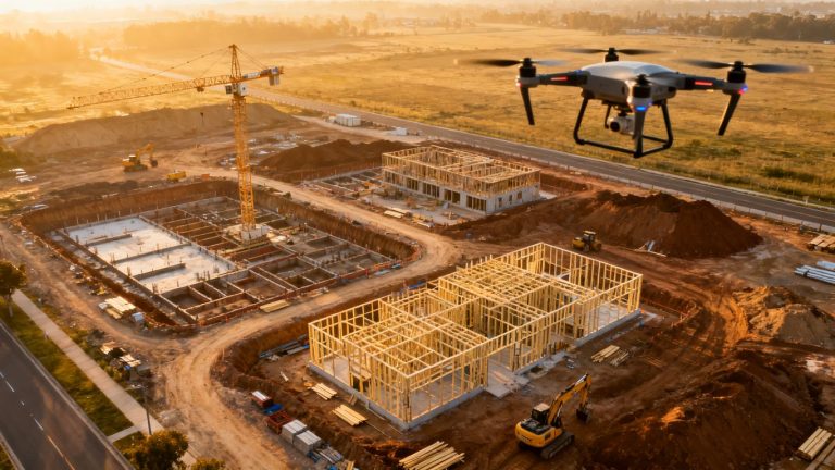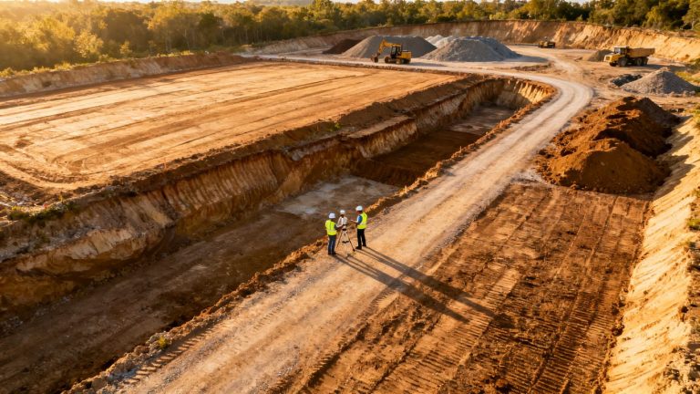
Aerial documentation for change order disputes
Key Takeaways
A defensible aerial record is planned before a disagreement appears. It connects changing site conditions with dates, locations, work sequence, cost records, and schedule effects.
- Establish baseline imagery before work changes the site.
- Repeat flights at agreed milestones and intervals.
- Preserve metadata and organize files with project records.
- Use imagery to support, not replace, notices and cost proof.
- Review limitations with the project team, experts, and counsel.
Understand how aerial documentation supports change order claims
A change order dispute usually turns on a small set of practical questions: what did the contract require, what condition or instruction changed that scope, and what did the change cost in time and money? Aerial documentation for change order disputes can help answer the factual part of that sequence. It is most useful when collected before memories diverge and tied to records that explain what the camera shows. The images do not decide entitlement by themselves, but they can make the project story easier to test.
What qualifies as a change order dispute
A change order is generally a formal adjustment to contracted scope, price, or time. A dispute arises when the parties disagree about whether a change occurred, who caused it, whether notice was adequate, or how much additional work and delay followed. That disagreement may concern differing site conditions, design revisions, access restrictions, added work, rework, or an alleged delay. A practical overview of the change order process can help teams distinguish a documented change from an informal field conversation.
The aerial record matters when it addresses a disputed fact rather than merely supplying attractive project footage. For example, a baseline may show the condition before excavation, while later flights show the extent of changed work and the sequence in which other activities were affected. Contract language, notices, instructions, daily reports, and measured costs still determine the claim; imagery supplies another contemporaneous reference point.
Why visual evidence strengthens project records
Written records describe events from a particular perspective. Aerial images add spatial context: the location of an excavation, the extent of stored material, the available access route, or the relationship between several work areas. That context can expose an apparent contradiction or help explain why a crew could not proceed as planned. Context turns isolated proof into a timeline when each image is connected to a date, location, and project event.
This does not make visual evidence automatically objective or conclusive. Camera angle, weather, resolution, and the person operating the aircraft all affect what can be seen. Still, a consistent series of images gives reviewers something concrete to compare with schedules, drawings, meeting minutes, and payment applications.
The difference between progress documentation and dispute documentation
Progress documentation asks, “What work appears to be complete?” Dispute documentation asks a wider set of questions: what was present before the event, what changed, when did it change, and what contemporaneous records support the claimed effect? A weekly progress image may be useful for both purposes, but only if its location, date, capture method, and relationship to the disputed work are clear.
A dispute-ready program also preserves images that may seem unimportant at the time. An empty staging area, an obstructed haul route, or an unexcavated section can later explain why labor and equipment were idle. The goal is not to photograph only favorable evidence. It is to preserve a reliable record of conditions as they existed.
Common weaknesses in photos, reports, and written notices
Many records fail because they are disconnected. A photo may have no visible reference point, a report may use vague phrases such as “site issue,” and a notice may identify a delay without stating the affected activity. Blurry ground-level images can miss the relationship between areas, while selectively saved drone footage can raise questions about what was omitted.
The remedy is coordination rather than volume. Each significant image should be traceable to a flight, area, and date, and each claimed impact should be supported by a corresponding schedule or cost record. Independent aerial documentation can also provide a useful outside record; the discussion of objective site documentation explains why regular, time-stamped imagery is more useful than a one-time flight after a disagreement begins.
Plan an aerial documentation program before work begins
Aerial collection works best as a project control practice, not as an emergency response. Before mobilization, the team should decide what areas matter, which milestones require special capture, and how imagery will be stored. The plan should fit the contract’s notice procedures and the site’s safety rules. It should also state who reviews the record and how unresolved gaps are escalated.
Defining the project areas and milestones to capture
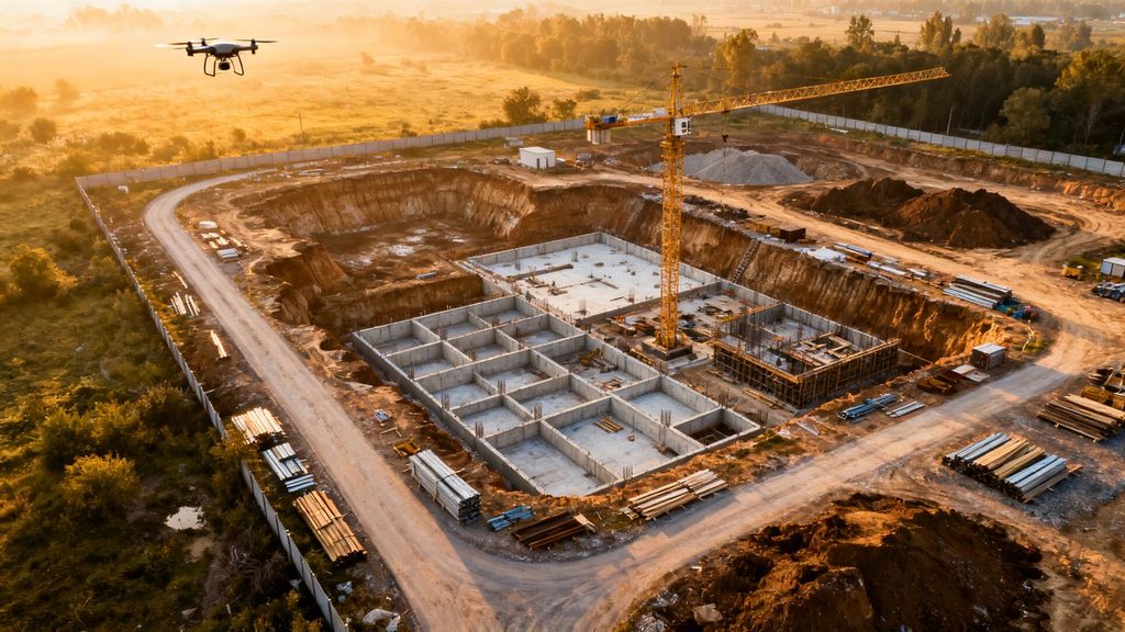
Start with a marked site plan. Identify boundaries, excavation zones, utilities, foundations, structural frames, laydown areas, access routes, temporary works, and neighboring property where conditions may later be questioned. Then list milestones such as pre-construction, demolition, excavation, backfill, concrete placement, enclosure, major deliveries, and substantial completion.
Not every area needs identical treatment. A sensitive excavation may need closer documentation than a stable storage yard, while a location scheduled to become concealed deserves a flight immediately before and after the work. The baseline should be broad enough to establish relationships, not so broad that the review team cannot find the relevant evidence.
Establishing flight frequency and documentation standards
Frequency should reflect the pace and risk of the work. A quiet site may support periodic flights, while rapid earthwork or changing access conditions may justify weekly or milestone-based capture. The written standard should address flight paths, altitude, image overlap, resolution, weather notes, camera settings, file formats, and the minimum identifying information for every flight.
Consistency matters more than an impressive isolated view. Repeatable viewpoints allow reviewers to compare the same area over time, while a wider overview preserves context. If a flight cannot follow the normal route because of weather, cranes, or other hazards, record the deviation and explain what alternative coverage was obtained.
Coordinating drone operations with site schedules
A flight plan belongs on the project calendar alongside inspections, concrete pours, deliveries, and schedule updates. The pilot should receive enough notice to coordinate with the superintendent and avoid interfering with cranes, workers, vehicles, or restricted operations. A short preflight briefing can confirm the area, expected hazards, weather, and any newly changed site condition.
Coordination also prevents a common evidentiary problem: an image that appears to show an unchanged site when work was temporarily paused or the area was inaccessible. Note those interruptions in the project log. The flight record should say what was planned, what was captured, and why any planned coverage was missed.
Assigning responsibility for collection, review, and storage
A program needs named owners for three different jobs: collecting the files, checking them for gaps, and preserving the final record. The pilot may perform the first job, but a project controls or construction manager should review whether the imagery answers the planned documentation needs. Someone with authority should decide when a gap requires a supplemental flight or written explanation.
A simple responsibility matrix can prevent files from sitting on a device or disappearing into an email thread. The owner’s representative, contractor, consultant, and counsel may each need defined access, but access should not mean uncontrolled editing. The construction progress reporting guidance is a useful reminder that planning, data capture, and processing are separate steps that should each have an accountable person.
Capture evidence that connects conditions to cost and time
Images become persuasive when they help connect a physical condition to a claimed consequence. That connection usually requires more than a before-and-after pair. The record should show location, sequence, affected work, and the point at which the condition changed the planned operation. Cost and schedule records then explain the financial and time effects.
Documenting the site before a change occurs
The baseline should be captured before demolition, excavation, delivery, or other work alters the relevant condition. Photograph boundaries, neighboring improvements, existing surfaces, access points, drainage paths, stockpiles, and visible obstructions where they could affect scope or responsibility. Include enough surrounding detail to locate the subject later.
A baseline is not a warranty that hidden conditions do not exist. It is a record of what was observable at a particular time. That distinction matters when a claim concerns underground conditions, concealed work, or information that no aerial view could reveal.
Recording concealed, changed, or differing site conditions
When a condition is discovered, capture it as soon as safely possible and before remediation changes the scene. Use an overview to locate the area, closer views where permitted, and a written note identifying the discovery date, affected activity, and people who observed it. If the condition becomes concealed, a final pre-cover flight and a post-cover flight can help establish the sequence.
Aerial imagery may show the footprint, access, spoil placement, or surrounding work without proving the nature of a buried or structural defect. Pair it with survey data, inspection reports, photographs from the work face, test results, and formal notice. The strongest record is usually a coordinated set of evidence rather than a single dramatic frame.
Showing work progress and sequence over time
A repeated flight path can show when an area moved from excavation to subgrade, from framing to enclosure, or from rough-in to finish work. Use consistent viewpoints and retain the original files as well as processed maps or videos. A timeline should identify gaps rather than imply that no work occurred between two flights.
For each disputed activity, ask whether the images show the work itself, the conditions that enabled it, or merely the surrounding site. This distinction keeps the analysis precise. An image may establish that material was delivered without establishing how much was incorporated or whether it met the specification.
Capturing access issues, delays, and impacts on other trades
Access and disruption claims benefit from wide views that show relationships among work zones. Record blocked routes, occupied staging areas, standing water, incomplete temporary works, equipment congestion, and work by other trades that changes the planned sequence. Pair the image with a schedule update, daily report, manpower record, or contemporaneous notice.
A compact capture checklist helps crews collect the facts consistently:
- Establish the affected area and nearby reference points.
- Record the condition before corrective or competing work begins.
- Note the planned activity, actual activity, and date of the difference.
- Identify access, safety, weather, or trade constraints visible at the time.
- Link the image set to the related notice, schedule activity, and cost record.
After collection, a reviewer should test whether the set explains both the physical obstruction and the claimed consequence. If it shows only a crowded area but not the affected operation, the record needs supporting project documentation rather than a stronger conclusion.
Build an organized and credible evidence record
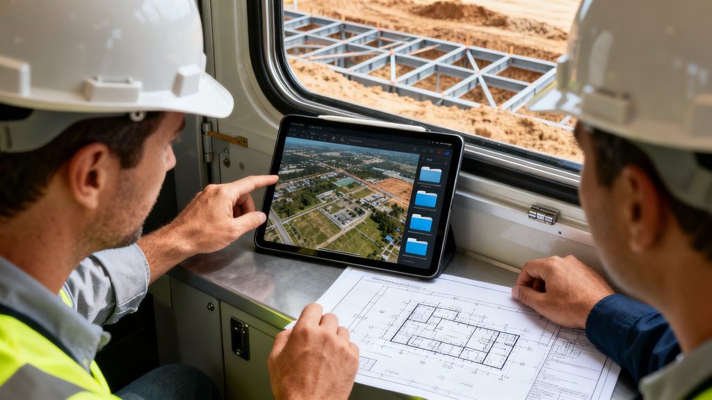
A large image library is not automatically a useful one. Reviewers need to find the relevant flight, understand how it was created, and compare it with other project records without guessing. Organization also protects the record from accidental overwriting and makes later disclosure less disruptive. Treat the archive as a project record from the first flight.
Preserving timestamps, location data, and flight metadata
Retain original files with their capture timestamps, location information where available, flight logs, camera details, and processing history. Do not rely solely on a platform’s displayed date or a filename typed after the fact. Export records in stable formats and document any conversion, stitching, compression, or enhancement.
Metadata is supporting evidence, not a substitute for independent verification. Compare it with the flight schedule, site access log, weather record, and visible construction state. If a clock was wrong or location data was unavailable, disclose the limitation instead of silently correcting it.
Naming, indexing, and versioning aerial files
File names should make the archive readable without opening every image. A consistent pattern might include project code, date, area, flight number, and processing status. An index can add the pilot, aircraft, camera, weather, planned coverage, deviations, and links to related reports.
Processed deliverables should never replace originals. Store the raw capture, working files, approved export, annotations, and revision history separately. That structure lets a reviewer distinguish what the aircraft recorded from what someone later highlighted or measured.
Combining drone imagery with schedules, drawings, and daily reports
The record becomes more useful when the visual evidence sits beside the records that explain it. Link image sets to schedule activities, drawing revisions, RFIs, notices, meeting minutes, delivery tickets, inspection reports, and daily reports. A map or timeline can provide the bridge, but the source documents should remain available.
The following matrix shows how different records answer different parts of a claim:
| Record type | Primary question | Useful connection |
| Baseline imagery | What condition existed first? | Site plan and pre-construction report |
| Progress imagery | What changed and when? | Schedule update and milestone log |
| Condition imagery | Where and how did the issue appear? | RFI, notice, inspection, or test report |
| Cost records | What resources were affected? | Daily reports, tickets, invoices, and payroll |
| Delay analysis | What time effect followed? | Logic schedule, updates, and contemporaneous notices |
This matrix prevents the aerial record from carrying claims it cannot prove. The image helps establish physical facts, while the surrounding records support entitlement, valuation, and time impact.
Maintaining chain of custody and access controls
Preserve an audit trail showing when files entered the record, who handled them, and what changes were made. Use controlled permissions, read-only copies for finalized material, and backups in more than one location. Keep a log for exports provided to consultants, insurers, mediators, or counsel.
Access controls are also practical project management. A clear archive reduces the chance that a team member edits the only copy, circulates an unverified annotation, or loses the context attached to a flight. If a file is challenged, the team should be able to explain its origin and preservation history.
Use aerial records during the change order process
Aerial evidence is most effective when introduced early, while the parties can still inspect the site and test the assumptions behind a request. It should accompany—not replace—the contractual notice, pricing detail, and schedule analysis. The objective is to narrow factual disagreement and identify what remains a question of contract interpretation.
Comparing baseline conditions with changed conditions
Begin with matched views or mapped areas rather than a collection of unrelated photographs. Identify the date of the baseline, the date of the changed condition, the common reference points, and the work that occurred between them. Annotate carefully, keeping the original image available beside each marked-up version.
A fair comparison includes unfavorable details as well as favorable ones. If a later image shows a changed condition but an earlier flight missed the precise area, say so. Honest limits generally make the rest of the comparison more credible than an overstated claim of certainty.
Supporting requests for additional labor, materials, and equipment
Imagery can help confirm the location and extent of added work, material delivery, staging, demolition, or rework. It cannot by itself prove labor hours, unit prices, productivity, or entitlement. Those parts require payroll, equipment logs, invoices, tickets, quantity measurements, and approved or disputed change documentation.
Build the package around a clear chain: condition, instruction or notice, affected activity, resources used, and amount requested. Where the image supports only one link, describe it narrowly. That approach gives the reviewer a practical way to test the request without treating visual evidence as a substitute for cost records.
Demonstrating schedule delays and disruption
A sequence of images can show that an area remained unavailable, that work progressed in an unexpected order, or that temporary conditions persisted. To connect that observation to delay, compare the imagery with the accepted schedule, updates, look-ahead plans, notices, and evidence of available labor or equipment. The analysis should identify the activity and path affected, not simply point to a late-looking site.
Disruption is even more fact-specific. Crowded work areas, repeated mobilization, stacking of trades, or altered access may be visible, but the claimed productivity effect needs project records and, where necessary, expert analysis. Use aerial evidence to establish context and test chronology, not to make unsupported schedule conclusions.
Presenting evidence during negotiation, mediation, or arbitration
Prepare a short exhibit sequence before presenting a full archive. A useful package may contain a site orientation, baseline image, changed-condition image, annotated timeline, linked notices, and a statement of what each exhibit does and does not establish. Keep originals and metadata available for inspection.
In negotiation, a clear visual comparison can resolve a factual misunderstanding quickly. In mediation or arbitration, the same material should be accompanied by authentication information, a witness or custodian who can explain collection, and experts where interpretation is disputed. The record is strongest when it is comprehensible to someone who did not visit the site.
Manage legal, technical, and operational limitations
Aerial documentation is powerful within its limits. The aircraft may not be permitted to fly, the weather may prevent a planned visit, and an overhead image may hide an important condition. Privacy, safety, contract, and evidentiary concerns should be addressed before capture begins. A limitation recorded at the time is easier to explain than one discovered during a dispute.
Following aviation, privacy, and site safety requirements
Use qualified operators and follow applicable aviation rules, site procedures, insurance requirements, and privacy expectations. Coordinate airspace, takeoff and landing areas, people on the ground, cranes, power lines, and nearby properties. The project plan should identify who can pause a flight when conditions are unsafe.
Permission to access a site does not necessarily resolve every aviation or privacy issue. Keep approvals, risk assessments, pilot qualifications, and incident records with the project documentation. A legally or operationally careless flight can damage the credibility of an otherwise useful archive.
Understanding image quality, blind spots, and weather constraints
Resolution, lighting, shadows, haze, rain, wind, dust, and camera angle affect interpretation. Roof edges, vertical faces, covered areas, and work beneath structures may be hidden. A stitched map can introduce seams or distortions, especially where capture conditions vary.
Record the conditions during every flight and avoid presenting a poor image as precise proof. Supplement aerial views with ground photographs, survey shots, inspection records, or other measurements where the subject is concealed or too small to resolve. The right response to a blind spot is additional evidence, not stronger wording.
Avoiding unsupported conclusions from aerial imagery
An image can show that an area was occupied, open, excavated, covered, or apparently progressed. It may not establish why work stopped, who caused a condition, whether installed work complied with specifications, or exactly how many hours were lost. Those conclusions require contract interpretation and corroborating records.
Use disciplined language: “the image shows,” “the record is consistent with,” or “the flight did not capture.” Avoid turning an inference into a fact. This distinction helps the project team preserve credibility when the opposing side identifies an alternative explanation.
Working with contracts, experts, and counsel to preserve admissibility
Review the contract’s notice, inspection, record-retention, and dispute-resolution provisions before finalizing the program. Counsel can advise on preservation once a claim is reasonably anticipated, while technical experts can explain surveying, mapping, image processing, or schedule implications. The operator or custodian should be able to describe the collection process in plain terms.
Admissibility rules vary by forum, so no workflow guarantees that every image will be accepted or given a particular weight. Preserve originals, document handling, identify annotations, and disclose known limitations. A record built for ordinary project administration is easier to defend than one assembled only after litigation begins.
Improve the workflow with repeatable tools and review practices
The best documentation program becomes routine enough that it does not depend on one person’s memory. Standard routes, naming conventions, review points, and escalation rules reduce variation between flights. They also make the archive useful to people outside the field team, including owners, designers, accountants, and counsel.
Using consistent flight paths and camera settings
Set repeatable takeoff points, routes, altitudes, camera orientations, overlap expectations, and capture intervals where safety permits. Record changes caused by cranes, temporary works, weather, or revised site boundaries. Consistency makes comparisons more meaningful without pretending that conditions are identical.
The operator should also confirm calibration, battery and storage capacity, geolocation settings, and any required ground control. A short preflight checklist is less burdensome than reconstructing why two apparently similar flights cannot be compared.
Creating annotated maps, timelines, and condition reports
A map helps orient the reader, a timeline explains sequence, and a condition report states the observed fact and its supporting records. Use annotations sparingly and maintain an unmarked original. Each deliverable should identify its source flights, preparation date, author, and limitations.
For large projects, a searchable portal or indexed folder can connect these deliverables to schedules and reports. Consistent presentation is valuable because it lets a reviewer move from a broad site view to a specific condition without losing the underlying source.
Reviewing imagery for gaps before a dispute escalates
Do not wait for a claim meeting to discover that the critical area was blocked, the image was overwritten, or the baseline was never captured. Review each flight soon after collection and compare it with upcoming work and known risk areas. If a gap matters, schedule a supplemental capture while the condition still exists.
A monthly review can ask four straightforward questions:
- Did the program cover every active high-risk area?
- Are milestone flights complete and correctly indexed?
- Can each important image be tied to project records?
- What upcoming work will conceal or alter useful evidence?
The answers should lead to an action, not merely a meeting note. Update the flight plan, preserve an explanation, request supporting ground documentation, or escalate a developing change order while facts remain available.
Measuring the return on investment of proactive documentation
Measure more than the number of flights. Track how quickly teams locate records, how often imagery identifies a coordination issue, whether supplemental evidence resolves a factual disagreement, and how much manual site inspection or rework the record helps avoid. Avoid claiming that imagery alone caused a financial result when several project controls contributed.
For one practical perspective, construction monitoring records describes the value of a geolocated visual timeline for clarifying progress, scope, and existing-condition disagreements. The broader lesson is modest but useful: a repeatable record can reduce time spent reconstructing events, even when it does not eliminate the dispute.
Conclusion
A defensible aerial record begins before the change order and continues through collection, review, preservation, and presentation. When images are tied to locations, dates, notices, schedules, and cost records, they help the parties separate observable conditions from interpretation. That discipline makes the project history clearer, gives negotiations a firmer factual base, and leaves fewer important questions to memory.
Frequently Asked Questions
What is aerial documentation for change order disputes?
It is a planned series of aerial images, maps, videos, and related records used to document site conditions, progress, sequence, and changes relevant to a construction claim.
When should the first aerial flight occur?
The first flight should occur before construction changes the relevant site conditions, ideally during pre-construction or before a milestone such as demolition, excavation, or major delivery.
How often should a construction site be documented?
Frequency depends on project pace, risk, and contract needs. Regular intervals should be combined with milestone flights and additional captures when conditions are about to be concealed or materially changed.
Can drone images prove a change order claim by themselves?
Usually not. Images can support physical facts and chronology, but entitlement, pricing, labor, equipment, and schedule effects generally require contracts, notices, reports, measurements, and other corroborating records.
What metadata should be preserved?
Retain original files, timestamps, location information where available, flight logs, camera and aircraft details, processing history, weather notes, and records of any export or annotation.
What if weather or safety prevents a planned flight?
Record the reason, the planned coverage, the limitation, and any alternative documentation. Reschedule when practical and supplement the aerial record with safe ground-based evidence.
Can aerial records be used in mediation or arbitration?
They can be presented as part of a broader evidence package, subject to the applicable rules. Preserve originals and chain-of-custody information, and ensure a qualified custodian or witness can explain how the records were collected and maintained.