California drone laws for commercial construction
Key Takeaways
Commercial construction drone work in California sits under federal aviation rules, state privacy and emergency-response laws, and local requirements. A compliant program treats every flight as a planned site activity, not an informal camera task.
- Commercial operators generally need an FAA Part 107 Remote Pilot Certificate.
- Aircraft registration, Remote ID, airspace review, and operating limits apply before takeoff.
- California privacy, trespass, emergency-response, and infrastructure rules can add risk.
- Construction companies should document pilots, aircraft, approvals, inspections, hazards, and data handling.
- Contracts, insurance, and a repeatable flight checklist help reduce disputes and liability.
Understand the federal rules that govern construction drone operations
The first layer of california drone laws for commercial construction is federal. The FAA controls the national airspace, and Part 107 supplies the basic framework for most business flights involving small unmanned aircraft. California location does not replace those requirements. Before a drone reaches a job site, the operator should know who is legally responsible, what the aircraft is permitted to do, and whether the planned operation fits the ordinary rule.
When commercial flights require an FAA Part 107 certificate
A flight conducted for construction planning, inspection, documentation, surveying, or another business purpose normally falls within the FAA’s commercial small-UAS framework. The remote pilot in command must hold a current Remote Pilot Certificate and understand the operating rules, airspace classifications, and emergency responsibilities that come with that role. A construction employee who occasionally flies for the company should not be treated as an informal hobbyist simply because the flight is short or performed over company property.
The certificate is only one part of the program. The organization should also confirm that the pilot is designated for the assignment, understands the site, and can make an independent decision to delay or cancel the flight. A subcontractor may perform the work, but the agreement should make clear who supplies the pilot, who controls the operation, and who retains the records.
Drone registration, remote identification, and aircraft requirements
The aircraft itself also needs attention. Depending on its weight and use, registration requirements apply, and eligible aircraft generally must comply with the FAA’s Remote ID framework unless an applicable exception or alternative applies. The operator should verify the aircraft’s registration status, serial information, firmware or equipment condition, and any manufacturer limits before bringing it onto a project.
A useful internal record connects each aircraft to its approved pilot and maintenance history. That makes it easier to answer a client’s question after a flight and to show that the company did not treat equipment checks as an afterthought.
Operating limits for altitude, speed, visibility, and airspace
Part 107 places limits on altitude, groundspeed, visual line of sight, and operations around people and moving vehicles. Airspace authorization may be needed near airports or in controlled airspace, while temporary flight restrictions can arise around wildfires, disasters, major events, or other sensitive operations. A construction schedule does not override a restriction that appears after the project’s original flight plan.
The following table is a practical planning aid, not a substitute for checking the current FAA rule and authorization status:
| Planning issue | What the team should verify | Why it matters on a construction site |
| Altitude | Planned height and nearby structures or terrain | Cranes, towers, and changing elevations complicate clearance |
| Visibility | Direct visual line of sight and visual observer coverage | Buildings and stockpiles can quickly block the aircraft |
| Airspace | Class of airspace, authorization, and temporary restrictions | A previously acceptable route may become unavailable |
| People and vehicles | Whether the flight passes over workers, visitors, or traffic | The operation may require a different risk assessment or compliance path |
After the review, the remote pilot should record the source checked, the time of the check, and any limitation that shaped the route. That simple note can prevent a planning assumption from being mistaken for legal approval.
When waivers or authorizations may be necessary
Some construction missions do not fit neatly within the ordinary Part 107 limits. Flights near controlled airports may require airspace authorization, while operations that involve people, night conditions, extended visual arrangements, or other unusual circumstances may require specific compliance steps or a waiver. The exact answer depends on the facts of the operation, the aircraft, and the current FAA rules.
Requests should be started before mobilization, with enough time to revise the mission if approval is unavailable. A waiver or authorization is not a general permission slip for every flight on the project; its conditions must be followed for the operation it covers.
Check California-specific laws before flying on a job site
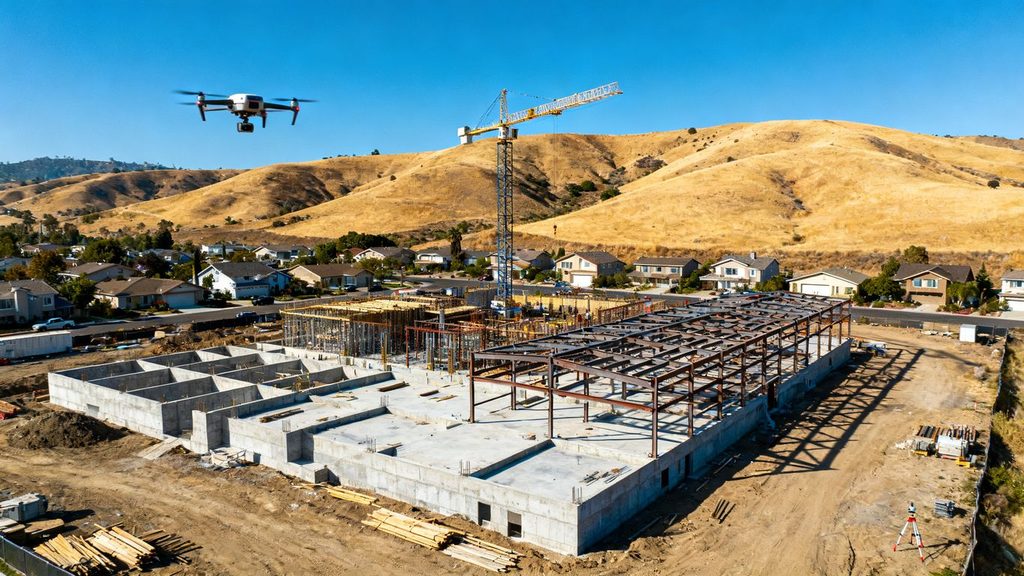
Federal compliance is necessary, but it is not the whole answer in California. Privacy, trespass, emergency response, public infrastructure, and local land-use concerns can affect a flight even when the aircraft is operated from a lawful launch point. The state’s rules can also matter when footage reaches beyond the project boundary, captures neighboring homes, or approaches an active incident.
A current California drone laws guide can help orient the team, but project counsel, the relevant agency, and the local authority may still need to resolve fact-specific questions.
State privacy and trespass concerns around neighboring properties
Owning or leasing a construction parcel does not automatically authorize recording every neighboring property. A camera pointed across a fence, into a residence, or toward a private area can create privacy and trespass concerns, particularly when the collection is unnecessary for the project. The safest approach is to define the survey boundary and camera purpose before flight, then avoid lingering over areas that do not support the work.
Construction teams should also consider how images will be used later. A progress photograph shared with a large distribution list may expose details that were not relevant to the original inspection. Cropping, masking, retention limits, and access controls are practical ways to reduce that exposure.
Restrictions near airports, emergency response areas, and critical infrastructure
Wildfire response and other emergencies deserve special caution. A drone near firefighting aircraft, rescue operations, or an active incident can create immediate danger and may be prohibited by a temporary flight restriction or other rule. The remote pilot should check current notices immediately before launch, not rely on a permit or airspace review completed days earlier.
Critical infrastructure and transportation corridors can add another layer of coordination. If work involves a state highway or bridge, Caltrans requirements may apply to launching, landing, or operating within the State Highway System right-of-way. The project manager should identify those boundaries early rather than discovering them when the crew is already on site.
Local ordinances, land-use rules, and city or county requirements
Cities, counties, airports, parks, and property managers may impose operational conditions that sit alongside FAA requirements. These can address launch locations, filming, public access, noise, work hours, or use of public land. A private construction agreement does not necessarily authorize a launch from a sidewalk, park, roadway, or other controlled property.
The compliance file should name the jurisdiction and record the local contact or approval used for the flight. If the project crosses municipal boundaries, repeat the review for each launch and landing area. The airspace may be federal, but the ground activity still has local consequences.
How California laws affect filming workers, residents, and the public
A job site can contain employees, subcontractors, delivery drivers, inspectors, and members of the public. Even when the flight is lawful, recording identifiable people raises workplace notice, privacy, and data-governance questions. Notices, designated exclusion zones, scheduling, and a clear purpose for the footage can reduce unnecessary collection.
The company should decide who may view raw footage and whether faces, license plates, home interiors, or unrelated activities must be blurred before distribution. Those decisions belong in the project’s privacy procedure, not in an improvised conversation after a complaint.
Build a compliant drone program for construction projects
A compliant flight is easier when the company has a program behind it. The program does not need to be complicated, but it should assign authority, define repeatable steps, and preserve evidence that the steps occurred. That structure is especially useful when several project managers, pilots, or subcontractors share equipment.
Assign a responsible remote pilot and accountable organization
Every mission should identify the remote pilot in command and the organization responsible for commissioning it. The pilot needs authority to stop the flight when weather, people, equipment, or airspace conditions change. A manager who controls the schedule should understand that schedule pressure does not transfer the pilot’s safety judgment to someone else.
If a service provider is hired, verify its pilot credentials, insurance, aircraft records, and operating plan. 1st Choice Aerials describes delivering aerial imagery, 3D models, and thermal reports for construction workflows; any provider selected for a California project should still be evaluated against the project’s particular legal and contractual requirements.
Create standard operating procedures for each project phase
A pre-construction survey, weekly progress capture, roof inspection, stockpile measurement, and final documentation flight have different hazards and data needs. The SOP should describe the purpose, approved launch areas, route, altitude, people controls, weather limits, communications, and stop conditions for each type of mission.
Keep the procedure usable in the field. A short mission brief that a superintendent and pilot can review together is more valuable than a long document nobody opens on flight day. Revise it when the site layout or scope changes.
Document aircraft inspections, maintenance, and flight records
The record should show which aircraft and payload were used, who flew, when the inspection occurred, and whether defects were found. Battery condition, propellers, firmware, navigation equipment, and collision-avoidance features deserve attention according to the aircraft instructions and company procedure.
A consistent archive also supports construction documentation. Guidance on construction drone photography describes uses such as site inspections, asset management, safety monitoring, and project communication; whichever use is selected, the resulting records should remain traceable to a date, location, pilot, and approved purpose.
Coordinate drone work with site safety and risk-management teams
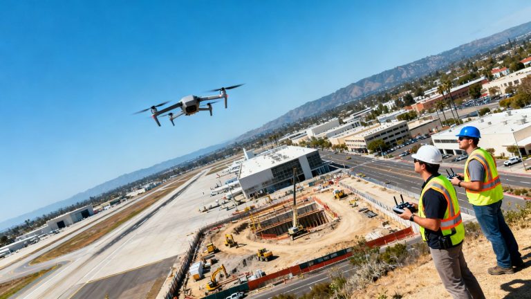
The pilot should be part of the site’s coordination process, not an isolated visitor with a remote controller. The safety team can identify crane swings, exclusion zones, haul routes, overhead utilities, and changing work fronts that may not be obvious from a map. Risk management can then align the flight plan with existing incident-reporting and emergency procedures.
This coordination is also where the team decides how to notify workers and subcontractors. A daily huddle, radio channel, spotter, and defined landing area can prevent a technically legal flight from becoming an operational surprise.
Plan safe drone flights around active construction sites
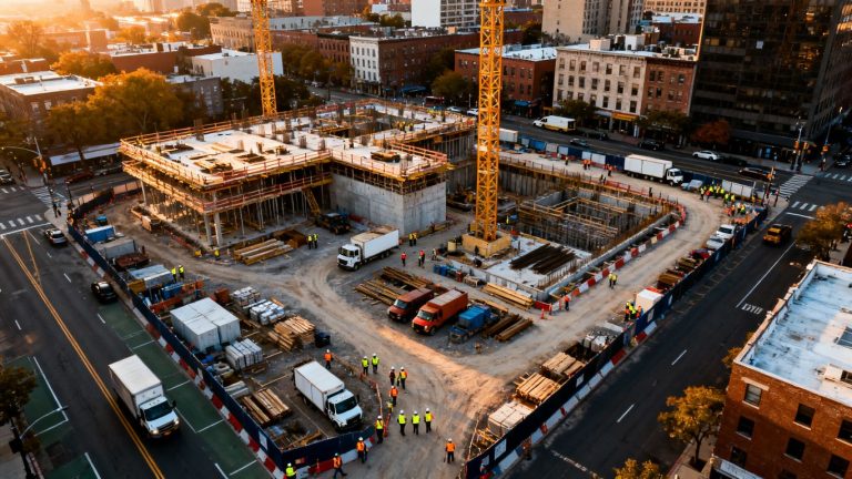
Construction sites are dynamic. The obstacle that was absent during a morning survey may be present by afternoon, and a clear flight corridor can disappear when a crane, lift, delivery truck, or temporary power line moves into place. The flight plan therefore needs a live site check, not merely a reusable map.
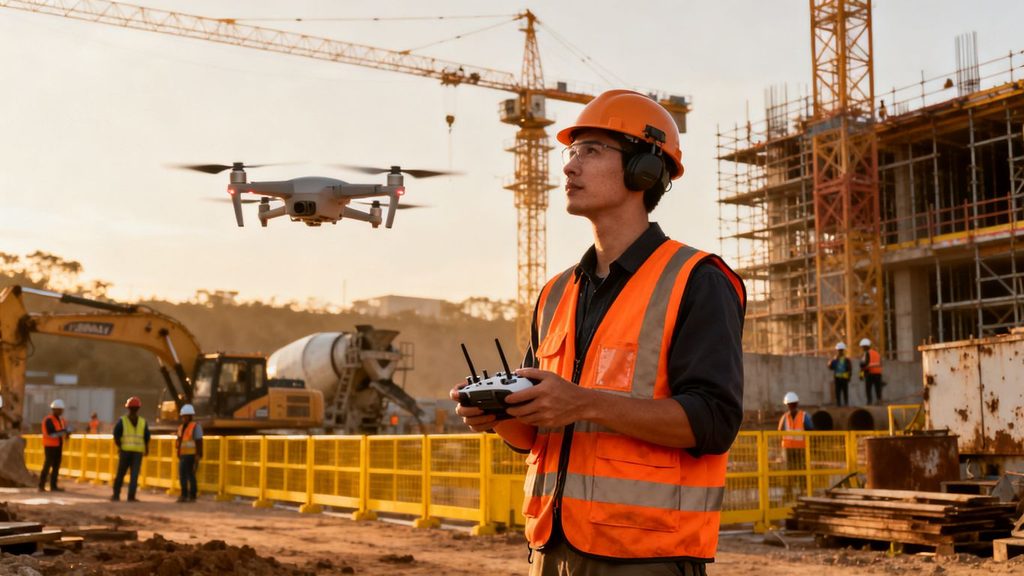
Safety planning should account for the aircraft, the people below it, and the equipment moving around it. It should also give the pilot a simple way to stop without debate.
Managing cranes, scaffolding, power lines, and other obstacles
Cranes are especially difficult because their booms and loads may move beyond the area shown on a site plan. Scaffolding, rebar, temporary netting, wires, dust, and reflective surfaces can interfere with visibility or navigation. The pilot should walk the launch and recovery area, identify the highest-risk geometry, and choose a route with a clear escape path.
Do not use proximity to a structure as a substitute for a measured plan. If the mission requires close inspection, reduce speed, use a visual observer where appropriate, and establish a hard boundary that the aircraft will not cross.
Separating drone operations from workers, vehicles, and equipment
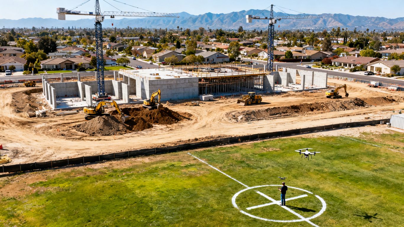
A flight zone should be communicated like any other temporary site control. The team can schedule the flight when a work area is quiet, pause vehicle movements, establish a landing zone, and keep nonessential personnel outside the operating area. The goal is not just to avoid a collision; it is to ensure that workers know what is happening overhead and can respond predictably.
For recurring flights, document the route and the controls that made it workable. 1st Choice Aerials discusses drone progress monitoring and reporting through consistent flight paths and georeferenced imagery; on any project, those repeatable paths still need to be rechecked against the current site layout before each mission.
Flying near people under the FAA’s operations-over-people rules
Workers may enter a planned flight area without warning, especially during deliveries or shift changes. The pilot must understand when an operation over people is allowed and what aircraft, operational, or category conditions apply. If the mission cannot satisfy those requirements, the team should redesign the route, move the people, or postpone the flight.
A waiver, consent form, or hard hat does not automatically make an otherwise restricted operation acceptable. The control should be physical and operational as well as documented, with a spotter or site contact empowered to call an immediate stop.
Handling changing site conditions, weather, and visibility
Wind around tall structures can be stronger and less predictable than conditions at the launch point. Dust, fog, rain, glare, and low light can affect both the aircraft and the pilot’s ability to maintain visual contact. A forecast is useful, but the pilot still needs to assess actual conditions at the site.
The SOP should specify cancellation triggers and a safe return or landing procedure. If a flight is stopped, record why; that record demonstrates sound judgment and helps improve the next plan rather than encouraging the crew to treat delays as failures.
Protect privacy, data, and project information
Aerial data can reveal much more than a conventional progress photograph. It may show neighboring homes, employee activity, security arrangements, unfinished systems, or commercially sensitive construction details. Compliance therefore continues after landing, when the files are copied, processed, shared, and eventually deleted.
Defining what construction data the drone may collect
Start with the project question. If the purpose is a roof inspection, the team may not need broad footage of adjacent residences. If the purpose is progress documentation, a defined route and recurring capture window may be enough. Written purpose limits help the pilot choose an appropriate sensor and avoid collecting material that creates unnecessary exposure.
The same discipline applies to processed outputs. A map, model, or report should carry a project name, date, location, and access classification so that recipients understand what they are receiving and how it may be used.
Limiting cameras, thermal sensors, and other payloads
Use the least intrusive payload that answers the question. High-resolution, zoom, thermal, and other sensors can disclose details that ordinary visual imagery would not. Their use should be approved for the mission, with attention to weather, calibration, accuracy, and any limitations that affect interpretation.
A sensor should not be added simply because it is available. The project owner, safety team, and privacy contact may need to agree on whether the extra information is necessary and who may access it.
Securing aerial images, maps, and inspection records
Access should follow project roles rather than convenience. Raw files, edited images, point clouds, maps, and reports may require different permissions and retention periods. Use controlled storage, authenticated accounts, transfer methods approved by the organization, and an audit trail where the sensitivity of the project warrants it.
The record should also show when data was shared externally and under what instruction. That becomes important when a client, lender, insurer, or dispute team later requests a complete project history.
Addressing employee, subcontractor, and neighboring-property privacy
Tell affected people what the drone is doing when notice is practical, and avoid capturing more personal information than the work requires. Contractors should receive the same expectations as employees, especially when they operate in areas covered by recurring flights. Neighboring-property images should be minimized, masked, restricted, or deleted when they have no legitimate project purpose.
A complaint should trigger a documented review rather than an informal promise. Identify the flight, preserve relevant records, assess whether the collection exceeded its purpose, and adjust the route or retention practice before the next mission.
Understand insurance, contracts, and project liability
Drone work can create liability for more than a damaged aircraft. A falling object, privacy complaint, property allegation, airspace violation, or unauthorized recording can involve the owner, general contractor, specialty contractor, pilot, and service provider. The contract and insurance review should happen before the first flight, while the parties can still allocate responsibilities clearly.
Reviewing commercial drone and general liability coverage
Confirm that the policy covers commercial unmanned-aircraft operations and that its exclusions fit the planned work. General liability, aviation or drone coverage, workers’ compensation, equipment coverage, and cyber or privacy coverage may address different risks. Ask whether subcontractor operations, bodily injury, property damage, data incidents, and regulatory investigations are treated separately.
The certificate of insurance is only a starting point. Review limits, deductibles, named insureds, additional insured requirements, territory, and notice obligations with the broker or counsel.
Assigning responsibility in owner and contractor agreements
The agreement should state who obtains approvals, supplies the pilot, controls the aircraft, coordinates with the site, owns the data, and reports an incident. It should also address indemnity, confidentiality, retention, deliverables, and responsibility for unauthorized flights. Vague language can leave the parties arguing about control after something goes wrong.
For recurring progress work, include the approved purpose and flight window. That helps prevent a provider from repurposing project footage for marketing or another client without permission.
Meeting public-project, lender, and client documentation requirements
Public agencies and lenders may require permits, insurance evidence, safety plans, flight records, or specific formats for maps and reports. A client may also require proof that the operator is certified and that the aircraft was inspected. Those requirements should be added to the mobilization list, not discovered during closeout.
Where a project touches state highways or bridges, the team should confirm whether a Caltrans encroachment permit or project coordination process applies. Contract requirements can be stricter than the legal minimum, and missing a documentation step can delay payment even when the flight itself was safe.
Reducing liability after an incident or unauthorized flight
If the aircraft contacts an object, loses control, enters restricted airspace, or captures sensitive footage unexpectedly, stop the operation and preserve the relevant records. Notify the designated project and insurance contacts, secure the aircraft and data, and document the time, location, conditions, people involved, and immediate actions.
Do not edit or delete files to make the event look cleaner. A factual incident record, followed by a root-cause review and corrective action, is more defensible than an incomplete file assembled later.
Create a repeatable compliance checklist for every flight
A checklist turns legal and operational judgment into a repeatable habit. It should be short enough for the field but detailed enough to identify the approvals and conditions that matter. The remote pilot can own the flight decision, while the project team confirms site access, work coordination, and data handling.
Preflight approvals, airspace checks, and weather review
Before launch, confirm the project purpose, pilot, aircraft, registration, Remote ID status, airspace, authorizations, local permissions, weather, and temporary restrictions. Check the actual launch and recovery location, especially if the job includes a roadway, bridge, airport area, or emergency activity nearby.
A practical preflight sequence might include the following:
- Confirm the mission, route, altitude, launch area, and recovery area.
- Verify pilot credentials, aircraft records, batteries, and required authorizations.
- Review weather, visibility, temporary flight restrictions, and nearby operations.
- Notify the site team and establish the operating and emergency zones.
After those checks, the pilot should record the decision to proceed, postpone, or cancel. That makes a cautious cancellation an ordinary program outcome rather than an exception that disappears from the file.
Site briefings, hazard assessments, and emergency procedures
The briefing should cover cranes, power lines, scaffolding, traffic, workers, public access, radio communication, lost-link behavior, landing locations, and who can call a stop. The hazard assessment should reflect the site as it exists that day, not as it appeared during the last flight.
Emergency procedures should be specific enough to use under pressure. Identify how to respond to a flyaway, injury, property contact, unexpected aircraft, sudden weather, or emergency response activity. Everyone who can affect the flight should know the simplest stop command.
Required records for pilots, aircraft, authorizations, and inspections
Keep the pilot certificate information, aircraft registration, Remote ID details, inspection and maintenance records, authorization or waiver documents, site approvals, risk assessment, weather review, and flight log together. The file should make the mission reconstructable without relying on one person’s memory.
Retention periods may come from law, contract, insurance, or the organization’s records policy. When those sources differ, ask the project’s legal or records contact which requirement controls.
Post-flight reporting, data handling, and incident follow-up
After landing, note the actual route, flight time, conditions, anomalies, people controls, and any deviation from the plan. Transfer files to the approved location, label them accurately, restrict access, and remove unnecessary copies from devices according to policy.
If something unusual occurred, report it while the facts are fresh. A short corrective-action note can identify a new obstacle, a privacy concern, or a recurring coordination gap before it affects the next flight.
Conclusion
California construction drone compliance is a layered process: meet federal aviation requirements, check California and local restrictions, coordinate with the active site, protect the resulting information, and keep records that show the work was planned responsibly. A practical program makes those steps part of normal construction management, so the safest decision is also the easiest one to repeat.
Frequently Asked Questions
Do commercial construction drone pilots need an FAA Part 107 certificate?
Generally, a person operating a drone for construction business purposes needs the appropriate FAA Remote Pilot Certificate under Part 107, unless another lawful operating framework applies.
Does a construction company need to register its drone?
Registration requirements depend on the aircraft and operation. The company should verify the applicable FAA registration and Remote ID obligations for each aircraft before using it commercially.
Can a drone fly over a California construction site without additional approval?
Not necessarily. The operation must satisfy federal rules and may also require airspace authorization, local permission, property access approval, or project-specific coordination.
Are drones allowed near California wildfires or emergency scenes?
Only when the operation is permitted and does not interfere with emergency response. Temporary flight restrictions and other emergency controls can prohibit or limit flights with little notice.
Can a construction drone record neighboring homes?
Unnecessary recording of neighboring property can create privacy or trespass concerns. Plan the route and sensor use to minimize collection outside the project’s legitimate purpose.
What records should a construction company keep for each flight?
Keep pilot and aircraft information, inspections, authorizations, airspace and weather checks, site briefings, risk assessments, flight logs, data-handling records, and incident reports when applicable.
Who is responsible if a subcontracted drone flight causes a problem?
Responsibility depends on the facts, contract, insurance, and applicable law. Agreements should clearly assign control, approvals, safety coordination, data use, reporting, and indemnity before the flight occurs.