Drone mapping cost in San Jose: What you should budget
Key Takeaways
Drone mapping prices in San Jose vary less by the drone itself than by the area, accuracy, processing, access, and final deliverables. A useful quote makes each of those cost drivers visible before work begins.
- Small, open sites usually cost less than complex or restricted locations.
- Accuracy requirements and ground control can materially change the price.
- Orthomosaics, 3D models, LiDAR, CAD files, and reports are separate deliverables.
- Faster turnaround often requires more processing capacity and scheduling flexibility.
- The clearest quote connects the requested data to a practical business decision.
Understanding drone mapping prices in San Jose
The phrase “drone mapping cost San Jose” can describe anything from a quick aerial record to a survey-grade data package. Local airspace, dense development, vegetation, and the intended use of the data all affect the estimate. The right comparison is not simply the lowest number, but the amount of useful information delivered for that number.
Typical cost ranges by project size
A small, accessible site may be priced as a short field visit with straightforward image processing. Larger construction sites, multi-acre properties, and repeat monitoring programs require more flight planning, storage, processing, and quality review. As a broad budgeting exercise, modest jobs may fall in the low thousands, while complex survey or LiDAR assignments can reach several thousand dollars or more.
Those ranges are planning figures, not promises. A site with difficult terrain or tight operating constraints can cost more than a larger, open parcel. Ask providers to separate field collection, processing, control, and optional deliverables so the estimate can be adjusted without rebuilding the entire scope.
Hourly, per-acre, and fixed-project pricing
Providers commonly structure quotes around time, area, or a defined project package. Hourly pricing can work for short inspections or uncertain scopes, while per-acre pricing is easier to compare when the terrain and deliverables are similar. Fixed-project pricing is often clearest when the flight boundary, outputs, accuracy, and delivery date are already known.
A useful pricing overview should account for complexity, data type, location, accuracy, turnaround, equipment, labor, insurance, and permits. The commercial drone mapping cost guide is a helpful reference for thinking through those components before requesting local proposals. The goal is to compare equivalent scopes, not merely equivalent totals.
What a basic mapping package usually includes
A basic package often includes flight planning, aerial image capture, image alignment, an orthomosaic, and a web or downloadable viewing format. Depending on the project, it may also include a point cloud, elevation surface, annotated images, or a short report. Those additions should be listed rather than assumed.
Before approving the work, confirm the coordinate system, coverage boundary, file format, expected ground sampling distance, and number of revision rounds. If the map will support design or measurement, also ask how accuracy will be checked and whether control points are included.
When a low quote may signal limited deliverables
A low estimate is not automatically a problem, especially for a small site with uncomplicated access. It becomes harder to assess when the proposal says only “drone photos” or “mapping” without naming the outputs, accuracy, processing method, or delivery terms. A reduced price may reflect fewer files, less quality control, no control survey, or slower delivery.
Read the exclusions as carefully as the inclusions. Permit coordination, repeat flights, difficult-area coverage, CAD conversion, and rush processing may all sit outside the headline figure. A slightly higher quote can be better value when it produces files your team can actually use.
Factors that affect drone mapping cost
The same acreage can produce very different estimates in San Jose. Terrain, buildings, trees, nearby people, airspace, and the intended measurement tolerance shape both the fieldwork and the processing. Mapping cost is therefore best treated as a scope calculation rather than a standard menu price.
Survey area, terrain, and site accessibility
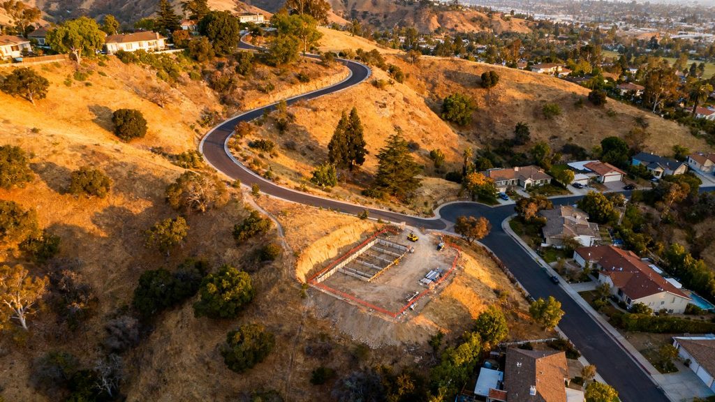
Area matters, but shape and surface conditions matter too. A compact, open parcel is usually easier to cover than a narrow corridor, steep hillside, wooded property, or active construction site with changing obstructions. Sites split across several locations may also require more setup and travel than their combined acreage suggests.
Access affects the estimate in practical ways. The crew may need a safe launch point, permission to enter private property, additional observers, or a revised flight plan around cranes and power lines. A clear boundary file and current site photographs can help a provider price the work more accurately.
Required accuracy and ground control points
Accuracy requirements should be tied to the decision the map must support. A visual progress record has different needs from a topographic surface used for engineering, grading, or quantity calculations. Higher confidence may require survey control, checkpoints, RTK or PPK equipment, additional overlap, and more extensive quality review.
Be precise about whether you need relative consistency, absolute positioning, or both. Ground control points can improve the relationship between the model and the project coordinate system, but they add field labor and may require a qualified survey professional. The quote should explain what is included and what accuracy is expected under the proposed method.
Turnaround time and data-processing requirements
The field flight may take only part of a day, while processing can continue for many hours. Large image sets, dense point clouds, textured 3D models, and several export formats all add computer time and review effort. A request for delivery the next morning can also require priority scheduling.
Tell the provider when the data must be usable, not merely when the aircraft must fly. A normal delivery window may reduce cost, while rush work can carry a premium. If your team needs recurring updates, ask whether a consistent processing template can make later projects faster and easier to compare.
Flight complexity, weather, and operational risk
Wind, heat, low light, rain, and poor visibility can delay a collection window or require a repeat visit. Urban settings bring additional considerations, including people, traffic, buildings, controlled airspace, and local operating restrictions. Those risks are part of the service rather than incidental details.
A provider should explain the weather policy, rescheduling terms, insurance, and permit responsibilities. Local rules can be especially relevant because some San Jose-area jurisdictions and parks restrict drone operations or require permits; San Jose drone regulations and permits can help identify questions to raise during scoping. Planning for compliance early is usually cheaper than correcting an avoidable delay.
Comparing drone mapping services and deliverables
“Mapping” is an umbrella term, not a single file. Two providers can fly similar aircraft and still deliver very different products because they use different sensors, processing settings, control methods, and export standards. Compare the finished data and its intended workflow, not just the aircraft or number of flight hours.
Orthomosaic maps and 2D site models
An orthomosaic combines corrected aerial imagery into a map-like image that can support visual documentation, planning, measurements, and progress comparisons. It is useful for seeing the whole site in context, especially when field conditions change frequently. The quote should identify resolution, coordinate reference, coverage, and whether the file is georeferenced.
A 2D map may be enough for logistics, stakeholder updates, or general site records. It may not replace a boundary survey or provide the vertical information needed for grading decisions. Clarifying that distinction prevents a client from paying for a product that is either too limited or unnecessarily elaborate.
3D models, point clouds, and digital elevation data
A 3D model adds shape and perspective, while a point cloud provides a collection of spatial points that can support measurement and further analysis. Digital elevation data describes terrain or surfaces in a form that may fit engineering, earthwork, or planning workflows. Each output has different file sizes, processing demands, and software requirements.
Ask whether the model includes buildings, vegetation, stockpiles, and other features relevant to the project. Also confirm whether the provider supplies the native data, a simplified viewer, or both. A polished visualization can be valuable, but it should not be mistaken for a measurement-ready dataset unless the scope says so.
Drone LiDAR mapping for vegetation and complex terrain
LiDAR can be considered when vegetation, uneven ground, or difficult visual conditions make image-based mapping less suitable. It introduces a different sensor, processing workflow, and quality discussion, so it generally costs more than a basic photogrammetry assignment. The decision should follow the terrain and required result rather than the appeal of a more advanced sensor.
For a San Jose land-development or topographic use case, Drone LiDAR Mapping describes outputs including 3D models, DTM surfaces with photo backdrops, and orthorectified aerial images aligned with survey drawings. Treat any provider’s listed outputs as a scope to verify, including coverage, accuracy, and whether survey services are part of the proposal.
GIS-ready files, CAD exports, and reporting
The final handoff often determines whether mapping data saves time or becomes another file archive. GIS users may need georeferenced imagery, rasters, vectors, metadata, and a defined coordinate system. Designers and engineers may need CAD-compatible linework, surfaces, or point-cloud formats, while managers may simply need an annotated PDF and a browser viewer.
Write the intended downstream use into the request for quote. A provider may be able to deliver several formats, but conversions, classification, interpretation, and reporting can carry separate fees. The more specific the handoff requirements, the less likely your team is to discover a mismatch after the flight.
Estimating costs for common San Jose projects
Project type provides a useful starting point, but it does not determine price by itself. A recurring construction flight, a one-time topographic survey, and a commercial roof inspection may all use a drone while requiring very different planning and outputs. Budgeting works best when the business decision and update frequency are stated alongside the site size.
Construction progress mapping and site documentation
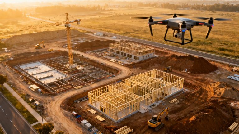
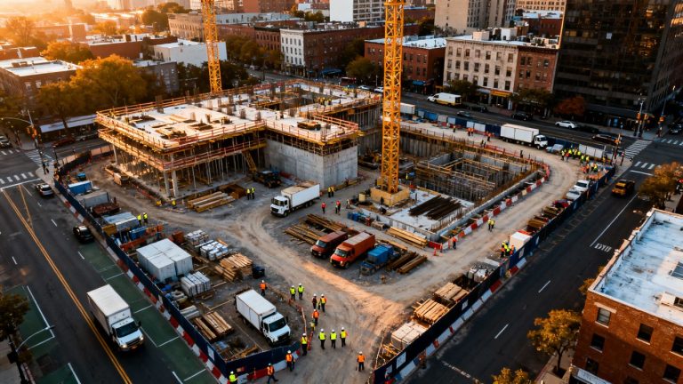
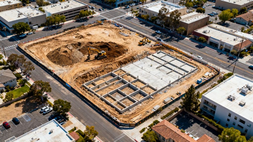
Construction teams often need repeatable imagery, orthomosaics, progress views, and occasional measurements. A single baseline flight may be relatively simple, while weekly or monthly monitoring adds scheduling, consistent flight paths, storage, processing, and stakeholder delivery. Active equipment, cranes, workers, and changing site conditions can also complicate collection.
For a project with recurring updates, request a setup price and a per-visit price. Construction drone mapping guidance offers useful background on progress tracking, topographic maps, volumetric measurements, and workflow integration, although a San Jose quote still needs to reflect the local site and requested outputs.
Land surveying and topographic mapping
Topographic work typically demands more clarity about control, checkpoints, vertical accuracy, breaklines, surfaces, and professional review. Drone data can complement surveying, but the client should ask who is responsible for boundary information, legal survey elements, and final certification. Those requirements can materially change the budget.
For early planning, a map and surface may be sufficient. For permitting, design, or construction staking, additional survey work may be needed. Separate the aerial collection from professional surveying tasks in the quote so the project team understands what each fee accomplishes.
Commercial inspections and asset management
Inspection assignments may focus on roofs, façades, solar equipment, utilities, or other assets rather than broad ground coverage. Pricing depends on access, the number of assets, image detail, thermal or other sensor needs, annotation, and the form of the report. Repeated inspections may justify a standardized capture and reporting process.
A company handling multiple assets should ask for a sample report, defect classification approach, file naming convention, and retention policy. AeroViews describes San Jose drone services that include inspections and surveys; any provider should still confirm the exact sensor, inspection scope, and reporting format in writing.
Agriculture, environmental, and infrastructure projects
Agricultural and environmental assignments may require multisite coverage, repeat dates, vegetation context, or careful documentation of changing conditions. Infrastructure corridors can add travel, access coordination, linear flight planning, and restrictions near roads or utilities. These projects are often priced around coverage and repeatability rather than one compact property.
Start with a pilot area if the full program is uncertain. A small, well-defined test can reveal the useful resolution, processing burden, and reporting needs before the organization commits to a larger campaign. For recurring work, consistency between visits may be more valuable than the lowest initial flight price.
How to evaluate drone mapping quotes
A quote should make the proposed method understandable to someone who will use the data but will not operate the aircraft. Look for a defined area, collection plan, deliverables, accuracy statement, schedule, assumptions, and exclusions. If two proposals use different language, ask each provider to restate the scope in the same format.
Questions to ask about pilot credentials and compliance
Confirm who will conduct the flight, what commercial qualifications apply, and how the provider handles airspace, property access, people, and permits. You can also ask about insurance, safety procedures, backup plans, and the person responsible for field decisions. These questions are practical ways to identify operational risk before work begins.
Do not treat a credential list as a substitute for a project plan. The operator should be able to explain how the proposed flight remains compliant at this particular site and what happens if conditions make the original plan unsuitable.
Confirming equipment, sensors, and flight coverage
The aircraft model matters less than whether the sensor and planned coverage can produce the requested output. Ask what camera or LiDAR system will be used, the intended altitude and overlap, the expected ground resolution, and how obstructions or no-fly areas will be handled. Confirm whether a repeat flight is included if a portion of the site is unusable.
A clear map boundary is useful here. Provide gates, launch areas, restricted zones, and features that must be included or excluded. The more complete the site information, the less contingency padding a provider may need to add to the estimate.
Reviewing accuracy standards and quality control
Accuracy language should identify the reference system, checkpoints or control, validation method, and expected tolerance. “High accuracy” alone does not tell an engineer or project manager whether the data is fit for the decision at hand. Ask how gaps, blurred imagery, poor matches, and outliers are found before delivery.
A quality review may include visual inspection, control-point checks, coverage checks, and file validation. It is reasonable to ask for a sample deliverable or a description of the acceptance process. Clear acceptance criteria make quote comparisons fairer and reduce disagreements at handoff.
Checking ownership, licensing, and data-delivery terms
The agreement should state who owns the captured imagery and processed files, what internal and external uses are permitted, and how long the provider retains project data. It should also list delivery formats, storage or portal access, revision terms, and any fees for future exports. These details matter when the data will be shared with designers, contractors, insurers, or regulators.
Before signing, confirm whether the quoted price includes raw imagery, processed outputs, reports, and later access. A lower initial price may become less attractive if every additional export or revision is billed separately.
Ways to manage and reduce mapping costs
Reducing cost does not always mean reducing the quality of the map. Often, the largest savings come from removing uncertainty, avoiding unnecessary outputs, and coordinating fieldwork with the project schedule. A focused brief gives providers room to price the actual need instead of adding broad contingencies.
Defining the required level of detail before requesting quotes
Begin with the decision the data must support. Is the team documenting progress, measuring stockpiles, checking drainage, planning earthwork, inspecting assets, or creating a visual record? Then specify the area, frequency, accuracy, outputs, coordinate system, and deadline.
A concise scope should identify:
- The exact site boundary and access conditions
- The decisions or measurements the data must support
- Required accuracy, resolution, and control points
- File formats, reports, and software compatibility
This information lets providers offer comparable options instead of guessing at the assignment. It also makes it easier to choose a basic package when a more advanced dataset would not improve the decision.
Combining mapping with inspection or surveying services
If a crew is already mobilizing to a site, related work may be collected during the same campaign when the flight plan and sensors allow it. For example, progress imagery and site mapping may share coverage, while an inspection may require different angles or close access. Combining services can reduce duplicated travel and setup, but only when the deliverables remain clearly defined.
Ask for a bundled option and an itemized option. The comparison should show whether the saving comes from shared mobilization, fewer site visits, or simply removing a deliverable that the team still needs.
Scheduling multiple sites in one flight campaign
Several nearby properties may be more efficient to schedule together than as isolated assignments. Grouping sites can reduce travel and administrative effort, particularly when access contacts and operating conditions are coordinated in advance. The practical benefit depends on distance, weather, permissions, and whether each site is ready on the same day.
Prepare a single site list with addresses, boundaries, contacts, hazards, access windows, and requested outputs. That package gives the provider a better basis for a campaign price and helps prevent a small overlooked site from causing a separate mobilization.
Balancing turnaround time with budget and project deadlines
Rush delivery should be reserved for decisions that genuinely cannot wait. If the field date is flexible, a normal processing window may reduce the premium associated with priority work. On the other hand, a delayed map can hold up grading checks, stakeholder reporting, or a payment milestone, so the cheapest schedule is not always the least expensive choice overall.
Ask for standard and expedited delivery options. A simple schedule comparison can show whether paying for speed changes the project outcome or merely shortens an already comfortable wait.
Conclusion
A realistic drone mapping budget for San Jose starts with the intended decision, then accounts for area, access, accuracy, sensors, processing, compliance, and deliverables. Requesting itemized quotes with shared definitions makes providers easier to compare and helps your team avoid paying for data it cannot use. The best proposal is the one that makes the work, limitations, and final handoff clear before the aircraft leaves the ground.
Frequently Asked Questions
What is the typical drone mapping cost in San Jose?
Small, accessible projects may cost in the low thousands, while larger, survey-grade, LiDAR, or highly time-sensitive assignments can cost several thousand dollars or more. The site, accuracy, outputs, and turnaround determine the actual quote.
Is drone mapping priced by the hour or by the acre?
Either approach is possible, along with fixed-project pricing. Hourly rates suit uncertain or short scopes, per-acre pricing can help compare similar sites, and fixed pricing works well when the area and deliverables are clearly defined.
Does drone mapping replace a land survey?
Not necessarily. Drone data can support planning, documentation, measurements, and mapping, but legal boundaries, certification, staking, and other professional survey requirements may still require a licensed survey professional.
What deliverables should a basic mapping package include?
A basic package may include aerial imagery, an orthomosaic, a viewing format, and selected processed files. Confirm the coordinate system, coverage, resolution, accuracy, file formats, and revision terms before approving the scope.
How much do ground control points add to the price?
The cost depends on the number of points, site access, required accuracy, field labor, and whether checkpoints or surveying services are included. Ask the provider to price control separately when comparing options.
How quickly can drone mapping data be delivered?
Straightforward projects may be delivered within several business days, while large datasets, complex models, quality review, or rush requests can take longer. The agreed schedule should specify when usable files and reports will arrive.
What should I include when requesting a drone mapping quote?
Provide the site boundary, location, access details, purpose, desired accuracy, required outputs, coordinate system, update frequency, deadline, and known hazards or restrictions. A complete brief produces more reliable and comparable estimates.