Revolutionize Your Projects: Advanced Construction Site Remote Monitoring Drone Services
Managing a construction project can feel like juggling a dozen things at once. You’ve got schedules to keep, safety to worry about, and keeping everyone on the same page is a whole other challenge. Traditional methods of checking in on the site often mean more paperwork, more time spent driving out there, and sometimes, you just don’t get the full picture. That’s where things get interesting with construction site remote monitoring drone services. These aren’t just fancy toys; they’re tools that give you a bird’s-eye view, helping you see what’s really going on, when it’s going on, without having to be there yourself.
Key Takeaways
- Using drones for construction site remote monitoring drone services gives you a clear, real-time look at your project’s progress from above.
- These services help track work accurately, making sure everything lines up with the plans and schedule.
- Drones can get to hard-to-reach or unsafe spots, making site inspections safer and more efficient.
- Aerial data provides detailed information for better planning, identifying issues early, and making smarter decisions.
- Implementing construction site remote monitoring drone services can cut down on delays, reduce costs, and keep clients happier with better transparency.
Elevating Construction With Real-Time Drone Insights
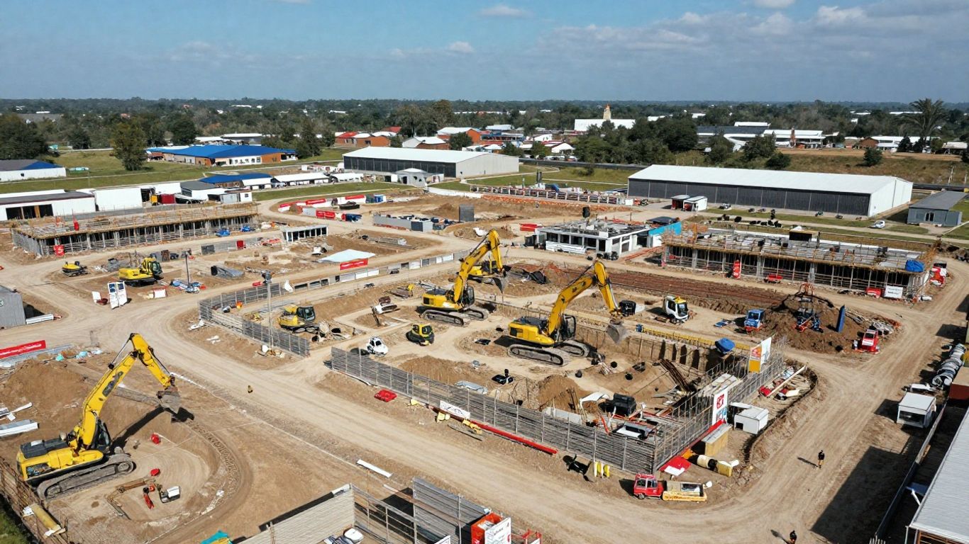
Getting up-to-date site information has always been a bit of a headache in construction. Now, thanks to the latest drone services, everything changes. Project managers can finally see what’s really happening without leaving their desks. Let’s look at how these advancements are actually improving sites day-to-day.
Leveraging Cutting-Edge Drone Technology
- Real-time aerial data helps managers stay connected to the job site around the clock.
- Drones make it easy to collect the same shots over time, so you can actually track changes.
- With digital twin services, managers and engineers get virtual versions of their sites, enabling remote checks and better planning.
| Feature | Traditional Methods | Drone Services |
|---|---|---|
| Data Collection | Manual, slow | Automated, instant |
| Progress Tracking | Periodic, on-site only | Continuous, remote possible |
| Safety Inspections | Labor-intensive, risky | Remote, fast, low-risk |
There’s no more guessing what’s happening halfway across a big site—drones put site status in your hands in real time.
Enhanced Operational Efficiency and Safety
Using drones, sites cut time spent on certain inspections way down. For example, one company using DJI Dock 3 and automated patrols reduced inspection hours by over 80%, and that’s not an outlier.
- Safer work environments: fewer people walking active construction zones
- Quicker response to potential issues before they get out of hand
- Accurate documentation leads to faster, less frequent rework
Clients and teams often report a 20% boost in efficiency and at least a 15% drop in on-site safety incidents. This isn’t just marketing fluff—site logs are showing it week to week.
Unparalleled Visibility and Control
When everyone can see the latest site status—whether it’s through regular drone flyovers or shared digital site models—coordination improves. Teams spot what’s off-schedule fast. Delays and miscommunications don’t snowball.
- Drone data gets shared easily, giving contractors, owners, and engineers a single source of truth
- Automated reports help with compliance, billing, and material tracking
- You’re not just saving time, you’re making better calls every day
If you’ve ever found yourself stuck waiting for someone’s inspection notes—or worse, walking two extra miles just to check a structure—this technology is a real game changer. It puts you in control without the legwork, and everyone benefits from the transparency that comes with routine smart construction monitoring.
Transforming Project Management Through Aerial Data
Let’s be honest, keeping tabs on a construction site used to be a real headache. You’d spend hours walking the grounds, trying to get a handle on where things stood, and often, you’d miss something important. That’s where drone services really change the game for project management. We’re talking about getting a bird’s-eye view that’s not just pretty, but incredibly useful.
Precise Progress Tracking and Site Inspection
Forget those grainy photos from a helicopter or relying solely on ground reports. Drones give us super clear, high-resolution images and videos. This means we can see exactly what’s happening, when it’s happening. We can track progress against the schedule with accuracy that was just not possible before. Think of it like having a live feed of your entire project, accessible from your desk.
- Regular flights capture consistent data. This makes it easy to spot deviations from the plan early on.
- Detailed inspections are possible without putting boots on the ground. This is a big win for safety, especially in tricky spots.
- Documentation becomes a breeze. Every stage is recorded, which is great for records and for showing clients how things are progressing.
Actionable Insights for Reduced Risks
It’s not just about seeing what’s going on; it’s about what you do with that information. The data from drone flights can highlight potential problems before they become major issues. Are materials being delivered on time? Is a certain section falling behind schedule? Are there any safety hazards developing that ground crews might miss? Getting this information quickly lets you make smart decisions to keep the project on track and avoid costly delays or accidents. This kind of proactive approach can really cut down on unexpected problems. For example, using drone data can help identify potential issues with earthwork calculations, which is where drone LiDAR technology really shines.
The ability to see the entire site from above, day after day, provides a unique perspective. It allows project managers to anticipate challenges and allocate resources more effectively, ultimately saving time and money.
Improving Client Satisfaction Through Transparency
Clients love to know what’s happening with their investment. With drone services, you can offer them a level of transparency that builds trust. Imagine sending clients regular aerial progress reports or giving them access to a portal where they can see the site’s development. This visual evidence is far more compelling than just words. It shows them you’re on top of things and that their project is moving forward as planned. This kind of open communication can lead to happier clients and fewer disputes. Companies using these tools have seen significant improvements in client relations, much like how AEX Software helped improve communication for Oregon Aerial Construction.
Advanced Drone Capabilities for Construction
High-Resolution Imaging for Detailed Documentation
Forget grainy photos from a helicopter or relying solely on ground crews. Drones equipped with top-tier cameras can capture incredibly detailed images and videos of your construction site. We’re talking about seeing the nitty-gritty details, like the exact placement of rebar or the finish on a concrete pour. This level of detail is a game-changer for documentation, providing a clear, visual record of progress and quality at every stage. It makes it way easier to spot potential issues before they become big problems.
Precise Mapping for Planning and Scope Accuracy
When you need to know exactly what you’re working with, drone mapping is the way to go. These aren’t just pretty pictures; they’re accurate, survey-grade maps. Using advanced sensors, drones can create detailed topographic maps and 3D models of your site. This precision is super important for planning earthwork, calculating volumes of materials, and making sure everything aligns with the original design. It helps avoid costly mistakes down the line and keeps your project scope tight and accurate. You can explore top drones designed for construction, providing precise mapping, detailed inspections, and effective progress tracking. These drones ensure reliable performance for various construction site needs.
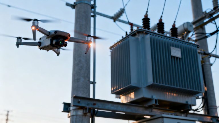
Remote Safety Inspections for Hazardous Sites
Safety is always number one, right? Drones really shine when it comes to inspecting areas that are too dangerous for people to access. Think steep slopes, unstable structures, or areas with potential chemical hazards. Drones can fly in, gather all the necessary visual data, and send it back to you without putting anyone at risk. This means you can identify safety concerns, check compliance, and plan mitigation strategies from a safe distance. It’s a smart way to manage risk and keep your team out of harm’s way. Aerial data collection using drones enhances project management by improving safety, ensuring compliance, and aiding emergency response. Drones can inspect hazardous areas remotely, identify safety hazards, and provide documentation for regulatory compliance and audits.
The ability to get high-quality data from hard-to-reach or dangerous spots means fewer surprises and a safer work environment for everyone involved. It’s about working smarter, not harder, and keeping your people out of unnecessary danger.
The Power of Precision Mapping and Analytics
So, you’ve got drones flying around your site, capturing all sorts of cool aerial shots. But what do you do with all that data? That’s where precision mapping and analytics come in. It’s not just about pretty pictures; it’s about turning that raw aerial footage into something actually useful for your project. Think of it as getting a super detailed, accurate blueprint from the sky.
Survey-Grade Deliverables for Earthwork Calculations
When it comes to moving dirt, accuracy is everything. Our drone services can generate survey-grade maps, like orthomosaics and digital surface models. These aren’t just rough estimates; they’re precise enough for calculating volumes of earthwork, like how much material needs to be cut or filled. This means you can plan your earthmoving operations much more effectively, avoiding costly mistakes and material waste. It really helps in getting the earthwork calculations spot on.
Quantifying Work Completed with Data-Driven Reports
Keeping track of what’s actually done versus what’s planned can be a headache. With drone data, we can create reports that show exactly how much work has been completed. We can measure areas, track the placement of materials, and even monitor the progress of specific tasks. This gives you a clear, data-backed picture of your project’s status, making it easier to manage budgets and timelines. It’s a big step up from just walking the site and guessing.
Comparing Progress Against Design and BIM Models
This is where things get really interesting. We can take the data captured by the drones and overlay it onto your original design plans or Building Information Models (BIM). This lets you see, with incredible accuracy, if the construction is matching the design. You can spot deviations early, check for alignment issues, and make sure everything is being built according to spec. It’s like having a real-time quality control check from above.
This kind of detailed comparison helps catch problems when they’re small and easy to fix, saving a ton of time and money down the line. It’s about being proactive, not reactive.
Here’s a quick look at what you can measure:
- Volume Calculations: For stockpiles, excavation, and fill.
- Area Measurements: To track the footprint of completed sections.
- Length and Distance: Useful for linear elements like roads or pipelines.
- Change Detection: Spotting modifications or new installations over time.
Streamlining Operations With Drone Services
Reducing Downtime and Increasing Efficiency
Let’s be honest, nobody likes it when a project grinds to a halt. Drone services are a game-changer for keeping things moving. Instead of waiting for someone to physically check on materials or progress, a drone can get eyes on the site in minutes. This means fewer delays and a much smoother workflow. Think of it as having a constant, quick check-up for your entire project. This rapid data capture helps identify potential bottlenecks before they even become a problem, saving you time and headaches.
Enhancing Team Coordination Through Shared Data
Getting everyone on the same page can be tough, especially on large sites. Drones help bridge that gap. The aerial photos and videos they capture give everyone a clear, shared view of what’s happening. This makes it easier for different teams to understand progress, plan their next steps, and communicate effectively. It’s like giving everyone a map of the entire construction zone, updated in real-time.
Here’s how it helps teams work better together:
- Clearer Communication: Everyone sees the same visual information, reducing misunderstandings.
- Better Planning: Teams can see how their work fits into the bigger picture.
- Faster Problem Solving: Issues can be spotted and discussed by the relevant people quickly.
Mitigating Risks With Proactive Aerial Surveillance
Safety is always the top priority, right? Drones are fantastic for spotting potential hazards from a safe distance. They can inspect hard-to-reach or dangerous areas without putting your crew at risk. This proactive approach means you can address safety concerns before they lead to accidents or costly rework. It’s about being one step ahead.
Drone surveillance allows for continuous monitoring of site conditions, identifying potential safety hazards like unsecured areas or improper equipment placement. This early detection significantly lowers the chance of accidents and ensures compliance with safety regulations, keeping your team safe and your project on track.
This kind of oversight is invaluable for keeping projects on schedule and within budget, ultimately leading to better project outcomes. You can get a better handle on project timelines with this kind of data.
Integrating Drone Technology Into Your Workflow
Getting drones into your day-to-day construction work might sound like a big deal, but honestly, it’s way simpler than you might think. We’re talking about making the switch smooth, so things don’t get messed up and you actually save time and effort. It’s all about making sure the tech works for you, not the other way around.
Smooth Transition to Drone Utilization
Making the move to drone services doesn’t have to be a headache. We focus on getting you up and running with minimal fuss. Think of it like adding a new tool to your toolbox; it just takes a little setup.
- Initial Assessment: We look at your current processes to see where drones fit best.
- Training: Your team gets hands-on training so they’re comfortable using the data.
- Pilot Program: We can start with a small project to iron out any kinks.
The goal is to make this feel natural, like you’ve been doing it for years. It’s about getting you the information you need without adding extra work.
Minimizing Disruption for Maximum Efficiency Gains
Nobody wants their work stopped to figure out new tech. Our approach is all about keeping things moving. We’ve seen clients boost their project tracking accuracy by about 25% and cut down on reporting time significantly. It’s about working smarter, not harder. This kind of data can really help with site surveys and mapping.
Driving Innovation With Cutting-Edge Monitoring
Using drones isn’t just about taking cool pictures from above. It’s about getting a better view of what’s happening on site, spotting issues before they become big problems, and keeping everyone in the loop. This kind of real-time information helps make better choices and keeps projects on track. It’s a big step forward in how we manage construction, turning raw data into clear, actionable insights that improve construction mapping software and overall project outcomes.
The Way Forward
So, we’ve talked a lot about how drones are changing the game for construction sites. It’s not just about getting cool aerial shots anymore. We’re seeing real benefits like better tracking of what’s actually getting done, spotting potential problems before they become big headaches, and keeping everyone on the site safer. It really boils down to making projects run smoother, faster, and with fewer surprises. If you’re still on the fence, it might be time to seriously look into how this tech can help your next build. It’s a smart move for staying ahead in this industry.
Frequently Asked Questions
What exactly are drone services for construction sites?
Think of it like having a super-smart robot bird that flies over your construction site. It takes pictures and videos from way up high, giving you a clear look at everything happening. This helps you see how the project is going, check for any problems, and make sure everyone is working safely.
How do these drones help make projects safer?
Drones can fly into places that might be dangerous for people, like high ledges or unstable areas. This means workers don’t have to put themselves at risk to check things out. The drone can spot potential dangers from a safe distance, helping to prevent accidents before they happen.
Can drones really help finish projects faster?
Yes! By giving you a quick and clear picture of the whole site, drones help you spot problems early. This means you can fix them right away instead of waiting for them to cause bigger delays. Plus, seeing the progress clearly helps teams work together better, which speeds things up.
What kind of information can drones collect?
Drones can capture super clear photos and videos, create detailed maps of the site, and even measure how much material you have, like piles of dirt or gravel. They can also help track exactly where things are being built and how much work has been done.
Is it hard to start using drones for my construction projects?
It might seem tricky at first, but it’s easier than you think! Companies that offer these services can help you get started smoothly. They use special technology and have teams that know how to make drone use work well with your current way of doing things, without causing too much trouble.
How do drones help clients feel better about the project?
When clients can see exactly how their project is progressing with clear pictures and reports from the drone, they feel more in the loop. This honesty builds trust and makes them happier because they know what’s going on without having to visit the site themselves.