Precision Land Grading: The Power of Topographic Drone Surveys
Remember the days of lugging heavy equipment across muddy fields, just to mark a few spots? Yeah, that feels like ancient history now. Drones are changing the game for land grading, making everything faster, safer, and way more accurate. We’re talking about getting super precise measurements without even touching the ground. This isn’t some far-off future thing; it’s happening right now. If you’re involved in any kind of land development, understanding how these flying gadgets work is pretty much a must.
Key Takeaways
- Topographic drone surveys use unmanned aerial vehicles with cameras or LiDAR to map land features and elevation with high detail.
- Drones significantly speed up data collection compared to traditional ground-based methods, saving time and resources.
- Technologies like photogrammetry and LiDAR allow for centimeter-level accuracy, even in dense terrain.
- The detailed 3D models and contour maps from drone surveys improve planning and reduce costly errors in land grading.
- Drone surveying offers improved safety by reducing the need for personnel to access hazardous areas.
Revolutionizing Land Grading With Drone Technology
Understanding Topographic Drone Surveys
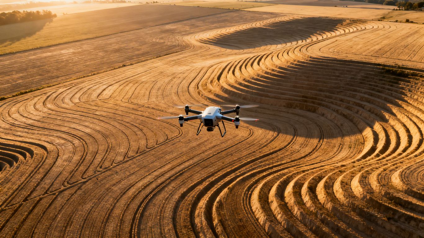
Remember the days of trudging through fields, manually measuring every bump and dip? It feels like ancient history now, doesn’t it? Topographic drone surveys are changing all that. Basically, we’re using unmanned aerial vehicles, or drones, equipped with fancy cameras and sensors to map out land. They fly pre-set paths, capturing tons of data from above. This isn’t just about getting a pretty picture; it’s about creating a super detailed digital map of the land’s elevation and features. Think of it as getting a high-definition blueprint of the terrain, but way faster and often more accurate than the old ways. This technology is making land development projects smoother from the get-go.
The Shift From Traditional Methods
Traditional land surveying often involves a crew on the ground with equipment like total stations or GPS units. This can be slow, especially on large or tricky sites. You’re talking about hours, sometimes days, of work just to get basic elevation data. Plus, getting accurate measurements in dense vegetation or on steep slopes can be a real headache. Drone surveys, on the other hand, can cover vast areas in a fraction of the time, providing a level of detail that was previously hard to achieve. This shift means less time spent on manual data collection and more time focused on design and execution. It’s a big step up for efficiency in land development projects.
Key Technologies: Photogrammetry and LiDAR
So, how do these drones actually get such good data? Two main technologies are usually at play: photogrammetry and LiDAR. Photogrammetry uses overlapping photos taken from the drone. Special software then stitches these images together to create detailed 3D models and maps. It’s great for getting true-color visuals and measuring distances. LiDAR, which stands for Light Detection and Ranging, uses laser pulses. It’s particularly useful because these lasers can actually penetrate through tree cover to map the ground beneath. This makes LiDAR a go-to for heavily wooded areas where photogrammetry might struggle to see the actual ground surface. Both methods can achieve accuracy down to a few centimeters, which is pretty impressive for aerial mapping.
Achieving Precision Through Topographic Drone Surveys
When it comes to land grading, precision isn’t just a buzzword; it’s the bedrock of a successful project. Traditional surveying methods, while tried and true, often involve a lot of manual labor and can introduce human error, especially over large or complex sites. This is where topographic drone surveys really shine, bringing a new level of accuracy and efficiency to the table.
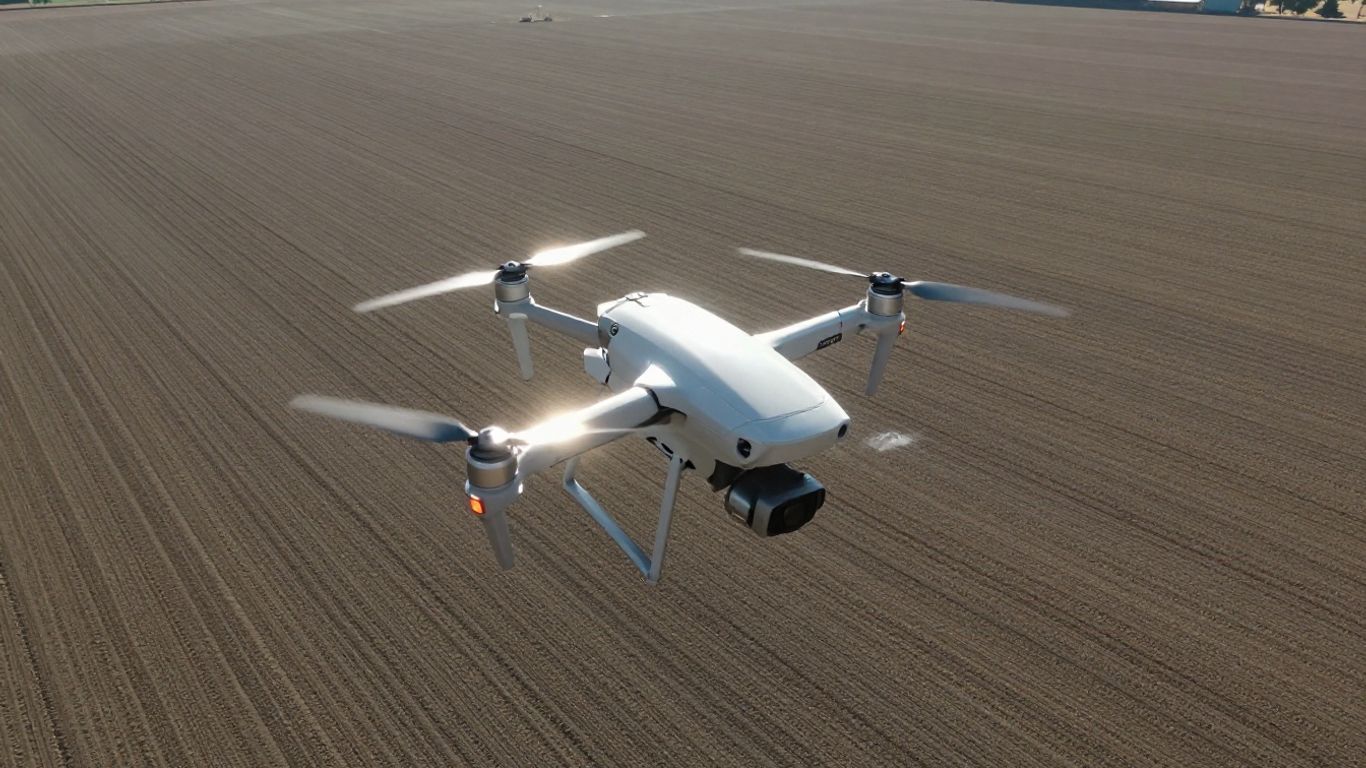
Accuracy Down To The Centimeter
Forget the days of squinting at a level or waiting for a shaky tripod reading. Drones equipped with advanced sensors can capture terrain data with accuracy down to the centimeter. This level of detail is game-changing for land grading. It means you can plan your earthmoving with confidence, knowing exactly how much material needs to be moved and where. We’re talking about precision that directly impacts your budget and the final outcome of your project. For instance, achieving a consistent slope across a large development area is made significantly easier when you have data this precise.
Ground Control: The Foundation Of Precision
Even the most advanced drone technology needs a solid reference point. That’s where Ground Control Points (GCPs) come in. These are carefully surveyed points on the ground that the drone’s software uses to calibrate its data. Think of them as anchors that tie the drone’s aerial perspective back to real-world coordinates. Without proper GCPs, even the best drone data can drift. It’s a bit like baking a cake – you need the right ingredients and precise measurements for it to turn out right. Integrating drone data capture with accurate coordinates is key to getting reliable results [c7ac].
LiDAR’s Advantage In Dense Terrain
Sometimes, the land you’re working with is covered in trees or thick vegetation. Traditional methods can struggle to see the actual ground beneath the canopy. This is where LiDAR (Light Detection and Ranging) technology, often mounted on drones, really shows its strength. LiDAR uses laser pulses to map the terrain, and it can actually penetrate foliage to get a clear picture of the bare earth. This is incredibly useful for understanding the true topography of a site before any clearing or grading begins, preventing surprises down the line. It’s a powerful tool for getting a true picture of the land, even when it’s not immediately visible.
- High-resolution data capture: Drones can cover large areas quickly.
- Penetrates vegetation: LiDAR sensors can see through trees and brush.
- Reduces fieldwork: Less need for surveyors to access difficult or dangerous areas.
The ability to gather such detailed topographic information from the air significantly streamlines the planning and execution phases of land development projects. It allows for more informed decisions to be made earlier in the process, potentially saving considerable time and resources.
Benefits Of A Topographic Drone Survey For Land Grading
So, why bother with drone surveys for your land grading projects? Honestly, it boils down to making your life easier and your projects better. Think about it: instead of spending days or even weeks with traditional methods, you can get a detailed picture of your site in a fraction of the time. This isn’t just about speed, though; it’s about getting more accurate information, keeping your crew safer, and ultimately, saving money.
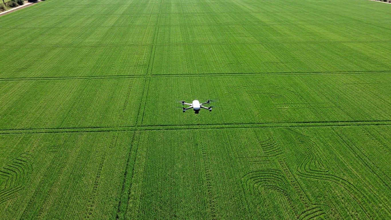
Enhanced Project Efficiency
This is a big one. Traditional land surveying can be a real time sink. You’ve got crews out there on foot, taking measurements point by point, often over rough or large areas. It’s slow work. With a drone, you can cover a massive site in just a few hours. The data collected is then processed quickly, giving you detailed maps and 3D models that are ready to go. This means less waiting around and more time spent actually planning and executing the grading work. You can get a clear view of the entire site, including elevation changes and surface features, much faster than before. This speed allows for quicker decision-making and keeps the project moving forward without those annoying delays.
Improved Safety In The Field
Let’s be real, construction sites can be dangerous places. Sending survey crews out onto steep slopes, near heavy machinery, or into areas with poor visibility just adds unnecessary risk. Drones completely change this dynamic. They do the dangerous work of data collection from the air, meaning your team doesn’t have to put themselves in harm’s way. This is especially true for sites with challenging terrain or active operations. By using survey grade UAVs, you significantly reduce the chances of accidents and injuries, making your worksite a much safer environment for everyone involved.
Cost-Effectiveness For Large Sites
While there’s an initial investment in drone technology or hiring a service, the long-term savings are substantial, particularly for larger projects. The reduction in labor hours, faster data acquisition, and minimized need for repeat surveys due to inaccuracies all add up. Think about the cost of a survey crew spending days on a large tract of land versus a drone completing the same task in hours. Plus, the improved accuracy means less rework down the line, which is a huge cost saver. For projects involving significant earthworks or complex grading, the efficiency and accuracy gains from drone land surveying often make it the more economical choice.
The ability to get precise, up-to-date information about a site quickly and safely is a game-changer for land grading. It allows for better planning, fewer surprises, and a smoother overall project execution.
Here’s a quick look at how the benefits stack up:
- Reduced Survey Time: Large sites surveyed in hours, not days.
- Increased Accuracy: Centimeter-level precision with proper ground control.
- Lower Labor Costs: Fewer personnel needed for data collection.
- Minimized Risk: Less exposure to hazardous site conditions.
- Better Planning: Detailed data supports more informed grading decisions.
Ultimately, adopting drone technology for topographic surveys isn’t just about keeping up with the latest tech; it’s about working smarter, safer, and more efficiently. It’s about getting the best possible data to make the best possible decisions for your land grading projects, leading to better outcomes and happier clients. You can even use this data for stockpile volumetrics with great success.
Data Deliverables For Informed Decisions
So, you’ve got this awesome topographic drone survey done. What do you actually get out of it? It’s not just a bunch of pretty pictures; it’s data that helps you make smart moves on your project. Think of it as getting the full story, not just a headline.
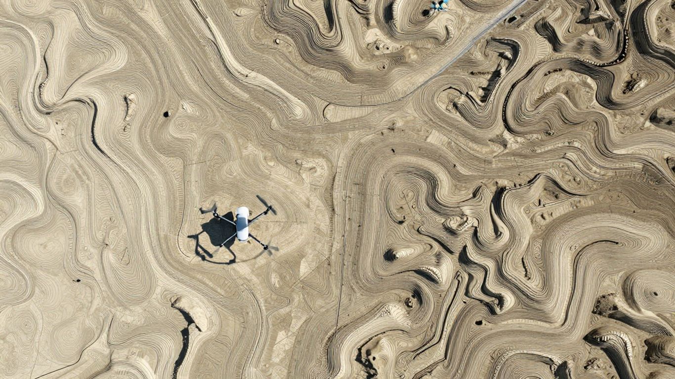
Detailed 3D Models And Contour Maps
This is where things get really interesting. You’re not just looking at a flat map anymore. Drone surveys give you a detailed 3D model of your site. This means you can see the ups and downs, the slopes, and the overall shape of the land in a way that’s super easy to grasp. Alongside this, you get contour maps. These lines show you elevation changes, which are key for planning drainage, figuring out where to cut and fill, and generally understanding the lay of the land. These outputs are the backbone of precise land grading. It’s like having a digital twin of your site that you can explore from your desk.
Visual Datasets For Clear Communication
Let’s be honest, sometimes explaining technical stuff can be a headache. That’s where the visual aspect of drone data shines. You get things like orthomosaics – basically, super-accurate, distortion-free aerial photos. These are great for showing stakeholders exactly what the site looks like, tracking progress visually, and spotting any issues that might pop up. Having these clear visuals means everyone on the team, from the project manager to the crew on the ground, is on the same page. It cuts down on misunderstandings and speeds up decision-making. You can even use these visuals as a background layer in your GIS software for more advanced analysis.
Integrating Data Into Your Workflow
Getting the data is one thing, but actually using it is another. The good news is that drone survey data is designed to fit right into your existing processes. You’ll typically get files like point clouds (think of them as a massive collection of 3D points defining your site), Digital Terrain Models (DTMs – showing the bare earth), and Digital Surface Models (DSMs – showing everything on the surface). These can be imported into various design and planning software. Here’s a quick look at some common deliverables and their uses:
- Orthomosaic: A true-scale aerial image. Great for measurements and visual checks.
- 3D Point Cloud: A detailed 3D representation. Used for precise measurements and modeling.
- Digital Terrain Model (DTM): Shows the ground surface. Essential for grading and drainage plans.
- Contour Maps: Lines showing elevation. Helps visualize slopes and plan earthwork.
The real power comes when you can easily take this data and plug it into the tools you already use. It’s about making the information work for you, not the other way around. This integration is what truly makes drone mapping a game-changer for construction projects.
This approach means you’re not just getting a survey; you’re getting a whole new way to look at your project site, making it easier to plan, execute, and finish on time and on budget. Understanding these survey deliverables is key to making the most of your drone investment.
The Future Of Land Development Surveys
So, where is all this drone surveying tech heading? It’s pretty exciting, honestly. We’re seeing drones get smarter, fly longer, and pack even more advanced sensors. Think about it: what used to take days on the ground can now be done in a fraction of the time, with data that’s often more detailed than before. This isn’t just about doing things faster; it’s about doing them better.
Evolving Drone Capabilities
The hardware is constantly improving. Drones are getting better batteries, meaning longer flight times and the ability to cover larger areas in one go. The cameras and LiDAR scanners are also getting higher resolution, capturing more detail than ever. Plus, artificial intelligence is starting to play a bigger role, helping to process all that data automatically and even predict potential issues on a site before they happen. It’s like having a super-smart assistant in the sky.
Expanded Applications For Site Management
Beyond just mapping, drones are becoming indispensable tools for managing entire projects. We’re talking about real-time progress tracking, automated volume calculations for earthworks, and even inspections of infrastructure like bridges or power lines. Imagine getting instant updates on how much dirt has been moved or if a structure is being built exactly to plan, all without anyone needing to physically be there. This kind of oversight helps keep projects on track and within budget. For instance, LiDAR drone surveys offer construction managers a faster, more accurate, and safer alternative to traditional surveying.
Partnering For Advanced Surveying Solutions
As this technology gets more sophisticated, working with specialized surveying companies becomes even more important. They have the expertise and the latest equipment to get the job done right. Whether it’s a massive development project or a complex engineering task, having the right drone survey partner can make all the difference. Companies like ZenaTech are already pushing the boundaries with new products designed for these expanding needs, like the ZenaDrone IQ Quad Drone, showing a commitment to supporting growth in key industries through innovative drone technology. It’s all about making sure you’re using the best tools available for the job.
Wrapping It Up
So, there you have it. Drone topographic surveys are really changing the game for land grading and pretty much any project that needs to know what the ground looks like. It’s way faster than the old ways, and honestly, it’s just safer. Plus, you get all this super detailed information that helps avoid costly mistakes down the road. If you’re still doing things the old-fashioned way, it might be time to look into what drones can do for your next job. It’s not just about being fancy; it’s about getting the job done right, efficiently, and with a lot less hassle.
Frequently Asked Questions
What exactly is a drone topographic survey?
Imagine a drone flying over a piece of land, taking lots of pictures or using lasers to scan it. A drone topographic survey uses this information to create a super detailed map showing all the ups and downs, like hills and dips, and other features on the ground. It’s like a super-accurate, 3D map made from the sky.
How is this different from how people used to survey land?
In the past, surveyors had to walk all over the land, using tools like tripods and special GPS devices to measure points one by one. This took a really long time, especially for big areas, and could be tough in tricky spots. Drones can cover the same area much faster and from a safe distance, making it way more efficient.
How accurate are these drone surveys?
These drone surveys are incredibly accurate, often down to just a few centimeters! This is possible because the drones use special cameras or lasers, and they often use markers placed on the ground (called ground control points) to make sure the measurements are spot on. This precision is great for planning exactly how to move dirt for building.
What kinds of information do you get from a drone survey?
You get a bunch of useful stuff! This includes detailed 3D models of the land, maps with contour lines that show elevation changes, and sometimes even super clear aerial photos of the whole site. This helps everyone involved in a project see exactly what the land looks like and understand the plan.
Are drone surveys safer than traditional methods?
Yes, definitely! Since the drone does the work from the air, surveyors don’t have to walk across rough, muddy, or dangerous terrain, or get too close to heavy machinery. This keeps the survey teams much safer while they gather the needed information.
Can drones see through trees to survey the ground?
Some drones use a technology called LiDAR, which works like radar but with lasers. These laser beams can actually pass through tree leaves and branches to measure the ground underneath. This is super helpful for surveying areas that are heavily covered in trees, giving you a clear picture of the actual land.