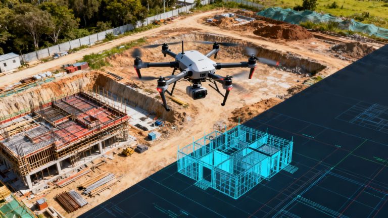
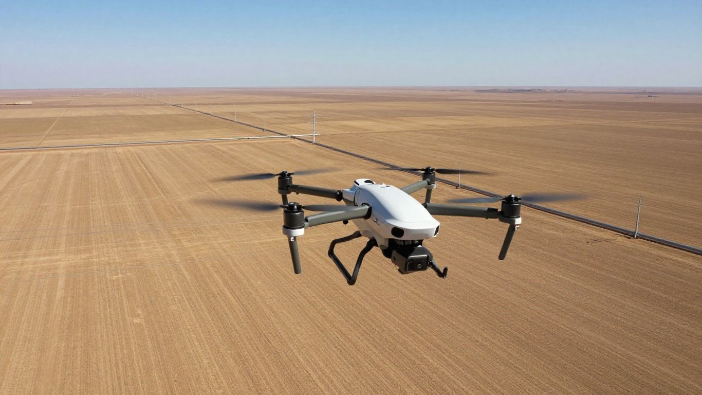
California’s Future: Advancing Linear Asset Inspection with Drone BVLOS Technology
California’s vast infrastructure, from power lines to pipelines, needs constant checks. Doing these checks the old way can be slow, costly, and even dangerous. But things are changing fast. New drone tech, especially flying beyond sight, is opening up ways to inspect these long assets more efficiently and safely. This article looks at how drone BVLOS inspection for linear assets California is becoming a game-changer.
Key Takeaways
- The FAA is working on new rules (like Part 108) to make flying drones beyond visual line of sight (BVLOS) easier for regular inspections, moving away from needing individual waivers.
- AI and automated systems are becoming really important for spotting problems on linear assets quickly and accurately, making inspections smarter.
- Setting up a drone inspection program means thinking about what you’re inspecting, how often, and what kind of sensors you need to get the best data.
- Safety is a big win with drones; they keep workers out of dangerous spots and can often finish jobs faster than traditional methods.
- Getting ready for future drone rules and using technology like AI and drone-in-a-box systems will help California’s infrastructure stay in top shape.
Navigating the Evolving Landscape of Drone BVLOS Inspection in California
It feels like just yesterday we were talking about getting special permission, or waivers, for drones to fly further than we could see. Now, things are really starting to shift. The Federal Aviation Administration (FAA) is pushing hard to make flying drones beyond visual line of sight (BVLOS) a lot more common and, frankly, easier. This isn’t just about hobbyists anymore; it’s a big deal for industries that need to inspect long stretches of infrastructure, like power lines, pipelines, and railways across California.
Understanding the FAA’s Push Towards Scalable BVLOS Operations
The FAA has been working on new rules, often referred to as Part 108, to create a more permanent system for BVLOS flights. The goal is to move away from the current process of getting individual waivers for each specific flight or area. Instead, they’re looking at a system where companies or agencies can get broader permits for routine operations. This is a huge change because it means we can plan for regular, long-range inspections without the constant hassle of applying for waivers. This shift is designed to make drone inspections more predictable and scalable for critical infrastructure. Think about it: instead of a patchwork of permissions, you’ll have a clearer path to conduct ongoing scans of miles of assets. This is especially important for California, with its vast network of utilities and transportation routes.
The Impact of Future Part 108 Regulations on Linear Asset Scans
When the new Part 108 rules are finalized, likely in early 2026, they’re expected to significantly change how we inspect linear assets. The current system, primarily under Part 107 with waivers, can be slow and costly. Part 108 aims to streamline this by setting clear standards for technology like detect-and-avoid systems. This means drones will be expected to sense and avoid other aircraft on their own, reducing the need for constant human oversight for every single flight. For linear assets, this translates to:
- More frequent inspections without the need for visual observers for every mile.
- Faster response times for identifying potential issues along long corridors.
- Reduced operational costs compared to traditional ground-based methods.
This move towards a more standardized approach will make it much easier for organizations to integrate drones into their regular maintenance and safety checks. It’s about making drone inspections a normal part of how we manage infrastructure, not a special project.
Preparing for a New Era of Routine Long-Range Drone Inspections
So, what does this mean for companies operating in California? It’s time to start thinking ahead. The FAA’s move towards Part 108 isn’t just a regulatory update; it’s an invitation to rethink your inspection strategies. You’ll want to look at:
- Technology: Are your current drones and sensors capable of meeting future BVLOS requirements, especially regarding detect-and-avoid technology?
- Workflows: How can you adapt your current inspection processes to take advantage of longer flight times and automated data collection?
- Training: Will your pilots and operators need additional certifications or training to comply with new standards?
The transition to routine BVLOS operations under Part 108 represents a significant opportunity to improve how we monitor and maintain our nation’s infrastructure. It’s about moving from limited, site-specific flights to a more integrated, data-driven approach that benefits safety and efficiency.
Getting ready now means you’ll be in a much better position to adopt these new capabilities as soon as they become available. It’s about being proactive in a rapidly changing field, ensuring your operations are not just compliant but also at the forefront of efficiency. This is a big step for infrastructure monitoring, and California is right in the middle of it, with its extensive network of assets that stand to benefit greatly from these advancements in drone technology.
Leveraging Advanced Technology for Enhanced Linear Asset Monitoring
So, how do we actually make these drone inspections work better and smarter, especially for those long stretches of infrastructure? It’s all about bringing in some serious tech upgrades. We’re talking about tools that can spot problems before they become big headaches and systems that can handle the heavy lifting so people don’t have to.
The Role of AI and Automation in Defect Detection
This is where things get really interesting. Instead of just flying a drone and hoping someone spots something on the footage later, we’re using Artificial Intelligence (AI) to do the heavy lifting. Think of it like having a super-powered assistant who can sift through hours of video and images in minutes, flagging anything that looks out of place. AI algorithms can be trained to recognize specific types of defects, like cracks on a bridge, vegetation encroaching on power lines, or even subtle temperature changes that might indicate a problem with underground pipes. This means we catch issues much earlier, often before they’re visible to the human eye, which is a game-changer for preventing failures and keeping things running smoothly. It also cuts down on the sheer volume of data that human inspectors have to review, saving a ton of time and reducing the chance of human error.
- Automated Data Review: AI significantly speeds up the process of analyzing inspection data, cutting down on manual labor hours.
- Improved Accuracy: Algorithms can detect subtle anomalies that might be missed during visual inspections.
- Early Intervention: Identifying issues sooner allows for proactive maintenance, preventing costly repairs and potential failures.
Integrating AI with drone data allows for the creation of detailed digital records. These records can be compared over time, helping to track the progression of any detected issues and inform maintenance schedules more effectively.
Exploring the Potential of Agentic UAVs for Complex Missions
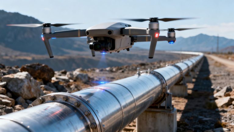
Beyond just automated data collection, we’re starting to see the rise of ‘agentic’ UAVs. These aren’t your typical drones; they have a degree of autonomy that allows them to make decisions on the fly. Imagine a drone that can not only fly a pre-programmed route but also react to its environment, perhaps rerouting if it encounters unexpected weather or focusing its sensors on an area that looks suspicious. For complex missions, like inspecting a vast network of pipelines across varied terrain, agentic UAVs could autonomously identify potential leaks or erosion, gather detailed LiDAR drone surveys in California data, and even initiate follow-up scans without direct human command for every step. This level of independence is key for scaling operations and tackling missions that would be too difficult or time-consuming for traditional methods.
Integrating Drone-in-a-Box Systems for On-Demand Inspections
For those times when you need inspections done quickly and efficiently, especially at remote or critical sites, drone-in-a-box (DIAB) systems are becoming super popular. These are essentially automated launch and landing stations that house a drone. You can deploy them at various locations, and they can launch autonomously for routine checks or respond to specific alerts. This means you can have a drone ready to go at a moment’s notice, without needing a pilot on-site every single time. It’s like having a permanent surveillance presence that can gather advanced mapping solutions data whenever needed. This setup is particularly useful for assets like utility poles or sections of railway where frequent monitoring is necessary to maintain compliance with FAA regulations and prevent issues before they escalate.
Strategic Planning for Drone BVLOS Inspection Programs
Alright, so you’re thinking about using drones for inspecting all those miles of power lines, pipelines, or maybe even train tracks. That’s a smart move, but just buying a drone isn’t the whole story. You’ve got to have a solid plan in place to make sure it actually works and keeps working. It’s not just about getting cool aerial shots; it’s about getting reliable data safely and legally.
Defining Your Mission: Asset Types and Inspection Frequency
First things first, what exactly are you looking at? Are we talking about a few cell towers, or are we covering hundreds of miles of utility lines? The type of asset really changes what kind of drone and gear you’ll need. A small drone might be fine for a quick look at a bridge, but for a long pipeline, you need something with more range and endurance. Also, how often do these things need checking? Daily, weekly, yearly? This all ties into your budget and what you expect to get out of the inspections.
- Identify your primary assets: Pipelines, power grids, railways, roads, etc.
- Determine inspection goals: What problems are you trying to find? (e.g., corrosion, vegetation encroachment, structural damage).
- Set inspection frequency: How often does each asset type need a check-up?
Thinking through these initial questions helps avoid buying the wrong equipment or setting up a system that doesn’t quite fit the job. It’s about being practical from the start.
Selecting the Right Sensors for Comprehensive Data Capture
Once you know what you’re inspecting and how often, you need to pick the right tools for the job. Drones can carry all sorts of cameras and sensors, and each one tells a different story. A regular high-res camera is good for spotting cracks or loose bolts. But if you need to check for overheating equipment, you’ll want a thermal camera. For mapping terrain or checking vegetation growth along a corridor, LiDAR is the way to go. Choosing the right sensor package is key to getting the data you actually need, not just pretty pictures.
| Sensor Type | Primary Use Cases | Data Output |
|---|---|---|
| RGB Camera | Visual inspection, crack detection, corrosion | High-resolution images, video |
| Thermal Camera | Overheating components, insulation issues | Thermal imagery, temperature maps |
| LiDAR | 3D mapping, vegetation analysis, elevation models | Point clouds, digital surface models |
| Multispectral | Vegetation health, soil analysis (less common for infra) | Spectral bands, vegetation indices |
Building Audit-Ready Workflows with Traceable Data
Finally, it’s not enough to just collect data; you need to be able to prove you did it right. This means setting up clear procedures for everything from flight planning to data storage. Think about how you’ll log every flight, keep track of pilot certifications, and manage all the information you gather. This isn’t just for your own records; it’s about being ready for any audits or regulatory checks. Having a well-documented process makes your drone program look professional and reliable, which is super important when you’re dealing with critical infrastructure.
- Develop Standard Operating Procedures (SOPs) for all flight operations.
- Implement a robust data management system for logging and archiving.
- Maintain detailed records of pilot training, certifications, and maintenance logs.
- Regularly review and update procedures based on operational feedback and regulatory changes.
California’s Infrastructure: Adapting to Drone Inspection Advancements
Addressing Traditional Challenges with Drone Solutions
Manual inspections for bridges, pipelines, and power lines have always come with tough trade-offs: they’re slow, risky, and can cost a fortune. Drones are now reducing these pains by making inspections safer and much faster. Instead of sending crews up scaffolding or closing lanes for hours, a drone can scan a bridge or a stretch of pipeline in minutes. Here’s how drones help California face its unique inspection headaches:
- No more risky climbs or hazardous setups for inspection crews.
- Fast visual and thermal data capture with less traffic disruption.
- Lower overall inspection budgets for cash-strapped municipalities.
| Method | Avg. Time/Asset | Safety Risk | Estimated Cost* |
|---|---|---|---|
| Manual | 6-10 hours | High | High |
| Drone (UAV) | 1-2 hours | Low | 40–60% less |
Based on bridge and powerline inspections in CA reported in 2025
Drones give infrastructure teams a real shot at shrinking costly delays and worker hazards while still getting all the data they need.
See how drone advancements are making inspections easier, especially for complex structures, in this overview of safer drone-based bridge inspections.
Improving Safety and Efficiency for Critical Infrastructure
Critical assets—highways, water systems, power corridors—can’t afford long downtimes or unsafe inspections. With drones, teams are able to cut out most of the exposure that leads to workplace injuries. Even remote, hard-to-reach sites aren’t a problem anymore. Here’s what efficiency upgrades look like now:
- Fewer lane closures = less traffic headache for the public.
- Inspections scheduled during low-traffic times or even remotely.
- Faster reporting means quicker fixes for infrastructure problems.
For example, a recent statewide pilot replaced day-long fieldwork with 30-minute drone scans. Technicians reviewed the footage in real time and flagged issues for immediate follow-up—the kind of workflow shift that’s now becoming the norm after public safety drone programs showed what’s possible.
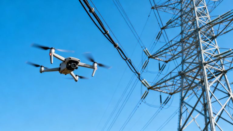
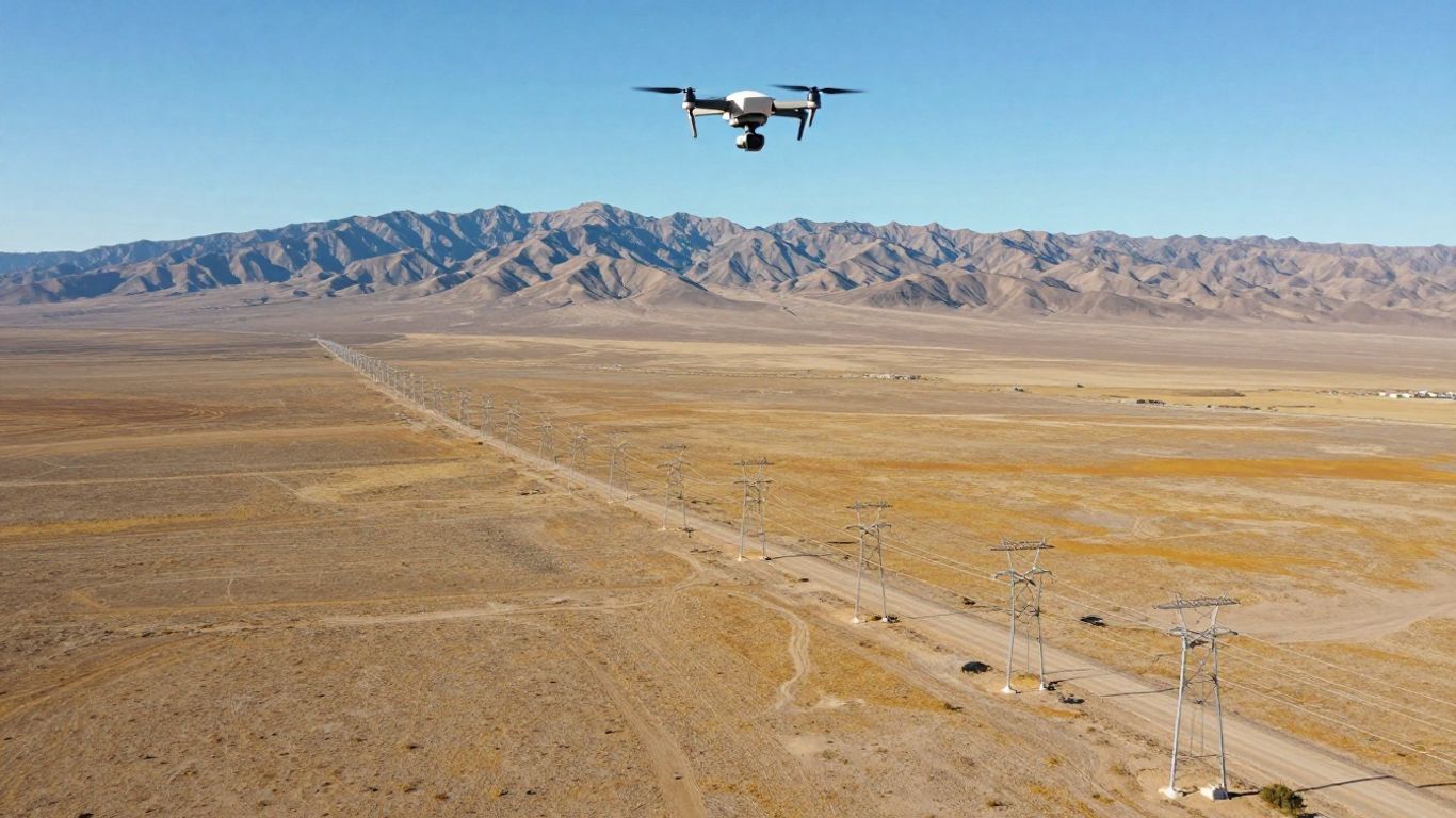
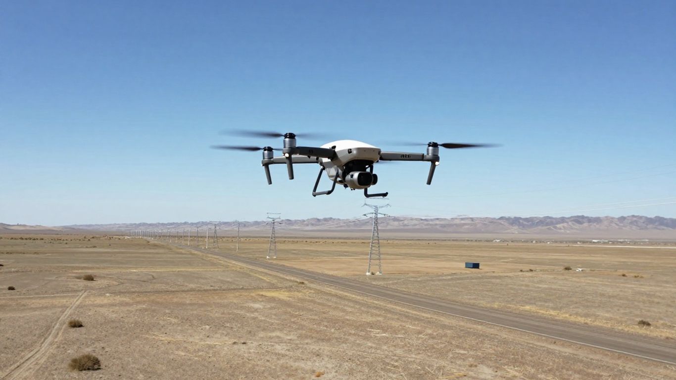
The Growing Importance of Drone BVLOS Inspection for Linear Assets
Linear infrastructure—meaning anything long and continuous like railways, waterways, or fiber optic lines—really benefits from beyond visual line of sight (BVLOS) drone programs. These flights let you map or scan dozens of miles from a single launch point.
Why does this matter?
- Coverage: Much longer corridors scanned with fewer takeoffs.
- Frequency: More frequent checks, catching issues before they snowball.
- Workforce: Smaller crews = fewer scheduling headaches.
BVLOS drone inspection, once a rarity, is quickly becoming a fixture for big utilities and infrastructure managers across California.
As drone laws and tech improve, you’ll see long-range, automated inspections move from pilot projects to business as usual.
Ensuring Compliance and Safety in Drone Operations
Flying drones for infrastructure checks isn’t just about having the coolest tech; it’s really about following the rules. For most of us right now, that means sticking to FAA Part 107. But as we start looking at longer stretches of pipelines or railways, the game changes, and we need to think about what a future Part 108 might look like. Understanding both is key to building a drone program that actually lasts.
Navigating FAA Regulations: Part 107 vs. Future Part 108
Part 107 is pretty much the starting point for any commercial drone flight in the U.S. If you’re inspecting anything for work, you’ve got to play by these rules. Think of it as the baseline. It covers things like keeping your drone under 55 pounds, staying within your line of sight, and flying during the day unless you get special permission. It works fine for checking out a single bridge or a cell tower.
But when you’re talking about scanning miles of power lines or a whole railway, Part 107 starts to feel a bit limiting. That’s where the idea of Beyond Visual Line of Sight (BVLOS) operations comes in, which is what the future Part 108 is aiming to address. This is where things get interesting for linear asset scans. It’s not just about flying further; it’s about having the right safety measures in place, like detect-and-avoid systems, and getting the proper FAA approvals. Getting ahead of these potential future regulations now means you’re not scrambling later.
Beyond FAA Rules: Considering OSHA and Local Airspace
Just because you’re following the FAA doesn’t mean you’re totally in the clear. You’ve also got to think about worker safety, which is where OSHA comes in. Even if drones mean fewer people climbing ladders or going into tight spots, standard safety protocols still apply. Plus, don’t forget about local rules. Some states or cities might have their own restrictions, especially around critical infrastructure. It’s a good idea to check with local authorities about any specific airspace limitations.
Here’s a quick rundown of what to keep in mind:
- Remote ID: This is like a digital license plate for your drone, broadcasting its location and other info. It’s mandatory and helps prove your flight was legal, especially in populated areas.
- Visual Line of Sight (VLOS): Under Part 107, you or a visual observer need to see the drone at all times. This is a big one that BVLOS operations aim to overcome.
- BVLOS: This requires specific FAA waivers or approvals under future rules. It’s what makes long-range inspections possible but needs robust safety plans.
- Audit-Ready Data: Keeping good records – flight logs, pilot certifications, maintenance schedules – is super important. You never know when you’ll need to show proof of compliance.
Prioritizing Safety Through Reduced Human Exposure
One of the biggest wins with drone inspections is keeping people out of harm’s way. Think about inspecting a tall bridge or a remote pipeline section. Sending a crew out there can be risky. Drones can get close-up views without anyone having to climb, rappel, or walk through difficult terrain. This dramatically cuts down on the chances of accidents.
When we talk about safety, it’s not just about avoiding fines. It’s about making sure everyone goes home at the end of the day. Using drones for tasks that used to require dangerous human intervention is a massive step forward for the industry. It means we can get the data we need without taking unnecessary risks.
Maintaining detailed flight logs and pilot certifications is part of this. It shows you’re serious about safety and compliance, making your operations more reliable and defensible.
The Future of Inspection: Embracing Innovation and Scalability
The way we inspect infrastructure is changing, and fast. Gone are the days of relying solely on manual checks and limited flight waivers. We’re moving towards a future where drones are not just a supplement but a core part of how we monitor everything from pipelines to power lines. This shift is all about making inspections more efficient, safer, and scalable.
The Shift from Site-by-Site Waivers to Scalable Permits
Remember when getting approval to fly a drone beyond visual line of sight (BVLOS) felt like a bureaucratic maze? That’s changing. The FAA is working on new rules, like the proposed Part 108, which aims to create a more streamlined process. Instead of needing individual waivers for every single inspection, we’re looking at a system where larger programs can get permits. This means routine, long-range inspections of linear assets, like those vast solar farms in California [659c], can become standard practice, not a special request.
- Easier Approvals: Moving from waivers to permits simplifies the process.
- Increased Scale: Allows for broader, more consistent inspection programs.
- Routine Operations: Makes long-range scans a regular part of maintenance.
How AI and Robotics Are Transforming Inspection Tasks
It’s not just about flying further; it’s about what the drones can do when they get there. Artificial intelligence (AI) is becoming a game-changer. Think about AI analyzing thousands of images to spot tiny cracks or defects that a human might miss, especially after a long day. This is already happening in areas like wind turbine and pipeline monitoring. Plus, the idea of ‘agentic’ drones – those that can make decisions and act more autonomously – is moving from science fiction to reality. This could mean drones working together, or even performing complex tasks without constant human input. The market for these autonomous systems is growing rapidly, showing just how much potential there is [ed8a].
The integration of AI and robotics means we can move from simply collecting data to actively understanding it. This proactive approach helps catch problems early, saving time and money down the line.
Considering Drone-as-a-Service for Operational Flexibility
For many organizations, building and managing an entire drone program in-house can be a big undertaking. That’s where Drone-as-a-Service (DaaS) comes in. Instead of buying and maintaining fleets of drones and training specialized staff, you can essentially ‘rent’ these capabilities. This approach lets you tap into advanced technology and expert operators without the upfront costs and ongoing management headaches. It’s a smart way to get the benefits of drone inspections, like creating detailed digital twins of assets [6b44], without the operational burden. This flexibility is key as the technology continues to evolve and new applications emerge.
Looking Ahead
So, it’s pretty clear that drones are changing how we keep an eye on all those miles of pipes, wires, and tracks. The rules are catching up, with things like Part 108 on the horizon, making it easier to fly further and more often. Plus, with smarter tech that can analyze data on its own, these inspections are getting faster and more accurate. It’s not just about having a cool gadget; it’s about making sure our infrastructure stays safe and sound, and doing it in a way that makes sense for everyone involved. Getting ready for these changes now means you’ll be ahead of the game when it comes to keeping California’s vital assets in good shape.
Frequently Asked Questions
What does BVLOS mean for drone inspections?
BVLOS stands for ‘Beyond Visual Line of Sight.’ It means drones can fly farther away from the pilot than they can see. This is a big deal for checking long things like pipelines or train tracks because drones can cover more ground without needing pilots to constantly follow them. New rules from the FAA are making this easier and more common.
How will new FAA rules change drone inspections?
The FAA is creating new rules, like the upcoming Part 108, that will make it simpler to fly drones for long distances. Instead of getting special permission for each flight (called a waiver), companies will be able to get permits for whole programs. This means checking things like power lines or pipelines will become a regular, easier job for drones.
Can drones find problems on infrastructure all by themselves?
Yes, to a degree! Drones can be equipped with smart technology like Artificial Intelligence (AI). AI can help the drone spot problems like cracks or hot spots automatically. Some advanced drones can even make decisions on their own if they see something unexpected, making inspections smarter and faster.
What’s a ‘Drone-in-a-Box’ system?
Imagine a special garage for a drone. A ‘Drone-in-a-Box’ system is like that. The drone can land, recharge itself, and even take off for its next job automatically from its box. This means inspections can happen regularly, like every day, without a person needing to be there to launch it each time.
Why are drones better than traditional ways of inspecting things like bridges?
Checking bridges or power lines the old way often means closing roads, using big cranes, or having workers climb dangerous heights. Drones can fly close to these structures and capture detailed pictures and videos from a safe distance. This makes inspections much safer, faster, and often cheaper, while still getting great information.
Do I need special training to fly drones for inspections?
Yes, you usually do. Right now, pilots need a Part 107 certificate from the FAA. As rules for flying farther away (BVLOS) develop, there might be even more advanced training or certifications needed. It’s important to follow all the FAA rules to fly legally and safely.