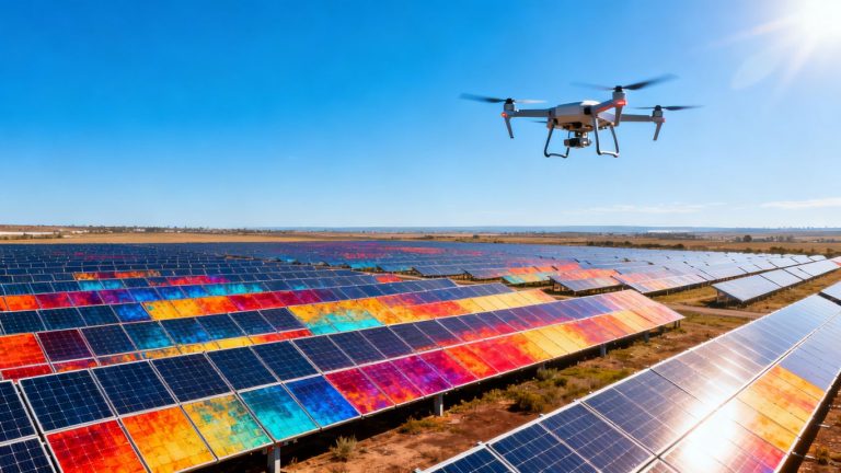
Precision Stockpile Volume Measurement: Drone Services for Accurate Inventory
Keeping track of materials is a big deal for a lot of jobs, whether it’s construction, mining, or just managing inventory. For ages, we’ve done it the old-fashioned way, which, let’s be honest, was kind of a pain. It took forever, cost a lot, and sometimes put people in tricky spots. But now, there’s a much smarter way to get these numbers. We’re talking about using drones for stockpile volume measurement drone services. It’s changing how we see our materials, making things faster, safer, and way more accurate.
Key Takeaways
- Traditional methods for measuring stockpiles are slow, expensive, and can put workers in unsafe situations.
- Drone services for stockpile volume measurement use advanced tech like photogrammetry and LiDAR to capture lots of data points for super accurate results.
- Using drones cuts down on the time and cost of inventory management, while also keeping your team out of harm’s way.
- The data from drone surveys helps make better decisions about earthmoving, material value, and overall project planning.
- Drone stockpile volume measurement drone services are adaptable for many industries, from big mining operations to smaller material yards, and even some indoor spaces.
Revolutionizing Stockpile Measurement With Drone Technology
Remember the old days of trying to figure out how much material you had? It usually involved a lot of guesswork, maybe some tape measures, and a prayer that your estimates were close. Traditional methods for inventory management, like manual surveys or even just eyeballing it, are frankly not cutting it anymore. They’re slow, they can be dangerous, and the accuracy just isn’t there for serious business decisions. We’re talking about a fundamental shift in how we track valuable resources.
The Inadequacy of Traditional Inventory Methods
Let’s be honest, the old ways of measuring stockpiles are pretty rough. Think about it: sending people out onto potentially unstable piles of gravel or coal, trying to get a few measurements here and there. It’s not only time-consuming, taking hours or even days, but it also puts your team at risk. Plus, with only a few data points, you’re essentially making an educated guess. This lack of precision can lead to all sorts of problems, from over-ordering materials to underestimating project costs.
Introducing Drone-Based Stockpile Volume Measurement Services
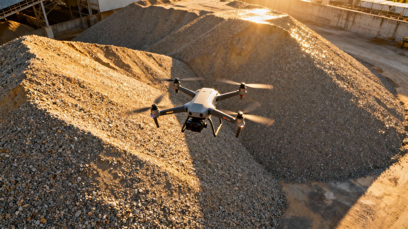
This is where drones come in, and it’s a game-changer. Instead of people climbing around, we send a drone up. It flies over your stockpiles and captures thousands, even millions, of data points. This creates a super detailed 3D model of your site. It’s way faster than traditional methods, often up to 10 times quicker, and keeps your workers safe on the ground. You get a clear, accurate picture of exactly how much material you have, without any guesswork. It’s a much better way to measure stockpile volumes.
Enhancing Accuracy Through High-Density Data Capture
What makes drone measurements so much better? It’s all about the data. Traditional methods might give you a handful of points, but drones capture a dense cloud of information. This means we can map the exact shape of a stockpile, even with irregular surfaces. This high-density data allows for incredibly precise volume calculations, far beyond what was previously possible without extensive, costly ground surveys. It’s like going from a blurry photo to a high-definition image – you see so much more detail, and that detail translates directly into accuracy.
The shift to drone technology for stockpile measurement isn’t just about adopting new gadgets; it’s about fundamentally improving operational efficiency, safety, and financial predictability. By replacing outdated, risky methods with precise aerial data capture, businesses can gain a clear, reliable understanding of their assets.
Achieving Unparalleled Accuracy in Stockpile Volume Measurement
Precision Through Advanced Drone Surveying Techniques
Forget those old ways of guessing or using a few points to figure out how much material you have. Drones change the game. When a drone flies over your site, it captures hundreds of thousands, sometimes millions, of data points. This isn’t just a quick look; it’s a detailed scan. We use sophisticated flight planning and onboard sensors to get a really clear picture of each pile. This means we can calculate volumes with a level of detail that just wasn’t possible before. It’s about getting the real shape, not just an approximation.
Comparing Drone Data to Traditional Survey Methods
So, how does this stack up against what people used to do? Traditional methods, like using GPS rovers or even manual measurements, often rely on a limited number of points. This can lead to significant errors, especially with irregularly shaped piles. Studies have shown that drone measurements, when done correctly, are incredibly close to more time-consuming and expensive GPS surveys. We’re talking about differences often within a fraction of a percent. This means you get reliable data without the hassle.
Here’s a quick look at what that difference can mean:
| Method | Data Points | Typical Accuracy | Time Required | Safety Risk |
|---|---|---|---|---|
| Traditional Survey | Few | Lower | High | High |
| Drone Surveying | Many | High | Low | Low |
The sheer volume of data collected by drones allows for a much more faithful representation of the stockpile’s true volume. This detailed data capture is what sets drone surveying apart, moving beyond simple estimations to precise calculations.
The Role of Photogrammetry and LiDAR in Accurate Measurement
How do drones actually get this accurate data? Two main technologies are key: photogrammetry and LiDAR. Photogrammetry uses overlapping photos taken from the drone to create a 3D model of the stockpile. It’s like stitching together a bunch of pictures to build a detailed digital replica. LiDAR, on the other hand, uses laser pulses to measure distances. It can penetrate certain materials and works well even in varying light conditions. By combining these techniques, or using them individually depending on the site’s needs, we can create highly accurate 3D models. These models are the foundation for calculating precise volumes, whether you need to track mining and construction materials or manage inventory for other purposes.
Streamlining Operations With Drone Services
Reducing Time and Cost in Inventory Management
Forget about those long days spent manually measuring piles of material. Drone technology completely changes the game for stockpile inventory. Instead of days or weeks, you can get accurate volume data in a matter of hours. This speed means less downtime for your operations and more time spent on actual production. Think about it: a drone can survey a large site much faster than a ground crew, and it doesn’t need to stop for breaks or lunch. This efficiency directly translates to lower labor costs and quicker project turnaround times. It’s a simple equation: faster surveys equal less money spent on the measurement process itself.
Here’s a quick look at how drone surveys stack up:
| Task | Traditional Method | Drone Method |
|---|---|---|
| Survey Time | Days to Weeks | Hours |
| Labor Required | High | Low |
| Data Availability | Delayed | Rapid |
| Cost per Survey | High | Moderate |
| Safety Risk | High | Low |
Minimizing Safety Risks for On-Site Personnel
Working around large stockpiles, especially in active industrial sites like mines or construction zones, can be pretty hazardous. You’ve got heavy machinery moving around, uneven terrain, and the risk of material shifts. Sending people out to physically measure these piles puts them directly in harm’s way. Drones, on the other hand, do all the hard work from a safe distance. They fly overhead, capturing all the necessary data without anyone needing to climb on or walk around the material. This significantly reduces the chances of accidents, injuries, and the associated costs like lost workdays and insurance claims. It’s a much smarter, safer way to get the job done.
The shift to drone-based measurement isn’t just about speed and cost; it’s a significant step forward in protecting your most valuable asset: your people. By keeping your team out of potentially dangerous situations, you create a more secure work environment.
Enabling Frequent and Timely Data Collection
With traditional methods, measuring stockpiles might only happen once a month, or even less frequently, simply because it’s such a hassle. But what if you need to know your inventory levels more often? Maybe you’re tracking material usage for a big project, or you need to monitor raw material intake daily. Drones make this frequent data collection practical and affordable. You can schedule regular flights – weekly, bi-weekly, or even daily if needed – to keep a close eye on your inventory. This constant stream of accurate data allows for much better planning and management. You can spot trends, anticipate shortages or surpluses, and make adjustments on the fly, preventing costly surprises down the line. It’s like having a real-time dashboard for your entire material inventory.
Leveraging Drone Data for Informed Decision-Making
So, you’ve got all this precise data from your drone surveys – what do you do with it? It’s not just about knowing how much material you have; it’s about using that information to make smarter choices. Think of it like having a super-detailed map of your inventory, but instead of just seeing where things are, you know exactly how much of everything there is, down to the last cubic yard.
Generating Actionable Insights from Volumetric Data
This is where the real magic happens. The raw numbers from your drone scans turn into clear, understandable reports. You can see:
- Current inventory levels: Know exactly how much raw material, finished product, or waste you have on hand.
- Material movement trends: Track how much material is being added or removed over time.
- Discrepancy identification: Quickly spot if actual inventory matches expected levels, flagging potential issues early.
This kind of detailed insight helps prevent surprises and keeps projects running smoothly. It means fewer last-minute orders and less wasted time figuring out what’s what.
Utilizing Cut and Fill Analysis for Earthmoving Optimization
For construction and mining, cut and fill analysis is a game-changer. Drones can map the terrain before, during, and after earthmoving operations. This lets you:
- Calculate exact volumes for excavation (cut) and placement (fill).
- Optimize material hauling: Determine the most efficient routes and quantities needed.
- Verify contractor billing: Ensure you’re paying for the actual work done.
Accurate cut and fill data means you’re not over-ordering or under-excavating. It directly impacts project timelines and budgets, making sure earthmoving tasks are done right the first time.
Calculating Tonnage and Material Value
Knowing the volume is one thing, but knowing the weight and value is another. By using known density factors for your materials (like gravel, coal, or aggregate), you can easily convert cubic yards or meters into tonnage. This allows you to:
- Track the financial value of your inventory.
- Manage procurement and sales more effectively.
- Improve financial reporting and forecasting.
It’s about turning raw data into dollars and cents, giving you a clearer picture of your assets and operational costs.
Tailored Drone Solutions for Diverse Industries
It’s not just about construction and mining, you know. Drone technology is really shaking things up across a bunch of different fields. We’re seeing it used in ways that just weren’t possible before, making things more efficient and, frankly, a lot less of a headache.
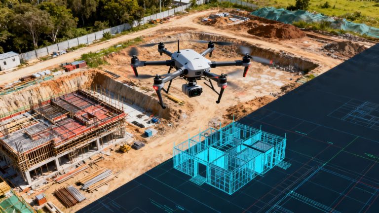
Applications in Mining and Construction
For construction sites, think about tracking progress. Drones can fly over a site and capture detailed maps and progress reports. This means less time spent walking around with measuring tapes and more time actually building. In mining, it’s similar but focused on the materials. Knowing exactly how much ore or aggregate you have is key to planning and avoiding costly mistakes. This kind of precise data helps keep projects on budget and on schedule.
Here’s a quick look at what drones can do:
- Progress Monitoring: Regular aerial surveys show how far along a project is.
- Volume Calculations: Accurately measure stockpiles of materials like sand, gravel, or coal.
- Site Mapping: Create detailed 3D maps for planning and analysis.
- Safety Inspections: Inspect hard-to-reach areas without putting people at risk.
The ability to get this information quickly and accurately means fewer surprises and better resource management. It’s a game-changer for operations that rely on precise inventory.
Stockpile Measurement for Material Management
Beyond just construction and mining, many industries need to keep tabs on their materials. Think about landscaping companies with piles of mulch, or agricultural operations storing grain. Being able to quickly and accurately measure these stockpiles is important for inventory control and financial reporting. Drones make this process much simpler than traditional methods. You can get a clear picture of your material volumes without the manual labor. This is especially helpful for agricultural operations looking to optimize their resources.
Addressing Challenges in Indoor Stockpile Measurement
Now, measuring stockpiles indoors, like in a warehouse or a processing plant, presents its own set of challenges. GPS signals don’t work well inside, and traditional surveying can be difficult due to confined spaces and existing structures. However, drone technology is adapting. With specialized indoor-capable drones and advanced sensor technology, it’s becoming possible to map and measure materials even in these complex environments. This opens up new possibilities for accurate inventory management in places where it was previously very difficult to get reliable data.
The Future of Inventory Management: Drone Services
The Evolution of Stockpile Measurement Technology
Remember the old days of trying to figure out how much material you had? It usually involved a lot of guesswork, maybe some manual measurements with tape measures, or even just counting truckloads. It was slow, often inaccurate, and frankly, a bit of a pain. Traditional methods just don’t cut it anymore when you need precise numbers fast. Drones have completely changed the game for how we track inventory. They let us get a bird’s-eye view, capturing tons of data points in a fraction of the time it used to take. This isn’t just about getting a number; it’s about getting a reliable number that you can actually trust for planning and accounting.
Benefits of On-Demand Drone Volumetric Services
Using drone services for stockpile measurements isn’t just a one-time thing; it’s about having a flexible, responsive tool at your disposal. Need an update today? No problem. The ability to get on-demand measurements means you’re never left guessing about your inventory levels. This quick turnaround is a huge plus for keeping projects on track and budgets in line.
Here are some key advantages:
- Speed: Get measurements done in hours, not days or weeks.
- Accuracy: High-density data capture means fewer errors compared to manual methods.
- Safety: Reduces the need for personnel to physically access potentially hazardous stockpile areas.
- Cost-Effectiveness: Saves on labor and equipment costs associated with traditional surveys.
The shift towards drone-based inventory management is more than just adopting new tech; it’s about fundamentally improving how businesses operate. It means less time spent on tedious calculations and more time focused on core business activities, all while having a clearer picture of valuable assets.
Choosing the Right Drone Service Provider
So, you’re convinced drones are the way to go. Great! But with a growing number of companies offering these services, how do you pick the best one for your needs? It’s not just about who has the coolest drones. You want a provider that understands your industry and can deliver the specific data you require. Look for companies that offer:
- Clear reporting formats: Can they give you reports that are easy to understand and use in your existing software?
- Data processing capabilities: Do they handle the complex processing, or do you need specialized software and staff?
- Reliability and turnaround time: What’s their typical time to deliver the final measurements after a flight?
- Experience in your sector: Have they worked with similar stockpiles or in similar environments before?
Finding the right partner means you get accurate data without the hassle, making your inventory management smoother than ever.
Wrapping It Up
So, there you have it. Measuring stockpiles used to be a real pain, often involving risky climbs or just plain guesswork. But with drones, things have really changed. You get super accurate numbers, way faster than before, and your team stays safe on the ground. It’s not just about knowing how much material you have; it’s about making smarter decisions, saving money, and keeping everyone out of harm’s way. If you’re still doing things the old way, it might be time to look into what drone services can do for your inventory management.
Frequently Asked Questions
Why are old ways of measuring piles not good enough anymore?
Old methods, like walking around and guessing or using basic tools, take a lot of time and can be dangerous. They also don’t give super accurate numbers because they don’t capture all the details of a pile’s shape. Drones take thousands of pictures from above, giving a much clearer and more precise picture of the pile.
How do drones measure the volume of a stockpile so accurately?
Drones fly over the piles and take many pictures. Special software then uses these pictures, along with GPS data, to create a 3D map of the pile. This map is very detailed and allows computers to calculate the exact volume, much like measuring a shape in 3D.
Is using drones for measuring stockpiles safe?
Yes, it’s much safer! Instead of people climbing on or walking around big, sometimes unstable piles of material, the drone does all the work from the sky. This keeps workers out of harm’s way.
How fast can drones measure stockpiles compared to other methods?
Drones are incredibly fast. What might take a whole day or more with older methods can often be done in just a few hours, or even less, with a drone. This means less downtime for your operations.
What kind of information can I get from drone measurements?
You get precise numbers for how much material you have (volume). You can also see how much material has been added or removed over time (cut and fill analysis). This helps you know exactly how much material you have, how much it’s worth, and if you’re using it wisely.
Can drones measure stockpiles that are inside buildings or covered areas?
Measuring stockpiles inside can be tricky, but with careful planning and the right drone equipment, it’s often possible. We can assess the specific situation to see if a precise drone measurement can be done safely and accurately.