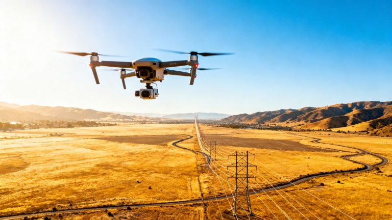
Revolutionizing Infrastructure: Advanced Utility Encroachment Monitoring Drone Services
Keeping our power lines, water pipes, and other essential services in good shape is a big job. It used to mean a lot of people climbing poles or walking miles of land, which wasn’t always safe or quick. But now, there’s a new way to keep an eye on things: drones. These flying gadgets are changing how we monitor utility infrastructure, making it safer, faster, and smarter. This is especially true when it comes to watching out for anything that shouldn’t be too close to our vital lines, a process we call utility encroachment monitoring drone services.
Key Takeaways
- Drones offer a safer way to inspect utility infrastructure, reducing the need for workers to go into dangerous spots.
- Using drones speeds up inspections and reporting, getting the job done much faster than old methods.
- Drone services for monitoring utility encroachment can lower costs by cutting down on labor and equipment needs.
- Advanced drone tech, like thermal cameras and LiDAR, provides detailed data for better decision-making about infrastructure.
- Automated flight plans and centralized data management help utility companies manage their drone operations more effectively across different areas.
How Drone Technology is Transforming Utility Infrastructure
It feels like just yesterday we were talking about how drones were mostly for hobbyists or taking cool aerial shots. Now? They’re seriously changing the game for utility companies. Think about it: inspecting miles of power lines or checking out a remote substation used to mean a lot of manual work, often in pretty risky conditions. Drones are flipping that script.
Enhancing Asset Management and Maintenance
This is a big one. Drones equipped with high-res cameras and even thermal sensors can get a super close look at everything from power poles to pipelines. They can spot tiny cracks, corrosion, or vegetation getting too close for comfort way faster than a person on the ground or in a helicopter. This means utilities can keep a much better handle on the health of their assets, planning maintenance before a small issue becomes a major problem. It’s all about being proactive, not reactive. This kind of detailed inspection is key for keeping infrastructure running smoothly.
Reducing Risks Through Remote Inspections
Let’s be honest, climbing towers or working near live electrical equipment isn’t exactly a walk in the park. Drones let us do a lot of that inspection work from a safe distance. This dramatically cuts down the chances of accidents and injuries for field crews. Plus, they can get into places that are just plain hard or impossible for humans to reach safely, like steep ravines or over busy roads. It’s a win-win: safer for people, and you still get the data you need.
Integrating Data-Driven Decision Making
What’s really cool is the sheer amount of data these drones collect. We’re talking high-definition photos, thermal readings, and sometimes even 3D scans. This information isn’t just sitting around; it’s being fed into systems that can analyze it. This helps utility managers make smarter choices about where to focus their resources, predict potential failures, and generally run things more efficiently. It’s moving from guesswork to solid, data-backed plans, which is a huge step forward for modernizing infrastructure.
The shift towards using drones for utility work isn’t just about adopting new gadgets; it’s about fundamentally changing how we approach safety, efficiency, and data collection in a critical industry. It’s about making sure the lights stay on and the water keeps flowing, but doing it in a smarter, safer way.
Here’s a quick look at how drone capabilities stack up:
- Visual Inspection: High-resolution cameras capture detailed images of asset condition.
- Thermal Imaging: Detects heat anomalies indicating potential electrical faults or insulation issues.
- LiDAR Scanning: Creates precise 3D models for detailed analysis and mapping.
This kind of advanced data collection, sometimes powered by AI like in Mobix Labs’ platform, is what’s really driving the transformation.
Key Benefits of Utility Encroachment Monitoring Drone Services
When you think about keeping utility lines and equipment in good shape, especially checking for things like overgrown trees or unauthorized structures getting too close, the old ways could be pretty rough. We’re talking about sending people up tall poles, using helicopters, or just spending ages driving around. Drones change the game entirely. They make the whole process safer, faster, and honestly, just smarter.
Boosting Safety for Utility Workers
This is a big one. Utility work can be dangerous. Climbing towers, working near live wires, or getting into tight spots – it all adds risk. Drones take workers out of harm’s way. Instead of someone having to physically go inspect a tricky section of power line, a drone can do it from a safe distance. This means fewer accidents and a much better work environment for everyone involved. It’s about getting the job done without putting people in unnecessary danger. This technology drastically reduces the need for risky manual climbs, enhancing safety and efficiency in inspecting utilities. See how drones help.
Accelerating Inspection and Reporting
Remember waiting weeks for inspection reports? Drones speed things up like you wouldn’t believe. They can cover miles of infrastructure in a single flight, capturing high-resolution images and data. What used to take days or weeks can now be done in hours. Plus, the data is immediately available for analysis, meaning you get reports much faster. This quick turnaround helps identify issues before they become major problems.
Minimizing Operational Costs
Let’s talk money. Traditional methods often involve expensive equipment like helicopters or large crews spending a lot of time on site. Drones cut down on those costs significantly. You need fewer people on the ground, less specialized equipment, and less time spent on inspections. This translates to real savings for utility companies, allowing them to allocate resources more effectively. It’s a more efficient way to manage your assets and keep things running smoothly.
Supporting Sustainability Goals
Utility companies are increasingly focused on being more environmentally friendly. Drones are a great way to support these goals. Compared to helicopters, drones have a much smaller carbon footprint. They also reduce the need for extensive ground travel by maintenance crews. By using drones for tasks like vegetation management around power lines, utilities can operate more sustainably and meet their environmental targets. Power line inspection drones offer electrical providers a safer and more precise method for assessing transmission and distribution assets. Learn about power line drones.
Here’s a quick look at how drone services stack up:
- Reduced Risk: Significantly lowers the chance of worker injury.
- Faster Turnaround: Inspection data is available almost immediately.
- Cost Savings: Less equipment and labor needed.
- Environmental Impact: Lower carbon footprint compared to traditional methods.
Using drones for encroachment monitoring isn’t just about new technology; it’s about a smarter, safer, and more cost-effective way to manage critical infrastructure. It allows for proactive problem-solving rather than reactive fixes, which is always the better approach.
Advanced Capabilities in Utility Encroachment Monitoring
So, what makes these drone services so special when it comes to keeping an eye on utility lines? It’s all about the tech packed into those flying machines. We’re talking about more than just a camera up in the sky. These drones are equipped with some pretty sophisticated tools that give us a much clearer picture of what’s going on.
Real-Time Data Collection and Analysis
One of the biggest game-changers is the ability to grab data as the drone is flying. Think about it – instead of waiting days or weeks for film to be developed or data to be downloaded and processed, you’re getting information almost instantly. This means if a drone spots something concerning, like a tree branch getting a little too close to a power line, the team can react much faster. This speed is a big deal for preventing problems before they even start. It really helps speed up the process of gaining insights from power line data [b8c1].
Thermal Imaging and LiDAR Applications
Beyond just seeing things, drones can also ‘feel’ heat and map terrain with incredible detail. Thermal imaging is super useful for spotting electrical issues. Hot spots on equipment can indicate problems that aren’t visible to the naked eye, pointing to potential failures before they happen. Then there’s LiDAR. This tech uses lasers to create detailed 3D maps of the environment. It’s fantastic for measuring distances precisely, which is perfect for checking how much space there is between utility lines and surrounding vegetation. This kind of detailed mapping is key for accurate vegetation management [943c].
Automated Reporting and Alerts
Nobody wants to sift through mountains of raw data. That’s where automation comes in. Drones can be programmed to fly specific routes and collect data in a structured way. Then, software can automatically analyze this information, flagging any issues that fall outside the normal parameters. This means you get alerts for potential problems, like vegetation that’s growing too close to a corridor, without needing someone to manually review every single image or scan. It’s like having a tireless digital assistant watching over your infrastructure 24/7.
The shift towards automated data analysis means that utility companies can move from reactive problem-solving to proactive maintenance. This proactive approach saves time, reduces costs, and significantly lowers the risk of service disruptions.
Here’s a quick look at what these advanced capabilities can do:
- Identify potential hazards: Spotting issues like damaged equipment, unstable structures, or encroaching vegetation.
- Quantify risks: Measuring the exact distance of vegetation from power lines or the severity of wear on an asset.
- Prioritize maintenance: Helping teams focus on the most critical issues first based on real data.
- Document conditions: Creating detailed records for compliance, planning, and historical tracking.
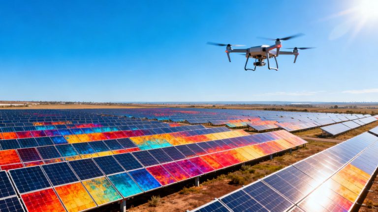
Aerial Vegetation Management for Utility Protection
Keeping trees and other plants in check around utility lines isn’t just about making things look tidy; it’s a big deal for keeping the power on and preventing fires. Traditionally, this meant a lot of manual work, sending crews out to eyeball things or using helicopters, which are expensive and not always the best for getting a close look. That’s where drones really change the game.
Using Drones for Precise Vegetation Checks
Drones equipped with high-resolution cameras and sometimes even thermal sensors can get up close and personal with vegetation without putting anyone in danger. They can spot branches that are getting a little too close for comfort to power lines, or identify areas where plants are growing too tall. This allows utilities to be proactive, addressing potential issues before they become actual problems. It’s like having a super-detailed map of exactly where the risks are, so you’re not just guessing.
Here’s a quick look at what drones can help identify:
- Proximity Alerts: Detecting vegetation within a specified safety zone of utility lines.
- Species Identification: Recognizing fast-growing or hazardous plant types.
- Health Assessment: Spotting signs of disease or stress that could lead to branch failure.
- Growth Prediction: Using data to estimate future growth and potential encroachment.
Supporting Compliance and Reliability
Utility companies have rules they need to follow regarding vegetation clearance. Drones make it much easier to prove they’re meeting these standards. They capture detailed records, like photos and flight logs, which are super helpful for audits and reporting. Plus, by catching problems early, you cut down on unexpected outages. Nobody likes losing power, and keeping vegetation managed properly is a huge part of making sure that doesn’t happen. This proactive approach really boosts the overall reliability of the grid. You can find more about how advanced drone services are transforming vegetation management at [0938].
Optimizing Maintenance Schedules
Instead of a one-size-fits-all approach, drones give you the data to schedule maintenance exactly where and when it’s needed. This means crews aren’t wasting time trimming trees that are perfectly fine. They can focus their efforts on the areas that actually pose a risk. This smart scheduling saves a ton of money and resources. It’s all about working smarter, not harder, and drones are a big part of that.
Managing vegetation around utility infrastructure is a constant challenge. Drones offer a way to get detailed, up-to-date information that was previously hard to obtain, making the whole process more efficient and effective.
This kind of detailed mapping is also a big help when planning new infrastructure or upgrades. For example, understanding the terrain and existing vegetation can be critical for projects like aerial corridor mapping.
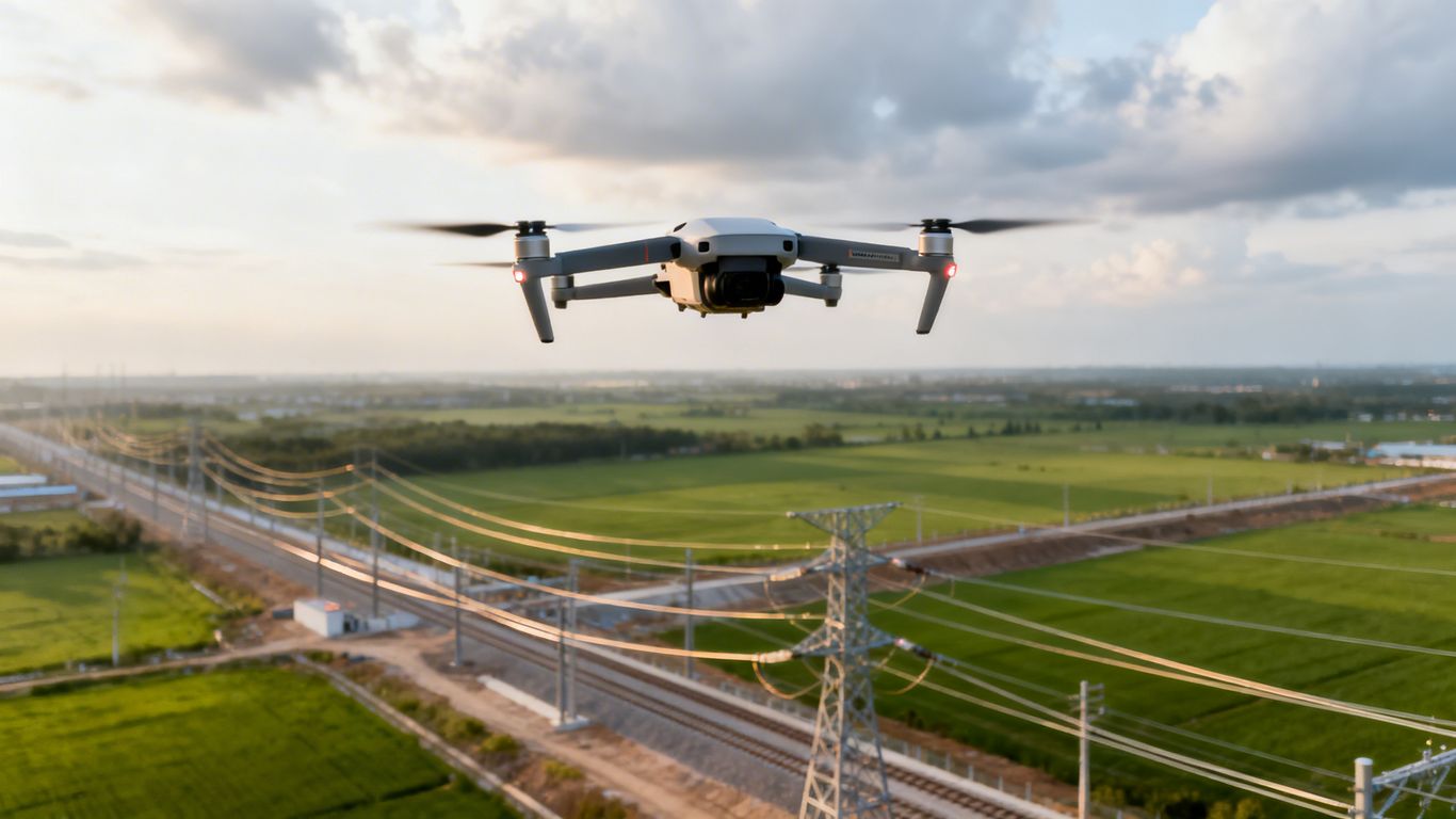
Real-World Applications of Drone Services in Utility Monitoring
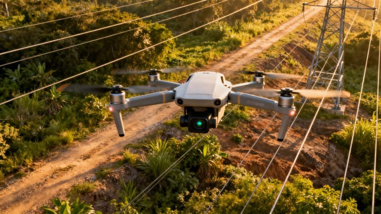
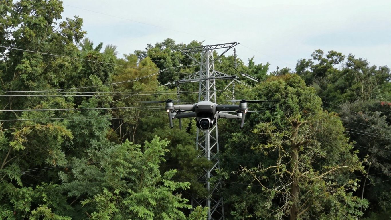
Power Line and Transmission Corridor Inspections
When it comes to keeping the lights on, inspecting power lines and the corridors they run through is a big job. Traditionally, this meant helicopters or crews climbing poles, which isn’t exactly a walk in the park. Drones have changed the game here. They can fly right alongside high-voltage lines, getting super close to spot issues like wear and tear, loose connections, or even vegetation getting a little too friendly. This means we can catch problems before they cause an outage. It’s all about getting detailed data quickly and safely. For example, utilities can track issues with individual tower assets using roll-up dashboards, helping them prioritize repairs and report effectively [c218].
Substation and Equipment Surveys
Substations are complex hubs, and inspecting all the equipment inside can be time-consuming and tricky. Drones can get into tight spots and capture high-resolution images of transformers, circuit breakers, and other gear. They can also use thermal cameras to find hot spots that might signal an impending failure. This kind of proactive check-up helps prevent costly downtime and keeps things running smoothly. It’s a much more efficient way to get a clear picture of equipment health.
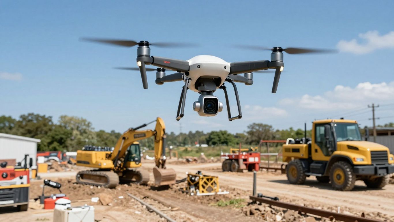
Disaster Response and Fast Recovery
When disaster strikes – think storms, floods, or fires – utility infrastructure often takes a beating. Getting a handle on the damage quickly is key to restoring power. Drones are perfect for this. They can be sent up right after an event to survey affected areas, showing exactly where lines are down or equipment is damaged. This information helps crews figure out where to focus their efforts first, speeding up the whole recovery process. It’s about getting critical information to the right people, fast, so communities can get back to normal sooner [9e39].
The ability of drones to quickly assess damage after a natural disaster significantly cuts down on the time it takes to restore essential services, making them an indispensable tool for emergency response teams.
Operationalizing Drone Fleets for Utility Encroachment Monitoring
So, you’ve got the drones, you’ve seen the benefits, but how do you actually make this work on a large scale? It’s not just about buying a few flying cameras; it’s about building a system. Scaling up means thinking about automation and centralizing your data.
Scaling Up with Automated Flight Plans
Manually flying drones for every single inspection just won’t cut it when you’re covering miles of infrastructure. This is where automated flight plans come in. You can pre-program routes for your drones to follow, ensuring consistent coverage every time. Think of it like setting up a GPS route for your car, but for the sky. This not only saves a ton of time but also means you’re less likely to miss spots. Plus, it helps keep your pilots focused on monitoring the feed and handling any unexpected issues, rather than just flying the drone itself. It’s a big step towards making drone operations more efficient and repeatable, especially when you’re looking at industrial drones for mapping.
Centralizing Data Across Multiple Locations
Imagine having inspection data scattered across different teams, different hard drives, or even different cloud accounts. It’s a mess, right? Centralizing all this information is key. You want a single place where all the data from your drone flights – images, videos, sensor readings – can be stored, organized, and accessed. This makes it way easier to compare data over time, identify trends, and make informed decisions about maintenance or potential encroachment issues. Without a central system, you’re basically flying blind, even with all the data you’re collecting. This is a common challenge, as many organizations struggle with a lack of an automated system for monitoring.
Training and Supporting Field Teams
Your field teams are the ones on the ground, and they need to be comfortable and proficient with the drone technology. This means providing solid training. It’s not just about how to fly the drone, but also how to use the software, interpret the data, and follow safety protocols. Ongoing support is just as important. Things change, software gets updated, and new challenges pop up. Having a support system in place means your teams can get help when they need it, keeping your drone operations running smoothly. It’s about building confidence and capability within your workforce.
Implementing a robust drone program requires more than just the hardware. It involves strategic planning for automated operations, establishing a unified data management system, and investing in your people through comprehensive training and continuous support. This integrated approach is what truly transforms drone capabilities from a novelty into a core operational asset for utility monitoring.
Data Security and Compliance in Utility Drone Services
When you’re using drones for utility work, keeping your data safe and following the rules is a big deal. It’s not just about getting cool aerial shots; it’s about protecting sensitive information about our power grids, water systems, and more. We need to make sure this data doesn’t fall into the wrong hands.
Protecting Sensitive Utility Information
Think about all the details a drone can capture: the exact location of critical infrastructure, its condition, and even patterns of use. This information is valuable, and not just to the utility company. That’s why strong security measures are a must. We’re talking about making sure only authorized people can access the data and that it’s protected from cyber threats. It’s like locking your front door, but for your digital assets.
Using Encrypted and Cloud-Based Solutions
One of the best ways to keep data secure is through encryption. This scrambles the information so that even if someone intercepts it, they can’t read it without the right key. Many drone systems now come with built-in encryption, like AES-256, which is pretty standard for keeping things safe. Plus, using cloud-based storage solutions, especially those that meet security certifications like ISO/IEC 27001, can centralize your data while keeping it protected. Platforms like DJI FlightHub 2, for example, can manage data on AWS servers, offering a secure way to store and access your inspection findings. For even tighter control, some solutions allow for on-premises deployment within your own secure network.
Ensuring Regulatory Compliance
Beyond just data security, there are regulations to think about. For instance, using drones that are NDAA-compliant is becoming increasingly important. This means the drones themselves don’t have components from certain manufacturers that are restricted by U.S. law. It’s all about making sure the technology you’re using meets legal standards, especially when dealing with critical infrastructure. Staying on top of these rules helps avoid potential legal issues and keeps your operations running smoothly. It’s also important that the data collected can be used for regulatory adherence, providing accurate mapping and site documentation that serves as proof of due diligence, which can be helpful for audits or insurance claims. This helps with compliance.
Here’s a quick rundown of what to look for:
- Encryption: Look for strong encryption standards (e.g., AES-256).
- Secure Cloud Storage: Opt for providers with robust security certifications.
- NDAA Compliance: Verify that your drone hardware meets U.S. legal requirements.
- Access Controls: Implement strict user permissions for data access.
- Regular Audits: Periodically review your security protocols and compliance status.
Keeping utility data secure and compliant isn’t just a technical requirement; it’s a fundamental part of responsible operation. It builds trust with the public and ensures the long-term integrity of our essential services. Making sure your drone operations align with these security and compliance needs is just as important as the inspections themselves. This technology helps.
By paying attention to these details, utility companies can confidently use drone services, knowing their data is protected and their operations are above board. It’s about building a secure foundation for the future of infrastructure monitoring. For more information on compliant drone technology, check out NDAA-compliant drones.
Wrapping It Up
So, we’ve talked a lot about how drones are changing the game for utility companies. It’s pretty clear that these flying gadgets aren’t just a fad. They’re making work safer, faster, and honestly, just smarter. Instead of sending people up rickety poles or out to remote spots, drones can get the job done with high-res cameras and sensors, spotting problems before they become big headaches. This means fewer accidents, less downtime, and ultimately, a more reliable power grid for everyone. As the tech keeps getting better and easier to use, it’s a no-brainer for utilities to jump on board. It’s really about keeping things running smoothly and making sure our infrastructure can handle whatever comes next.
Frequently Asked Questions
What exactly are utility encroachment monitoring drone services?
Imagine flying a small, remote-controlled airplane, but instead of a person, it’s a drone with cameras and special tools. These services use these drones to fly around and check on things like power lines, gas pipes, and water systems. They look for anything that shouldn’t be there, like trees growing too close to power lines or construction happening too near underground pipes. It’s like having super-powered eyes in the sky keeping an eye on important stuff.
How do drones make utility work safer?
Working with utilities can be dangerous. Sometimes workers have to climb tall poles or go into tricky spots. Drones can do a lot of that checking work from the ground or from the air. This means fewer people have to do risky jobs, which helps prevent accidents and keeps workers out of harm’s way.
Can drones really help save money for utility companies?
Yes, they can! Instead of sending out big crews in trucks to check every single mile of a power line, a drone can cover a lot of ground much faster. This saves on gas, time, and the number of people needed for the job. Plus, by spotting problems early, they can fix them before they become big, expensive issues.
What kind of special cameras do these drones use?
Drones can have different kinds of cameras. Some have super clear regular cameras to see details. Others have special ‘thermal’ cameras that can see heat. This is useful for finding spots that are getting too hot, which could mean a problem is starting. Some can even use lasers, called LiDAR, to create 3D maps of the area, which is great for checking how close trees are to power lines.
How do utility companies get the information from the drones?
The drones take lots of pictures and videos. This information is sent back to a computer where special software can look at it. Sometimes, the software can even automatically spot problems, like a tree branch that’s too close. This helps the utility company know exactly what needs to be fixed and where.
Are these drones always being flown by people?
Not always! While people are in charge, drones can be programmed to fly specific routes all by themselves, like following a power line. Some systems even have ‘docks’ where the drone can land, recharge, and get ready for its next flight without anyone needing to be there. This makes inspections super efficient.