Revolutionizing Land Development with Drone Topographic Mapping
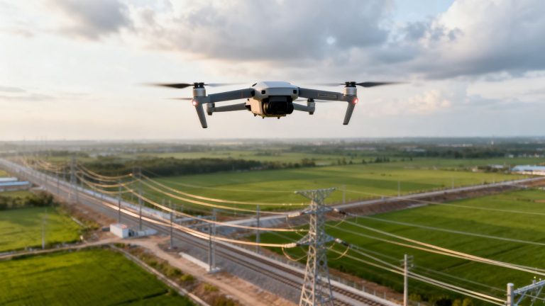
Remember when getting a good look at a piece of land meant endless walking and maybe some questionable aerial photos from a plane? Yeah, those days are pretty much over. Now, we’ve got drones zipping around, taking super detailed pictures and making maps that are way better than what we used to get. This whole drone topographic mapping thing is really changing how we look at land for building and developing. It’s faster, more accurate, and honestly, a lot less hassle than the old ways. Let’s talk about how it works and why it’s becoming such a big deal.
Key Takeaways
- Drone topographic mapping gives us detailed views of land, helping with everything from buying property to planning construction.
- Drones collect data much faster and often more accurately than traditional surveying methods, saving time and money.
- This technology makes it easier to get approvals for land use and zoning because the maps are so clear.
- Construction projects benefit from constant aerial updates, helping managers keep things on track and avoid mistakes.
- Combining drone data with systems like GIS and AI is creating even smarter ways to plan and manage land development in the future.
Revolutionizing Land Development with Drone Topographic Mapping
Land development used to be a slow, painstaking process. Think about it: surveyors trekking across fields, taking measurements by hand, and then spending ages back in the office turning all that data into something usable. It worked, sure, but it wasn’t exactly speedy or cheap. Now, though, things are changing, and drones are a big part of that. They’re making it possible to get a really clear picture of the land much faster and with more detail than ever before.
Understanding Topographical Maps
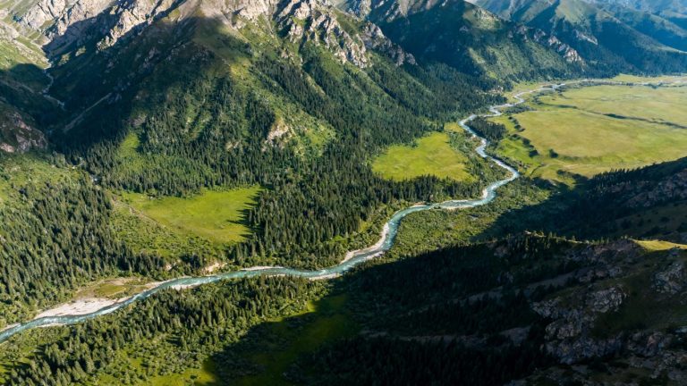
Topographical maps are basically detailed blueprints of the land’s surface. They show not just where things are, but also how high or low the ground is. Imagine trying to build a house on a slope – you need to know exactly how steep it is, right? Topographic maps use lines, called contour lines, to show elevation. Where the lines are close together, the land is steep. Where they’re farther apart, it’s flatter. These maps are super useful for all sorts of things, from planning where to put roads to figuring out how water will flow across a property. They show natural features like mountains and rivers, and man-made ones like buildings and power lines.
Key Features of Topographic Maps
What makes a topographic map so handy? Well, it’s the combination of information it presents. You get:
- Elevation Data: This is the core of it, showing the ups and downs of the terrain.
- Feature Representation: Both natural (lakes, hills) and man-made (roads, structures) elements are clearly marked.
- Spatial Relationships: You can see how different features relate to each other in terms of distance and elevation.
- Detailed Surface Information: Beyond just elevation, they can show vegetation cover and other surface characteristics.
These maps provide a visual narrative of the land, allowing stakeholders to grasp complex terrain characteristics at a glance. This clarity is vital for making informed decisions early in the development cycle.
Essential Applications of Topographic Data
Why do we even bother with all this detail? Because the information from topographic maps is gold for land development. It’s used in:
- Site Selection: Finding the best spot for a new project based on terrain and existing features.
- Design and Planning: Architects and engineers use it to design buildings, roads, and drainage systems that work with the land, not against it.
- Resource Management: Understanding how to manage water runoff or protect natural habitats on the site.
- Construction: Guiding excavation, grading, and building processes accurately.
The ability to accurately map terrain is no longer a luxury but a necessity for efficient and responsible land development. This detailed understanding, now more accessible than ever thanks to new technology, sets the stage for smarter projects from the ground up. Getting this kind of data used to be a huge undertaking, but now, with tools like drone surveying, it’s becoming much more straightforward.
The Evolution of Surveying with Drone Technology
Remember the days of lugging around heavy equipment, spending hours on foot to get basic measurements? Surveying used to be a slow, labor-intensive process. Think about it: total stations, GPS units, and a whole lot of walking. It worked, sure, but it wasn’t exactly speedy, especially for large sites. Plus, getting into tricky spots could be a real headache, and sometimes downright unsafe for the surveyors.
From Traditional Methods to Aerial Surveying
Traditional surveying relied on ground-based measurements. This meant surveyors had to physically be at every point they wanted to measure. For large tracts of land or complex terrain, this was incredibly time-consuming and costly. Imagine trying to map out a new housing development or a sprawling construction site using only ground methods – it would take ages. The advent of aerial surveying, initially with planes and helicopters, was a big step up, offering a broader view. However, these methods were still expensive and not always practical for frequent updates. The real game-changer, though, has been the rise of drones. These Unmanned Aerial Vehicles (UAVs) have dramatically changed how we approach land surveying, making aerial data collection accessible and efficient.
Accessibility of Advanced Drone Capabilities
For a long time, advanced aerial mapping technology was out of reach for most companies. It was the domain of large government agencies or big corporations with deep pockets. But that’s all changed. Thanks to rapid advancements in camera technology, battery life, and the miniaturization of electronics, sophisticated drones are now within the budget of small and medium-sized businesses. Getting certified to fly commercially is also much simpler than it used to be. This democratization of technology means that more professionals can now access the benefits of aerial data collection, transforming their workflows. It’s not just about having a drone; it’s about having access to the tools that make drone technology history so compelling.
Enhancing Mapping Accuracy with Digital Technology
Drone surveying isn’t just about speed; it’s also about the quality and detail of the data. Unlike traditional methods that might give you a set of lines on a map, drone surveys can produce a rich, visual dataset. This includes:
- Orthomosaics: Highly detailed, georeferenced aerial images.
- Point Clouds: Millions of data points representing the terrain’s surface.
- Digital Terrain Models (DTMs): Accurate 3D representations of the ground.
- Contour Maps: Lines showing elevation changes.
This wealth of information, captured quickly and efficiently, provides a much clearer picture of a site than ever before. The integration of digital processing platforms means that raw aerial photos are transformed into actionable survey-grade maps with remarkable precision. It’s a far cry from just taking a few pictures; it’s about creating a digital replica of the land.
The shift from manual, ground-based measurements to automated aerial data capture represents a significant leap forward. This evolution not only speeds up the surveying process but also introduces a level of detail and accuracy previously difficult to achieve, especially over large or challenging landscapes.
How Drone Topographic Mapping Works
So, how does this whole drone mapping thing actually happen? It’s not magic, though it might seem like it sometimes. It’s a pretty straightforward process, really, broken down into a few key stages. Think of it like taking a bunch of photos and then using some smart software to stitch them together into a super-detailed map.
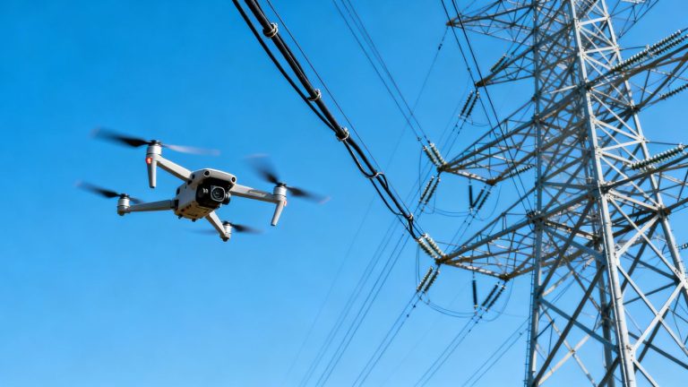
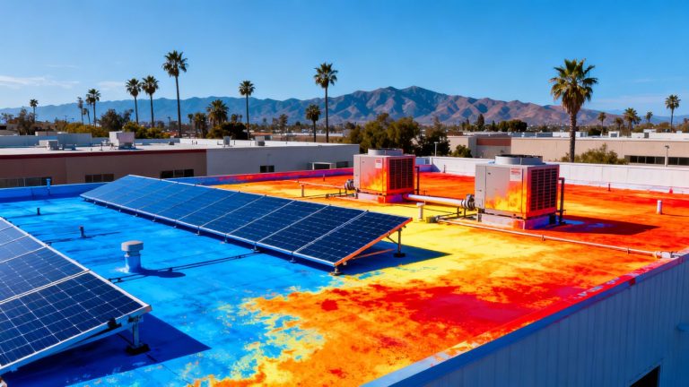
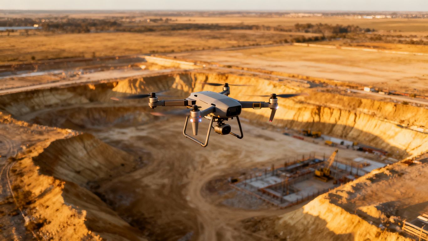
Data Acquisition with Advanced Sensors
This is where the drone takes flight. Equipped with specialized cameras and sensors – like regular RGB cameras, multispectral sensors, or even LiDAR (which uses lasers to measure distances) – the drone flies over the site. It’s not just randomly snapping pictures, though. The flight path is planned out beforehand to make sure every inch of the area is covered from multiple angles. Each photo or scan is tagged with precise GPS coordinates. This is super important for making sure the final map is accurate.
- Planned Flight Paths: Drones follow pre-programmed routes for complete coverage.
- Sensor Variety: Different sensors capture different types of information (visual, elevation, etc.).
- Geotagging: Every piece of data is linked to its exact location on Earth.
The Process of Data Processing
Once the drone has done its job and landed, all those photos and sensor readings need to be put together. This is where the software comes in. Using a technique called photogrammetry, specialized programs take all those overlapping images and stitch them together. It’s like putting together a giant jigsaw puzzle, but instead of a picture, you end up with a 3D model of the terrain. This digital model is the foundation for everything else.
The raw data from the drone is just a collection of points and images. It’s the processing software that transforms this raw information into a usable, detailed map. This automation is a big step up from manually collecting data.
Crucial Data Analysis for Development
Now that you have the 3D model and the map, it’s time to actually use the information. This is the analysis phase. Planners, engineers, and developers look at the map to understand the land’s features – its slopes, elevations, any existing structures, and so on. This detailed view helps in making informed decisions about where to build, how to grade the land, and what potential challenges might exist. It’s the step that turns raw data into actionable insights for any land development project.
- Elevation Contours: Identifying high and low points on the site.
- Volume Calculations: Estimating earthwork needed for construction.
- Feature Identification: Pinpointing roads, buildings, and natural elements.
Benefits of Drone Topographic Mapping for Development
Using drones for topographic mapping really speeds things up for land development projects. Think about it: instead of spending days or even weeks with traditional surveying gear, a drone can cover a large area and gather detailed information in just a few hours. This means you get the data you need much faster, which is a big deal when you’re trying to get a project off the ground.
Accelerating Real Estate Development and Acquisition
When you’re looking at buying land or starting a new development, having accurate topographic data right away is super helpful. Drones can quickly map out potential sites, showing you the lay of the land, any elevation changes, and existing features. This helps you make quicker, more informed decisions about whether a property is a good fit and what the development costs might look like from the start. It cuts down on the guesswork and gets you closer to closing the deal.
Streamlining Land Entitlement and Zoning Approvals
Getting permits and approvals from local authorities can be a long process. Detailed topographic maps created by drones provide clear, visual information that planners and zoning boards need. They can easily see how a proposed development fits into the existing landscape, understand drainage patterns, and assess potential impacts. This clarity can help avoid back-and-forth discussions and speed up the approval timeline.
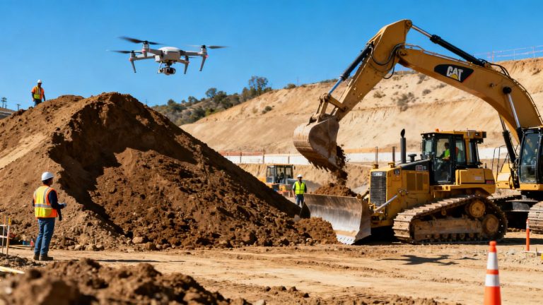
Improving Construction and Project Management
Once construction starts, drone mapping continues to be useful. You can track progress by comparing current site conditions to the initial topographic maps. This helps in managing earthmoving, checking if work is on schedule, and identifying any issues early on. It also means fewer people need to go out onto potentially hazardous construction sites to take measurements, which is a win for safety.
Here’s a quick look at how drone mapping helps:
- Faster Data Collection: Cover large areas in hours, not days.
- Detailed Site Insights: Get precise elevation, contour, and feature data.
- Cost Savings: Reduce labor and equipment costs compared to traditional methods.
- Improved Decision-Making: Make quicker, more informed choices based on accurate visuals.
The ability to get a bird’s-eye view with precise measurements means fewer surprises down the road. It’s like having a crystal ball for your construction site, showing you what’s really going on without having to be right in the middle of it all.
Maximizing Drone Technology in Land Use Planning
When it comes to planning how we use our land, drones are really changing the game. Forget the old ways of measuring and surveying; drones give us a bird’s-eye view that’s both detailed and fast. This aerial perspective is super helpful for making smart decisions about development, zoning, and even how we manage construction projects.
Integrating Aerial Data with GIS Systems
One of the biggest advantages is how easily drone data fits into Geographic Information Systems (GIS). Think of GIS as a digital map where you can layer all sorts of information. By feeding drone-collected topographic data into a GIS, planners can see exactly what they’re working with. This means you can spot potential issues, like drainage problems or difficult terrain, before they become big headaches. It helps in creating more realistic development plans and predicting how a project might affect the environment. This kind of integrated approach makes for much smarter land development strategies.
Leveraging High-Resolution Mapping Capabilities
Drones equipped with advanced cameras and sensors can capture incredibly detailed images and data. We’re talking about high-resolution mapping that shows features on the ground with amazing clarity. This level of detail is fantastic for assessing properties accurately, especially when you’re looking at real estate acquisition. Instead of spending weeks on traditional surveys, you can get a thorough site assessment in a fraction of the time. This speed means fewer delays and better-informed investment choices. For example, aerial drone surveys can cut down site assessment time by up to 60% compared to older methods.
Reducing Costs and Enhancing Safety
Let’s talk about the practical side: money and safety. Using drones for surveying and mapping can significantly cut down on the costs associated with traditional methods. You need fewer people on the ground for extended periods, which lowers labor expenses. Plus, sending a drone into tricky or dangerous spots is a lot safer than sending people. This means fewer risks of accidents and injuries on the job site. It’s a win-win: saving money and keeping your team out of harm’s way. Many projects find they can reduce on-site labor by as much as 50% while boosting safety conditions.
The ability to quickly gather precise, visual data from above is transforming how we approach land use. It allows for more informed planning, faster approvals, and more efficient project execution, ultimately leading to better outcomes for development and communities alike.
Here’s a quick look at how drone mapping stacks up:
- Faster Data Collection: Get detailed site information in hours, not weeks.
- Cost Savings: Reduce labor and equipment expenses significantly.
- Improved Accuracy: Obtain high-resolution maps and topographic data.
- Enhanced Safety: Minimize the need for personnel in hazardous areas.
- Better Decision-Making: Visualize and analyze site conditions with greater clarity.
This technology is really making a difference in how we plan and build. For anyone involved in land development, understanding how to use these tools is becoming increasingly important. It’s not just about having a drone; it’s about integrating that data into your planning and operational workflows. You can find more information on how drones are revolutionizing agriculture and precision farming at precision farming.
The Future of Land Surveying with Drones and AI
Integrating Geospatial Artificial Intelligence
Artificial intelligence, or AI, is really starting to change how we look at all the data drones collect. Think of it like this: drones are the eyes, gathering all this detailed information about the land, and AI is the brain that makes sense of it all. It can sift through massive amounts of data way faster than any person could, spotting patterns and details that might otherwise be missed. This means we can get more out of every flight, turning raw images and sensor readings into clear, actionable information for planning and development.
Creating Digital Twins for Enhanced Understanding
We’re moving towards creating "digital twins" of sites. This isn’t just a 3D model; it’s a living, breathing virtual replica of a piece of land or a structure. By combining drone data with AI analysis, these digital twins can simulate different scenarios. For example, you could see how a proposed building might affect water runoff or how a new road might impact traffic flow, all before breaking ground. This level of predictive modeling is a game-changer for avoiding costly mistakes and making smarter development choices.
Transforming Data Collection and Processing Workflows
The way we collect and process survey data is getting a major overhaul. AI is automating many of the tedious steps, like identifying features in images or calculating elevations from point clouds. This frees up surveyors and engineers to focus on the more complex aspects of their jobs, like interpreting the results and advising clients. It also means projects can move along much quicker.
Here’s a look at how workflows are changing:
- Automated Feature Extraction: AI can automatically identify roads, buildings, trees, and other features from drone imagery.
- Predictive Analysis: AI algorithms can analyze historical data and current conditions to forecast potential issues, like soil erosion or flood risks.
- Real-time Data Updates: As more data is collected, digital twins and analyses can be updated almost instantly, providing the most current picture.
The combination of drones and AI is making land surveying more efficient, accurate, and insightful than ever before. It’s not just about collecting data; it’s about understanding it deeply and using that understanding to build better, safer, and more sustainable projects for the future.
Wrapping It Up
So, there you have it. Drones aren’t just for cool aerial shots anymore; they’re seriously changing how we plan and build things on the ground. From getting a super clear picture of the land before we even break ground to keeping an eye on progress, this tech makes everything faster and usually cheaper. It’s like going from a flip phone to a smartphone for land development. We’re seeing more accurate maps, fewer headaches with approvals, and a safer way to work. It’s pretty clear that if you’re involved in developing land, ignoring drone mapping is probably not the smartest move anymore. This is definitely the way forward.
Frequently Asked Questions
What exactly is a topographic map?
Think of a topographic map as a special kind of map that shows you the shape of the land. It uses lines to show how high or low the ground is, like mountains, hills, and valleys. It’s like a 3D picture of the land, but on a flat piece of paper or screen.
How do drones help make these maps?
Drones are like flying cameras that can take tons of pictures of an area from above. Special software then stitches these pictures together to create a very detailed and accurate map of the land’s surface. It’s much faster than old-fashioned methods.
Why are these drone maps so useful for building things?
These maps give builders and planners a super clear picture of the land before they start. They can see exactly where the slopes are, where water might flow, and any existing features. This helps them plan better, avoid problems, and make sure the project is safe and efficient.
Is using drones for mapping expensive?
Actually, using drones can save a lot of money compared to older ways of surveying. They can cover large areas quickly, meaning fewer people and less time are needed. This lowers the overall cost of getting the important land information.
How accurate are drone-made maps?
Drone maps are incredibly accurate. They use advanced cameras and sensors, and when combined with ground markers, they can show details down to a few inches. This level of precision is crucial for planning and building.
Can anyone use drone mapping technology?
Yes! While it used to be only for big companies, drones and the software to use them are much more common and affordable now. This means smaller businesses and even individuals can use this powerful technology for their projects.