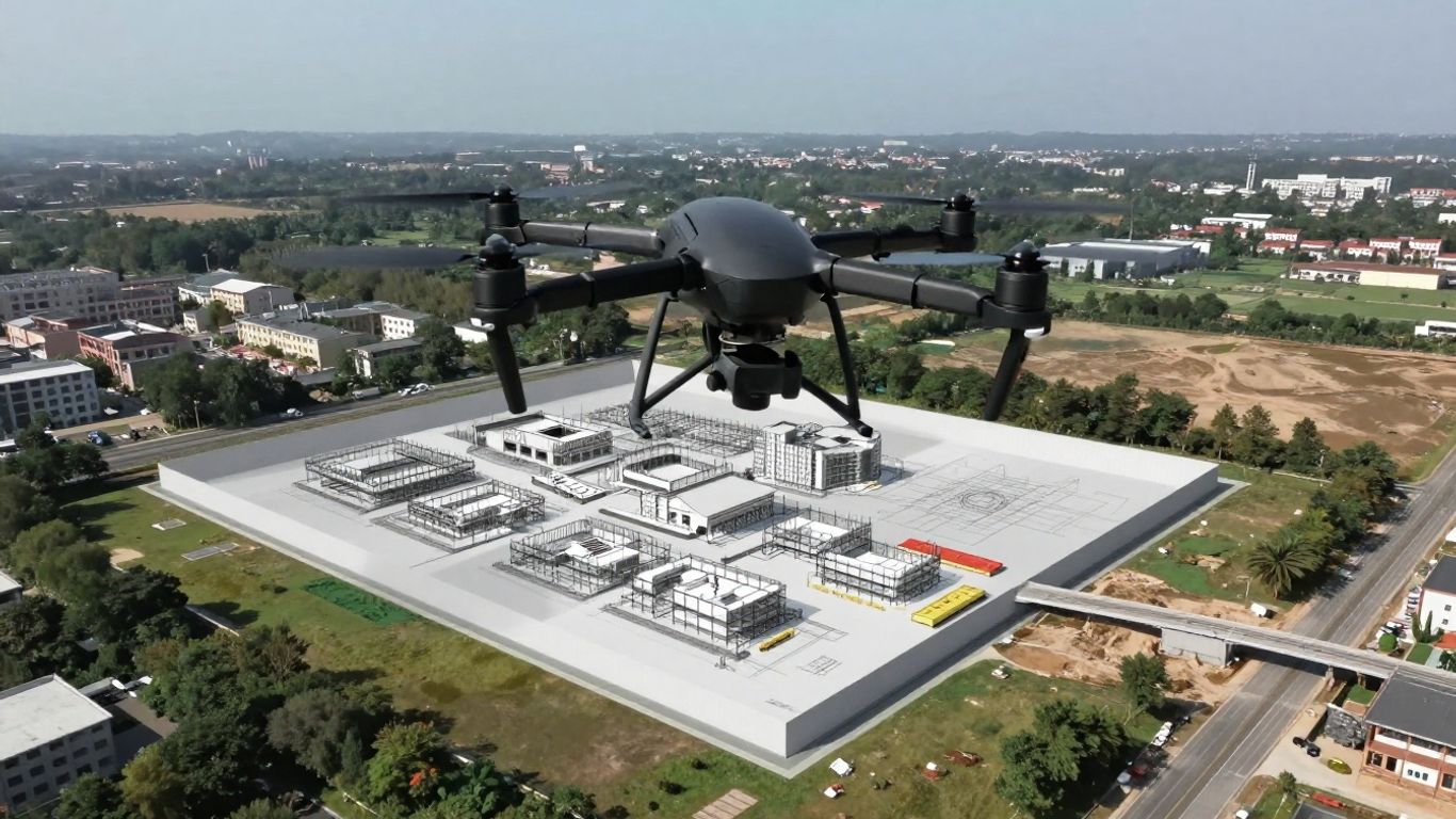
Streamlining Workflows: Achieving Seamless 3D Drone Mapping for BIM Integration
Getting accurate 3D models of construction sites into BIM software can be a real headache. Traditional methods take ages and cost a fortune. But what if there was a better way? 3D drone mapping for BIM integration is changing the game, making the whole process faster, cheaper, and way more accurate. Let’s look at how this tech is shaking things up.
Key Takeaways
- Drones drastically cut down the time and cost of collecting site data compared to old-school methods.
- Using drones with photogrammetry or LiDAR sensors provides highly detailed and accurate 3D models for BIM.
- Integrating drone data into software like Revit helps in better planning, clash detection, and as-built documentation.
- Remote inspections using drones significantly improve safety by reducing the need for workers to enter hazardous areas.
- Future advancements in AI and drone tech will make 3D drone mapping for BIM integration even more efficient and automated.
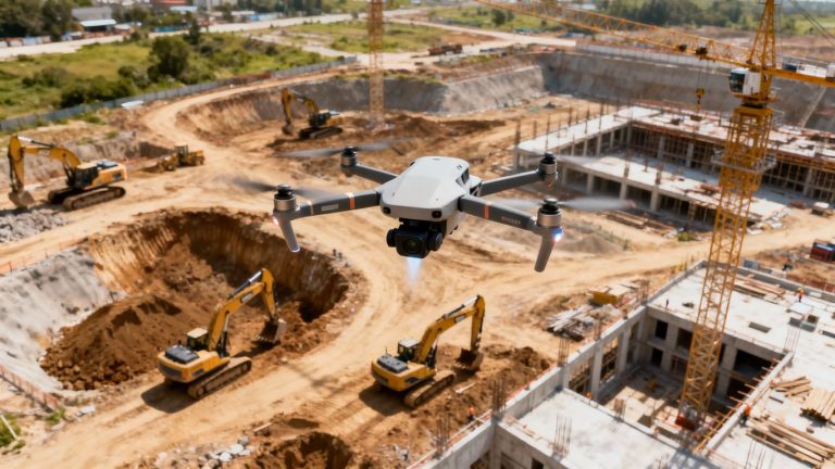
Transforming Construction Data Acquisition With Drones
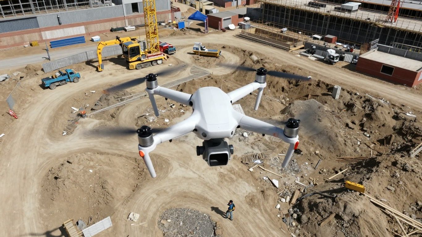
Drone technology is quickly changing how construction teams collect and use site data. Not too long ago, getting detailed measurements and visuals from a job site usually meant lots of manual work, delays due to weather, and, let’s face it, a good amount of hope that nothing was missed. Today, with drones, all of that looks very different—and much simpler. Teams can capture more information faster, safer, and with less hassle than ever before.
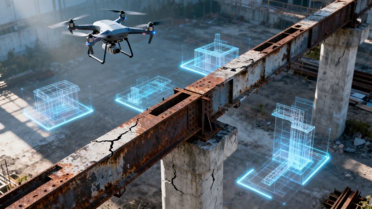
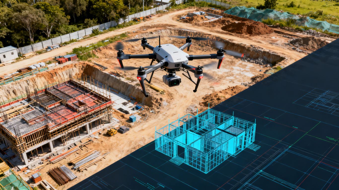
Bridging The Gap Between Reality Capture And BIM
Construction projects demand up-to-date, accurate records of site conditions, especially if you’re integrating with Building Information Modeling (BIM). Drones serve as a perfect connector between the real-world site and digital BIM environments. By flying a drone and capturing hundreds (sometimes thousands) of overlapping images, you get a rich, current "digital twin" that plugs directly into BIM models. This dramatically reduces the disconnect between field conditions and what’s displayed on your computer screen.
- Rapid image capture using photogrammetry technology
- Up-to-date 3D models for site plans, progress tracking, and verification
- Clearer communication between field teams, project managers, and clients
Check out a quick overview of how drones and BIM software line up to make project management easier.
Faster updates lead to faster fixes. When you know what’s happening onsite, you’re less likely to be caught off-guard by unexpected issues.
Elevating Data Completeness And Geometric Accuracy
It’s really tough—for both surveyors and superintendents—to spot every bump, dip, or structural detail using only manual tools. Drone mapping nearly eliminates these guesswork gaps because the data is so thorough. Even challenging or inaccessible areas, like building roofs or complex elevation changes, are easy targets for a drone and its camera.
Here’s a simple table showing differences before and after drone integration:
| Survey Method | Average Coverage Time (acres/day) | Data Accuracy (cm) |
|---|---|---|
| Manual (Total Station) | 1.5 | 5–10 |
| Drone Mapping | 15 | 1–3 |
- Hard-to-reach areas now get documented without sending someone up a ladder
- Volume measurements and cut/fill analysis become routine and quick
- Fewer site revisits because you catch more on the first go
Streamlining Scan To BIM Workflows
Getting from raw site data to a usable BIM model often meant a lot of file conversions and back-and-forth with different formats. But when drones collect data, the entire output—such as point clouds or orthomosaics—can slide right into BIM tools like Revit. This is especially helpful for architects, designers, and project planners who want to keep things moving.
A basic "scan to BIM" workflow with drone data:
- Plan drone flight paths and capture site imagery or LiDAR scans
- Process data into point clouds using photogrammetry or LiDAR software
- Import point cloud directly into BIM platforms for model creation or update
If you want a nuts-and-bolts walk-through of drone mapping and outcomes for construction professionals, you’ll appreciate this process breakdown.
The less time spent wrestling with file formats, the more time teams can spend actually solving project problems.
Leveraging Drone Technology For Precise 3D Modeling
The Power Of Photogrammetry And LiDAR
When we talk about getting super accurate 3D models from drone data, two main technologies come to mind: photogrammetry and LiDAR. Photogrammetry is basically using a bunch of overlapping photos taken from the drone. The software then figures out the 3D shape of things by finding common points in those pictures. It’s pretty neat how it works, kind of like how our brains process what our eyes see to understand depth. This method is fantastic for creating detailed visual models and maps. LiDAR, on the other hand, uses lasers. The drone shoots out laser pulses and measures how long it takes for them to bounce back. This gives you a really precise
Enhancing Project Efficiency Through Drone Integration
Using drones on construction sites really speeds things up. Think about it: instead of teams spending days walking the site with measuring tapes and levels, a drone can cover the same ground in a fraction of the time. This means less time spent on data collection and more time actually building.
Accelerated Data Capture and Reduced Timelines
The speed at which drones can gather information is a game-changer for project schedules. Traditional surveying methods can be slow, especially on large or complex sites. Drones, however, can fly over vast areas quickly, capturing high-resolution images and data. This rapid data acquisition directly translates to shorter project timelines. Imagine getting detailed site maps and progress reports within hours instead of days. This quick turnaround allows project managers to make faster decisions, identify potential issues early, and keep the project moving forward without costly delays.
Improving Site Logistics and Planning
Getting the site layout just right is key to a smooth construction process. Drones help with this by providing detailed 3D models and aerial views of the site. This makes it way easier to figure out the best spots for material storage, plan efficient access routes for vehicles, and even position temporary structures. It’s like having a bird’s-eye view that helps you avoid bottlenecks and keep everything organized. This kind of planning can save a lot of headaches and money down the line.
Real-Time Project Insights for Better Decisions
One of the coolest things about drone data is how current it is. You can get updated site information regularly, sometimes even daily. This means you’re always working with the most accurate picture of what’s happening on the ground. Project managers can use this data to track progress against the plan, spot any deviations early, and make adjustments as needed. This constant stream of information helps prevent small problems from turning into big ones, leading to better overall project outcomes.
Having up-to-date, detailed site information readily available means fewer surprises and more control over the project’s direction. It’s about making informed choices based on what’s actually happening, not just what was planned weeks ago.
Ensuring Safety And Accuracy In Data Collection
When you’re out there with your drone, mapping a site for BIM, safety and accuracy aren’t just buzzwords; they’re the bedrock of the whole operation. Messing up here means your whole BIM model could be off, and nobody wants that. Plus, flying drones, especially around active construction sites, comes with its own set of rules and potential hazards.
Minimizing Risks With Remote Inspections
Think about it: instead of sending people up scaffolding or into tight, potentially dangerous spots, a drone can do the job from a safe distance. This is a big win for worker safety. Drones can get up close to structures, capture detailed images, and help spot issues without anyone having to put themselves in harm’s way. It’s a smarter way to do things, especially for tasks like checking the condition of a roof or inspecting a tall facade. This technology offers a new standard in home drone assessments, providing a more thorough and efficient evaluation process.
Achieving Sub-Centimeter Accuracy
Okay, so how do we make sure the data we’re collecting is actually useful and precise? It’s all about the tech and the process. Using things like Ground Control Points (GCPs) – basically, markers with known coordinates on the ground – helps calibrate the drone’s data. When the drone captures images, these GCPs act as anchors, making sure the final 3D model lines up correctly with the real world. This is how you get that sub-centimeter accuracy needed for detailed BIM work. It’s a bit like using a ruler on a map, but way more advanced.
Adhering To Safety Regulations For Drone Operations
Flying drones isn’t just a free-for-all. There are rules, and you’ve got to follow them. This means understanding airspace regulations, getting any necessary permits, and making sure your drone is properly maintained. Skilled pilots are key here; they know how to navigate different sites, avoid obstacles, and keep track of what’s going on around them. It’s about being responsible and professional. This integrated approach aims to enhance the efficiency and accuracy of creating Building Information Models (BIM) from 3D scan data.
Proper planning before any flight is non-negotiable. This includes checking weather conditions, understanding the site layout, and having a clear flight path mapped out. It’s better to spend extra time planning than to have to redo the entire job because of a preventable mistake or safety lapse.
The Future Of 3D Drone Mapping For BIM Integration
So, what’s next for drone mapping and BIM? It’s pretty exciting stuff, honestly. We’re seeing a big push towards smarter drones that can do more on their own. Think AI-driven data assessment, where the drone not only captures the information but also starts to figure out what it’s seeing in real-time. This means more autonomous flights, where the drone can adjust its path on the fly to avoid obstacles or get better angles, all without a human constantly at the controls. It’s like giving the drone a brain, making the whole data collection process smoother and more efficient.
AI-Driven Data Assessment and Autonomous Flights
Artificial intelligence is really changing the game here. Drones are getting equipped with advanced algorithms that let them process data right from their sensors, like LiDAR and cameras. They can actually look at their surroundings, identify different objects, and make smart choices about how to capture data. This could mean automatically changing flight plans to dodge a tree or a crane, or even adjusting camera settings to get the best possible shots of a specific feature. It’s all about making the data collection more precise and less reliant on constant human input.
Sustainability Through Drone-Enabled BIM
There’s also a growing focus on making construction more sustainable, and drones are playing a part in that. By creating really accurate 3D models with BIM, we can get a much better handle on material quantities. This helps reduce waste on site and plan resources more effectively, which in turn lowers the carbon footprint of a project. Plus, drones can do a lot of inspections remotely. Instead of sending people out to a site multiple times, a drone can do the job, cutting down on travel and emissions. It’s a win-win for efficiency and the environment.
Expanding Applications In Construction
Beyond just capturing existing conditions, drones are finding new uses all over the construction lifecycle. We’re talking about using them for progress monitoring, checking the quality of work as it happens, and even for safety inspections in hard-to-reach or dangerous areas. This means fewer risks for workers and more up-to-date information for project managers. The ability to get detailed, accurate data quickly is opening up possibilities we might not have even considered a few years ago. It’s really about making construction smarter and safer, one flight at a time.
Real-World Successes In Scan To BIM
Case Study: Retail Coffee Outlet As-Built Model
We worked with a building surveying firm in the USA on a project for a retail coffee outlet. They gave us point cloud data, scans, and 360 photos from drones and laser scanners. It was a bit tricky with large datasets and some lower-quality scans, but we managed. We ended up creating a point cloud to BIM as-built model, complete with elevations, site plans, and sections. A full Revit file audit made sure everything was solid.
After we handed over the final model, the client could:
- Use the As-Built model and drawings ahead of schedule.
- Analyze the building’s condition with accuracy within +- 10mm in a shared space.
This project really showed how valuable accurate as-built documentation is for renovations and facility management.
Case Study: Commercial Project Scan To BIM Conversion
A European company specializing in topographic services came to us for help with a commercial project. They provided .rcp files, and we had to deal with big point cloud files, adjoining boxes, and some pretty tight deadlines. Using tools like Revit, Recap, and AutoCAD, we successfully converted the scan data into a BIM model. We produced accurate structural models along with the basic architectural elements for the building.
The client saw benefits like time savings during construction and more accurate load calculations for their new building design. This kind of conversion is a game-changer for planning and execution.
Client Benefits: Time Savings and Accurate Analysis
Across the board, using drones for Scan to BIM workflows brings some clear advantages. For instance, capturing high-resolution point clouds of large areas with drones cuts down on risks and speeds up project timelines. It also means better accuracy for the final BIM models. This is especially helpful when you need to get a detailed look at existing conditions without spending ages on-site. You can explore United-BIM’s BIM modeling and coordination services through detailed case studies to see more examples of how this technology is applied. It’s all about getting the right data, quickly and safely, to make smarter project decisions.
Wrapping Up: Drones and BIM Working Together
So, we’ve talked a lot about how drones are changing the game for 3D mapping and getting that data into BIM. It’s pretty clear that using drones makes collecting all that information faster and, honestly, a lot safer than the old ways. Plus, the data you get is really detailed, which helps make better 3D models. While there’s a bit of a learning curve with the tech and software, the payoff in terms of accuracy and efficiency for projects is huge. It looks like drones are here to stay in the world of construction and design.
Frequently Asked Questions
What exactly is drone mapping for construction?
Imagine taking tons of pictures of a building site from a drone. Drone mapping is like putting all those pictures together, like a giant puzzle, to create a super detailed 3D map or model of the area. It helps us see exactly what the site looks like from above and all around.
How does this 3D map help with Building Information Modeling (BIM)?
BIM is like a digital blueprint that contains all the information about a building. The 3D map from the drone acts as a super accurate ‘as-built’ model, showing what’s really there. This helps builders make sure their digital BIM model matches the real building, catching any differences early on.
Is it hard to get the drone data into BIM software like Revit?
Not really! The data from the drone, called a point cloud, can be easily loaded into programs like Revit. Think of it like importing a special type of digital file. Revit then uses this data to help you build or check the 3D model very precisely.
Are drones more accurate than old-fashioned ways of measuring?
Often, yes! Drones with special tools like LiDAR can capture details with amazing accuracy, sometimes down to less than an inch. They can also cover large areas quickly and reach tricky spots that would be hard or dangerous for people to get to.
Can drones help make construction projects safer?
Definitely. Drones can go inspect places that are risky for people, like unstable structures or high places. This means fewer workers have to put themselves in danger to get the information needed for the project.
What’s next for drones in construction?
Things are getting even smarter! Soon, drones will use artificial intelligence (AI) to understand the data they collect on their own, and even fly themselves more efficiently. They’ll also help make building projects more eco-friendly by reducing waste and the need for lots of travel.