
FAA Part 107 airspace authorization at San Jose Airport: A practical guide for drone operators
Key Takeaways
Airspace authorization is only one part of a compliant Part 107 operation near San Jose Mineta International Airport. The operator must also confirm current airspace conditions, follow the approved limits, and keep the flight plan aligned with the actual site and mission.
- Check the current FAA airspace status before planning the flight.
- Obtain authorization before operating in airspace that requires it.
- Use LAANC when available and DroneZone when manual review is necessary.
- Treat authorization separately from waivers and other Part 107 requirements.
- Keep approval records, site details, crew assignments, and contingency plans together.
Understanding the airspace around San Jose Airport
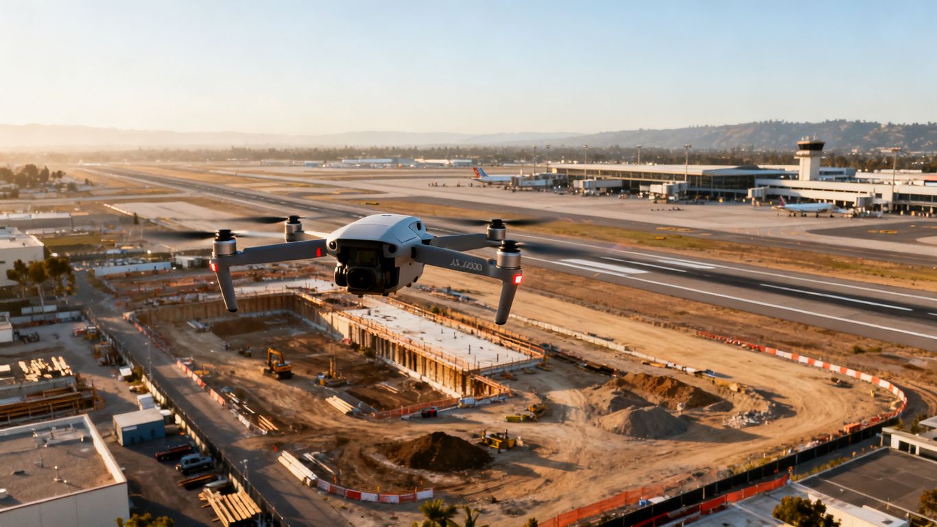
San Jose Mineta International Airport influences drone operations well beyond the airport property itself. A proposed flight may be affected by controlled airspace, airport procedures, altitude limits, or temporary restrictions depending on its precise location and timing. For project teams, the safest approach is to make airspace review part of the initial planning process rather than something checked immediately before launch.
How San Jose Mineta International Airport affects drone operations
The airport’s proximity means that a flight near San Jose should not be judged by distance alone. The relevant question is whether the proposed operating area falls within airspace where prior authorization is required and whether the flight can be conducted without creating a hazard to manned aircraft. A construction or inspection team should identify the site boundary, proposed operating altitude, and intended dates before selecting an authorization path.
Identifying controlled, restricted, and special-use airspace
Controlled airspace can include Class B, Class C, Class D, and certain Class E areas designated for an airport. Part 107 operations in those areas require prior authorization, while restricted or special-use areas may introduce additional limitations or coordination needs. The FAA’s Part 107 airspace guidance is a useful starting point for separating an authorization question from other operating requirements.
The label shown on an airspace map is not the entire analysis. Operators should also look for boundaries, floor and ceiling information, airport data, and any notes that affect the proposed activity. If the work is near an active construction site, the airspace review should be matched to the exact parcel rather than a general city or ZIP code.
Why location, altitude, and operating time matter
A location can fall under different requirements from a nearby location, and a proposed altitude can change whether a grid authorization is available. Operating time matters as well because temporary restrictions, airport activity, weather, and visibility can change after an application is submitted. Small planning differences can change the approval path, so the application should describe the real operation rather than an approximate version of it.
For a practical site review, record the following before submitting anything:
- The launch and recovery point, including its coordinates.
- The lateral boundary of the area where the aircraft may operate.
- The planned maximum altitude above ground level.
- The proposed dates, time window, and operating conditions.
That information gives the pilot a defensible starting point and makes it easier to correct an application before the flight date.
Checking current FAA airspace data before planning a flight
Airspace information should be checked close to the planning date and again before takeoff. Review the current FAA map or approved authorization application, then confirm whether NOTAMs, TFRs, airport notices, or local site conditions affect the mission. A saved screenshot or exported planning record can help show what was reviewed, but it does not replace the authorization itself.
Determining whether FAA authorization is required
The phrase “near the airport” is not, by itself, a complete legal test. The requirement depends on the applicable airspace, the operation’s location and altitude, and the rules governing the flight. Operators should first determine whether the planned area is controlled or otherwise subject to authorization, then decide whether the request belongs in LAANC or DroneZone.

When Part 107 operations need prior approval
Under Part 107, a small unmanned aircraft may not be operated in certain controlled airspace without prior authorization from Air Traffic Control. The authorization is separate from the remote pilot certificate, aircraft registration, and the other operating rules that apply to the mission. The FAA’s authorization process describes LAANC and DroneZone as the channels for requesting access rather than contacting an airport tower directly.
An approval should be received before the operation begins. A pending request, an informal conversation, or a plan to call the tower on the day of the flight is not a substitute for written authorization through the applicable system.
How airport proximity influences authorization requirements
Airport proximity is a useful warning sign, but it does not tell the operator the exact altitude or approval outcome. The proposed location must be compared with the relevant airspace boundary and any published grid value. A flight on one side of a boundary may have a different process from a flight only a short distance away.
For commercial work, build this review into the schedule before crews, equipment, and site access are committed. That is especially important when a client expects repeated progress flights or when the operation covers several separate parcels.
Distinguishing airspace authorization from a Part 107 waiver
Airspace authorization addresses access to airspace that requires approval. A Part 107 waiver addresses a request to operate outside a specific regulatory limitation, such as certain beyond-visual-line-of-sight, night, over-people, or altitude conditions. One does not automatically provide the other.
The FAA explains the distinction in its Part 107 waiver information. A pilot who needs both an airspace authorization and a waiver must address each requirement through the appropriate process and follow every condition attached to the resulting approvals.
Reviewing temporary flight restrictions and local advisories
An authorization does not erase a temporary flight restriction or other applicable notice. Before launch, check current restrictions and advisories for the precise area and time of the operation. If conditions change, pause and reassess instead of assuming that an earlier approval remains sufficient for the revised plan.
Applying through LAANC near San Jose Airport
LAANC is often the practical first route for eligible Part 107 requests near an airport. It connects the operator’s proposed location and altitude with the applicable FAA authorization framework, but the operator remains responsible for entering accurate information and complying with the issued conditions. A fast response does not make an inaccurate application acceptable.

Confirming LAANC availability for the intended location
Start by entering the exact operating area into an FAA-approved LAANC service. Confirm that the location is covered, that the relevant grid is displayed, and that the requested activity fits the available workflow. If the location is not supported or the request requires additional coordination, move to the appropriate manual process instead of forcing the flight into an unsuitable category.
LAANC is designed to automate requests and deliver authorizations through approved UAS Service Suppliers. The FAA’s LAANC overview provides additional background, but the active application should still be treated as the controlling source for the request details and approval conditions.
Entering the correct flight details and operating altitude
The application should reflect the actual launch area, operating boundary, maximum altitude, date, and time window. Do not enter a lower altitude merely because it is more likely to be approved if the aircraft will be flown higher. If the work needs several locations, review whether each one requires its own request or a separately defined operating area.
A useful internal check is to compare the application with the mission brief, site map, and pilot’s preflight notes. Any mismatch should be corrected before submission, not explained after the flight.
Understanding FAA-approved altitude limits and grid values
UAS Facility Map grid values indicate the altitude at which an automated authorization may be available in a particular area. They are not a general permission to fly anywhere in the grid, and they do not remove the need to comply with Part 107. The approved altitude is tied to the submitted location and request, so the pilot should verify the issued authorization rather than rely on a remembered value.
If the proposed altitude exceeds the automated limit, the request may require further coordination or a different application route. The operator should not treat a neighboring grid’s value as transferable to the worksite.
Handling further coordination or authorization requests
Some LAANC requests can be submitted for further coordination when automated approval is not available at the desired altitude or location. That request still needs review and approval before the flight. If LAANC cannot support the operation, prepare a DroneZone request with the same level of precision rather than changing the mission informally.
Requesting authorization when LAANC is unavailable
DroneZone is the route for manual Part 107 airspace authorization requests when LAANC is unavailable or does not fit the operation. Manual review generally requires more explanation, clearer maps, and more lead time. A complete submission helps reviewers understand exactly where the aircraft will operate and how the pilot will control the risks.

When to use the FAA DroneZone application
Use the FAA DroneZone application when the proposed location or operation cannot be handled through LAANC, including situations that require manual airspace authorization review. The airspace authorization application remains distinct from a Part 107 waiver request, even when both are submitted through FAA systems.
If the work is scheduled around a fixed construction milestone, begin well before mobilization. The FAA advises submitting airspace authorization requests in advance, and a late request may not be processed in time for the planned operation.
Preparing maps, coordinates, and operating boundaries
A manual request should identify the launch point, operating area, coordinates, maximum altitude, and date and time window in a way that another person can understand without guessing. Include a clear map and avoid broad descriptions such as “the project site” when the aircraft will operate over only part of it.
For a multi-day project, explain whether the same boundary and altitude apply throughout the requested period. If the operation will move between parcels, list those areas clearly and verify that they belong in the same request.
Explaining the purpose and safety controls of the flight
Describe what the aircraft will do, who will operate it, and how the crew will maintain visual awareness and respond to nearby aircraft or changing conditions. The purpose might be construction documentation, inspection, or another defined project activity, but the explanation should stay factual and tied to the proposed area.
A safety description can cover crew roles, communication, aircraft limitations, launch and recovery controls, and the decision to suspend operations. It should explain the actual plan rather than rely on broad statements that the flight will be conducted safely.
Allowing time for manual FAA review
Manual review takes planning time and may lead to requests for clarification or revised information. Do not schedule an irreversible site activity around an assumption that approval will arrive by a particular date. Keep the client and field team informed about the request status, and preserve any correspondence with the application record.
Building a compliant flight plan
Authorization is a gateway, not a complete flight plan. The pilot still has to follow Part 107, assess the site, supervise the crew, and make conservative decisions when conditions differ from the approved plan. For construction and engineering teams, the flight plan should connect regulatory requirements with practical site controls.
Establishing visual line of sight and crew responsibilities
The remote pilot should define how visual line of sight will be maintained and who is responsible for observing the aircraft, communicating hazards, and making the decision to stop. If a visual observer is used, assign that person a specific position and communication method rather than treating the role as informal support.
The plan should also identify who controls the aircraft, who coordinates with the site, and who records changes. Clear responsibility reduces hesitation when a vehicle enters the area, visibility drops, or an unexpected aircraft appears.
Planning for people, vehicles, buildings, and airport activity
Map people, vehicle routes, cranes, structures, power lines, and other obstacles before the aircraft launches. A project site can change during the day, so the pilot should confirm that the planned buffer and launch area remain clear. Airport-related activity is another reason to maintain a conservative lookout and be prepared to land.
A project team can use San Jose aerial imaging as a reference for how aerial data may support construction project management, while keeping the actual flight plan focused on the approved mission and applicable aviation rules.
Coordinating with property owners and local authorities
FAA authorization does not automatically provide permission to enter private property, close a road, use a launch area, or interfere with local operations. Obtain the property owner’s consent where needed and coordinate with site management, public agencies, or emergency personnel when the work could affect them.
This coordination is separate from airspace authorization, but it belongs in the same preflight record. A well-organized plan makes it clear who approved access and who should be contacted if the site conditions change.
Creating contingency procedures for changing conditions
Write down what happens if the wind rises, visibility deteriorates, a crew member loses sight of the aircraft, or airport activity creates a concern. The pilot should know where the aircraft can land safely and which conditions require an immediate pause. A contingency procedure does not need to be complicated; it needs to be understood before the aircraft is airborne.
For teams managing recurring work, drone service guides can provide broader context on aerial data applications, while each individual mission still needs its own current airspace and site assessment.
Avoiding common authorization and compliance mistakes
Most preventable problems begin with a mismatch between the approved request and the flight that actually occurs. A correct authorization can still be undermined by the wrong launch point, an unapproved altitude, an expired time window, or a crew that does not understand the conditions. Treat the approval as a controlled project record and compare it with the field plan before every operation.
Flying before receiving written FAA approval
A pending application is not an authorization. Neither is a verbal indication that the request should be acceptable. The pilot should have the applicable approval available before launch and should confirm that its location, altitude, date, time, and conditions match the intended flight.
If approval has not arrived, reschedule or redesign the operation. Pressing ahead because equipment and personnel are already onsite creates a compliance problem that a later approval cannot undo.
Selecting the wrong location or altitude on an application
An incorrect pin or boundary can place the request in a different grid or airspace area. Likewise, an altitude entered below the actual operating altitude does not make the planned flight compliant. Review the map at a useful scale, compare coordinates with the site plan, and check the issued authorization for the final details.
When the project changes, submit or request the appropriate update rather than assuming that a nearby location or different altitude is covered.
Treating authorization as permission to ignore Part 107 rules
Airspace authorization does not waive visual line of sight, aircraft and crew requirements, restrictions on careless or reckless operation, or other Part 107 rules. It also does not replace a waiver when the proposed operation falls outside a regulatory limitation. The pilot must satisfy all applicable requirements at the same time.
The FAA’s Part 107 operating rules are useful for checking the requirements that remain in force after airspace access has been approved.
Documenting approvals, conditions, and flight records
Keep the approval, application details, site map, crew information, preflight assessment, and flight record together. Note any changes, pauses, incidents, or weather decisions while they are fresh. For project managers, this record supports accountability and makes later flights easier to plan without relying on memory.
When the documentation is organized, the authorization becomes part of a repeatable safety process rather than a file that is retrieved only if someone asks for it.
CTA: Plan Your Aerial Work
For construction and engineering teams that need organized aerial information, plan your project with Aeroskape and discuss a practical approach to compliant data capture.
Conclusion
FAA Part 107 airspace authorization san jose airport planning is most reliable when it begins with the exact site, altitude, and operating window, then continues through current airspace checks, accurate applications, and disciplined field procedures. Authorization supports access to the airspace, but a compliant operation also depends on the pilot, crew, site coordination, and records that carry the plan into the field.
Frequently Asked Questions
Do all drone flights near San Jose Airport need FAA authorization?
Not necessarily. The requirement depends on the exact location, applicable airspace, operating altitude, and current restrictions, so review the FAA’s current airspace information before planning the flight.
What is the difference between LAANC and DroneZone?
LAANC provides an automated path for eligible Part 107 airspace authorization requests through approved service suppliers. DroneZone is used for manual airspace authorization requests and for applicable waiver applications.
Can a pilot call the airport tower for authorization?
Part 107 operators should request authorization through LAANC or DroneZone rather than attempting to obtain it directly from an ATC facility. The applicable FAA process determines the appropriate route.
Does an airspace authorization replace a Part 107 waiver?
No. Airspace authorization permits access to airspace that requires approval, while a waiver addresses operation outside a specific Part 107 limitation. A flight may require one or both, depending on its circumstances.
What information should be included in an authorization request?
Provide the precise location, operating boundary, maximum altitude, dates, time window, purpose, and relevant safety controls. The request should describe the operation that will actually occur.
Can an approved altitude be exceeded if conditions are safe?
No. The pilot must remain within the approved altitude and all other authorization conditions unless the appropriate additional approval has been obtained. A safe judgment in the field does not change the authorization.
What should a pilot do if conditions change after approval?
Pause and reassess the operation. Review current restrictions, weather, airport activity, site conditions, and the approval terms before deciding whether the flight can continue or must be rescheduled.