Revolutionizing Utility Operations: Advanced Vegetation Management Drone Services
Managing the growth of trees and plants around power lines is a huge job for utility companies. It’s expensive and, honestly, pretty tough to get it all done perfectly with old methods. But now, there’s a better way. Using drones equipped with smart technology is changing how utilities handle this, making things faster, cheaper, and a lot safer for everyone. It’s all about using the right tools to keep the power flowing without a hitch.
Key Takeaways
- Drone services for utilities are revolutionizing vegetation management by offering a faster, more accurate, and cost-effective alternative to traditional methods.
- AI and high-resolution data collected by drones allow for precise identification of vegetation risks near power lines, preventing outages and improving grid reliability.
- Implementing a digital twin of the power grid, powered by drone data, enables smarter, real-time management and optimization of vegetation control efforts.
- Combining drone data with satellite imagery and LiDAR surveys provides a complete picture for efficient clearance distance checks and risk assessment.
- Partnering with specialized drone service providers helps utilities access the necessary technology and expertise to streamline their vegetation management drone services operations.
Transforming Vegetation Management With Advanced Drone Services
Managing the growth of trees and other plants around power lines has always been a headache for utility companies. It’s a constant battle to keep everything clear, and frankly, the old ways just aren’t cutting it anymore. We’re talking about spending billions each year on this, yet outages caused by encroaching greenery keep happening. It’s a big problem that needs a fresh approach.
The Growing Challenge Of Vegetation Encroachment
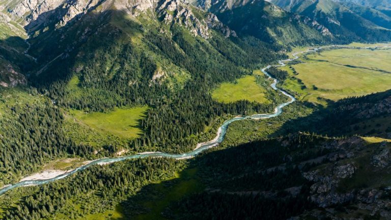
Vegetation encroachment is more than just an annoyance; it’s a serious risk to the reliable delivery of electricity. As trees grow, they can lean into power lines, break branches that fall onto them, or even cause lines to sag and touch each other. This isn’t just about occasional flickers of the lights. We’re seeing more frequent and longer power outages because of this, especially with more extreme weather events stressing our infrastructure. Utilities are tasked with keeping these lines clear, but the sheer scale of the job, combined with the unpredictable nature of plant growth, makes it a really tough challenge.
Inefficiencies Of Traditional Vegetation Management Methods
For years, utility companies have relied on methods like scheduled tree trimming and reactive cutting after an outage occurs. Ground crews manually inspect areas, which is slow, expensive, and can be dangerous. Imagine trying to get a clear view of every inch of a power line from the ground, especially in rough terrain or dense woods. It’s easy to miss spots, and even experienced foresters can misjudge distances. This leads to a lot of wasted effort and money, and as we’ve seen, doesn’t always prevent outages. It’s a bit like trying to inspect a whole city by walking every street – you’ll eventually get there, but it takes forever and you might miss a lot.
The Promise Of Data-Driven Drone Technology
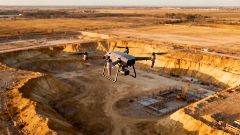
This is where drones come in, changing the game entirely. Instead of relying solely on boots on the ground, we can now use drones to get a bird’s-eye view, and much more. These flying gadgets can quickly cover vast areas, capturing high-resolution images and other data. This allows for a much more precise and proactive approach to managing vegetation near critical infrastructure. Think of it as upgrading from a paper map to a real-time GPS system for your entire power grid. By collecting detailed information, utilities can pinpoint exactly where the problems are and plan their work much more effectively. This shift towards data-driven insights is key to modernizing how we manage our power systems and can be seen in the work of companies providing advanced drone inspection services.
The old ways of managing vegetation around power lines are simply not keeping up with the demands of a modern grid and the increasing environmental pressures. A new strategy is needed, one that uses technology to see more, react faster, and plan smarter.
Leveraging Drone Technology For Smarter Utility Operations
The Growing Challenge Of Vegetation Encroachment
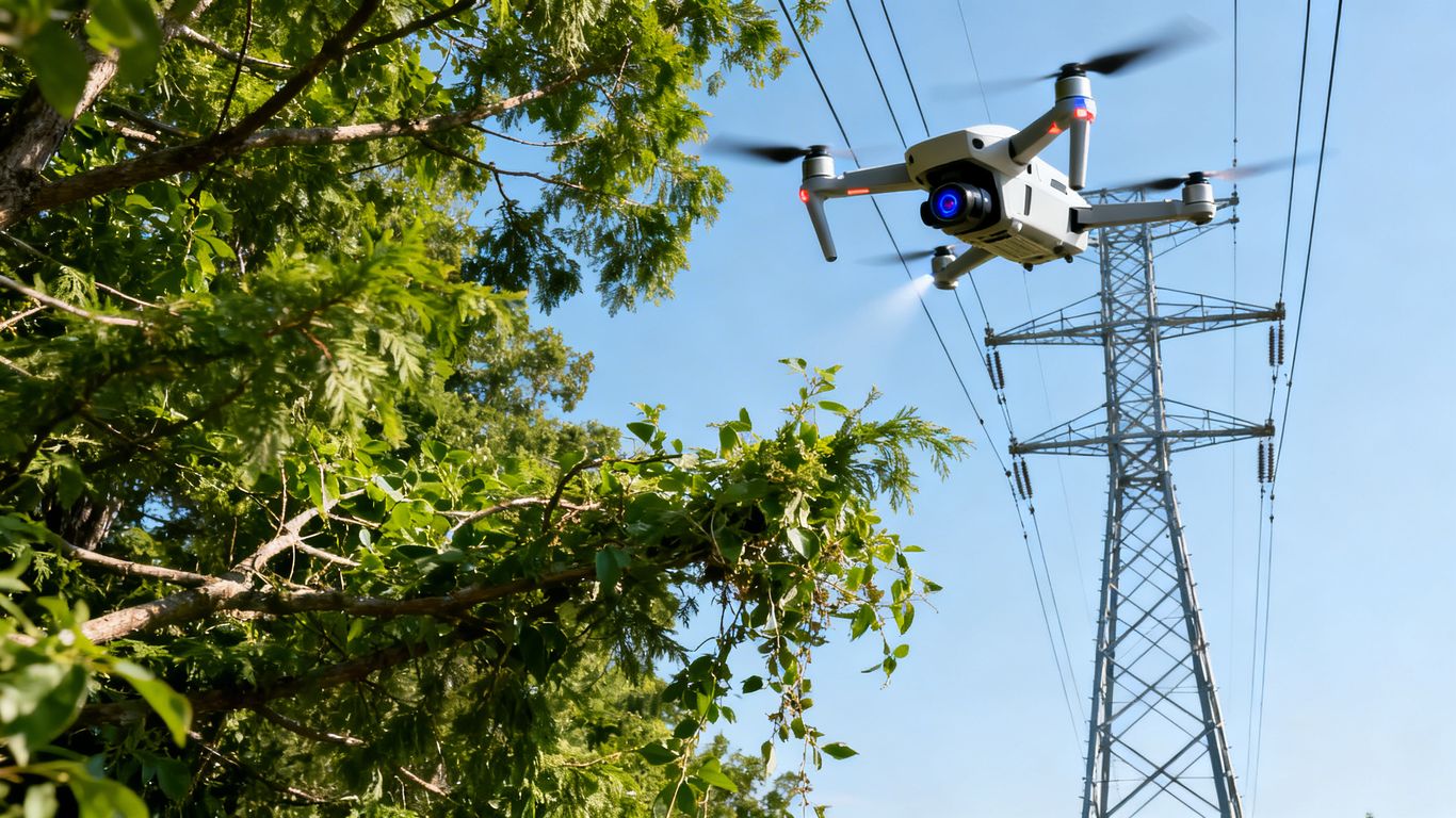
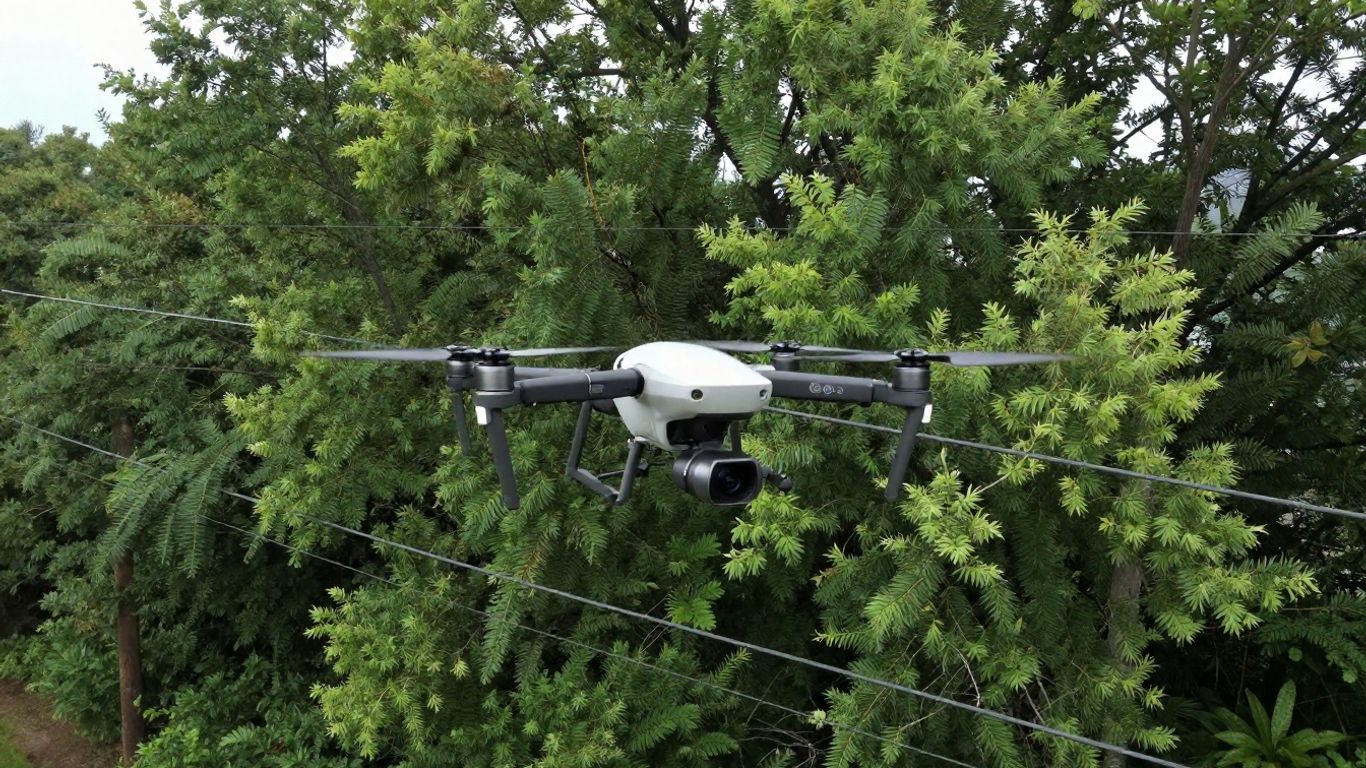
Dealing with vegetation that gets too close to power lines used to be a real headache. Think about it: crews had to drive or walk miles and miles, trying to spot every little branch that might cause trouble. It was slow, expensive, and honestly, pretty dangerous work. Plus, you never really knew if you’d caught everything. This is where drones really change the game. They can fly over vast areas quickly, giving us a bird’s-eye view that’s just impossible to get from the ground. This aerial perspective allows utilities to see the bigger picture and identify potential problems before they become actual issues. It’s like going from reading a book one word at a time to seeing the whole page at once. This shift means we can be way more efficient with our time and resources, focusing on the areas that actually need attention. It’s a smarter way to manage the constant battle against encroaching plants.
Inefficiencies Of Traditional Vegetation Management Methods
Traditional methods for managing vegetation around power lines often involved a lot of guesswork and manual labor. Crews would spend a lot of time on what we call "truck rolls" – driving out to inspect areas that, more often than not, didn’t even need trimming. This led to wasted time, fuel, and money. Imagine sending a team out to check on a section of line, only to find out there’s no immediate threat. It’s like going to the grocery store for one item and ending up wandering the aisles for an hour. This approach wasn’t just inefficient; it also meant that sometimes, critical issues might be missed because the sheer volume of work made thorough inspection difficult. We’re talking about a system that was reactive rather than proactive, often addressing problems only after they’d started to cause trouble. This is why looking into aerial imagery and AI analytics for vegetation management makes so much sense for utilities today.
The Promise Of Data-Driven Drone Technology
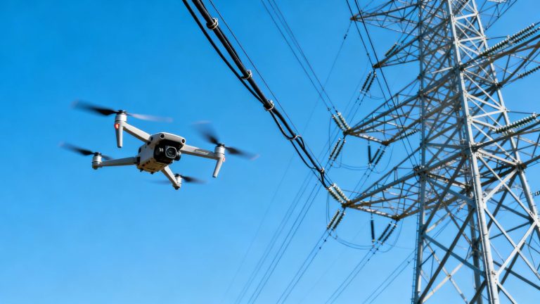
Drone technology, especially when paired with advanced sensors and software, offers a much more precise and data-driven approach. Instead of just looking, drones collect detailed information. Think high-resolution photos, videos, and even data from LiDAR sensors. This information can be processed to measure exact distances between vegetation and power lines, identify specific types of trees, and assess their growth rates. This means utilities can move from broad, often inaccurate, assessments to pinpointing exactly where and when trimming is needed. It’s about making informed decisions based on real, measurable data. This allows for better planning and prioritization, ensuring that maintenance efforts are focused where they’ll have the most impact. The ability to collect and analyze this kind of detailed data is what truly transforms vegetation management from a chore into a strategic operation. It helps utilities meet regulatory requirements and improve the reliability of their power grid.
Here’s a quick look at what drone data can help achieve:
- Precise Clearance Measurement: Accurately determine the distance between vegetation and power lines.
- Risk Prioritization: Identify areas with the highest risk of vegetation-related outages or fires.
- Optimized Scheduling: Plan trimming activities based on actual need and growth rates, not just guesswork.
- Detailed Record Keeping: Generate comprehensive reports for compliance and future planning.
The shift to drone-based inspections means utilities can finally get a clear, accurate picture of their infrastructure and the surrounding environment. This data isn’t just for show; it directly informs maintenance schedules, helps prevent costly outages, and improves overall grid safety. It’s about working smarter, not just harder, and using technology to make better decisions on the ground.
Optimizing Power Grid Asset Management With AI-Powered Drones
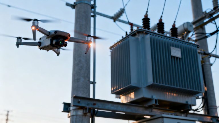
Rapid Identification Of Degrading Asset Conditions
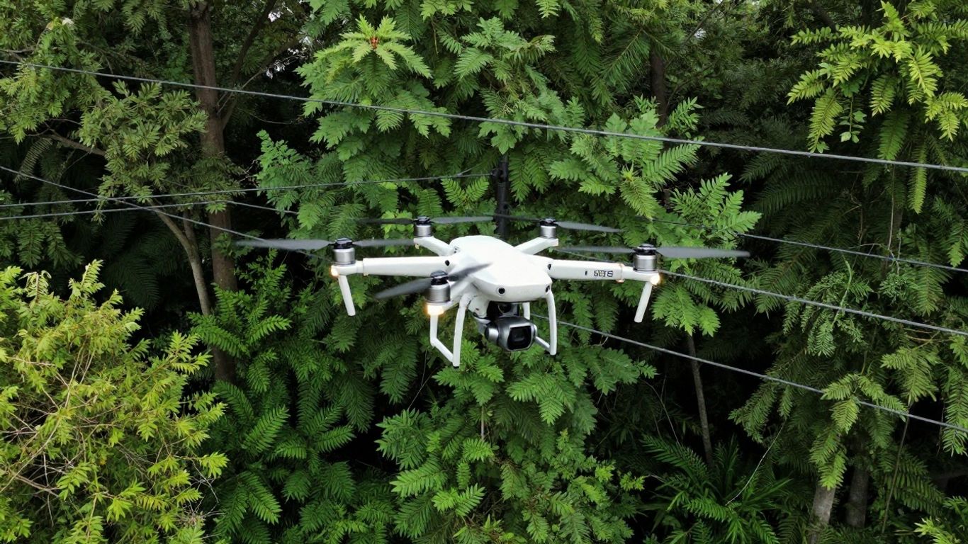
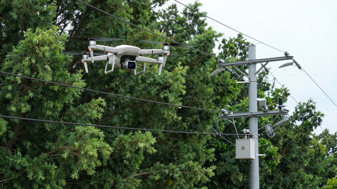
Keeping the power flowing means keeping an eye on everything, and that includes the stuff around the power lines. Think trees, branches, you name it. When they get too close or start looking a bit rough, it’s a problem waiting to happen. Traditional checks can be slow, and sometimes you just can’t see everything from the ground. That’s where drones really shine. They can zip around and get super close-up photos and data, way better than what a person could do on a ladder. AI can then look at all this information and flag down any issues, like a branch that’s way too close to a wire or a pole that looks like it’s seen better days. It’s like having a super-fast, super-detailed inspection crew that never gets tired.
Automating Trouble Ticketing And Dispatch For Faster Repairs
Once those AI drones spot a problem, the next step is getting it fixed, right? Instead of someone having to manually write up a report and send it off, the system can actually do a lot of that automatically. The drone data can feed right into a system that creates a work order, figures out who needs to go where, and gets them dispatched. This cuts down on the time it takes from spotting a problem to actually fixing it. Less waiting means fewer chances for an outage. It’s all about making the whole process smoother and quicker.
Predictive Asset Management Of Power Grid Assets
This is where things get really interesting. We’re not just talking about fixing problems after they pop up. By looking at the data drones collect – things like how fast vegetation is growing, the type of trees, and even weather patterns – we can start to guess what might happen in the future. Imagine knowing that a certain section of trees is likely to cause trouble in the next six months. That means you can plan your trimming crews way ahead of time, instead of just reacting when it’s almost too late. It’s about being smart and proactive with how we manage the grid, so we can keep the lights on more reliably.
- Data Points Collected: High-resolution imagery, LiDAR scans, thermal readings.
- Analysis Performed: Vegetation encroachment levels, asset condition assessment, growth rate prediction.
- Outcome: Prioritized maintenance schedules, reduced outage risks, optimized resource allocation.
Using AI with drone data helps us move from just reacting to problems to actually anticipating them. It’s a smarter way to keep the power grid running smoothly and safely for everyone.
Enhancing Vegetation Management Through Data Integration
So, we’ve talked about drones and AI, but how do we actually make all that information useful? It’s all about bringing different kinds of data together. Think of it like putting together a puzzle – each piece is important, but you don’t get the full picture until they’re all connected.
Utilizing LiDAR For Precise Clearance Distance Surveys
When we’re talking about keeping trees and power lines safe, knowing the exact distance is key. That’s where LiDAR comes in. It’s a laser-based system that can map out the environment with incredible accuracy. Drones equipped with LiDAR can fly over an area and create a 3D model, showing us exactly how close vegetation is to the lines. This isn’t just a rough estimate; it’s precise enough to tell us if a branch is inches away or feet away. This level of detail helps us figure out exactly which areas need trimming and how much needs to be cut, so we’re not doing unnecessary work.
Optimizing Inspections For Maximum Efficiency
Nobody wants to waste time or money, right? By combining data from different sources – like satellite imagery for a broad overview and LiDAR for detailed scans of problem areas – we can be way smarter about where we focus our efforts. Instead of inspecting every single mile of power line every year, we can use the data to pinpoint the spots that actually need a closer look. This means our crews spend less time driving around and more time doing the actual work that matters. It’s about working smarter, not just harder.
Pinpointing Vegetation Risks By Combining Data Sources
This is where it all comes together. Imagine you have satellite data showing areas where vegetation is growing fast. Then, you use drone-based LiDAR to get a super-detailed look at those specific spots. Maybe the satellite data shows a whole forest is getting dense, but the LiDAR reveals that only a few trees are actually close to the power lines. By putting these pieces together, we can create a really clear picture of the risks. We can even use AI to analyze all this combined data, flagging potential issues before they become real problems. This way, we can prevent outages and keep the power flowing reliably.
The real game-changer is when we stop looking at data in silos. When satellite, drone, and ground-level information are all integrated, we get a much clearer, more actionable view of vegetation risks. This allows for proactive management that saves money and keeps the lights on.
Here’s a quick look at how different data types help:
- Satellite Imagery: Good for seeing the big picture, tracking general growth patterns across large areas, and identifying potential problem zones from afar.
- LiDAR Data: Provides highly accurate 3D mapping, perfect for measuring exact distances between vegetation and power lines, and identifying specific branches that pose a threat.
- AI Analysis: Helps process all this information, spot trends, predict future growth, and prioritize areas needing immediate attention based on risk levels.
The Role Of Expert Drone Service Providers
Look, managing all the trees and bushes around power lines is a huge job. It’s not just about trimming; it’s about knowing what to trim, when to trim it, and making sure you’re not missing anything that could cause a problem later. This is where bringing in the pros, the drone service providers, really makes a difference. They’ve got the gear and the know-how to do this job right.
Collaborating With Experienced Drone Service Providers
Think about it: you need specialized drones, fancy cameras, and software to make sense of all the data. Plus, you need people who know how to fly these things safely and legally. Instead of trying to build all that yourself, which is a massive undertaking, you can team up with companies that already do this. They’ve been doing it for a while, so they know the ins and outs. They can help you set up a whole system for checking your lines with drones, process all the images and information, and then feed that back into how you manage your vegetation.
Addressing Societal, Economic, and Environmental Impacts
This vegetation stuff isn’t just a technical headache; it affects everyone. When trees fall on power lines, it causes outages, which messes with businesses and people’s lives. It can also spark wildfires, which is a huge environmental and safety risk. Drones help utilities get ahead of these problems. By using drone inspections, they can spot areas where trees are getting too close to power lines and trim them before they cause an outage or a fire. This means more reliable power for everyone and less risk of those scary wildfires. It’s about keeping communities safe and the economy running smoothly.
Filling Data Gaps With Combined Satellite and Drone Data
Now, drones are great for getting super-detailed looks at specific areas. But they can’t cover the entire power grid all the time. That’s where satellite images come in. By putting drone data and satellite data together, and then using AI to analyze it all, you get a much bigger picture. Satellite images show you the general trends of how vegetation is growing across a large area. Then, the AI can spot changes or areas that look a bit suspicious and flag them for a closer look with a drone or even a ground crew. This combination means you’re not missing anything important, and you can focus your efforts where they’re needed most. It’s like having a wide-angle view and a magnifying glass all at once, which is pretty handy for managing a vast network of power lines. This approach helps in pipeline inspection.
The real benefit of working with experienced drone providers is that they bring not just the technology, but also the practical knowledge of how to use it effectively in real-world utility settings. They understand the regulations, the environmental factors, and the specific challenges utilities face, allowing for a more tailored and successful implementation of drone services.
Key Technologies Driving Vegetation Management Innovation
So, what’s actually making all this new-fangled vegetation management possible? It’s a mix of cool tech that works together. We’re talking about stuff that can see things from way up high, figure out what it’s seeing, and then tell us exactly what needs doing.
Satellite Data for Comprehensive Coverage
Think of satellite data as the big picture. It gives us a broad view of everything, helping to spot general problem areas across huge stretches of land. It’s great for initial assessments and understanding the overall landscape. This kind of data is really useful for getting a handle on where the biggest issues might be before we even send anything else out. It helps utilities get a handle on their entire network without having to be everywhere at once. It’s a smart way to start planning your approach.
Machine Learning Algorithms for Risk Frameworks
This is where the ‘smart’ part really kicks in. Machine learning algorithms are like super-smart assistants that can sift through all the data we collect. They learn patterns and can predict where vegetation is likely to cause problems in the future. They help us move from just reacting to problems to actually anticipating them. This means we can focus our efforts on the areas that pose the greatest risk, saving time and money. It’s all about being proactive instead of reactive, which is a huge shift for utility operations. This technology is really changing how we think about grid maintenance and is a big part of AI in agribusiness and drones.
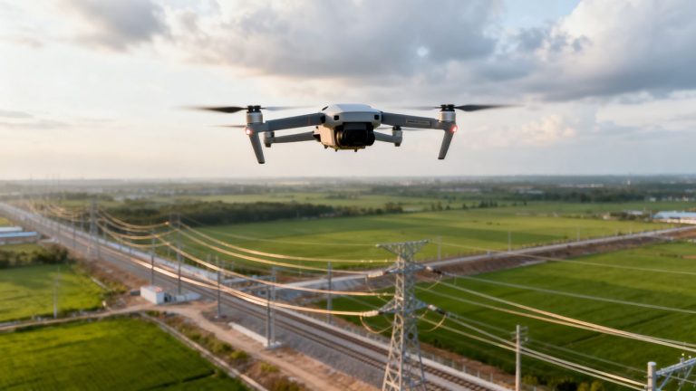
LiDAR and UAVs for Actionable Insights
Now, for the nitty-gritty details. Unmanned Aerial Vehicles, or UAVs (that’s drones to most of us), equipped with LiDAR sensors are game-changers. LiDAR uses lasers to create incredibly detailed 3D maps. When a drone flies over, it can measure the exact distance between power lines and tree branches with amazing accuracy. This lets us see precisely where vegetation is getting too close for comfort. Combining this detailed data from drone and robotics programs with the analysis from machine learning gives us clear, actionable steps. We know exactly which trees need trimming and by how much, making the whole process much more efficient and effective. This data can then be fed into a unified operations platform for maximum benefit, as seen in utility drone inspections.
The real magic happens when these different technologies talk to each other. Satellite data gives us the overview, machine learning helps us predict risks, and LiDAR on drones gives us the precise measurements we need to act. It’s this integration that truly revolutionizes how we manage vegetation around our power lines.
The Future of Grid Management is Here
So, we’ve talked a lot about how drones are changing the game for utility companies, especially when it comes to keeping trees and power lines in check. It’s pretty clear that using this tech isn’t just a fancy upgrade anymore; it’s becoming the smart way to do things. By getting a better look at what’s going on with drones, companies can spot problems early, save money, and most importantly, keep the lights on for everyone. It’s all about working smarter, not harder, and making sure our power systems are reliable for years to come.
Frequently Asked Questions
What exactly is vegetation management for power lines?
It’s like keeping the trees and bushes in check so they don’t get too close to the power lines. When plants grow too big, they can cause power outages or even start fires. Drones help us see where the plants are getting too close and where we need to trim them back to keep the electricity flowing safely.
Why are traditional ways of managing plants around power lines not working so well?
The old methods involve a lot of walking around and guessing, which takes a long time and can be inaccurate. Sometimes, people miss spots or can’t reach difficult areas. Plus, it’s expensive and not always done before a problem happens. It’s like trying to find a needle in a haystack without a good map.
How do drones help make vegetation management better?
Drones are like flying cameras that can get super close-up pictures and gather lots of information. They can fly over large areas quickly and see places that are hard for people to get to. This helps us find problems early and be more precise about where we need to do work.
What is a ‘digital twin’ and how does it relate to drones and power lines?
A digital twin is basically a virtual copy of the real power lines and the plants around them. Drones collect detailed information to build this copy. Then, we can use this virtual model to see how things are doing in real-time, predict problems, and plan our work much better, all without having to be there physically all the time.
Can drones help fix problems faster?
Yes! Drones can spot problems like overgrown plants or damaged equipment really quickly. The information they gather can be automatically sent to the right people, so repairs can be made much faster. This means fewer power outages for everyone.
What is LiDAR, and how is it used with drones for power lines?
LiDAR is a special tool on some drones that uses lasers to create very accurate 3D maps. It helps us measure exactly how much space there is between the power lines and the trees. This is important to make sure plants aren’t too close and don’t become a hazard.