Revolutionize Infrastructure Renovation with Drone 3D Modeling: A New Era of Precision
Fixing up old buildings and infrastructure is a big job. It used to take a lot of time and guesswork. Now, we’ve got drones that can fly around and take super detailed pictures and scans. This information gets turned into 3D models, which is a total game-changer for planning renovations. It’s like having a perfect digital copy of the real thing before you even start swinging a hammer.
Key Takeaways
- Drones with special cameras and lasers can capture very accurate 3D data of existing structures.
- This data is used to create detailed 3D models, which helps in planning renovations precisely.
- Using drone 3D modeling for infrastructure renovation saves time and money by reducing errors and rework.
- Drones make it safer to inspect hard-to-reach or dangerous areas of old buildings and infrastructure.
- This technology helps everyone involved in a project, from designers to builders, work together more effectively with accurate information.
Embracing the Digital Transformation in Infrastructure
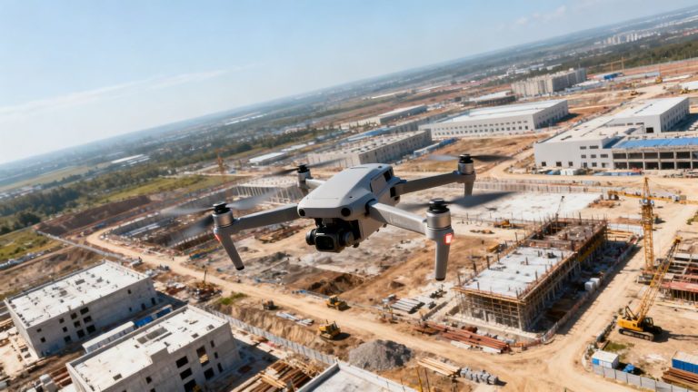
It feels like just yesterday we were relying on tape measures and clipboards for everything. Now, the whole construction and engineering world is shifting gears, moving towards a more digital way of doing things. It’s not just about having a computer anymore; it’s about using smart tools to get the job done better, faster, and safer. Think about it – the old methods for surveying and mapping sites could take ages and sometimes put people in tricky spots. That’s where things like drone surveying and the whole Scan to BIM process come into play. They’re changing how we look at projects from the ground up.
The Rise of Drone Surveying and Scan to BIM
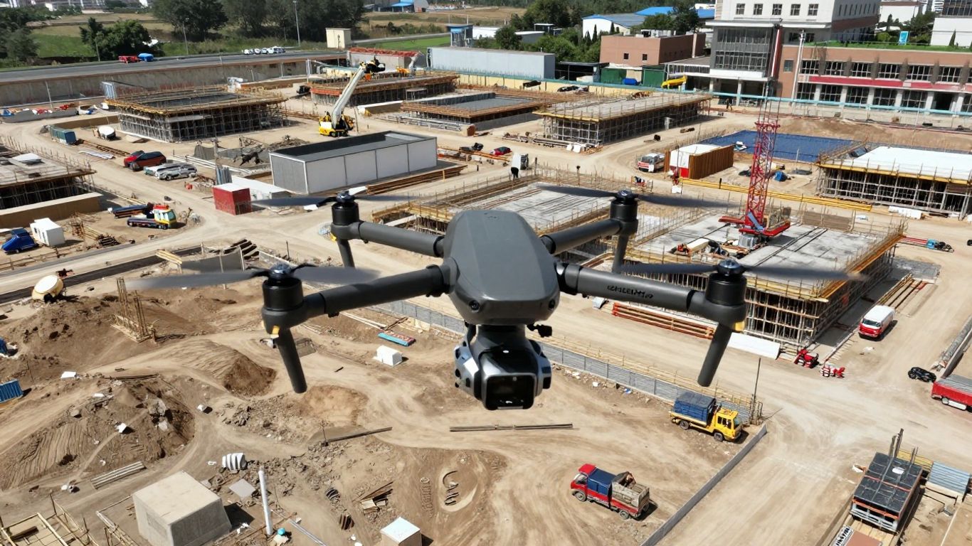
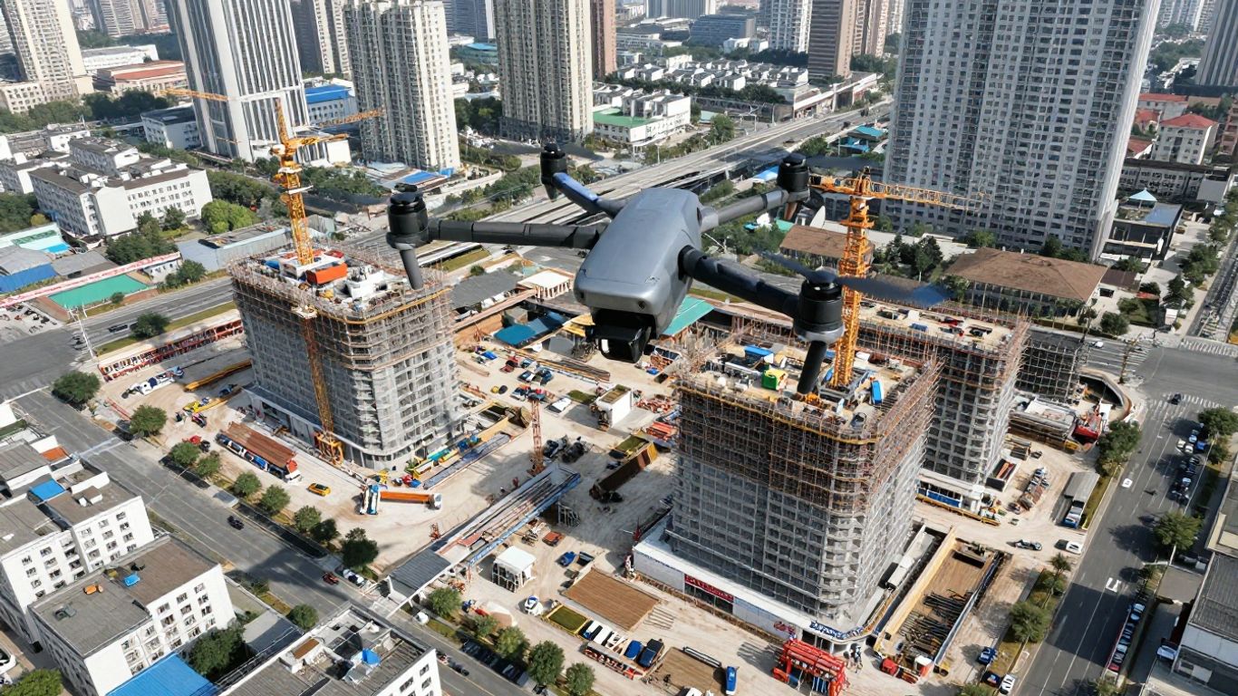
This is where things get really interesting. Drones, equipped with fancy cameras and sensors, are now flying over sites, collecting tons of data. This data then gets turned into detailed 3D models. It’s a huge step up from just looking at flat blueprints. When you combine this with Scan to BIM, you’re essentially taking a snapshot of the real world and building a digital replica that’s packed with information. This makes planning and managing renovations way more straightforward. It’s a big deal for anyone involved in infrastructure development.
Key Technologies Driving Innovation
So, what’s actually making this happen? A couple of technologies are leading the charge. You’ve got photogrammetry, which is basically stitching together a bunch of photos to create a 3D model. Then there’s LiDAR, which uses lasers to measure distances and create super-accurate point clouds. These aren’t just buzzwords; they’re the tools that let us capture reality with incredible detail. It’s pretty wild how much information you can get from a drone flying overhead.
A New Era for Construction and Engineering
Honestly, it feels like we’re entering a whole new chapter. The ability to get such precise data so quickly is a game-changer. It means fewer surprises on site and a much clearer picture of what needs to be done. This shift is making projects more predictable and less prone to costly errors. It’s about working smarter, not just harder, and that’s something everyone can get behind.
The move towards digital tools means we can get a much clearer picture of existing conditions before any work even begins. This upfront clarity helps avoid a lot of headaches down the line.
Here’s a quick look at what’s changing:
- Data Collection: Moving from manual measurements to automated drone scans.
- Modeling: Creating detailed 3D models from real-world data.
- Collaboration: Sharing precise digital information among teams.
- Planning: Using accurate site data for better project design.
This digital transformation isn’t just a trend; it’s becoming the standard way to approach complex projects, especially when you’re looking at renovations. It’s all about making sure we have the best possible information to make the best possible decisions, leading to more successful outcomes for everyone involved in construction site data collection.
Precision Data Capture with Drone 3D Modeling
How Drone Surveying Enhances Renovation Projects
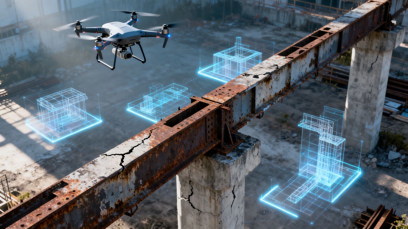
When you’re looking at renovating an existing structure, getting the details right from the start is super important. Old buildings, especially, can have all sorts of quirks that aren’t on any original plans. That’s where drone surveying really shines. Instead of just guessing or relying on outdated blueprints, drones equipped with advanced sensors can fly around and capture the actual, real-world condition of a site. This means you’re working with data that reflects exactly what’s there, down to the millimeter. It’s like having a perfect digital twin of the existing structure before you even lift a hammer.
Leveraging LiDAR and Photogrammetry
So, how do these drones actually get such detailed information? Two main technologies are usually involved: LiDAR and photogrammetry. LiDAR, which stands for Light Detection and Ranging, uses laser pulses to measure distances. It’s fantastic for creating highly accurate 3D point clouds, giving you precise measurements of shapes and distances, even in areas that are hard to reach. Photogrammetry, on the other hand, uses a bunch of overlapping high-resolution photos taken from the drone. Software then stitches these images together to create a 3D model. Think of it like putting together a super detailed jigsaw puzzle, but instead of a picture, you get a 3D representation of the building or site. Often, these two methods are used together, combining the strengths of both for the most complete picture possible.
Capturing Reality with Unprecedented Detail
What you end up with from drone 3D modeling is a level of detail that was pretty much impossible with older methods. We’re talking about capturing everything from the exact slope of a roof to the precise location of every pipe and conduit on a facade. This detailed data is then processed into a 3D model that architects and engineers can use. It’s not just a visual model; it’s packed with accurate measurements and spatial information. This allows for:
- Precise measurements of existing conditions.
- Identification of structural anomalies or damage.
- Detailed mapping of utilities and infrastructure.
- Creation of accurate as-built documentation.
This detailed capture process significantly reduces the guesswork involved in renovation planning. It means fewer surprises on site and a much clearer path from assessment to execution, making the whole renovation process smoother and more predictable.
Transforming Renovation Workflows with Scan to BIM
So, you’ve got an old building that needs a facelift, or maybe a whole system overhaul. How do you even start to get a handle on what’s really there? That’s where Scan to BIM comes in, and when you pair it with drone data, things get really interesting.
From Site Assessment to Project Planning
Forget spending days with tape measures and clipboards. Drones can zip around a site, capturing tons of data from angles you’d never reach easily. This aerial data, whether it’s from high-res cameras or LiDAR sensors, gives you a super detailed snapshot of the existing conditions. Think of it as getting a digital twin of the site before you even lift a hammer. This means you can start planning much faster and with a lot more confidence. It’s a big change from the old way of doing things, where site assessment could take ages and still miss key details.
Creating Intelligent 3D BIM Models
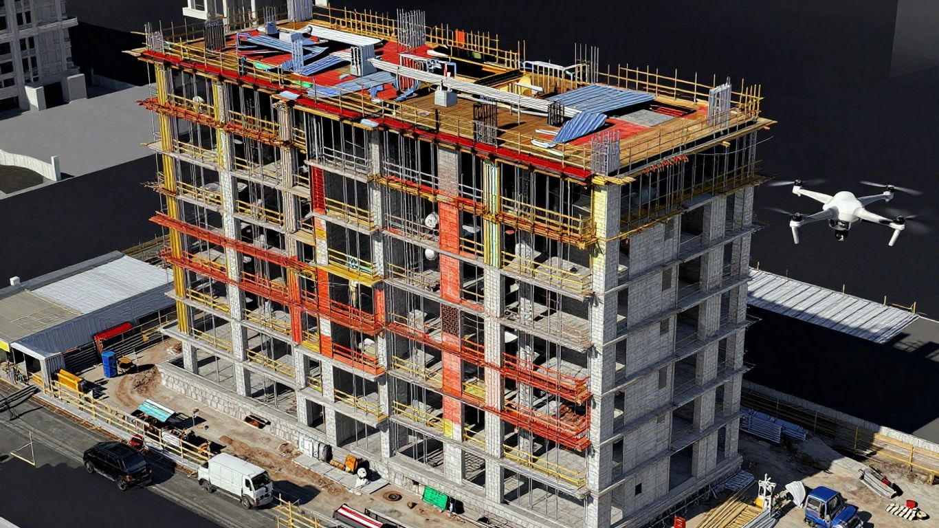
Once you have all that raw data from the drones, the next step is turning it into something useful: a Building Information Model (BIM). This isn’t just a 3D drawing; it’s a smart model packed with information about the structure, materials, and systems. For renovation, this is gold. You can see exactly how new designs will fit with what’s already there, spotting potential clashes early on. Companies like United BIM are experts at taking that scanned data and building these accurate BIM models, making the renovation process much smoother.
Integrating Real-World Conditions into Design
This is the really cool part. By using drone data to build your BIM model, you’re essentially bringing the real world directly into your design software. No more guesswork or assumptions based on outdated blueprints. You get a model that reflects reality, down to the millimeter. This accuracy helps in a bunch of ways:
- Fewer Mistakes: When you know exactly what you’re working with, you’re less likely to make costly errors during construction.
- Better Material Estimates: You can order just what you need, cutting down on waste and saving money.
- Clearer Communication: Everyone on the project, from the architect to the contractor, is looking at the same, accurate picture.
The ability to visualize existing conditions with such precision before any physical work begins drastically reduces the risk of surprises. It allows for more informed decisions and a more predictable project outcome.
This whole process, from flying the drone to having a detailed BIM model ready for renovation, is changing how we approach building upgrades. It’s about working smarter, not just harder, and making sure the final result is exactly what was intended. For complex projects, having this level of detail is a game-changer, and services like those offered by Scanpro are key to making it happen.
The Tangible Benefits of Drone 3D Modeling for Renovation
So, why exactly are folks in construction and engineering getting so excited about using drones for 3D modeling on renovation projects? It really boils down to a few big wins that make a real difference on the ground. We’re talking about getting things done faster, cheaper, and a whole lot safer.
Achieving Millimeter-Level Accuracy
Forget the days of guesswork. Drones equipped with advanced sensors can capture data with incredible precision. We’re talking about accuracy down to the millimeter. This means when you’re planning a renovation, you know exactly what you’re dealing with. No more surprises when a wall is opened up and it’s not quite where the old blueprints said it would be. This level of detail is a game-changer for planning and execution.
Significant Time and Cost Efficiencies
Traditional surveying methods can take ages. Sending crews out to measure every nook and cranny is slow and can rack up costs quickly. Drones, on the other hand, can survey a large site in a fraction of the time. Think hours instead of days. This speed translates directly into cost savings. Plus, with accurate data from the start, you cut down on rework and change orders, which are notorious budget killers. It’s about making smarter decisions early on, which pays off big time down the line. This advanced site analysis helps keep projects on track and within budget, which is always the goal. This technology saves time.
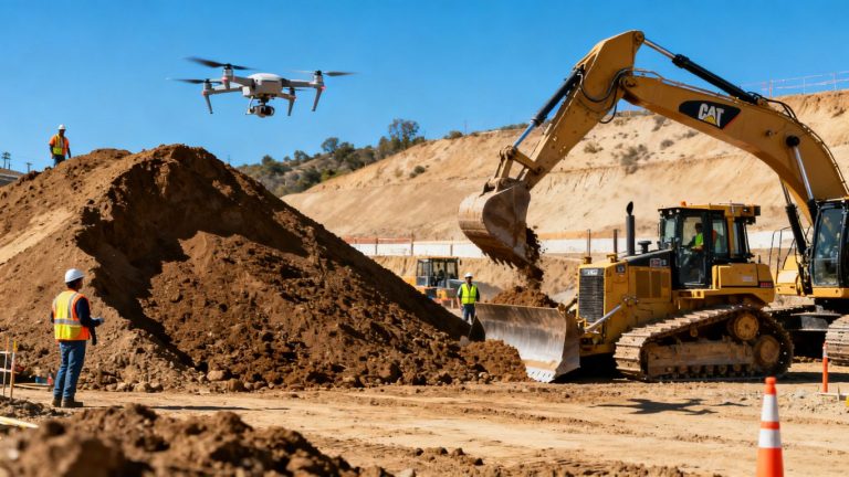
Enhancing Safety in Hazardous Environments
Let’s be honest, some renovation sites are just plain dangerous. Think unstable structures, hard-to-reach areas, or sites with active hazards. Sending people into these spots to take measurements is risky business. Drones can go where humans can’t, or shouldn’t, safely. They can capture all the necessary data without putting workers in harm’s way. This is a massive improvement for worker safety and peace of mind.
Fostering Seamless Collaboration
When everyone’s looking at the same, accurate 3D model, communication gets a whole lot easier. Architects, engineers, contractors, and even clients can see exactly what the project entails. This shared visual understanding helps iron out any potential issues before they become problems on site. It means fewer misunderstandings and a smoother project flow from start to finish. Having this kind of detailed 3D model makes it easier to plan and execute complex projects, improving overall project accuracy.
The ability to get such precise, real-world data quickly and safely is fundamentally changing how we approach renovations. It’s not just about having a fancy model; it’s about making better, more informed decisions throughout the entire project lifecycle, from the initial assessment right through to the final touches. This leads to fewer headaches and a better final product.
| Benefit Category | Traditional Methods | Drone 3D Modeling |
|---|---|---|
| Data Capture Time | Days/Weeks | Hours |
| Accuracy | Variable, prone to error | Millimeter-level |
| Safety Risk | High in hazardous areas | Low |
| Rework Potential | Significant | Minimized |
| Collaboration | Fragmented, prone to miscommunication | Unified, visual |
This shift towards drone-based 3D modeling isn’t just a trend; it’s a practical evolution that brings concrete advantages to the renovation world. It’s about working smarter, not just harder, and optimizing site analysis for better outcomes.
Expanding Horizons: Beyond Traditional Renovation
While drone 3D modeling and Scan to BIM are already making waves in standard renovation projects, their impact stretches much further. Think about historical buildings that need careful restoration, or complex city-wide utility networks. These are areas where the precision and detail offered by drone technology really shine, opening up new possibilities.
Applications in Heritage Preservation and Archaeology
Restoring old buildings or uncovering historical sites presents unique challenges. Traditional methods can be slow and sometimes invasive. Drones, however, can get up close to delicate structures without causing damage. They capture incredibly detailed 3D models of facades, intricate carvings, or even archaeological digs. This allows preservationists and archaeologists to study, document, and plan restoration work with a level of accuracy that was previously unimaginable. It’s like having a perfect digital copy of history to work with.
- Detailed Documentation: Capturing the exact state of historical artifacts or structures before any work begins.
- Non-Invasive Assessment: Surveying hard-to-reach or fragile areas without physical contact.
- Virtual Reconstruction: Creating digital models that can be used for planning repairs or even virtual tours.
The ability to create precise 3D models of heritage sites means we can preserve them digitally for future generations, even if the physical structures face damage or decay.
Optimizing Urban Infrastructure Management
Cities are complex systems, and managing their infrastructure – roads, bridges, utility lines – is a massive undertaking. Drone surveying provides a bird’s-eye view, quite literally, of these vast networks. By regularly mapping infrastructure with drones, city planners can identify issues like cracks in roads, failing drainage systems, or overgrown vegetation impacting power lines. This data can be fed into Geographic Information Systems (GIS) for better land development planning. It helps in prioritizing maintenance, planning upgrades, and responding to emergencies more effectively. Imagine knowing the exact condition of every bridge in your city at any given moment.
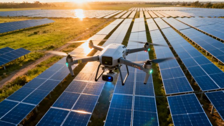
Advancements in Energy Sector Inspections
The energy sector, from power plants to wind farms and solar arrays, relies on extensive infrastructure that often operates in remote or hazardous locations. Drones equipped with specialized sensors can inspect turbines, solar panels, and transmission lines far more safely and quickly than human crews. They can detect defects, monitor performance, and identify potential failure points. This proactive approach reduces downtime, cuts maintenance costs, and significantly improves worker safety by keeping people out of dangerous situations.
| Inspection Area | Drone Technology Used | Key Benefit |
|---|---|---|
| Wind Turbines | Photogrammetry, LiDAR | Detect blade damage, structural integrity |
| Solar Panels | Thermal Imaging | Identify faulty cells, optimize energy output |
| Power Lines | LiDAR, Visual Cameras | Monitor vegetation encroachment, detect faults |
| Pipelines | Visual Cameras | Inspect for leaks, corrosion, or damage |
The Future of Infrastructure Renovation
AI and Machine Learning Integration
Artificial intelligence and machine learning are set to become even more integrated into how we plan and execute infrastructure renovations. Think about it: AI can analyze vast amounts of data from drone scans, identifying patterns and potential issues that a human eye might miss. This means we can predict maintenance needs before they become big problems, saving a ton of hassle and money down the line. It’s like having a super-smart assistant that’s constantly learning and improving.
The Role of Autonomous Drones
We’re already seeing drones do amazing things, but the future holds even more. Autonomous drones will be able to fly pre-programmed routes, collect data, and even perform basic inspections without constant human control. This frees up skilled professionals to focus on more complex tasks. Imagine a swarm of drones mapping a large bridge or a sprawling industrial complex, all coordinated and reporting back in real-time. This level of automation is a game-changer for efficiency and safety, especially in hard-to-reach or dangerous spots. Software that processes Lidar point clouds will become even more sophisticated, working hand-in-hand with these autonomous systems.
Augmented Reality for On-Site Visualization
This is where things get really cool. Augmented reality (AR) is going to change how we interact with renovation plans on the ground. Instead of looking at flat blueprints or even 3D models on a screen, workers will be able to use AR glasses or tablets to see the digital model overlaid onto the real-world site. This means you can instantly see where new pipes should go, how a renovated section will look, or identify potential clashes between different systems. It makes complex plans much easier to understand and execute correctly, reducing errors and speeding up the construction process. It’s like having a virtual blueprint that you can walk through.
The integration of these advanced technologies promises a future where infrastructure renovation is not just about fixing what’s broken, but about building smarter, more resilient, and more sustainable structures with unparalleled precision and efficiency.
Here’s a quick look at what’s coming:
- Predictive Maintenance: AI algorithms analyzing sensor data to forecast component failures.
- Automated Reporting: Drones and AI generating detailed inspection reports with minimal human input.
- Real-time Design Adjustments: AR and digital twins allowing for immediate modifications based on site conditions.
- Enhanced Safety Protocols: Autonomous systems monitoring work zones and identifying hazards proactively.
These advancements are paving the way for truly intelligent infrastructure management and renovation, making projects safer, faster, and more cost-effective. The development of drone digital twin services is a prime example of this evolution.
Wrapping It Up
So, we’ve seen how using drones for 3D modeling is really changing the game for fixing up our infrastructure. It’s not just about getting a fancy digital picture; it’s about being way more precise, saving time, and honestly, making things safer for everyone involved. This tech lets us see problems and plan fixes in a way that just wasn’t possible before. It feels like we’re entering a new phase where we can tackle these big renovation jobs with a lot more confidence and a lot less guesswork. It’s pretty cool stuff, and it’s definitely the direction things are heading.
Frequently Asked Questions
What exactly is drone 3D modeling for building renovations?
Imagine taking tons of pictures and using special scanners from a drone flying over a building. Then, we use computers to put all that information together to create a super-detailed 3D model of the building. It’s like building a digital copy of the real thing, which helps us plan renovations much better.
How is this better than old ways of measuring buildings?
Old ways took a long time and could be dangerous, especially for tall or tricky buildings. Drones can cover large areas quickly and safely from the air. This means we get more accurate information, faster, and without putting people in harm’s way.
What is ‘Scan to BIM’ and how does it work with drones?
‘Scan to BIM’ means taking a scan of a real place and turning it into a smart 3D model called a BIM. When we use drones for the scanning part, we get a very accurate digital copy of the building as it is. This digital copy then helps us build the BIM model, which is useful for planning and doing the renovation work.
Does this really save time and money?
Yes! Because the 3D models are so accurate, we can plan the renovation work perfectly from the start. This means fewer mistakes, less wasted material, and less need to redo work. Getting it right the first time saves a lot of time and money.
Can drones help make renovation sites safer?
Absolutely. Drones can fly into dangerous areas, like unstable structures or hard-to-reach spots, to collect data. This means workers don’t have to go into risky situations, making the whole renovation process much safer for everyone involved.
What kind of details can these drone models show?
These models are incredibly detailed, showing things down to the millimeter! This means we can see every crack, every pipe, and every surface precisely. It’s like having a perfect digital blueprint of the building before we even start the renovation.