Precision Power: Unlocking Solar Farm Potential with LiDAR Drone Surveying
Solar farms are getting bigger, and keeping them running smoothly is a real challenge. Traditional ways of checking on all those panels take a lot of time and can be risky. But there’s a new method using drones with special scanners, called LiDAR, that’s changing the game. This approach, known as LiDAR drone surveying for solar farms, gives us a super detailed look at everything, helping us catch problems early and keep the power flowing.
Key Takeaways
- LiDAR drone surveying for solar farms provides incredibly detailed data, creating precise digital models of the entire site.
- These digital models, or ‘digital twins,’ help managers see the real condition of solar assets and plan maintenance better.
- AI can analyze the data from drone surveys to automatically find issues like damaged panels or dirt buildup, helping with predictive maintenance.
- Using drones for inspections cuts down on labor costs, makes work safer, and speeds up the whole process, leading to better financial returns.
- Combining drone technology, AI, and data analysis helps make solar farms more efficient and sustainable in the long run.
Revolutionizing Solar Farm Management with LiDAR Drone Surveying
The Evolving Landscape of Solar Energy
The solar energy sector is growing fast. Every year, more solar farms pop up, helping us move towards cleaner power. But managing these big farms isn’t always easy. They cover a lot of ground, and keeping tabs on every single panel and piece of equipment can be a real headache. It’s a bit like trying to find a needle in a haystack, but the haystack is miles wide.
Challenges in Traditional Solar Farm Inspections
Think about how solar farms used to be checked. Mostly, it was people walking around, looking at panels, maybe using a handheld thermal camera. This takes ages, especially for huge farms. Plus, people can miss things, or it can be dangerous if there’s faulty equipment. Relying just on the data from the inverters gives you a general idea, but it doesn’t tell you exactly what’s wrong with a specific panel. It’s slow, costly, and not always accurate enough.
Introducing LiDAR Drone Surveying for Solar Farms
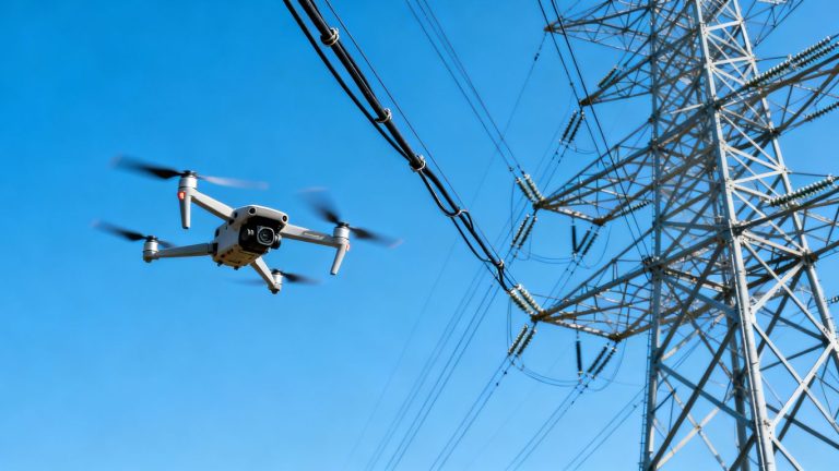
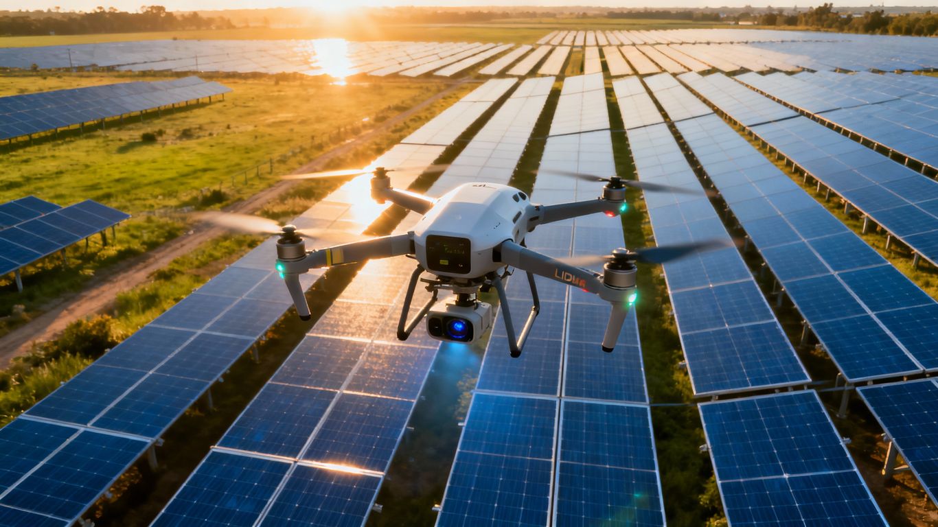
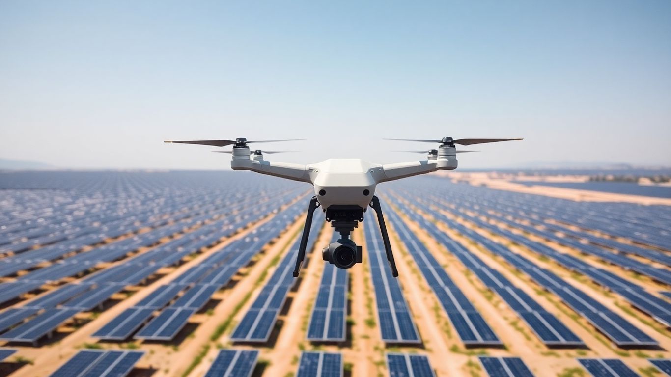
This is where things get interesting. We’re now using drones equipped with LiDAR technology to survey solar farms. LiDAR, which stands for Light Detection and Ranging, uses lasers to create incredibly detailed 3D maps of the farm. This technology lets us see things we couldn’t before, with amazing precision. It’s a game-changer for how we manage and maintain these vital energy sources. Instead of slow, manual checks, we can get a complete, detailed picture of the entire farm quickly and safely from the air. It’s like upgrading from a blurry old photo to a high-definition video.
Capturing Unprecedented Detail with LiDAR Technology
So, how do we get all this super-detailed information about a solar farm? It’s not just about snapping a few pictures from a plane anymore. We’re talking about using some pretty advanced tech, and LiDAR drone surveying is at the forefront. This isn’t your average camera; LiDAR uses lasers to map things out with incredible accuracy.
Understanding LiDAR Point Cloud Data
Imagine a giant cloud of tiny dots, where each dot represents a point in space measured by a laser. That’s basically a LiDAR point cloud. The drone sends out laser pulses, and when they bounce back, it records the time it took and the direction. This gives us precise measurements of everything the laser hits – the solar panels, the ground, the mounting structures, even nearby vegetation. This creates a 3D map with centimeter-level accuracy. It’s like having a digital blueprint of the entire solar farm, down to the smallest detail. This data is what allows for accurate surveying and GIS applications.
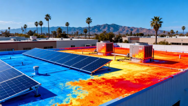
High-Resolution Imaging and Sensor Capabilities
While LiDAR gives us the shape and structure, we also need to see the surface details. That’s where the high-resolution cameras and other sensors on the drone come in. They capture detailed images of the panels, wiring, and other components. Think of it as getting a super sharp photograph of every single part. Combined with LiDAR, this gives us a complete picture – the structure from the lasers and the visual condition from the cameras. This dual approach means we don’t miss anything, from a tiny crack on a panel to a loose connection.
Creating Accurate Digital Twins of Solar Assets
Now, what do we do with all this data? We use it to build a digital twin. This is a virtual replica of the physical solar farm. It’s not just a 3D model; it’s a living, breathing digital version that contains all the information gathered by the drone. This includes:
- Precise location and orientation of each solar panel.
- Details about the mounting structures and their condition.
- Information on inverters and other electrical components.
- Topographical data of the site.
This digital representation is built from the ground up using the detailed measurements from LiDAR and the visual data from cameras. It’s a powerful tool for understanding the farm’s current state and planning for the future.
By processing this drone data with specialized software, we can create a digital twin that shows the performance and health of every single component. This virtual model is key to identifying issues before they become big problems and helps in planning maintenance effectively.
Leveraging Digital Twins for Enhanced Operations
Benefits for Solar Stakeholders
So, you’ve got this super detailed 3D map of your solar farm, right? That’s basically what a digital twin is. It’s like having a virtual copy of everything, from the panels themselves to the wires and the ground they sit on. This isn’t just for show, though. It actually helps a lot of different people involved with the solar farm.
- Investors: They can see exactly how their money is performing. Is the farm running well? Are there any hidden problems that could cost them later? The digital twin gives them the data to make smart choices.
- Farm Managers: They get a clear picture of the farm’s health. They can spot issues early, figure out the best way to fix them, and plan maintenance without guessing.
- Maintenance Crews: Instead of driving out to every single panel, they can use the digital twin to pinpoint exactly where a problem is. This saves a ton of time and makes their job safer.
This virtual model allows for data-driven decisions, helping everyone involved understand the farm’s status and potential for improvement.
Linking Physical and Digital Realms
What makes a digital twin really powerful is how it connects to the real solar farm. It’s not just a static picture. Think of it like this: sensors on the actual solar panels are constantly sending information back to the digital twin. This means the virtual model is always up-to-date with what’s happening in the real world.
This constant flow of information allows for:
- Real-time Performance Monitoring: See how much power each section is generating right now.
- Condition Tracking: Monitor the wear and tear on components over time.
- Environmental Impact Assessment: Understand how weather conditions are affecting output.
It’s like having a live dashboard for your entire solar operation, all in one place.
Real-Time Updates and Maintenance Planning
Because the digital twin is linked to the actual farm, it gets updated automatically. If a panel starts underperforming or a connection gets loose, the digital twin reflects that change. This is a game-changer for planning maintenance.
Instead of waiting for a scheduled inspection or for a problem to become obvious, you can see issues developing in the digital twin. This allows for:
- Proactive Repairs: Fix small problems before they turn into big, expensive ones.
- Optimized Scheduling: Plan maintenance visits when they are most needed, not just when a calendar says so.
- Resource Management: Make sure you have the right parts and people ready before heading out to the site.
This continuous feedback loop means the digital twin isn’t just a snapshot; it’s a living, breathing representation of the solar farm that evolves alongside it. This dynamic connection is key to keeping the farm running at its best and preventing unexpected downtime.
AI-Powered Analysis for Predictive Maintenance
Automated Defect Detection with AI Algorithms
Think about it like this: instead of waiting for a panel to break or a whole section to stop working, we can now use smart drones and AI to spot problems before they get bad. It’s a big change from the old way of just checking things when they seemed off. These drones fly over the solar farm, taking tons of pictures and thermal readings. Then, AI software looks at all that data. It’s like having a super-powered inspector that never gets tired and sees things humans might miss.
Identifying Hotspots and Physical Damage
One of the coolest things AI can do is find "hotspots." These are areas on a solar panel that are getting too hot, which usually means something isn’t working right and it could get worse. The AI can spot these from the thermal images the drone takes. It can also find physical problems like tiny cracks in the panels that you wouldn’t see just by looking. It’s pretty neat how it can pick out these small issues.
Here’s a quick look at what the AI can flag:
- Hotspots: Areas with unusual heat signatures.
- Cracks: Small fractures in the panel glass or cells.
- Loose Connections: Signs of electrical issues that might show up as heat.
- Debris: Buildup on panels that reduces their output.
Monitoring Soiling and Vegetation Encroachment
Beyond just panel damage, AI drone analysis also helps keep an eye on things that affect how much power the farm makes. It can tell if panels are getting really dirty from dust or bird droppings, and how much that’s hurting their performance. It can also spot when plants or trees are growing too close and might start shading the panels. This means we can schedule cleaning or trimming before it really impacts the energy production.
This shift to predictive maintenance means we’re not just fixing things when they break. We’re using data to guess what might go wrong and fixing it early. This saves money, keeps the farm running smoothly, and is just a smarter way to manage these big energy projects. It’s all about being proactive instead of reactive.
Maximizing ROI Through Efficient Inspections
Reducing Labor and Maintenance Costs
Think about how much time and money it takes to walk around a huge solar farm, looking at every single panel. It’s a lot. Traditional methods mean sending out teams, often with specialized gear, to do visual checks or use handheld thermal cameras. This takes ages and costs a bundle in wages and travel. LiDAR drone surveying drastically cuts down on this by covering vast areas quickly and safely from the air. Instead of a week-long ground inspection, a drone can map the entire site in a day or two. This means fewer people on site for shorter periods, directly lowering labor expenses. Plus, by spotting issues early, you avoid costly emergency repairs that can happen when problems are left to get worse.
Increasing Operational Safety
Working on a solar farm can be risky. You’ve got electrical equipment, sometimes uneven terrain, and large structures. Sending people out to inspect panels up close, especially if there’s a suspected fault, puts them in harm’s way. Drones change this game. They let us get a bird’s-eye view and detailed scans without anyone needing to climb ladders or get near potentially dangerous equipment. This keeps your maintenance crews out of harm’s way, reducing the chance of accidents and the associated costs like insurance claims or lost workdays.
Automating Inspection Processes for Efficiency
Manual inspections are slow and repetitive. You’re looking for the same kinds of problems over and over. LiDAR drones, combined with smart software, can automate much of this. You can plan flight paths, and the drone follows them precisely, capturing data consistently every time. This makes it easier to compare data from one inspection to the next, spotting changes over time. The real win here is how this automation speeds things up and makes the whole process more predictable. It’s not just about doing things faster; it’s about doing them more reliably and getting better data to make smarter decisions about when and where maintenance is actually needed.
The shift from manual, ground-based checks to automated aerial surveys using LiDAR isn’t just a tech upgrade; it’s a fundamental change in how solar farms are managed. It moves operations from reactive problem-solving to proactive, data-informed maintenance, which is key to keeping energy production high and costs low over the long haul.
The Future of Solar Farm Optimization
Synergies Across Industries
Think about it: the tech we’re using for solar farms isn’t just a one-trick pony. The same LiDAR drones and AI analysis that spot a cracked solar panel can also check the health of a forest, map out infrastructure for a city, or even help farmers monitor their crops. This cross-pollination of technology means faster improvements and lower costs for everyone. As these tools get better and cheaper, we’ll see them pop up in more and more places, making all sorts of operations smarter and more efficient.
The Role of Edge Computing in Drone Monitoring
Right now, a lot of the heavy lifting for AI analysis happens back at a central server. But what if the drone could do more of that analysis right there, on the spot? That’s where edge computing comes in. Instead of sending tons of raw data back, the drone processes it itself, identifying issues in real-time. This means faster alerts – like spotting a panel overheating before it causes a major problem – and less data to transmit, which is a big deal when you’re out in the middle of nowhere.
Here’s a quick look at how edge computing changes things:
- Faster Decision-Making: Immediate analysis means quicker responses to issues.
- Reduced Data Transmission: Less bandwidth needed, saving costs and improving reliability.
- Enhanced Security: Sensitive data stays on the drone or is processed locally.
- Offline Operation: Drones can still function effectively even with spotty internet.
Driving Sustainability Through Data-Driven Decisions
Ultimately, all this advanced tech is about making solar power even better for the planet. By keeping solar farms running at peak performance, we get more clean energy without needing more land. Plus, extending the life of panels and reducing the need for replacements cuts down on waste. It’s not just about generating electricity; it’s about doing it in the most responsible way possible. This focus on efficiency and longevity is key to solar energy’s role in a sustainable future.
We’re moving beyond just installing panels. The future is about smart, data-informed management that squeezes every bit of clean energy out of existing infrastructure while minimizing our environmental impact. It’s about making solar farms not just power generators, but also good neighbors to the environment around them.
Looking Ahead
So, we’ve seen how using drones with LiDAR can really change the game for solar farms. It’s not just about getting a picture anymore; it’s about creating a detailed digital copy, a ‘digital twin’, that helps keep everything running smoothly. This means fewer problems, less downtime, and ultimately, more power being generated. As this tech gets better and cheaper, it’s going to be a standard way to manage these big energy projects. It’s a smart move for anyone involved in solar to look into how these drone surveys can help them get the most out of their solar farm.
Frequently Asked Questions
What exactly is LiDAR drone surveying?
LiDAR drone surveying uses a special laser scanner on a drone to create a super detailed 3D map of a solar farm. Think of it like using a laser to measure everything precisely, giving us a very accurate picture of all the solar panels and equipment.
How does this help manage solar farms better?
It helps by creating a digital copy, or ‘digital twin,’ of the entire solar farm. This twin shows exactly how everything is doing, so we can spot problems early, plan repairs, and make sure the farm is working as well as it can.
Can AI really find problems on solar panels automatically?
Yes! AI can look at the data from the drone surveys and automatically find things like hot spots on panels, cracks, or even if plants are growing too close and blocking the sun. It’s like having a super-smart assistant checking everything.
How does this save money and improve safety?
Instead of people climbing around on panels, drones do the dangerous work from a safe distance. This means fewer workers are needed for inspections, saving money on labor and reducing the risk of accidents.
What is a ‘digital twin’ in this context?
A digital twin is a virtual replica of the physical solar farm. It’s built using the data from drone surveys and includes all the important details about the panels, structures, and equipment. It’s a living model that can be updated.
Is this technology only for big solar farms?
While it’s very useful for large solar farms, the technology can also help smaller ones. The goal is to make inspections more efficient and effective, no matter the size of the solar energy setup.