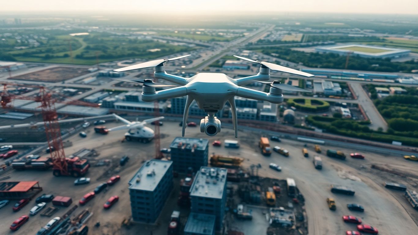
Elevating Your Projects: The Power of Commercial Drone Photography for Construction Progress
You know, thinking about construction projects, it’s easy to get bogged down in the details on the ground. But what if you could step back and see the whole picture? That’s where commercial drone photography for construction progress really shines. It’s not just about cool aerial shots; it’s about getting a better view of what’s happening, spotting problems before they get big, and keeping everyone in the loop. This kind of tech is changing how we build things, making it safer, faster, and frankly, a lot smarter. Let’s look at how getting up in the air can make a real difference for your next project.
Key Takeaways
- Getting a bird’s-eye view helps with planning and seeing the whole project site clearly.
- Drones make it simple to check on how work is progressing regularly and spot issues early.
- Using drones means fewer people need to go into dangerous spots, making work safer.
- Accurate aerial data helps avoid wasting materials and prevents costly mistakes or delays.
- Good aerial photos and videos help show off the project’s scale and progress to clients and the public.
Unlocking Project Potential with Aerial Perspectives
Comprehensive Site Overviews for Enhanced Planning
Think about trying to understand a big construction project just by walking around on the ground. It’s tough, right? You can only see so much from one spot. That’s where getting up in the air changes everything. Drone photography gives you a complete picture of the entire site, all at once. It’s like having a map that shows you exactly where everything is in relation to everything else. This makes planning so much easier because you can spot potential issues or figure out the best way to move equipment before you even start digging.
- See the whole site layout clearly.
- Understand how different parts of the project fit together.
- Identify access points and potential bottlenecks early.
Visualizing Project Scope and Spatial Relationships
When you’re looking at a project from above, you get a real sense of its scale. You can see how big the building footprint is, how far the roads will extend, or how much land is being prepped. This bird’s-eye view helps everyone involved, from the architects to the construction crew, grasp the full scope of what needs to be done. It’s not just about looking pretty; it’s about making sure everyone’s on the same page regarding the project’s size and how different elements interact. This clarity helps prevent misunderstandings down the line.
Getting a clear view of the entire project area from the start helps teams make better decisions about resource allocation and site logistics. It’s about seeing the forest and the trees.
The Power of Bird’s-Eye Views in Construction
Honestly, looking at a construction site from the sky is a game-changer. It provides a perspective that ground-level views just can’t match. You can track progress over time, see how materials are being staged, and even spot safety hazards that might be missed by someone walking the site. This kind of overview helps project managers stay on top of things, making sure the project stays on track and within budget. It’s about having the best possible information to make smart choices throughout the construction process.
Transforming Construction Monitoring with Drones
Keeping tabs on a construction project from the ground can be tough. You’re always moving, trying to see everything, and sometimes you just miss stuff. That’s where drones really change the game. They give you a consistent, high-level look at what’s happening, making it way easier to stay on track.
Real-Time Progress Tracking and Timeline Adherence
Imagine getting a clear picture of your site every day, or even multiple times a day. Drones can do that. They capture images and video that show exactly where things stand. This isn’t just about pretty pictures; it’s about hard data. Project managers can see if work is happening as planned, if materials are arriving on time, and if any part of the project is falling behind schedule. This constant stream of visual information is key to keeping everything moving forward and hitting those important deadlines.
- Daily Site Snapshots: Regular flights provide a clear visual record of daily activities.
- Milestone Verification: Easily confirm when key project phases are completed.
- Resource Placement: See if equipment and materials are where they need to be.
Early Identification of Potential Delays and Issues
Because drones give you that bird’s-eye view, you can spot problems before they become big headaches. Maybe a certain area is getting too crowded with equipment, or perhaps a delivery is stuck somewhere it shouldn’t be. Seeing these things early means you can fix them quickly, often before they cause significant delays or cost extra money. It’s like having an extra set of eyes that can see the whole picture at once.
Spotting a minor issue from the air can prevent a major setback that might have gone unnoticed until it was too late to fix without impacting the schedule or budget.
Facilitating Remote Oversight and Stakeholder Alignment
Not everyone involved in a project can be on-site every day. That’s where drone footage becomes super useful. You can share these aerial updates with clients, investors, or team members who are working remotely. It keeps everyone on the same page, no matter where they are. This transparency builds trust and makes communication smoother. It means fewer meetings trying to explain what’s happening and more time actually getting work done.
| Stakeholder Type | Benefit of Drone Monitoring |
|---|---|
| Clients | Clear view of progress, builds confidence |
| Investors | Visual proof of project advancement |
| Remote Teams | Keeps everyone informed and aligned |
| Project Managers | Quick assessment of site status |
Elevating Safety Standards Through Drone Technology
Minimizing Personnel Exposure in Hazardous Areas
Construction sites can be tricky places, right? Lots of moving parts, uneven ground, and sometimes, areas that are just plain dangerous to get to. Think steep slopes, unstable structures, or areas with active heavy machinery. Sending people into these spots to check things out can be risky. Drones change that game. They can fly right into these tricky zones, giving us a clear look without putting anyone in harm’s way. This means fewer chances for falls, fewer close calls with equipment, and generally a safer environment for the crew.
Proactive Hazard Identification and Risk Assessment
Instead of just reacting to problems, drones let us spot them before they become big issues. Regular flights over the site mean we can catch things like unsecured scaffolding, potential trip hazards, or areas where erosion might be starting. This visual information is gold for safety managers. They can use it to update risk assessments and put preventative measures in place. It’s like having an extra set of eyes, always watching, always looking for what might go wrong.
Here’s a quick look at how drone inspections help:
- Identify Unsafe Conditions: Spotting things like missing guardrails or improper material storage.
- Monitor High-Risk Zones: Checking on areas that are difficult or dangerous for people to access regularly.
- Document Safety Compliance: Providing visual proof that safety protocols are being followed.
Using drones for safety checks isn’t just about avoiding accidents; it’s about building a culture where safety is considered from the start, not as an afterthought. This proactive approach saves time, money, and most importantly, protects the people working on the project.
Reducing On-Site Accidents and Enhancing Worker Protection
Ultimately, all these safety measures boil down to one thing: fewer accidents. When we can inspect dangerous areas remotely and identify hazards before anyone gets hurt, we’re making the job site better for everyone. This not only protects workers from injury but also helps keep the project on schedule. Fewer accidents mean less downtime, fewer investigations, and a more productive work environment. It’s a win-win for safety and for the project’s bottom line.
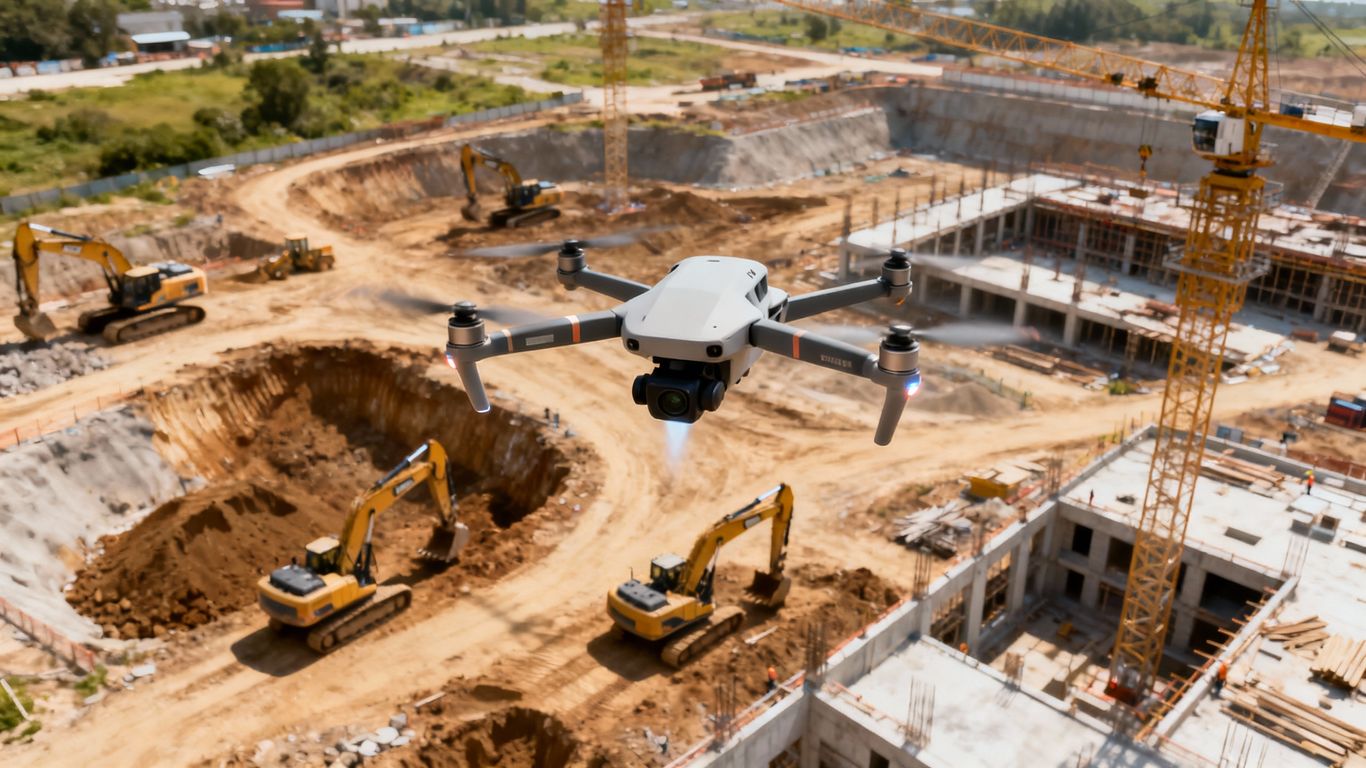
Driving Efficiency and Cost Savings in Construction
Let’s talk about how using drones on your construction sites can actually save you money and make things run smoother. It’s not just about cool aerial shots; it’s about smart business. Accurate data from above means fewer surprises and less wasted effort.
Minimizing Resource Wastage with Accurate Data
Think about ordering materials. If you’re guessing based on ground-level views, you might order too much or too little. Drones give you a precise look at what’s actually been done and what’s needed. This means you’re not paying for extra concrete you don’t need or facing delays because you ran out of rebar.
Here’s a quick look at how this plays out:
- Precise Material Estimation: Get exact measurements of stockpiles and completed work.
- Optimized Site Layout: Plan where materials and equipment should go to avoid unnecessary movement.
- Reduced Over-ordering: Avoid the cost of buying surplus materials that might go unused or degrade.
The ability to see the entire site clearly from above helps in making better decisions about resource allocation. It’s like having a perfect map that shows you exactly where everything stands, preventing costly mistakes before they happen.
Reducing Rework and Project Delays
One of the biggest drains on a construction budget is rework – fixing something that was done wrong the first time. Drones help catch these issues early. Regular aerial checks mean you can spot a misplaced wall or an incorrectly installed pipe before it gets covered up and becomes a major headache (and expense) to fix.
- Early Issue Detection: Spotting deviations from plans before they become major problems.
- Quality Control: Verifying that work is being done according to specifications.
- Streamlined Inspections: Faster, more thorough checks of completed work.
This proactive approach keeps the project on schedule. Delays cost money, not just in labor but in extended equipment rentals and potential penalties. By keeping things on track, drones contribute directly to the bottom line.
The Financial Benefits of Aerial Photography
When you add it all up, the financial advantages are clear. You’re cutting down on waste, reducing the chances of expensive rework, and keeping the project moving forward on time. This translates directly into better profit margins and happier clients. It’s an investment that pays for itself by making the entire construction process more efficient and less prone to costly errors.
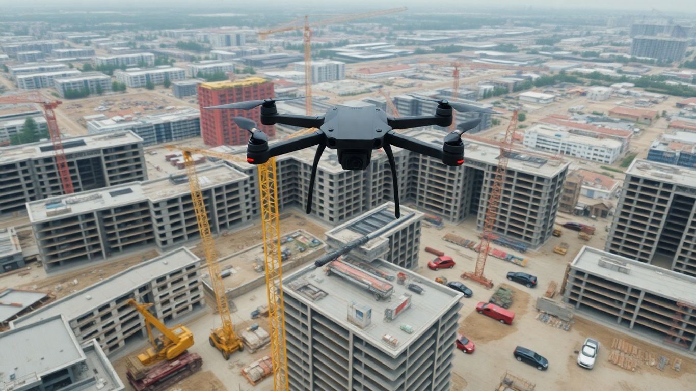
Leveraging Commercial Drone Photography for Marketing
Okay, so you’ve got this amazing construction project going on, right? You want people to see it, to get excited about it. That’s where drone photography really shines, especially when you’re trying to sell or promote what you’re building. It’s not just about pretty pictures; it’s about telling a story from a perspective that ground-level shots just can’t match.
Showcasing Scale and Progress with High-Quality Imagery
Think about it. A buyer or investor looking at a piece of land or a building under construction. A drone shot gives them the whole picture, instantly. You can see how the project fits into the neighborhood, the sheer size of it, and how much work has already been done. This kind of visual information helps people imagine the finished product and understand the investment’s potential much better. It turns a flat listing into something dynamic.
- Impress potential buyers: High-resolution images and videos make properties look more appealing and professional.
- Demonstrate project momentum: Time-lapse sequences show progress over weeks or months, proving the project is on track.
- Highlight unique features: Aerial views can showcase landscaping, access points, or surrounding amenities that might be missed from the ground.
Enhancing Transparency and Stakeholder Communication
Keeping everyone in the loop can be tough, especially on big projects. Drone photos and videos are fantastic for this. You can send updates to clients, investors, or even your own team members who might be working remotely. It’s a clear, undeniable way to show exactly what’s happening on site.
Regular aerial updates provide a consistent and objective record of project development. This visual documentation builds trust and keeps all parties aligned, reducing the need for constant in-person meetings and clarifying any potential misunderstandings about the project’s status.
Boosting Online Engagement for Listings
Let’s be real, people scroll through a lot of stuff online. Listings with great aerial photos just grab more attention. Studies show that properties with drone imagery get way more clicks and interest. It makes your listing stand out from the crowd and can even speed up the sales process.
- Increased website traffic: Listings with aerial photos often see a significant jump in views.
- Better social media performance: Engaging aerial content gets shared more, reaching a wider audience.
- Faster sales cycles: Potential buyers feel more informed and confident, leading to quicker decisions.
Technical Considerations for Optimal Aerial Imaging
Getting the best shots from your drone isn’t just about pointing and shooting. There are a few things to keep in mind to make sure the images you get are actually useful for your construction project.
Understanding Lighting Conditions for Clarity
Lighting plays a huge role in how clear and detailed your aerial photos will be. The time of day can drastically change how shadows fall and how well you can see different parts of the site. Early morning or late afternoon, often called the ‘golden hours,’ usually provide softer light and longer shadows, which can help define terrain and structures. Midday sun can be harsh, creating strong, dark shadows that hide details. It’s about finding that sweet spot where the light helps reveal, not hide, what you need to see. A drone with a good lens, like one that minimizes distortions, is a big help here.
Navigating Weather Factors for Image Quality
Weather is another big one. You can’t control it, but you can plan around it. Clear, sunny days are obviously the best. They give you sharp images with good contrast. Overcast days can be okay, offering diffused light that reduces harsh shadows, but they can also make everything look a bit flat and dull. Rain, fog, or high winds? That’s usually a no-go for quality aerial imaging. Not only does it affect the drone’s stability and safety, but water droplets on the lens or fog can really mess up the clarity of your photos. It’s best to schedule your flights when the weather forecast looks promising for good visibility.
Ensuring Regulatory Compliance for Operations
This is super important and often overlooked. You can’t just fly a drone anywhere, anytime. You’ve got to know the rules. This means understanding airspace restrictions, like no-fly zones around airports or sensitive areas. You’ll likely need to get the right certifications, like the FAA Part 107 license if you’re flying commercially in the US. Keeping up with these regulations is key to avoiding fines and keeping your operations smooth. It’s about being a responsible operator and making sure your flights are legal and safe for everyone involved. You can find information on FAA drone regulations to get started.
Wrapping It Up
So, we’ve talked a lot about how drones can really change the game for construction projects. It’s not just about getting cool aerial shots anymore, though those are pretty neat. We’re talking about better planning, keeping a closer eye on how things are progressing, and even making job sites safer. Plus, it can actually save money and time in the long run. If you’re involved in building anything, big or small, it’s worth looking into how drone photography can help you out. It’s a smart way to keep your projects on track and show everyone what you’re doing.
Frequently Asked Questions
Why is looking at a construction site from above so helpful?
Seeing a construction site from high up, like a bird’s eye view, helps everyone involved see the whole picture. It’s like looking at a map instead of just one street. This makes it easier to plan where things should go, understand how different parts of the project fit together, and spot potential problems before they become big issues. It gives a much better sense of the project’s size and progress than just looking from the ground.
How do drones help keep construction sites safe?
Drones can go places that are too dangerous for people, like high ledges or unstable areas. By using drones to check these spots, workers don’t have to put themselves at risk. This means fewer accidents happen on the job. Drones can also spot hazards, like loose equipment or unsafe conditions, from a safe distance, allowing teams to fix them before anyone gets hurt.
Can drones actually save money on construction projects?
Yes, they really can! Drones help by giving exact information about the site. This means builders can order just the right amount of materials, so nothing goes to waste. They also help catch mistakes early on, which stops the need for costly fixes later. Plus, keeping projects on track with better monitoring means fewer delays, and delays cost a lot of money.
How do drone photos help sell or rent buildings?
When you want to show off a building or a piece of land, pictures from a drone are amazing. They show the whole property and how it fits with its surroundings. This makes potential buyers or renters more interested because they can see everything clearly and imagine what it would be like to be there. It makes listings look much more exciting and professional.
What’s the best time of day to take drone photos of a construction site?
The best time to take drone photos is usually when the light is soft and creates nice shadows. This often happens in the early morning, shortly after the sun comes up, or in the late afternoon, before the sun sets. This ‘golden hour’ light makes the photos look more dramatic and helps show off the details of the construction site without harsh glare.
Do I need special permission to fly a drone for construction photos?
Yes, you usually do need permission. There are rules about where and how you can fly drones, especially around airports or busy areas. You’ll likely need to get a license or permit, like the FAA’s Part 107 certification in the US, and follow specific flight rules. It’s important to check the regulations for your area to make sure you’re flying legally and safely.