Enhancing California’s Landscape: The Power of Aerial Geospatial Data Collection
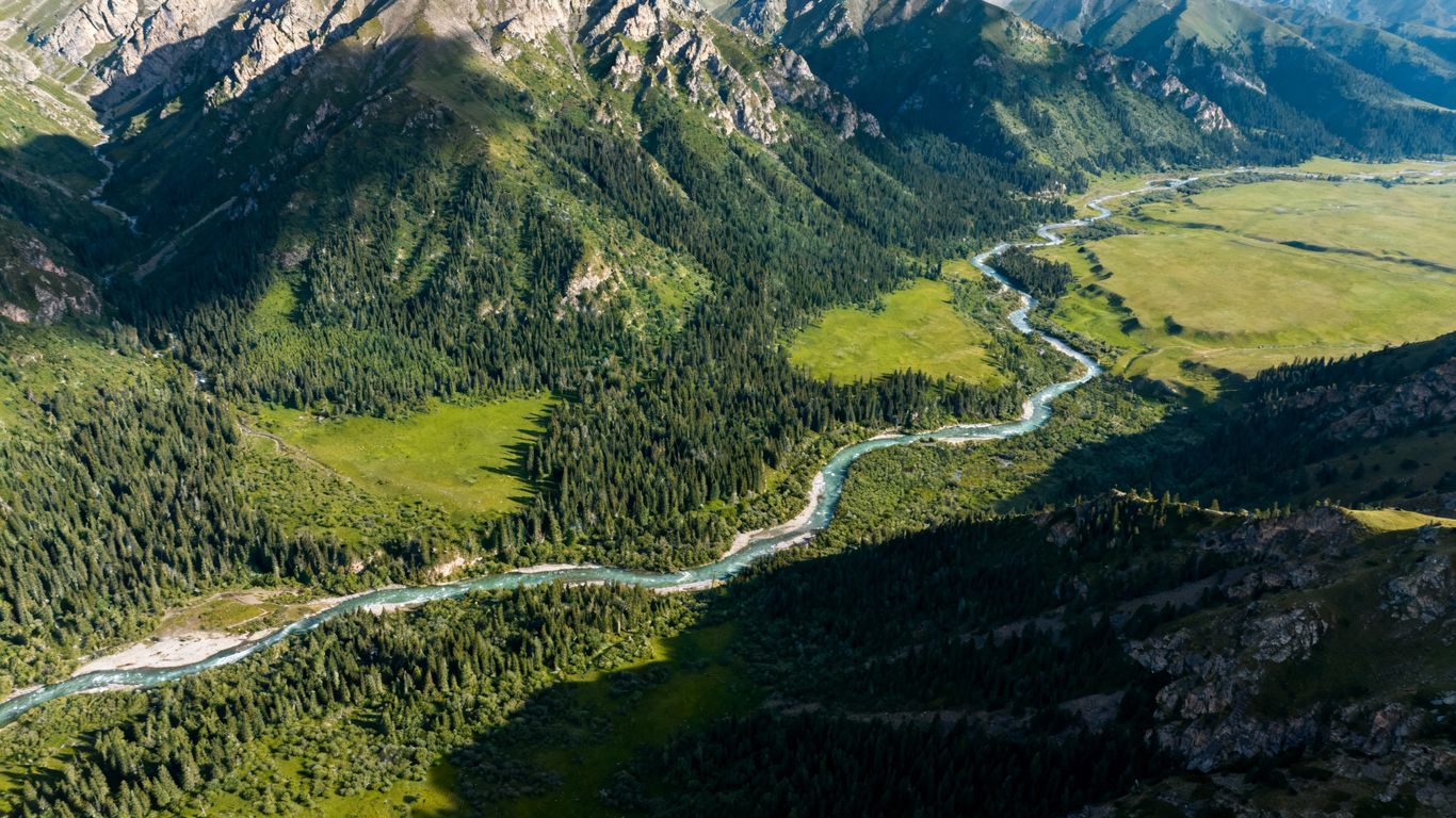
California’s natural spaces are pretty amazing, right? From giant forests to the coast, there’s a lot to keep an eye on. But keeping track of everything, especially with things like wildfires and changing weather, can be tough. That’s where new tech comes in. Using drones and other aerial tools to collect data is becoming a big deal for understanding and looking after our state’s landscapes. This approach, known as aerial geospatial data collection California, is changing how we manage everything from forests to coastlines.
Key Takeaways
- Aerial geospatial data collection California offers a way to get a bird’s-eye view of large areas, helping us understand forest health and plan for wildfires.
- Drones can reach difficult spots, collect real-time information, and are often cheaper than older methods for monitoring environments.
- This technology helps protect wildlife and their homes by letting us watch them and their habitats without disturbing them.
- Coastal areas and oceans can be monitored for changes and pollution, aiding conservation efforts.
- Using aerial data makes land management quicker and safer, especially when dealing with hazardous areas or invasive plants.
Revolutionizing California’s Environmental Monitoring
California’s natural spaces are huge, from the coast to the mountains and forests. Keeping an eye on these places is super important, especially with all the environmental changes happening. It used to be a real pain to get good data, involving lots of time and money. But now, things are changing fast. We’re talking about using drones, which are really shaking things up in how we watch over our environment.
The Growing Need for Advanced Data Collection
Environmental issues in California are pretty serious. Wildfires, droughts, and other problems mean we need to monitor things closely and quickly. Traditional methods just aren’t cutting it anymore. We need better ways to see what’s going on across large areas, often in places that are hard to get to.
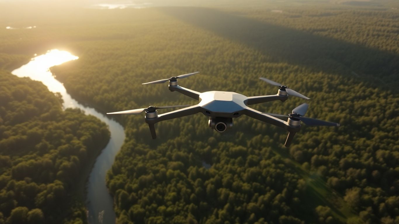
Drones: A New Era in Landscape Analysis
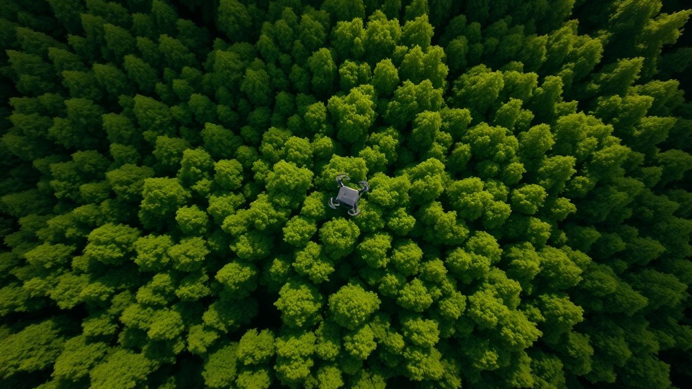
Drones are changing the game. They can fly over tough terrain, like steep mountains or dense forests, without disturbing anything. This gives us a bird’s-eye view that’s hard to get otherwise. They can capture detailed images and other types of data in real-time, which helps people make decisions faster. Think about spotting a problem early, like a patch of sick trees or a new invasive plant, before it gets out of hand. It’s a big step up from just walking around and looking.
Bridging Traditional Practices with Modern Technology
It’s not about ditching old methods entirely, but about making them better. Drones can work alongside what we already do. For example, a drone might map out an area, showing exactly where the problem spots are. Then, a ground crew can go directly to those specific locations, saving a lot of time and effort. This combination means we can get more done, more accurately, and often for less money than before. It’s about using the best tools for the job to keep California’s environment healthy.
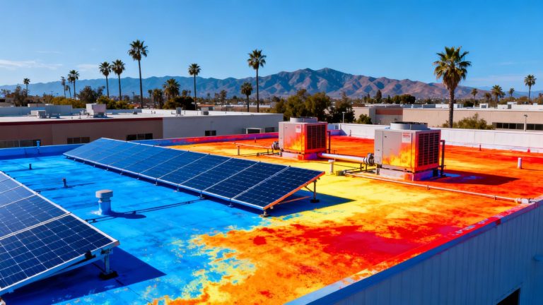
Enhancing Forest Health and Wildfire Prevention
California’s forests are facing a lot of pressure these days, from drought to pests and, of course, wildfires. Keeping them healthy and reducing the risk of massive fires is a huge job. That’s where aerial data collection really shines.
Mapping Vegetation for Precise Forest Management
Think about trying to manage a forest without really knowing what’s in it. It’s like trying to cook without knowing your ingredients. Aerial surveys, especially using drones, give us a detailed look at the forest floor up. We can map out exactly what kind of trees are where, how dense they are, and even their general health. This information is super important for planning how to manage areas, like deciding where to thin out trees or where to focus efforts to make the forest more resilient.
Assessing Tree Health and Canopy Cover
It’s not just about knowing where the trees are, but how they’re doing. Drones equipped with special sensors can help us see which trees are struggling. We can get data on things like canopy cover – how much of the ground is shaded by leaves and branches. This helps us spot areas with too many trees packed together, which can make them more vulnerable to disease and drought. Identifying stressed or dead trees early on is key to preventing larger problems down the line.
Mitigating Wildfire Risk Through Data-Driven Planning
Wildfire prevention is a massive concern for California. By using aerial data, we can get a much clearer picture of wildfire fuel loads – basically, how much dry, burnable material is out there. This lets us plan fuel reduction treatments more effectively. Instead of guessing, we can target specific areas that pose the biggest risk. This data also helps us understand how fire might move across the landscape, allowing for better planning of fire breaks and evacuation routes. It’s about using what we see from above to make smarter decisions on the ground.
Gathering this kind of detailed information used to take a lot of boots on the ground, which is slow and can be dangerous in rugged terrain. Now, drones can cover large areas quickly, giving us the data we need without putting people in harm’s way just to survey.
Here’s a look at what we can measure:
- Tree Density: How many trees are in a given area.
- Canopy Cover: The percentage of ground covered by tree canopies.
- Vegetation Type: Identifying different kinds of plants and trees.
- Tree Health Indicators: Signs of stress, disease, or dead trees.
This kind of detailed mapping helps land managers make informed choices about forest treatments, aiming to reduce the intensity and spread of wildfires while promoting healthier, more robust forests for the future.
Protecting California’s Diverse Ecosystems
California is a state blessed with an incredible variety of natural environments, from the Pacific coastline to towering forests and fragile wetlands. Keeping these places healthy and vibrant is a big job, and it’s getting tougher with climate change and increasing human activity. That’s where aerial geospatial data collection really shines.
Monitoring Wildlife and Preserving Habitats
Tracking wildlife and making sure their homes are safe is a huge part of conservation. Drones equipped with special cameras, like thermal imagers, can spot animals without us even getting close. This means we can count populations, see where they’re moving, and check on the health of their living spaces without disturbing them. It’s a much gentler way to gather information compared to older methods. We can also use this tech to keep an eye on habitat restoration projects, like replanting areas damaged by fires or development. Seeing how well those efforts are going from above helps conservationists make better plans.
- Non-invasive population counts: Get accurate numbers without stressing out animals.
- Habitat health assessment: Identify areas needing restoration or protection.
- Movement tracking: Understand migration patterns and resource use.
Gathering this kind of detailed information helps us make smarter decisions about where to focus our conservation efforts, making sure we’re protecting the species that need it most.
Coastal and Marine Conservation Efforts
California’s coastline is beautiful but also really sensitive. Pollution, erosion, and rising sea levels are constant threats. Drones are fantastic for mapping out the shoreline, watching how sand moves, and spotting areas that are likely to erode. They can also help track pollution, like plastic waste floating in the ocean. This allows teams to respond quickly when problems pop up, helping to keep our oceans cleaner and healthier. It’s a big help for coastal monitoring efforts.
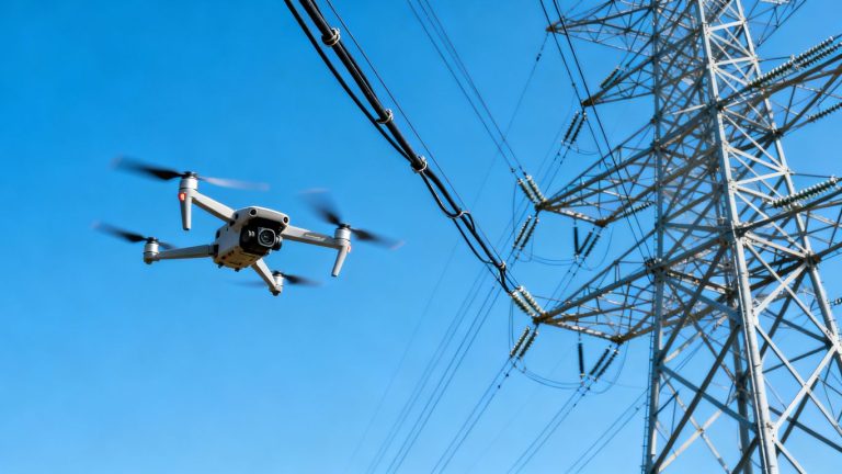
Tracking Pollution and Environmental Changes
Beyond the coast, drones help us keep tabs on pollution and other environmental shifts across the state. They can fly over industrial areas, waterways, or agricultural lands to spot sources of pollution or changes in water quality. This data is super important for regulatory agencies and environmental groups trying to keep California’s air, water, and soil clean. Being able to see these changes from above, often in real-time, means we can act faster to fix problems before they get worse.
The Advantages of Aerial Geospatial Data Collection California
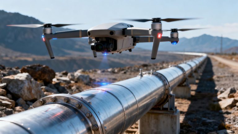
When we talk about collecting data for environmental work in California, it’s easy to get bogged down in the details. But let’s zoom out for a second. The biggest win with aerial geospatial data collection, especially using drones, is how it completely changes what’s possible. It opens up access to places we just couldn’t get to easily before, or at all. Think about those steep, remote canyons or dense forests – getting boots on the ground there is tough, time-consuming, and sometimes downright dangerous. Drones, however, can fly right over, giving us a clear picture without the hassle.
Accessing Remote and Challenging Terrains
California’s landscape is incredibly varied, from the jagged peaks of the Sierra Nevada to the sprawling deserts and the rugged coastline. Traditional methods of surveying these areas often involve a lot of hiking, driving, and setting up equipment, which can take days or even weeks. Drones bypass a lot of that. They can be launched from a roadside or a small clearing and quickly cover vast, difficult-to-reach areas. This means we can get data from places like the wildland urban interface near Mammoth Lakes, where mapping vegetation is key for wildfire prevention, without putting survey teams in harm’s way.
Real-Time Data for Swift Decision-Making
One of the most impactful benefits is the speed at which we can get information. Instead of waiting for film to be developed or for field teams to return with notes and samples, drones can transmit data almost immediately. This is a game-changer when dealing with fast-moving environmental issues. For instance, if a new pollution event is detected along the coast, drone imagery can show its extent and trajectory within hours, allowing response teams to act much faster than they could with older methods. This quick turnaround is vital for minimizing damage and protecting sensitive ecosystems.
Cost-Effectiveness and Scalability
Let’s be honest, budget is always a concern. Sending out large crews for extensive field surveys, especially in remote areas, racks up costs quickly – think fuel, equipment, personnel time, and safety measures. Drones, while an initial investment, drastically cut down on these ongoing expenses. A single drone flight can cover the same ground as multiple ground crews, often in a fraction of the time. This makes it possible to conduct more frequent monitoring or to scale up projects without a proportional increase in budget. It’s about getting more bang for your buck, allowing resources to be redirected to actual conservation work rather than just data gathering.
The ability to collect detailed information from above, without the limitations of ground access or the expense of manned aircraft, fundamentally changes how we approach environmental management. It’s not just about efficiency; it’s about enabling a level of detail and responsiveness that was previously out of reach for many projects.
Improving Land Management Efficiency and Safety
Reducing Field Survey Time and Costs
Think about how long it used to take to check on a big patch of forest or a remote hillside. Teams would spend days, maybe weeks, hiking around, taking notes, and trying to get a good look at everything. It was slow, expensive, and sometimes just plain tough work. Now, with aerial data collection, we can cover huge areas in a fraction of the time. Drones can map hundreds of acres in a week, giving us detailed information about vegetation, tree health, and potential issues. This means fewer boots on the ground, saving money on travel, equipment, and personnel hours. It’s like having a super-powered magnifying glass that can see the whole picture at once.
Enhancing Safety in Hazardous Environments
Some areas are just too risky for people to survey directly. We’re talking about steep cliffs, places with lots of dead trees that could fall, or areas affected by recent fires. Sending crews into these spots puts them in danger. Aerial data collection changes that. Drones can fly over these hazardous zones, gathering all the necessary information without putting anyone at risk. This is a huge win for safety, allowing land managers to assess dangerous areas from a secure distance. It means we can still get the job done without risking injuries or worse.
Streamlining Invasive Species Management
Dealing with invasive plants is a constant battle. They spread fast, and it’s hard to keep track of them, especially when resources are limited. Aerial imagery is a game-changer here. It allows us to quickly survey large areas and spot where invasive species are popping up. We can monitor how well removal efforts are working and pinpoint new infestations before they get out of hand. This visual overview helps us focus our limited resources where they’re needed most, making the whole process much more efficient and effective.
The ability to quickly survey vast and often dangerous landscapes from above significantly cuts down on the time and expense associated with traditional ground-based methods. This shift not only frees up valuable personnel for other tasks but also dramatically reduces the risks associated with working in challenging or hazardous terrains, making land management operations safer and more productive.
The Future of Aerial Geospatial Data Collection
Integrating Advanced Sensor Technologies
So, what’s next for getting eyes in the sky? Well, it’s all about smarter sensors. We’re moving beyond just taking pictures. Think about sensors that can detect specific chemical compounds in the air, helping us spot pollution sources faster. Or imagine sensors that can measure soil moisture with incredible detail, which is a big deal for farming and managing water resources, especially with California’s dry spells. These new tools are going to give us a much clearer picture of what’s happening on the ground, from the health of individual plants to the overall condition of large areas.
The Role of AI in Data Analysis
Collecting all this data is one thing, but making sense of it is another. That’s where artificial intelligence, or AI, really shines. AI can sift through massive amounts of aerial data way faster than any human team could. It can spot patterns we might miss, like subtle changes in vegetation that indicate stress or the early signs of an invasive species spreading. This means we can react much quicker to problems before they get out of hand. AI also helps automate tasks, like counting wildlife or mapping burn scars, freeing up experts to focus on the bigger picture and making decisions.
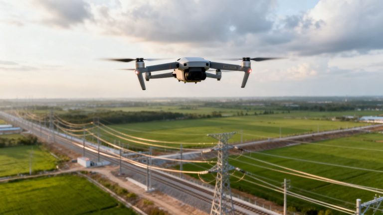
Expanding Applications Across California
We’re just scratching the surface of what aerial data can do. Right now, it’s a big help for forest management and environmental monitoring. But think bigger. We could use it for tracking changes in our coastlines, monitoring agricultural yields across the Central Valley, or even helping with urban planning by mapping green spaces and infrastructure. The possibilities are pretty wide open. It’s not just about looking down; it’s about understanding and managing California’s diverse landscapes more effectively for years to come.
The ongoing development in sensor technology and data processing means that aerial data collection is becoming more precise and more useful. What used to take weeks of fieldwork can now be done in days, or even hours, with greater accuracy and less risk to personnel. This shift is changing how we approach land management and environmental stewardship across the state.
Looking Ahead
So, it’s pretty clear that using drones for collecting information about California’s environment is a big deal. We’ve seen how they help us keep an eye on forests, especially with wildfire risks, and even check on wildlife and coastlines. It’s not just about getting a better view; it’s about getting that view faster and safer than before. This kind of data helps folks make smarter choices for managing our natural spaces. As this technology gets even better and more people start using it, we’re likely to see even more good things happen for California’s landscapes.
Frequently Asked Questions
What exactly is aerial geospatial data collection?
It’s like taking pictures and gathering information from high up, usually using drones or planes. This helps us see the big picture of places like forests or coastlines, and even zoom in on details, all without having to be right there on the ground.
How do drones help with forest fires?
Drones can map out forests to see which trees are unhealthy or too crowded, which makes them more likely to catch fire. This information helps people plan better to reduce fire risks and keep communities safe.
Can drones help protect animals and their homes?
Yes! Drones can fly over natural areas to watch wildlife and check on their homes without scaring them. This helps scientists and park rangers protect different kinds of animals and keep their living spaces healthy.
Is using drones cheaper than older ways of collecting data?
Often, yes! Sending out drones can be faster and less expensive than sending lots of people out to check areas on foot or using helicopters. This means more money can be spent on actual conservation work.
Are drones safe to use in dangerous places?
Definitely. Drones can go into tough spots like steep mountains or areas with lots of dead trees that might be dangerous for people. This keeps workers safer while still getting the important information needed.
What’s next for this technology?
Scientists are making drones even smarter with better cameras and tools. They’re also using computers to help understand the information faster. This means drones will be used for even more important jobs in the future, helping to protect California’s environment.